List of geotopes in the district of Göttingen
The list of geotopes in the district of Göttingen contains the geotopes in the district of Göttingen in Lower Saxony . Some of these geotopes are also protected as natural monuments (ND), landscape protection areas (LSG), nature reserves (NSG) or part of these.
| Geotope no. | designation | place | comment | Coordinates | image |
|---|---|---|---|---|---|
| 4127/05 | Zechstein transgression on folded lower carbon | Bad Grund (Harz) | Geotope type: discordance. Length 20 m, width 20 m, height 15 m. Area 0.04 ha. Stratigraphy: Perm-Zechstein to Lower Carboniferous, Kulm. Petrography: folded, steeply set Grauwacken and slate of the Kulm under Zechstein conglomerate, copper slate and Zechstein limestone (Zechstein 1, Werra series). Natural monument. |
51 ° 48 '7.9 " N , 10 ° 11' 17.2" E | |
| 4127/10 | Huebichenstein | north of Bad Grund (Harz) in the immediate vicinity of federal highway 242 | Geotope types: cliff, rock needle. Stratigraphy: Upper Devonian. Petrography: rock cliff / needle consisting of massive limestones of the Adorf level, remains of corals and reef organisms, weathering processes. In the landscape protection area LSG-OHA 10 "Harz". |
51 ° 49 '12 " N , 10 ° 14' 2.4" E |
 more pictures |
| 4127/11 | Winterberg lime works | north of Bad Grund (Harz) | Geotope type: rocks. Stratigraphy: Devon (Givet-Adorf). Petrography: reef at West Harz Sill, probably on a volcanic base. |
51 ° 49 '35.4 " N , 10 ° 14' 6.7" E | |
| 4127/14 | Iberg stalactite cave | near Bad Grund (Harz) | Geotope type: In the landscape protection area LSG-OHA 10 "Harz". |
51 ° 49 '3 " N , 10 ° 15' 10.1" E |
 more pictures |
| 4226/02 | Wrinkle and angle discordance in layers of the Lower Muschelkalk | Osterode am Harz , west of Eisdorf | Geotope types: fold, discordance. Length 15 m, height 4 m. Stratigraphy: Triassic Lower Muschelkalk. Petrography: Foam limestone banks of the Lower Muschelkalk; steep fold; Angular discordance; yellowish-gray, platy to thinly layered (2–8 cm) limestones. |
51 ° 45 ′ 42.8 " N , 10 ° 9 ′ 21.2" E | |
| 4226/03 | Gypsum stone cliff in the Upper Buntsandstein | Osterode am Harz , west of Dorste | Geotope type: rock tower. Length 300 m, height 20 m. Stratigraphy: Triassic Upper Buntsandstein (red). Petrography: weathered layers of gypsum and red sandstones of the Upper Buntsandstein. |
51 ° 41 '50.3 " N , 10 ° 8' 27.6" E | |
| 4127/14 | Karst area "Bare Mountain" | Osterode am Harz , approx. 1.5 km from ESE Ührde | Geotope type: Stratigraphy: Triassic red sandstone. |
51 ° 42 '25.2 " N , 10 ° 12' 50.4" E | |
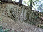
| 4227/15 | Former Fuchshalle quarry | in the urban area of Osterode am Harz east of the Fuchshaller Weg (towards the old hospital) | Geotope type: rocks. Stratigraphy: Upper Tournai to Lower Vise (Lower Carboniferous). Petrography: flat copper slate from Zechstein I, gray marl interlayers. Natural monument |
51 ° 43 ′ 27.5 " N , 10 ° 14 ′ 25.8" E |
 more pictures |
| 4228/02 | Hammerstein cliffs with block heap, chamber quartzite | Non-parish area Harz , approx. 3.3 km south of Altenau. | Geotope types: dump, cliff. Stratigraphy: lower carbon. Petrography: ventricular quartzite. Natural monument ND-OHA 58 in the landscape protection area LSG-OHA 10 "Harz". |
51 ° 45 ′ 56.9 " N , 10 ° 26 ′ 56.8" E | |
| 4228/04 | All cliff | Non-parish area Harz , approx. 1.6 km E Riefensbeck. | Geotope types: dump, cliff. Height 15 m. Stratigraphy: lower carbon. Petrography: ventricular quartzite. In the landscape protection area LSG-GS 34 |
51 ° 45 ′ 15.8 " N , 10 ° 24 ′ 41.8" E | |
| 4228/16 | "Henriette" barite passage with copper ores, a former day tunnel and two shafts | Osterode am Harz , approx. 550 m Sieber | Geotope type: discordance. Length 85 m, height 30 m. Mouth hole approx. 0.85 m. Stratigraphy: lower carbon. Petrography: Sub-Carboniferous greywacke, heavy spade mouth hole, copper ore. |
51 ° 42 '7.9 " N , 10 ° 26' 38.8" E | |
| 4327/01 | Karst area Hainholz | Osterode am Harz , 0.75 km W and SW Düna | Geotope types: sinkhole, karst cave. Length 1500 m, width 700 m. Area 641.0 ha. Stratigraphy: Perm-Zechstein to Quaternary. Petrography: Zechstein 3 (main anhydrite), 26 caves with 1400 m (total) passage, collapse dolines, karst cones, stream shrinkage. Nature reserve NSG-BR 033 "Gipskarstlandschaft Hainholz". |
51 ° 41 ′ 3.8 " N , 10 ° 16 ′ 20.6" E | |
| 4327/02 | Beierstein karst area | south of Osterode am Harz , approx. 0.75 km SSE Beierfelde | Geotope types: sinkhole, caves, rocks. Stratigraphy: Perm-Zechstein. Petrography: outcrops in the main dolomite (approx. 2). Nature reserve NSG-BR 033 "Gipskarstgebiet Hainholz-Beierstein". |
51 ° 41 '37 " N , 10 ° 15' 2.5" E | |
| 4327/03 | Sinkfalls "Finnenbruch" and "Floating Island" | Herzberg am Harz , SE Pöhlde, N and S of the railway line | Geotope type: sinkhole. Diameter approx. 25 m. Stratigraphy: Permian to Quaternary. Nature reserve NSG-BR 039 "Floating Island, Finnenbruch and Big Butter Hole". |
51 ° 36 '7.9 " N , 10 ° 19' 27.5" E | |
| 4327/04 | Sinkhole area | Herzberg am Harz , approx. 2.8 km NW Pöhlde, directly on the Gieboldehausen-Herzberg road (B 27) | Geotope type: sinkhole. Length 200 m, width 200 m. Stratigraphy: Perm-Zechstein to Quaternary. Petrography: Water-filled (2 pieces) diameter (lake) 20 or 15 m, further sinkholes very inaccessible. |
51 ° 37 '48.4 " N , 10 ° 16'23.5" E | |
| 4327/05 | Summary and expansion of the Beierstein and Hainholz NSG between Osterode and Hörden | Hörden , south of Osterode (Harz). | Geotope types: karst spring, rocks, shrinkage. Length 3000 m, width 2000 m. Stratigraphy: Perm-Zechstein 2 and 3 to Quaternary. Petrography: Outcrop in Zechstein 3 (plate dolomite, main dolomite). Nature reserve NSG-BR 033 "Gipskarstlandschaft Hainholz-Beierstein". |
51 ° 40 '51.2 " N , 10 ° 15' 55.4" E | |
| 4327/07 | Sinkholes | Herzberg am Harz , approx. 3 km NW Pöhlde. | Geotope type: sinkhole. Length 200 m, width 200 m. Stratigraphy: Permian to Quaternary. Petrography: filled with water. |
51 ° 37 '48.4 " N , 10 ° 16'23.5" E | |
| 4327/09 | Middle terrace edge "Auf dem Klimp" | Herzberg am Harz , approx. 1.1 km N Pöhlde. | Length 1200 m, height 10 m. Stratigraphy: Quaternary Pleistocene, Saale and Vistula glaciation. |
51 ° 37 '45.1 " N , 10 ° 19' 28.2" E | |
| 4327/10 | Sinkholes in the main anhydrite, called "Long Break" | Herzberg am Harz , approx. 2 km north of Pöhlde | Geotope type: sinkhole. Length 200 m, width 90 m. Stratigraphy: Perm-Zechstein 3, Trias-Unterer Buntsandstein to Quaternary. Natural monument ND-OHA 80. |
51 ° 38 ′ 11 " N , 10 ° 19 ′ 12.4" E | |
| 4328/03 | "Herzynkalk" cliff | approx. 4 km east of Herzberg am Harz | Geotope type: limestone cliff. Stratigraphy: Silurian (?), Lower Devonian, Ems level. In the landscape protection area LSG GS 39. |
51 ° 39 '52.9 " N , 10 ° 25' 11.3" E | |
| 4328/04 | Western stones | Bad Lauterberg in the Harz Mountains , approx. 700 m west of Bartolfelde. | Geotope type: Stromatolite reefs. Length 500 m, width 100 m, height 20 m. Stratigraphy: Perm-Zechstein. Petrography: 3 stromatolites (blue-green algae) reefs, massive dolomitized reef limestone, an important document of the predominance of the tropical sea in the early Zechstein Age / Zechstein 2 (Starßfurt dolomite). Natural monument ND-OHA 29. |
51 ° 35 '59.6 " N , 10 ° 25' 53.8" E | |
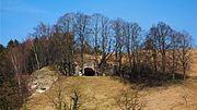
| 4328/05 | Natural monument "stone church" | Herzberg am Harz , north of Scharzfeld. | Geotope type: Dolomite cliffs. Height 15 m. Stratigraphy: Perm-Zechstein. Petrography: Zechstein 2 (Straßfurt-Dolomit), in the dolomitic rock complex a cave was created, artificial. Enlargement to a rock church. Natural monument ND-OHA 17 in the nature reserve NSG BR 78 "Steinberg". |
51 ° 37 '59.9 " N , 10 ° 22' 38.6" E |
 more pictures |
| 4328/06 | " Wiedensee " sinkhole | Herzberg am Harz , approx. 1 km southwest. Scharzfeld. | Geotope type: sinkhole. Diameter 60 m. Stratigraphy: Permian to Quaternary. Petrography: water-filled sinkhole above leached gypsum stone in the subsoil (Zechstein 1, Werra anhydrite). Natural monument ND-OHA 18. |
51 ° 37 '28.2 " N , 10 ° 21' 11.5" E |
 more pictures |
| 4328/07 | Sinkhole area "Pöhlder Weg" | Herzberg am Harz , approx. 1.5 km southwest. Scharzfeld. | Geotope type: sinkhole. Length 1500 m, width 500 m. Stratigraphy: Permian to Quaternary. Petrography: sinkhole area in the leaching area of the Werra anhydrite (Zechstein 1). |
51 ° 37 '4.1 " N , 10 ° 20' 31.6" E | |
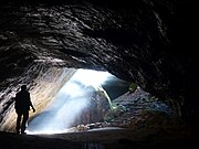
| 4328/09 | Unicorn cave | Herzberg am Harz , approx. 600 m north of Scharzfeld. | Geotope type: Karst cave in the Zechsteindolomit. Length 550 m. Stratigraphy: Permian to Quaternary. Petrography: Formation by dissolution in the coarsely banked dolomite of the Zechstein 2 (Straßfurt dolomite) pebbles mainly from Grauwacken and Rotliegendporphyres. Natural monument ND-OHA 64 in the landscape protection area LSG-OHA 10 "Harz". |
51 ° 38 ′ 6 " N , 10 ° 24 ′ 15.1" E |
 more pictures |
| 4328/11 | Dolomite rock "Butterberg" | Bad Lauterberg in the Harz Mountains , approx. 900 m north of Bartolfelde. | Geotope type: cliff-like dolomite rocks. Area 33.6 ha. Stratigraphy: Perm-Zechstein 2. Petrography: Straßfurt dolomite, dolomite stones are yellowish-gray, e.g. Partly heavily weathered and very porous. Nature reserve NSG-BR 102 "Butterberg / Hopfenbusch". |
51 ° 36 '46.4 " N , 10 ° 27' 24.8" E | |
| 4328/13 | Former quarry near Kupferhütte | north of Bad Lauterberg in the Harz at the sports field. | Geotope type: cliff-like dolomite rocks. Length 50 m, height 3 m. Stratigraphy: Silurian. Petrography: slate with graptolites. |
51 ° 38 '10.3 " N , 10 ° 27' 23.4" E | |
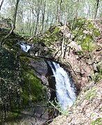
| 4328/15 | Lonauer waterfall | northern exit of Herzberg am Harz . | Geotope type: waterfall. Stratigraphy: Quaternary. Petrography: the Sieber has deepened into the soft Zechstein layers (limestone) in the transition area of the hard Grauwacken of the Harz Basement Mountains faster than the Lonau. Natural monument ND-OHA 36. |
51 ° 39 '46.1 " N , 10 ° 20' 54.2" E |
|
| 4328/16 | Owl stone | Bad Lauterberg in the Harz Mountains , approx. 2.7 km east of Bartolfelde. | Geotope type: dolomite rocks. Width 15 m, height 5 m. Stratigraphy: Perm-Zechstein 1. Petrography: isolated weathered dolomite rock. It is a stromatolite reef rock that has deposited on the top of the Eichsfeld threshold. Natural monument ND-OHA 15 in the landscape protection area LSG-OHA 10 "Harz". |
51 ° 36 '5.4 " N , 10 ° 29" 52.8 " E | |
| 4328/17 | Schulbergklippen | Herzberg am Harz , north of Scharzfeld. | Geotope type: dolomite rocks. Width 15 m, height 5 m. Stratigraphy: Perm-Zechstein 2. Petrography: several dolomite cliffs, find point of Mesolithic settlement. Natural monument ND-OHA 31 in the landscape protection area LSG-OHA 10 "Harz". |
51 ° 37 '57 " N , 10 ° 22" 58.8 " E |

|
| 4328/18 | Beber pond | Bad Lauterberg in the Harz Mountains , approx. 1 km southwest. Barbis. | Geotope type: sinkhole. Length 20 m, width 20 m. Stratigraphy: Perm-Zechstein 3 to Quaternary. Petrography: A sinkhole filled with water in the main anhydrite (Zechstein 3), sinkhole with year-round water level. Natural monument ND-OHA 75. |
51 ° 36 '23.4 " N , 10 ° 24' 28.8" E |
 more pictures |
| 4328/19 | Hahnemann's hole | approx. 800 m southeast of Herzberg am Harz . | Geotope type: sinkhole. Length 30 m, width 15 m. Stratigraphy: Perm-Zechstein 1 and 2 to Quaternary. Petrography: Zechstein 1 (Werra anhydrite), Zechstein 2, created by leaching the gypsum stones of the lying Werra anhydrite. Natural monument ND-OHA 81. |
51 ° 38 '43.1 " N , 10 ° 21' 36.7" E | |
| 4328/25 | Jues-See sinkhole | in Herzberg am Harz . | Geotope type: sinkhole. Length 600 m, width 200 m. Stratigraphy: Perm-Zechstein, Werra-anhydrite to Quaternary. Petrography: created by leaching the underlying Werra anhydrite, the largest sinkhole in Europe. |
51 ° 39 '14.8 " N , 10 ° 20' 40.9" E |
 more pictures |
| 4328/27 | "Zandersberg" sinkhole area | Herzberg am Harz , approx. 2.2 km SW Scharzfeld. | Geotope type: sinkhole. Length 600 m, width 2.3 m. Stratigraphy: Perm-Zechstein 3, Trias-Unterer Buntsandstein to Quaternary. |
51 ° 36 '7.6 " N , 10 ° 19" 54.5 " E | |
| 4328/29 | Kaiser cliffs | Non- parish area Harz near Scharzfeld. | Geotope type: rocks. Stratigraphy: Perm-Zechstein. Petrography: oncolithic shallow water facies of the Zechstein limestone. In the landscape protection area LSG-OHA 10 "Harz". |
51 ° 37 '59.9 " N , 10 ° 24' 5.4" E | |
| 4328/32 | Abandoned quarry | Bad Lauterberg in the Harz Mountains , Bartolfelde. | Geotope type: rocks. Stratigraphy: Upper Devonian to Perm - Zechstein. Petrography: A surf reef made of thick-banded greywacke, preserved by a Zechstein bryozoal reef, is open. |
51 ° 36 '7.2 " N , 10 ° 27" 32.4 " E | |
| 4329/01 | Silurian deposits on a road embankment | Harz region free of municipalities . Zorge-Braunlage road, approx. 2.5 km NNW Zorge. | Geotope types: rocks, fossils. Length 100 m, height 3 m. Multiple pits. Stratigraphy: Silurian, Upper Valentium. Petrography: Graptolite slate, flat, dark clay slate, often bleached on the surface, with occasional lime casings, strike 55 °, fall 35 ° SE. In the LSG OHA 7 landscape protection area. |
51 ° 39 '19.4 " N , 10 ° 37' 4.8" E | |
| 4423/01 | Fossil-bearing Upper Oligocene sand, former sand pit | Dransfeld , approx. 2.8 km SE Glashütte, Sandberg. | Geotope types: fossils, basalt. Length 25 m, height 6 m. Stratigraphy: Tertiary Oligocene. Petrography: quartzites and white quartz sand veins, fossil-bearing Kassel sea sand. In the landscape protection area LSG-Gö 10. |
51 ° 30 '51.5 " N , 9 ° 39" 9.4 " E | |
| 4423/02 | Weser old water "Red Pump" | Hann. Münden , 250 m south of Bursfelde. | Geotope type: oxbow lake. Stratigraphy: Quaternary. Natural monument ND-Gö 152. |
51 ° 32 '17.5 " N , 9 ° 37' 28.9" E | |
| 4424/02 | Basalt knoll " Backenberg ", former quarry | approx. 300 m SW Güntersen | Geotope type: rocks, basalt. Height 25 m. Stratigraphy: Tertiary. Petrography: basalts over tuff, submiocene sands and gravels, sole over Kassel sea sand over Röt, sole water. In the LSG "Sollingvorland" conservation area. |
51 ° 31 '58.8 " N , 9 ° 43' 26.4" E | |
| 4424/03 | Shell limestone layers with fossils in vertical storage, former limestone quarry | approx. 2.5 km WNW Barterode , on the lower slope of the Riesenberg | Geotope type: storage conditions, fossils. Length 20 m, height 6 m. Stratigraphy: Triassic Muschelkalk. Petrography: vertical storage of the Lower Muschelkalk layers in an east-west trending special ditch with fossils, Schill Agen, creeks etc. . In the LSG "Sollingvorland" conservation area. |
51 ° 33 ′ 21.6 " N , 9 ° 44 ′ 27.6" E | |
| 4424/04 | Basalt dike in the shell limestone | approx. 1.7 km ESE Güntersen , Hünenburg | Geotope type: storage conditions, basalt. Width 1.5 m. Stratigraphy: Triassic to Tertiary. Petrography: layer concordant in the mu (terebratel zone), apophysis of the Ossenberg basalt (world-famous exposure). In the nature reserve NSG-BR 92 " Ossenberg - Fehrenbusch ". |
51 ° 32 ′ 6 " N , 9 ° 45 ′ 46.8" E | |
| 4425/01 | Shell limestone closure, former quarry in the Billingshausen battle | Göttingen , 500 m N of the Nikolausberger Warte on the way to Oberbillingshausen. | Geotope type: rocks. Stratigraphy: Triassic Muschelkalk. Petrography: important testimony to the deposition conditions and the deposition environment of a bench of the lower shell limestone. Natural monument ND-Gö-S 61. |
51 ° 35 '3.1 " N , 9 ° 59' 52.8" E | |
| 4425/02 | Sinkhole on the Sommerberg (above the Rischenhacke) | Göttingen , 300 m N the pony farm at the entrance to the Börltal. | Geotope type: sinkhole. Stratigraphy: Triassic Muschelkalk to Quaternary. Natural monument ND-Gö-S 60. |
51 ° 32 '31.9 " N , 9 ° 51' 14.4" E | |
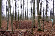
| 4425/03 | Sinkhole | Göttingen , 300 m east of the former BW shooting range in the Geismar Forest. | Geotope type: sinkhole. Stratigraphy: Triassic Muschelkalk to Quaternary. Petrography: steep-walled, funnel-shaped, dry, due to gypsum leaching in the subsoil (Middle Muschelkalk). Natural monument ND-Gö-S 59. |
51 ° 31 '2.6 " N , 9 ° 59' 26.9" E |
|
| 4425/06 | Ceratiten layers with pril grooves and ripples | Rosdorf , approx. 0.5 km NW Olenhusen. | Geotope types: ripple marks, fossils. Almost vertical exposure, horizontal stratification. Stratigraphy: Triassic Muschelkalk. In the landscape protection area LSG-Gö 9. |
51 ° 30 '34.2 " N , 9 ° 51' 1.8" E | |
| 4425/07 | Sinkhole | Göttingen , approx. 0.5 km WSW Herberhausen. | Geotope type: sinkhole. Diameter 16 m. Filled with water, water level 1 to 2 m. Stratigraphy: Triassic Muschelkalk. In the landscape protection area LSG-Gö 9. |
51 ° 32 '12.8 " N , 9 ° 58' 38.3" E |
 more pictures |
| 4425/08 | Trochitic limestone layers in a former quarry | Göttingen , approx. 0.2 km south of the Hainholzhof. | Geotope type: rocks. Length 15 m. Height 5 m. Stratigraphy: Triassic Muschelkalk. In the landscape protection area LSG-Gö 9. |
51 ° 31 '21 " N , 9 ° 58' 39.4" E | |
| 4426/06 | "Lutteranger" subrosion basin | Waake , 1.2 km south of Wollbrandshausen. | Geotope type: subrosion sink. Hardly mineralized quarry forest peat at least 2 m deep in the former lake area. Stratigraphy: Permian to Quaternary. In the landscape protection area LSG-GÖ 14 "Untereichsfeld". |
51 ° 34 ′ 31.8 " N , 10 ° 9 ′ 38.2" E | |
| 4426/13 | Limestone cliffs | 1.5 km south of Waake . | Geotope type: limestone cliffs. Stratigraphy: Perm-Zechstein. Petrography: Muschelkalk sliding on Röt, landslides, crevices. In the landscape protection area LSG-GÖ 3. |
51 ° 32 '1.3 " N , 10 ° 3' 6.1" E | |
| 4427/01 | Sinkhole area "Großes Butterloch" | Herzberg am Harz , NE of Rhumspringe approx. 800 m east of the Rhum spring. | Geotope type: sinkhole. Area 17.0 ha. Stratigraphy: Perm-Zechstein 3 to Quaternary. Petrography: the sinkhole area was created as a result of leaching processes of the gypsum rock of Zechstein 3 (Werra anhydrite) in the subsoil. In the nature reserve NSG-BR 039 "Finnenbruch, Großes Butterloch und Schwim". |
51 ° 35 ′ 22.6 " N , 10 ° 19 ′ 26" E | |
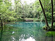
| 4427/02 | Rhume spring | Herzberg am Harz , NE of Rhumspringe. | Geotope type: source. Stratigraphy: Permian - Zechstein 2, Triassic - Lower Buntsandstein to Quaternary. Petrography: one of the largest springs in Europe, karst spring. Natural monument ND-Gö 183 in the landscape protection area LSG-OHA 6 "Rhumequelle". |
51 ° 35 '23.1 " N , 10 ° 18' 36.7" E |
 more pictures |
| 4428/02 | Sinkhole area | Herzberg am Harz , approx. 2.8 km east of Rhumspringe. | Geotope type: sinkhole. Numerous sinkholes, mostly dry, some are muddy, a few sinkholes are unusual in size. Stratigraphy: Perm-Zechstein, Trias-Unterer Buntsandstein to Quaternary. |
51 ° 35 '24 " N , 10 ° 21' 7.9" E | |
| 4428/03 | Sinkhole area and springs, stream shrinkage; 2 karst springs | Bad Lauterberg in the Harz Mountains , approx. 2.2 km west of Bartolfelde. | Geotope types: sinkhole, spring, stream shrinkage. Length 700 m. Width 300 m. Stratigraphy: Perm-Zechstein 3 (main anhydrite) to Quaternary. Petrography: sinkholes caused by the gypsum and dolomite stones lying underground. |
51 ° 35 '42 " N , 10 ° 24' 50.4" E | |
| 4429/01 | Römerstein dolomite cliffs | approx. 2.5 km southwest of Bad Sachsa . | Geotope type: Dolomite cliffs. Stratigraphy: Perm-Zechstein. Petrography: reef of the former Zechstein Sea (Straßfurt series), mainly made up of stromaries (probably calcareous algae) and bryozoa (Fenestella). Natural monument ND OHA 33. |
51 ° 34 ′ 31.8 " N , 10 ° 31 ′ 28.6" E | |
| 4429/05 | Sachsenstein cliffs | Bad Sachsa , approx. 200 m north of Neuhof. | Geotope type: gypsum cliffs. Length 800 m. Height 20 m. Stratigraphy: Perm-Zechstein. Petrography: Werra anhydrite modulated out by the Uffe. Natural monument ND OHA 41 in the nature reserve NSG-BR 003 "Priorteich / Sachsenstein". |
51 ° 35 '0.6 " N , 10 ° 34' 54.5" E | |
| 4429/06 | Priest stone cave | Bad Sachsa , approx. 300 m west of Neuhof. | Geotope type: Laughöhle. Length 75 m. Stratigraphy: Perm-Zechstein 1, Werra anhydrite to Quaternary. Petrography: Inventory of forms of the still water environment in the Werra anhydrite, in the cave in places medium terrace gravel (Herzyn gravel). Natural monument ND OHA 47. |
51 ° 34 ′ 33.6 " N , 10 ° 34 ′ 22.8" E | |
| 4429/08 | Steinatal, karst area and karst spring "Fritzmühlenspring" and sinkhole area in the gypsum | Bad Sachsa , south of Steina, near Nüxei. | Geotope types: spring, creek drift, sinkhole. Diverse gypsum karst area, several shrinkage points with Holocene sediment rearrangements, sinkholes, steep walls. Stratigraphy: Perm-Zechstein, Trias-Unterer Buntsandstein to Quaternary. In the nature reserve NSG-BR 046 "Weißensee und Steinatal". |
51 ° 33 '52.6 " N , 10 ° 31' 1.2" E | |
| 4429/09 | Nut pond, Weissensee | Bad Sachsa , approx. 1.5 km northwest. Tettenborn. | Geotope types: Polje, karst spring, sinkhole, gypsum cliffs. Stratigraphy: Perm-Zechstein. Petrography: Outlines the sequence of layers of the Zechstein. In the nature reserve NSG-BR 046 "Weißensee und Steinatal". |
51 ° 34 '7.7 " N , 10 ° 31" 47.6 " E | |
| 4429/11 | Gypsum karst area "Kleiner Trogstein" | Bad Sachsa . | Geotope types: stream shrinkage, karst hollow form, spring. Length 200 m. Width 100 m. "Little Trogstein" with cave and stream swirl as part of the karst river system "Trogstein-Fitzmühle". Stratigraphy: Perm-Zechstein to Quaternary. Petrography: karst hollow form in gypsum (Zechstein 1, Werra anhydrite). Natural monument ND OHA 82. |
51 ° 34 '30.4 " N , 10 ° 32' 30.1" E | |
| 4429/12 | Gypsum karst area, Pfaffenholzschwinde | Bad Sachsa , approx. 800 m northeast. Tettenborn. | Geotope types: stream shrinkage, spring, sinkhole system. Length 200 m. Width 200 m. Stratigraphy: Perm-Zechstein 1 to Quaternary. Petrography: Gypsum (Zechstein 1, Werra anhydrite), there is a permanent lake at the bottom of the sinkhole, which rises up to 3 m when the snow melts. Natural monument ND OHA 78. |
51 ° 34 '24.2 " N , 10 ° 33' 28.1" E | |
| 4429/13 | Dwarf holes | Harz , approx. 500 m east of Bad Sachsa, north and south of the railway line Herzberg, Walkenried. | Geotope type: swelling caves "dwarf holes". Stratigraphy: Perm-Zechstein, Perm-Unteres Rotliegende to Quaternary. Petrography: the conversion of anhydrite in gypsum leads to an increase in volume of approx. 64%, the formation of swelling cavities. In the nature reserve NSG-BR 003 "Priorteich / Sachsenstein". |
51 ° 35 '21.1 " N , 10 ° 35' 13.9" E | |
| 4429/14 | Stream shrinkage and springs in the Wiedatal | approx. 550 m or 1.1 km southeast of Walkenried . | Geotope types: spring, creek dwindle. Stratigraphy: Perm-Zechstein to Quaternary. Petrography: water seeps into the fissured rock, approx. 500 m to the southeast there is an extensive headwaters / gypsum, anhydrite and dolomite stones of the Zechstein. In the landscape protection area LSG-OHA 10 "Harz". |
51 ° 34 '39 " N , 10 ° 37' 37.9" E | |
| 4429/15 | Röseberg, Untere Gipsklippen, gypsum karst area | southeast of Walkenried . | Geotope type: Partial plaster walls. Stratigraphy: Perm-Zechstein 1 and 2 to Quaternary. Petrography: Steep walls in gypsum, which are continuously steepened by a valley stream, at the foot of the wall (receiving water), karst water emerges over a large area, various karst reliefs. Natural monument ND OHA 79 in the landscape protection area LSG-OHA 10 "Harz". |
51 ° 34 ′ 40.8 " N , 10 ° 37 ′ 13.1" E | |
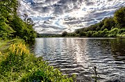
| 4429/17 | "Itelteich" nature reserve | approx. 1 km southeast of Walkenried . | Geotope type: diverse and distinctive karst features. Length 1800 m. Width 1000 m. Area 120.0 ha. Stratigraphy: Perm-Zechstein 1 and 2 to Quaternary. Petrography: gypsum cliffs, gypsum stone of the Werra anhydrite (Zechstein 1) emerges in steep, steep slopes. Sinkholes, erosion sinks, chutes, caves with cave streams. Nature reserve NSG-BR 002 "Itelteich". |
51 ° 34 '50.9 " N , 10 ° 38' 39.1" E |
 more pictures |
| 4429/19 | Upper and lower crane pond, erosion depression, silting sinkhole, priest stone cave | SSE Bad Sachsa . | Geotope types: erosion sink, sinkhole subsidence. Length 1000 m. Width 350 m. Stratigraphy: Perm-Zechstein 1, Werra anhydrite to Quaternary. Petrography: swamp and pond formations over subsidence fields of the leached gypsum, liquor cave with inventory of forms of the still water environment in the Werra anhydrite. |
51 ° 34 ′ 33.6 " N , 10 ° 34 ′ 22.8" E | |
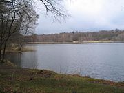
| 4429/24 | "Priorteich" nature reserve | between Bad Sachsa and Walkenried . | Geotope type: diverse and distinctive karst features. Length 1900 m. Width 1900 m. Area 315.0 ha. Stratigraphy: Permian - Rotliegende, Permian - Zechstein to Quaternary. Petrography: 20 m thick gypsum cliffs (gypsum stone of the Werra anhydrite) sinkholes, erosion depressions, cart formation, chasms and karst cones, dwarf holes. In the nature reserve NSG-BR 003 "Priorteich / Sachsenstein". |
51 ° 35 ′ 13.9 " N , 10 ° 35 ′ 33" E |
 more pictures |
| 4429/25 | Quarries | Bad Lauterberg in the Harz Mountains , north-west. from Nüxei. | Geotope type: rocks. Height 170 m. Stratigraphy: Strasbourg. Petrography: fine-grained, even-layered dolomites that were deposited below the wave base, rippled grainstones with large oncoids. |
51 ° 34 '44.4 " N , 10 ° 30' 14.4" E | |
| 4429/28 | Gypsum quarry "Röseberg" / Kutzhütte | west of Walkenried . | Geotope type: rocks. Stratigraphy: Perm-Zechstein. Petrography: Werra anhydrite, pletholitic sulphate sediments, changing state of the threshold slope. In the landscape protection area LSG-OHA 10 "Harz". |
51 ° 34 '48.4 " N , 10 ° 36' 14.4" E | |
| 4429/30 | Heidergott gravel pit | SSE Bad Sachsa . | Geotope type: rocks. Stratigraphy: Quaternary Pleistocene, Saale and Vistula glaciation. Petrography: Upper terrace gravel: higher proportion of clay and silt, strong weathering of the Grauwackengerölle. |
51 ° 34 '49.8 " N , 10 ° 34' 1.2" E | |
| 4524/07 | Quarry Hoher Hagen | Dransfeld , 2.8 km WNW Jühnde. | Geotope types: basalt and tuff layers. Height 30 m. Stratigraphy: Tertiary. Petrography: basalt and tuff layers next to contact metamorphoses. In the landscape protection area LSG-GÖ 10 "Münden Nature Park". |
51 ° 28 '26.4 " N , 9 ° 45' 50.4" E |
 more pictures |
| 4525/01 | Sandstone cliffs | Same , in the village of Reinhausen. | Geotope type: sandstone cliffs. Stratigraphy: Triassic red sandstone. Petrography: Building sandstone Solling series of the Middle Buntsandstein. In the landscape protection area LSG-Gö 9. |
51 ° 27 '57.6 " N , 9 ° 58' 44.4" E | |
| 4526/01 | Abandoned sandstone quarry | Same , 500 m SW Appenrode. | Length 80 m. Height 20 m. Stratigraphy: Triassic red sandstone. Petrography: fine-grained, thick-banked, partly sloping sandstone, up to 2 m thick claystone lenses with plant remains and well-preserved limulides. In the landscape protection area LSG-Gö 3. |
51 ° 27 '23.8 " N , 10 ° 1' 53.8" E |
See also
- List of nature reserves in the district of Göttingen
- List of landscape protection areas in the district of Göttingen
- List of natural monuments in the district of Göttingen
- List of protected landscape elements in the district of Göttingen
Web links
Commons : Geotopes in the district of Göttingen - collection of images, videos and audio files
Individual evidence
- ↑ Iberger Cave , (pdf; 280 kB)
- ↑ Dolomitwerk Ührde , (pdf; 516 kB)
- ↑ Fuchshalle , (pdf; 555 kB)
- ↑ Hammerstein Cliffs , (pdf; 383 kB)
- ↑ Westersteine , (pdf; 261 kB)
- ↑ Steinkirche Scharzfeld , (pdf; 260 kB)
- ↑ Unicorn Cave , (pdf; 191 kB)
- ↑ Jues-See , (pdf; 159 kB)
- ↑ Bartolfelde municipal quarry , (pdf; 642 kB)
- ↑ Rhumequelle , (pdf; 276 kB)
- ↑ Römerstein , (pdf; 307 kB)
- ↑ Zwergenlöcher , (pdf; 407 kB)
- ↑ Kranichstein , (pdf; 397 kB)
- ↑ Nüxeier dolomite quarry , (pdf; 280 kB)