List of geotopes in the Heidekreis district
The list of geotopes in the district of Heidekreis contains the geotopes in the district of Heidekreis in Lower Saxony . Some of these geotopes are also protected as natural monuments (ND), landscape protection areas (LSG), nature reserves (NSG) or part of these.
| Geotope no. | designation | place | comment | Coordinates | image |
|---|---|---|---|---|---|
| 2924/01 | Boulder | 0.5 km SE Sprengel on filling material of a former sand pit, Neuenkirchen | Geotope type: boulder. Length 2.3 m, width 0.7 m, height 1.6 m. Stratigraphy: Quaternary Pleistocene, Saale Glaciation. Petrography: eye gneiss. |
53 ° 3 '46.4 " N , 9 ° 44' 22.6" E | |
| 2925/01 | Sinkhole "Grundlose Kuhle" over salt dome | approx. 1.3 km SE Ahlften , Soltau | Geotope type: sinkhole. Diameter approx. 12 m. Stratigraphy: Perm-Zechstein to Quaternary. Natural monument ND-HK 21. |
52 ° 59 '59.6 " N , 9 ° 51' 12.6" E |

|
| 3024/12 | Headwaters | in Hambrook, NE of Jettebruch , Bad Fallingbostel | Geotope type: headwaters. Natural monument ND-HK 16. |
52 ° 56 '12.1 " N , 9 ° 48' 35.6" E | |
| 3025/06 | Wild mountains | approx. 3 km west of Suroide , Wietzendorf | Geotope type: moraine area. Size 15 ha. Landscape protection area LSG-HK 30 Wild mountains and surroundings. |
52 ° 57 '57 .6 " N , 9 ° 55' 33.6" E | |
| 3122/04 | Inland dune | northwest of Groß Häuslingen and southeast of Klein Häuslingen | Geotope type: dune. Length 250 m, width 150 m. Sand summit in the Allerniederung. The dune body sits on the valley sand from the Vistula period (lower terrace). A small sand pit in the north and a flat steep edge in the northeast of the dune body are interpreted as relics of earlier mining activities. Stratigraphy: Quaternary Holocene. Petrography: fine to medium sand, Aeolian. |
52 ° 48 '31 " N , 9 ° 21' 41" E | |
| 3125/01 | regenerating high moor | SW Marbostel , Bergen | Geotope type: raised bog. Area 850.0 ha. Stratigraphy: Quaternary. In the nature reserve NSG LÜ 134 "Großes Moor bei Becklingen" |
52 ° 52 ′ 37.2 " N , 9 ° 56 ′ 57.5" E |
 more pictures |
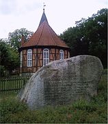
| 3224/02 | "Hohenstein" boulder | Ostenholz, at the church, Bad Fallingbostel | Geotope type: boulder. Stratigraphy: Quaternary Pleistocene, Saale Glaciation. Petrography: granite. Natural monument ND-HK 50. |
52 ° 46 '31.1 " N , 9 ° 43' 19.9" E |

|
See also
- List of nature reserves in the Heidekreis district
- List of landscape protection areas in the Heidekreis district
- List of natural monuments in the Heidekreis district
- List of protected landscape components in the Heidekreis district
Web links
Commons : Geotopes in the district of Heidekreis - collection of images, videos and audio files