List of geotopes in the district of Leer
The list of geotopes in the district of Leer names the geotopes in the district of Leer in Lower Saxony . Some of these geotopes are also protected as natural monuments (ND), landscape protection areas (LSG), nature reserves (NSG) or part of these.
| Geotope no. | designation | place | comment | Coordinates | image |
|---|---|---|---|---|---|
| 2306/02 | Greune Stee | Borkum | Geotope Type: Island Landing Area. Size 330 ha. In the landscape protection area LSG-LER 10. |
53 ° 34 '22.8 " N , 6 ° 42' 21.6" E |
 more pictures |
| 2611/04 | Boulder | in Bagband , E-Kirche in Straßeninsel (formerly Hartog Hinnerksteen), 400 m NW at the intersection. | Geotope type: boulder. Length 0.5 m, width 0.3 m, height 0.2 m. Stratigraphy: Quaternary Pleistocene, Saale Glaciation. Petrography: granite. |
53 ° 21 '10.8 " N , 7 ° 36' 39.6" E | |
| 2612/01 | Boulder | in Hinrichsfehn , cemetery S-part. | Geotope type: boulder. Ellipsoid shape. Length 2.5 m, width 2 m, height 1.1 m. Stratigraphy: Quaternary Pleistocene, Saale Glaciation. Petrography: Rapakiwi, reddish with feldspatovoids averaging 1–2 cm in diameter, max. 8 cm in diameter. |
53 ° 22 '24.6 " N , 7 ° 44' 2.4" E | |
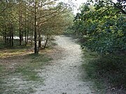
| 2612/03 | NSG " Holle Sand " (dune area) | approx. 1.5 km northwest of Großoldendorf . | Geotope type: dune landscape. Size 126.3 ha. NSG AU 9 nature reserve; NSG-WE 105 "Holle Sand". |
53 ° 20 '12.8 " N , 7 ° 43' 10.9" E |
 more pictures |
| 2709/02 | Flat moor lake with various stages of siltation | 1 km E Bunderhee , 700 m W Sankt Georgswold. | Geotope type: lake, flat moor. Shape almost round, diameter approx. 100 m. Stratigraphy: Quaternary Coastal Holocene. Nature reserve NSG Au 26. |
53 ° 12 '43.9 " N , 7 ° 18" 44.6 " E |
See also
- List of nature reserves in the district of Leer
- List of landscape protection areas in the district of Leer
- List of natural monuments in the district of Leer
- List of protected landscape elements in the district of Leer
Web links
Commons : Geotopes in the district of Leer - Collection of images, videos and audio files