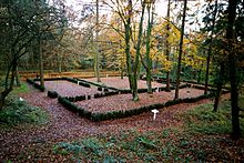
List of landscape protection areas in the district of Leer
The list of landscape protection areas in the district of Leer contains the landscape protection areas of the district of Leer in Lower Saxony .
| image | number | Name of the area | Area in hectares | map | Coordinates | Date of regulation |
|---|---|---|---|---|---|---|
| LSG LER 00002 | South Georgsfehner Moor | 69.00 | location | position | 2009 | |

|
LSG LER 00003 | Rheiderland | 8750.00 | location | position | 2011 |
| LSG LER 00014 | Langholter Meer and Rhauder Meer | 204.00 | location | position | 1966 | |

|
LSG LER 00015 | Stiekelkamper forest and surroundings | 175.00 | location | position | 1969 |

|
LSG LER 00016 | Heseler forest and surroundings | 863.00 | location | position | 1969 |
| LSG LER 00017 | Filsumer Moor | 45.00 | location | position | 1975 | |
| LSG LER 00019 | Norderkolk and the surrounding area | 52.00 | location | position | 1978 | |

|
LSG LER 00020 | Boekzeteler Meer and surroundings | 100.00 | location | position | 1966 |
| LSG LER 00021 | Oldehave | 200.00 | location | position | 1975 |
See also
- List of nature reserves in the district of Leer
- List of natural monuments in the district of Leer
- List of protected landscape elements in the district of Leer
- List of geotopes in the district of Leer
Web links
Remarks
- ↑ Coordinates were taken from the European Nature Information System (EUNIS) of the European Environment Agency : Nationally designated areas (CDDA) , file CDDA_v12_csv.zip, status October 2014. The map column shows the exact boundaries.