List of landscape protection areas in Wilhelmshaven
The list of landscape protection areas in Wilhelmshaven contains the landscape protection areas of the independent city of Wilhelmshaven in Lower Saxony .
| image | number | Name of the area | Area in hectares | map | Coordinates | Date of regulation |
|---|---|---|---|---|---|---|
| LSG WHV 00009 | Old graveyard | 2.50 | location | position | 1938 | |
| LSG WHV 00010 | The crow bush | 1.30 | location | position | 1938 | |

|
LSG WHV 00012 | Wilhelmshavener Park (Kurpark) | 15.00 | location | position | 1938 |

|
LSG WHV 00015 | Great Belt | 0.70 | location | position | 1938 |

|
LSG WHV 00016 | Potenburg | 0.30 | location | position | 1938 |

|
LSG WHV 00020 | Siebethsburg | 4.30 | location | position | 1938 |

|
LSG WHV 00028 | Aldenburg cemetery | 8.20 | location | position | 1938 |

|
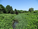
LSG WHV 00029 | Altengrodener Weg | 6.90 | location | position | 1938 |
|
LSG WHV 00031 | Heete with Heeteniederung | 0.50 | location | position | 1938 |
| LSG WHV 00033 | 8 throws | 0.30 | location | position | 1938 | |
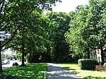
| LSG WHV 00037 | Wilhelmshaven cemetery | 8.60 | location | position | 1938 | |
|
LSG WHV 00039 | Frerichs farm | 0.60 | location | position | 1938 |

|
LSG WHV 00040 | Old and New Maade | 22.50 | location | position | 1983 |
| LSG WHV 00041 | Farms | 2.50 | location | position | 1938 | |

|
LSG WHV 00042 | Kreuzelwerk | 1.10 | location | position | 1938 |
| LSG WHV 00046 | Langewerth dike | 13.00 | location | position | 1938 | |

|
LSG WHV 00047 | Oyensburg farm | 0.50 | location | position | 1938 |

|
LSG WHV 00049 | Kniphausen Castle | 8.10 | location | position | 1938 |

|
LSG WHV 00051 | Mönkeburg Bush | 0.60 | location | position | 1938 |

|
LSG WHV 00052 | Dorfwarf Hohewerth | 2.50 | location | position | 1938 |

|
LSG WHV 00053 | Hohewerther grass house | 1.20 | location | position | 1938 |

|
LSG WHV 00054 | Deichzug Steindamm to Schilldeich | 4.90 | location | position | 1938 |

|
LSG WHV 00055 | Deichzug Steindamm via Schnapp | 10.50 | location | position | 1938 |

|
LSG WHV 00056 | Stone dam | 1.10 | location | position | 1938 |

|
LSG WHV 00061 | 2 farms in Mitteldeich | 1.10 | location | position | 1938 |

|
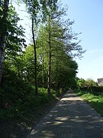
LSG WHV 00064 | farm | 1.00 | location | position | 1938 |
|
LSG WHV 00065 | Dike from Hörn to Voslapp | 5.80 | location | position | 1938 |

|
LSG WHV 00068 | Former Fort Rüstersiel | 14.50 | location | position | 1968 |

|
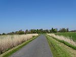
LSG WHV 00069 | Wehlens | 35.20 | location | position | 1975 |
|
LSG WHV 00070 | Breddewarden | 6.80 | location | position | 1937 |

|
LSG WHV 00071 | Utters | 6.10 | location | position | 1937 |

|
LSG WHV 00072 | city Park | 118.00 | location | position | 1982 |

|
LSG WHV 00073 | Old and New Maade between Coldewei and Kreuzelwerk | 47.00 | location | position | 1983 |

|
LSG WHV 00077 | Former Heppens shooting ranges between Freiligrathstrasse and Neuengrodendeich | 13.70 | location | position | 1994 |
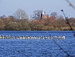
| LSG WHV 00080 | Hessen | 109.00 | location | position | 2004 | |
|
LSG WHV 00087 | Barghauser See | 32.00 | location | position | 2007 |
Remarks
- ↑ Coordinates were taken from the European Nature Information System (EUNIS) of the European Environment Agency : Nationally designated areas (CDDA) , file CDDA_v12_csv.zip, status October 2014. The map column shows the exact boundaries.
See also
- List of nature reserves in Wilhelmshaven
- List of natural monuments in Wilhelmshaven
- List of protected landscape components in Wilhelmshaven
Web links
Commons : Landscape protection areas in Wilhelmshaven - collection of images, videos and audio files