List of landscape protection areas in the Osnabrück district
The list of landscape protection areas in the district of Osnabrück contains the landscape protection areas of the district of Osnabrück in Lower Saxony .
| image | number | Name of the area | Area in hectares | map | Coordinates | Date of regulation |
|---|---|---|---|---|---|---|
| LSG OS 00001 | Northern Teutoburg Forest Nature Park - Wiehengebirge | 34694.50 | location | position | 1965 | |
 |
LSG OS 00002 | Forest in the Westerhauser Bruch | 3.00 | location | position | 1954 |
 |
LSG OS 00003 | Wulbergsheide | 40.00 | location | position | 1954 |
 |
LSG OS 00004 | Cabbage sheet | 3.00 | location | position | 1954 |
 |
LSG OS 00005 | Forest near Gesmold Castle | 11.00 | location | position | 1954 |
 |
LSG OS 00006 | The tale at Gesmold | 6.40 | location | position | 1954 |
 |
LSG OS 00007 | Groenenberg | 9.00 | location | position | 1954 |
 |
LSG OS 00008 | Brucher wood | 13.00 | location | position | 1954 |
 |
LSG OS 00009 | Strothheide | 21.00 | location | position | 1954 |
 |
LSG OS 00010 | Grove near Buer | 3.90 | location | position | 1954 |
 |
LSG OS 00011 | Forest area near Tittingdorf | 15.00 | location | position | 1954 |
 |
LSG OS 00012 | Düingdorfer Berg | 58.00 | location | position | 1954 |
 |
LSG OS 00013 | Limberg and Dieselkamp | 13.00 | location | position | 1954 |
 |
LSG OS 00016 | Riemsloh Forest | 220.00 | location | position | 1954 |
 |
LSG OS 00017 | Wooded area in Döhren | 49.40 | location | position | 1954 |
 |
LSG OS 00018 | Forest area near Neuenkirchen | 19.00 | location | position | 1954 |
 |
LSG OS 00019 | Warmenau banks | 1.00 | location | position | 1954 |
 |
LSG OS 00020 | Koenigsbrück | 15.00 | location | position | 1954 |
 |
LSG OS 00021 | Brennenheide | 21.00 | location | position | 1954 |
 |
LSG OS 00022 | Horstmann's wood | 49.00 | location | position | 1954 |
 |
LSG OS 00023 | Broken horse | 25.00 | location | position | 1954 |
 |
LSG OS 00024 | Forest area in Eickholt | 15.00 | location | position | 1954 |
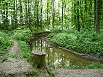 |
LSG OS 00025 | Forest areas near Dielingdorf and Handarpe | 32.00 | location | position | 1954 |
 |
LSG OS 00026 | Forest areas near Gerden | 19.00 | location | position | 1954 |
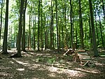 |
LSG OS 00027 | Forest areas around Sondermühlen | 241.40 | location | position | 1954 |
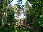 |
LSG OS 00028 | Wiedebrocksheide | 250.00 | location | position | 1954 |
 |
LSG OS 00029 | Forest areas near Schlochtern | 24.00 | location | position | 1954 |
| LSG OS 00031 | In the Hamme | 9.00 | location | position | 1955 | |
| LSG OS 00032 | Arguing | 4.00 | location | position | 1959 | |
| LSG OS 00033 | Schelenbusch | 7.30 | location | position | 1959 | |
| LSG OS 00034 | State forest Diepholz | 111.30 | location | position | 1969 | |
| LSG OS 00035 | Royal firs | 45.40 | location | position | 1959 | |
| LSG OS 00036 | At the Tappenburg | 38.50 | location | position | 1959 | |
| LSG OS 00037 | Hinterbruch forest area | 236.00 | location | position | 1959 | |
| LSG OS 00038 | Langelage | 98.20 | location | position | 1959 | |
| LSG OS 00039 | Meyer zu Broxten | 17.40 | location | position | 1959 | |
| LSG OS 00040 | Bohmter heather | 406.00 | location | position | 1959 | |
 |
LSG OS 00041 | Ippenburg | 48.90 | location | position | 1959 |
| LSG OS 00042 | Hünnefeld | 100.00 | location | position | 1959 | |
| LSG OS 00043 | Rottwald (forest east of the Hunte) | 54.00 | location | position | 1959 | |
| LSG OS 00044 | Hunte between Barkhausen and Wittlage | 14.90 | location | position | 1959 | |
| LSG OS 00045 | Arenshorst | 83.40 | location | position | 1959 | |
 |
LSG OS 00046 | Park at Gut Vehr | 5.20 | location | position | 1950 |
| LSG OS 00047 | dumber | 9.2 | location | position | 1981 | |
 |
LSG OS 00048 | Kilverbachtal | 122.00 | location | position | 1959 |

|
LSG OS 00049 | Teutoburg Forest | 11369.90 | location | position | 2004 |
 |
LSG OS 00050 | Wiehengebirge and northern Osnabrück hill country | 28839.10 | location | position | 2009 |
Remarks
- ↑ Coordinates were taken from the European Nature Information System (EUNIS) of the European Environment Agency : Nationally designated areas (CDDA) , file CDDA_v12_csv.zip, status October 2014. The map column shows the exact boundaries.
See also
- List of nature reserves in the Osnabrück district
- List of natural monuments in the Osnabrück district
- List of protected landscape components in the district of Osnabrück
- List of geotopes in the Osnabrück district
Web links
Commons : Landscape protection areas in the district of Osnabrück - Collection of images