List of landscape protection areas in the Aurich district

from Wikipedia, the free encyclopedia

The list of protected landscape areas in the district of Aurich contains the protected landscape areas of the district Aurich in Lower Saxony .

image number Name of the area Area in hectares map Coordinates Date of
regulation
View over the nature reserve LSG AUR 00001 Big sea and surroundings 2177.10 location position 1972
LSG AUR 00002 Bollandswater lowland area 19.40 location position 2007
Peat hut in the landscape protection area LSG AUR 00003 Victorburer and Georgsfelder Moor 445.30 location position 1993
LSG AUR 00004 Donkens wood 12.90 location position 1966
The monument on the hill LSG AUR 00005 Upstalsboom and the surrounding area 6.00 location position 1965
LSG AUR 00006 Wilhelminenholz 3.00 location position 1964
Rib ferns on a ditch embankment in the Egels forest, 1982 LSG AUR 00007 Egels forest and surroundings 881.00 location position 1965
Sandhorst Castle is located in the middle of the nature reserve LSG AUR 00008 At the Sandhorst Forestry Office 8.80 location position 1969
LSG AUR 00009 Popenser wood and surroundings 15.80 location position 1972
LSG AUR 00010 Residual moor area on the Donkens wood 2.80 location position 1972
Lake in the Berumerfehner - Meerhusener Moor LSG AUR 00011 Berumerfehner - Meerhusener Moor 1670 location position 1973
LSG AUR 00012 Residual moor area near Ochtelbur 19.20 location position 1974
The museum mill near Bagband is part of the landscape protection area LSG AUR 00013 Oldehave 724.00 location position 1975
LSG AUR 00014 Forest "Dreesche" 32.00 location position 1940
Rib ferns on a ditch embankment in the Egels forest, 1982 LSG AUR 00015 Tree population "Gut Kempe" 3.00 position 1965
Berum Castle LSG AUR 00016 Area near Berum Castle 2.80 location position 1965
Area near the castle in Hinte LSG AUR 00018 Area near the castle in Hinte 10.10 location position 1965
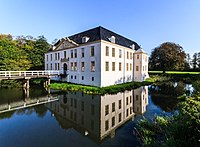
Castle park and the Kreihörn in Dornum LSG AUR 00019 Castle park and the Kreihörn in Dornum 11.80 location position 1969
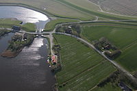
View from the Leybuchtsiel bascule bridge to the reservoir LSG AUR 00020 Neuwesteel 244.00 location position 1972
View from the Boekzeteler to the Timmeler Meer LSG AUR 00021 Boekzeteler Meer and surroundings 37.50 location position 1966
LSG AUR 00022 Remaining raised bog area Kreismoor 12.00 location position 1984
LSG AUR 00023 Raised moor on Mooracker- and 1. Hochmoorweg 22.60 location position 1984
View over the Ihlower forest LSG AUR 00024 Ihlower forest and the lowlands of the Krummen low 818.00 location position 1986
LSG AUR 00025 New Moor - Herrenmoor 281.00 location position 1986
LSG AUR 00026 Osteregelser Moor and surroundings 363.00 location position 1990
LSG AUR 00027 At the Ottermeer 116.00 location position 1991
Landscape protection area Ostfriesische Marsch between the north and Esens LSG AUR 00029 East Frisian march between the north and Esens 6339.20 location position 2011
View of the nature reserve from camping LSG AUR 00030 Krummhörn 5195.87 location position 2012
View of the nature reserve LSG AUR 00031 Western march 28.92 location position 2012

Remarks

  1. Coordinates were taken from the European Nature Information System (EUNIS) of the European Environment Agency : Nationally designated areas (CDDA) , file CDDA_v12_csv.zip, status October 2014. The map column shows the exact boundaries.
  2. Not shown on the map of the Federal Agency for Nature Conservation
  3. Not shown on the map of the Federal Agency for Nature Conservation
  4. Not shown on the map of the Federal Agency for Nature Conservation

See also

Web links