List of landscape protection areas in the district of Vechta
The list of landscape protection areas in the district of Vechta contains the landscape protection areas of the district of Vechta in Lower Saxony .
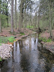
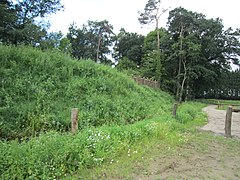
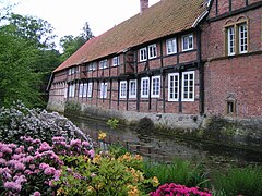
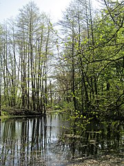
| image | number | Name of the area | Area in hectares | map | Coordinates | Date of regulation |
|---|---|---|---|---|---|---|

|
LSG VEC 00001 | Dammer mountains | 5567.30 | location | position | 2018 |

|
LSG VEC 00002 | Endeler- and Langenheide with the valleys of the Engelmannsbäke, Twillbäke, Schaarenbäke and Aue | 979.60 | location | position | 1980 |

|
LSG VEC 00003 | Freesenholz, Stubbenkamp, Wetschenholz, Holtershagen, Buchholz, Breitenbruch, Herrenholz, Arkeburg and Buchhorst | 1999.40 | location | position | 1980 |
| LSG VEC 00004 | Kühling's wood | 80.90 | location | position | 1980 | |
| LSG VEC 00005 | Rechterfelder Bruchbachtal | 12.70 | location | position | 1980 | |
| LSG VEC 00006 | Denghauser Mühlenbach valley | 61.70 | location | position | 1980 | |
| LSG VEC 00007 | Valley of the Brok and Elbows | 59.10 | location | position | 1980 | |
| LSG VEC 00008 | Apeler Bachtal | 24.60 | location | position | 1980 | |
| LSG VEC 00009 | Valley of the Goldenstedter Mühlenbach | 72.00 | location | position | 1980 | |
| LSG VEC 00010 | Varenescher Bäke | 29.70 | location | position | 1980 | |
| LSG VEC 00011 | Lahrheide forest area | 18.60 | location | position | 1980 | |
| LSG VEC 00012 | Oland | 33.00 | location | position | 1980 | |
| LSG VEC 00014 | Pastor's Bush | 1.60 | location | position | 1980 | |
| LSG VEC 00015 | Schlatt Niemann | 2.90 | location | position | 1980 | |
| LSG VEC 00016 | Schlatt Morthorst | 1.90 | location | position | 1980 | |
| LSG VEC 00017 | Schlatt Teven Pott | 5.30 | location | position | 1980 | |
| LSG VEC 00018 | Schlatt Sandman | 2.60 | location | position | 1980 | |
| LSG VEC 00019 | Schlatt Bruns | 3.10 | location | position | 1980 | |
| LSG VEC 00020 | Schlatt Kaufhaut | 5.10 | location | position | 1980 | |
| LSG VEC 00021 | Swamp with broken willow | 0.60 | location | position | 1980 | |
| LSG VEC 00022 | At the clay pit II | 1.70 | location | position | 1980 | |
| LSG VEC 00023 | Alder break with reeds | 1.90 | location | position | 1980 | |
| LSG VEC 00024 | Schlatt Erlte | 1.50 | location | position | 1980 | |
| LSG VEC 00025 | Schlatt | 0.20 | location | position | 1980 | |
| LSG VEC 00026 | Schlatt Slor | 9.20 | location | position | 1980 | |
| LSG VEC 00027 | Forest parcel | 1.10 | location | position | 1980 | |
| LSG VEC 00028 | Deciduous forest parcel with hedgerows | 16.50 | location | position | 1980 | |
| LSG VEC 00029 | Schlatt in the Dullen Moore | 2.50 | location | position | 1980 | |
| LSG VEC 00030 | Horseshoe-shaped pond at Gut Vardel | 0.10 | location | position | 1937 | |
| LSG VEC 00031 | Broken bush | 1.50 | location | position | 1937 | |
| LSG VEC 00032 | Pond in Deindruper Esch | 0.20 | location | position | 1937 | |

|
LSG VEC 00033 | Mill pond in Spreda | 0.80 | location | position | 1937 |
| LSG VEC 00034 | Harmerwood | 30.00 | location | position | 1937 | |
| LSG VEC 00035 | Quarry forest | 10.00 12.50 |
Location location |
position | 1937 1937 |
|
| LSG VEC 00036 | Old pod bushes | 0.50 | location | position | 1937 | |

|
LSG VEC 00037 | Forest of the Daren estate | 186.50 | location | position | 1958 |

|
LSG VEC 00041 | Groves near the Welpe and Füchtel estates | 67.00 | location | position | 1937 |
| LSG VEC 00045 | Place of growth of Lycopodium annotinum | 1.60 | location | position | 1937 | |
| LSG VEC 00047 | Moorbach knee | 1.00 | location | position | 1937 | |

|
LSG VEC 00049 | Dinklage Castle | 372.00 | location | position | 1983 |

|
LSG VEC 00050 | Klövekorns Helle | 0.01 | location | position | 1937 |

|
LSG VEC 00051 | Moat around the Lohne pastorate | 0.10 | location | position | 1937 |

|
LSG VEC 00052 | Wooded area around Gut Hopen | 26.40 | location | position | 1937 |

|
LSG VEC 00053 | Castle moat and forest near Haus Brettberg | 13.20 | location | position | 1937 |

|
LSG VEC 00054 | Stream with steep banks | 1.90 | location | position | 1937 |
| LSG VEC 00055 | Quarry forest | 10.00 12.50 |
Location location |
position | 1937 1937 |
|
| LSG VEC 00056 | Irregularly wide wall | 4.00 | location | position | 1937 | |
| LSG VEC 00057 | Forest stand "In catch" | 4.00 | location | position | 1937 | |

|
LSG VEC 00061 | Mill pond Lohne | 9.00 | location | position | 1955 |

|
LSG VEC 00062 | Mühlenteich Krimpenforter Mühle | 0.40 | location | position | 1937 |
| LSG VEC 00066 | Klün-Pott | 0.70 | location | position | 1955 | |
| LSG VEC 00070 | Blush pool | 0.70 | location | position | 1956 | |
| LSG VEC 00071 | Old trees | 0.30 | location | position | 1962 | |

|
LSG VEC 00072 | Geestrücken with its wooded areas between Vechta and Steinfeld | 1647.30 | location | position | 1986 |

|
LSG VEC 00073 | dumber | 651.90 | location | position | 1981 |

|
LSG VEC 00074 | Medium hunte | 695.10 | location | position | 1976 |

|
LSG VEC 00075 | Bockhorster Moor, Wilder Pool, Märschendorfer Teiche | 384.60 | location | position | 1984 |
| LSG VEC 00076 | Haverbeker Moor | 174.00 | location | position | 1990 |
Remarks
- ↑ The coordinates correspond to the center of a rectangle that frames the boundaries of the landscape protection area. Due to the shape of an area, they can also be located outside the actual area. The map column shows the exact limits.
- ↑ Lower Saxony State Office for Water Management, Coastal Protection and Nature Conservation (NLWKN): Ordinance of October 18, 2018 on the landscape protection area VEC No. 1 "Dammer Berge" [...]
- ↑ a b The Federal Agency for Nature Conservation shows two areas with the same names on its map
See also
- List of nature reserves in the Vechta district
- List of natural monuments in the district of Vechta
- List of protected landscape elements in the district of Vechta
- List of geotopes in the district of Vechta
Web links
Commons : Landscape protection areas in the district of Vechta - collection of images
