
District of Vechta
| coat of arms | Germany map |
|---|---|

|

Coordinates: 52 ° 41 ′ N , 8 ° 13 ′ E |
| Basic data | |
| State : | Lower Saxony |
| Administrative headquarters : | Vechta |
| Area : | 812.63 km 2 |
| Residents: | 142,814 (Dec. 31, 2019) |
| Population density : | 176 inhabitants per km 2 |
| License plate : | VEC |
| Circle key : | 03 4 60 |
| NUTS : | DE94F |
| Circle structure: | 10 municipalities |
| Address of the district administration: |
Ravensberger Strasse 20 49377 Vechta |
| Website : | |
| District Administrator : | Herbert Winkel ( CDU ) |
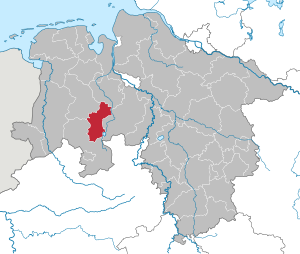
| Location of the district of Vechta in Lower Saxony | |
  |
|
The district of Vechta is a district in the west of Lower Saxony . The district town is Vechta .
geography
location
The district of Vechta represents the southern part of the Oldenburger Münsterland and extends to a maximum extent of about 50 km in north-south direction and 30 km in east-west direction between Oldenburg and Bremen in the north or northeast and Osnabrück in the south.
Located in the North German Plain , the district of Vechta has a share in the Wildeshauser Geest Nature Park in the northeast and in the Dammer Berge - Dümmer Nature Park in the south . The highest elevation of the district is to 146 m high ridge Damme mountains, m with 22 lowest point is in the northeastern corner of the community Goldenstedt on Huntetalgraben . In the east, large raised bogs form the natural border with the Diepholz district, some of which are under nature protection; the west and the middle of the district lie comparatively low and are crossed by a large number of small tributaries of the Hase . In the northeast, the Hunte forms the district boundary; it absorbs the surface water of the areas in the east of the district.

As a geographical specialty, the Weser-Ems watershed crosses the Vechta district from south to north, from the Großer Moor and the Dammer Mountains in the Dümmer Nature Park via the Arkeburg in the Goldenstedt community, which is exactly on the watershed, to Visbek , and further into the Cloppenburg district inside.
Neighboring areas
The district borders clockwise from the north on the districts of Oldenburg , Diepholz , Osnabrück and Cloppenburg .
Communities
The number of inhabitants on December 31, 2019 in brackets.
|
  |
history
In the early Middle Ages, Westphalian Saxons settled in the area of today's Vechta district . The north of the area belonged to the Lerigau , the south to the Dersagau .
In 1252, the power of government in the "Herrschaft Vechta" passed from the Counts of Ravensberg to the Bishop of Münster. Until 1803 the area was part of the bishopric of Münster . On July 18, 1803, the Vechta office was incorporated into the Duchy of Oldenburg as the "Landvogtei" . Apart from a short break during the so-called French period, during which Vechta belonged to the French Hanseatic Département de l'Ems-Supérieur (department of the Upper Ems) under Emperor Napoleon I from 1811 to 1813 , the area remained Oldenburg until 1946. Since the foundation of the state in 1946, the district of Vechta has been assigned to the state of Lower Saxony .
Most of the towns and communities in the Vechta district were already part of the Vechta rule in 1252. The parishes of Emstek and Cappeln were made into the district of Cloppenburg in 1814; the parish of Twistringen was ceded to the Kingdom of Hanover in 1817 . In 1879 the Vechta office was expanded to include the two dissolved offices of Damme and Steinfeld.
The Vechta district became the district of Vechta in 1939 . After the Second World War , the three communities Holdorf , Langförden and Lutten , which had lost their independence during the Oldenburg regional reform of 1933, were restored.
In the course of the Lower Saxony regional reform on March 1, 1974, the municipality of Lutten was incorporated into the municipality of Goldenstedt and the municipality of Langförden was incorporated into the city of Vechta. At the same time, the communities of Vörden , Hörsten and Hinnenkamp , which had previously been part of the Osnabrück district, became part of the Vechta district and became part of the Neuenkirchen-Vörden community .


Until 1998 the district administration resided in today's Niels-Stensen-Haus on the former site of Vechta Castle . In 1998 the new district building on Ravensberger Straße was completed. The building complex is based on a design by Eckhard Gerber (Hanover). The outer ends are faced with Bockhorn clinker . There is a ground level passage to the main entrance on Ravensberger Straße. The facility, which is open to the east on the park side, encloses a green, open inner area with elongated water basins. The assembly area is designed as a circular building with a plenary hall, a small conference room and a café. In the front courtyard there are ten wooden steles by the Lohner artist Ulrich Fox , which are intended to symbolize the ten towns and cities in the district. The system is closed in the rear parking zone by the “Steel Gate” by Horst Linn.
Population development
| year | Residents | source |
|---|---|---|
| 1933 | 49,427 | |
| 1939 | 51,912 | |
| 1950 | 79.125 | |
| 1960 | 74,200 | |
| 1970 | 86,600 | |
| 1980 | 98,500 | |
| 1990 | 105,408 | |
| 2000 | 126,434 | |
| 2010 | 135,374 |
religion
The district of Vechta, like the district of Cloppenburg , the district of Emsland , the former Osnabrück monasteries (only about 50% of this, however), Hildesheim and the Untereichsfeld are among the regions in Lower Saxony that - in contrast to most of the country - traditionally from the Catholic Church are shaped. Vechta is the seat of the worldwide unique institution in terms of state church law, the Bishop of Munster Officialate .
politics
District council
The district council currently has 48 elected members. In addition, there is the directly elected full-time district administrator . The district council is composed as follows:
| Parties and constituencies | Percent 2016 |
Seats 2016 |
Percent 2011 |
Seats 2011 |
Percent 2006 |
Seats 2006 |
Percent 2001 |
Seats 2001 |
|
|---|---|---|---|---|---|---|---|---|---|
| CDU | Christian Democratic Union of Germany | 59.07 | 28 | 64.18 | 28 | 69.72 | 31 | 68.31 | 35 |
| SPD | Social Democratic Party of Germany | 20.13 | 10 | 20.21 | 9 | 16.99 | 7th | 19.54 | 10 |
| Green | Alliance 90 / The Greens | 4.19 | 2 | 5.16 | 2 | 2.38 | 1 | 2.92 | 1 |
| FDP | Free Democratic Party | 4.61 | 2 | 4.45 | 2 | 6.35 | 3 | 4.52 | 2 |
| left | The left | 1.58 | 1 | 0.99 | 1 | - | - | - | - |
| UWG | Independent constituency of Vechta District (UWG) | 4.49 | 2 | 4.92 | 2 | 4.53 | 2 | - | - |
| AfD | Alternative for Germany | 5.90 | 3 | - | - | - | - | - | - |
| CENTER | Center Party | - | - | 0.05 | - | - | - | - | - |
| Flat share | Groups of voters | - | - | - | - | - | - | 4.7 | 2 |
| total | 100 | 48 | 100 | 44 | 100 | 44 | 100 | 50 | |
| voter turnout | 55.71% | 55.38% | 56.36% | 61.5% | |||||
- Groups of voters, as the 2001 result cannot be broken down into individual groups of voters.
District Administrator
District of Vechta is Herbert angle (CDU). In the last district council election on May 25, 2014, the previous first district council was elected with 81.13% of the votes without opposing candidates. The turnout was 48.97%. Even before he officially took office on November 1, 2014, Winkel represented Albert Focke (CDU), who died on June 5, 2014 . The district administrator automatically also belongs to the district council.
Institutional Membership
The district of Vechta is a member of the " Oldenburg landscape ", a registered corporation under public law for the maintenance and promotion of cultural and historical concerns in the former state of Oldenburg, as well as of the " Verbund Oldenburger Münsterland ", an institution for the promotion of tourism in the districts of Vechta and Cloppenburg.
Demographics and economics
High birth rate and low average age
The district of Vechta, like the neighboring district of Cloppenburg , is at the top of the districts with a low average age in Germany (40.5 years in the district of Vechta, 40.6 years in the district of Cloppenburg). This low value can be explained by the high birth rates per inhabitant of 1.87 (Lk Vechta) and 2.00 (Lk Cloppenburg). The reason given for the relatively high number of children per woman is the classic distribution of roles between men and women in the region that is considered “conservative”, as well as the comparatively high number of repatriates from the former Soviet Union in the region, many of whom are middle-aged and older women have many children .
Rise to the economic boom region
In the district of Vechta, the number of employees grew by 149% between 1978 and 2014; At that time there was no such strong growth in any other of the 325 rural districts and cities in the old federal states that existed at the time. The unemployment rate of 4% was one of the lowest in 2014, and the home ownership rate of over 80% was one of the highest in Germany. So
far, there has been particular growth in the food industry, especially since the Vechta district, together with the Cloppenburg district, is the center of the so-called meat processing industry in Germany. The Oldenburger Münsterland has a high concentration of fattening farms for pork, poultry and beef. In the district of Vechta, the mechanical and plant engineering, plastics technology and construction industries are also booming.
Endangerment of what has been achieved
In 2010, the district of Vechta was ranked 52nd out of 412 districts and independent cities in Germany in the future atlas of Prognos AG. In 2016 it was ranked 66th out of 402 local authorities (“class 3”). In 2016 it was again rated as a region and with “high future prospects”. In 2019, the district took 126th place. In the current “Future Atlas”, it is one of the regional authorities in “Class 4” (areas with “easy opportunities”).
According to Prognos AG, the development of the labor market in the district of Vechta in the years 2017 to 2019 and the dynamics of economic development as a whole are below the average of the 402 ranked regional authorities. In terms of demography, the district was ranked 26th.
In 2020, the “ Institute of the German Economy ” also examined the economic strength and dynamism of all 401 rural districts and urban districts in Germany. In terms of economic power, the district of Vechta ranks 90th according to the IW. However, the district is certified as having relatively low economic development dynamics: In this category, it ranks 314th. In districts with relatively low economic dynamics, according to the IW, there is a risk of “To rest too long on the successes of the past and miss the decisive course for a future-oriented development.”
Overall, the IW classifies the Vechta district as a “relegated” region. In a three-year comparison - mostly from 2017 to 2019 - only the development in the proportion of employees subject to social insurance contributions in knowledge-intensive services is positive. Vechta did poorly in terms of the development of the age quotient on the labor market (361st place), private overindebtedness (369th place) and the number of building permits (355th place).
This assessment was made on the basis of data that had been collected before the outbreak of the COVID-19 pandemic in Germany .
Self-image and external image
The district administration is of the opinion that "[t] he district of Vechta [...] is rightly considered particularly family-friendly". In contrast, CONTOR GmbH published its study "Family-friendly medium-sized towns" in 2020. In the ranking of all 585 German medium-sized cities, Vechta was placed 184th, Lohne 422nd.
traffic
Rail transport
The Vechta district was initially developed by the Oldenburg State Railways .
From 1885 a branch line ran from Ahlhorn on the Oldenburg – Osnabrück main line to Vechta, which was extended to Lohne in 1888. The extension to Neuenkirchen 1899 and Hesepe 1900 only took place after the direct line from Delmenhorst to Vechta had been opened in 1898.
The Holdorf – Damme branch line was also built in 1900. There, Wittlager Kreisbahn AG joined its line to Bohmte in 1914 .
In the same year, the Vechta-Cloppenburg rail association opened the connection to the district town of the neighboring district of Cloppenburg.
The community of Dinklage had already found a connection to the state railway in Lohne in 1904 through its own small railway .
Of the 91 km of routes with passenger traffic, 39 km were closed within ten years:
- 1952: Ahlhorn - Langförden - Vechta-Falkenrott 8 km; Holdorf - Damme 7 km; Vechta - Vestrup - Cloppenburg 11 km
- 1954: Lohne - Dinklage 8 km
- 1962: Schwegermoor - Südfelde - Damme 5 km
The Holdorf – Damme railway line was still used sporadically by the automotive supplier Lemförder Metallwaren AG, the agricultural reference cooperative and the Dammer agricultural machinery manufacturer Grimme for the transport of goods until around the mid-1990s . After that, the railway line was completely dismantled from 2000. There is now a cycle path on the former embankment .
The Lohne – Dinklage railway line was also dismantled from 2000 onwards; until 1999 it only served the function of a sporadically used transport route for the goods of the Dinklager animal feed manufacturer and agricultural trade HBD. On the premises of the company, only remnants of the track system are reminiscent of the railway line, and parts of the old railway embankment now also have a cycle path - as was the case on the Holdorf – Damme line .
The remaining Delmenhorst – Hesepe railway is operated by the NordWestBahn .

Road traffic
-
Federal highways
- A 1 (Hansa line)
- Federal highways
On July 1, 1956, the district was assigned the distinguishing sign VEC when the vehicle registration number that is still valid today was introduced . It is still issued today.
Local public transport
The Delmenhorst – Hesepe railway is used by the NordWestBahn, which serves the following places in the Vechta district: Rechterfeld , Goldenstedt , Lutten , Vechta , Lohne , Mühlen , Steinfeld , Holdorf and Neuenkirchen . Connection takes place every 60 minutes (approximately between 6 a.m. and 11 p.m.)
Bus traffic was intensified in 2007 with the establishment of the Verkehrsgemeinschaft Landkreis Vechta (VGV): There are only buses between some villages on school days, but this applies (almost) every day on all lines that lead to Vechta (no operation on Sundays and public holidays) . The Vechta city bus operated by VGV runs every 60 minutes from Monday to Saturday . The city bus was started in 2008 as a pilot project and ran until the end of 2011. Due to the number of passengers of 94,000 journeys (in 2011), the system proved to be a success and has been continued ever since. The bus pilot project moobil + was started at the district level on October 31, 2013 . This network of 14 minibuses serves all the municipalities in the district of Vechta and is geared towards needs (i.e. there are stops that are scheduled according to a fixed schedule and stops that are on-demand that can be called by phone or internet). The project is financed by the state of Lower Saxony, the district of Vechta and the cities and municipalities in the district as well as the local bus companies.
ecology
Protected areas
In the district of Vechta there are ten designated nature protection areas, four FFH areas, 76 landscape protection areas and 73 natural monuments .
See also:
- List of nature reserves in the Vechta district
- List of FFH areas in Lower Saxony
- List of landscape protection areas in the district of Vechta
- List of natural monuments in the district of Vechta
- List of protected landscape elements in the district of Vechta
The Federal Agency for Nature Conservation states in its “profile” about the Bersenbrücker Land as a natural area, to which the part of the Vechta district south of the Vechtaer Moorbach belongs, that this natural area only had an “effective protected area share” of 3% in 2010. “The area around Vechta is one of the centers of factory farming in Germany. The previously widespread use of grassland is now of subordinate importance (less than 3% area share) [,] whereas almost two thirds of the total area is used for arable farming. The terminal moraine arches are used almost exclusively as coniferous forests. Deciduous forest only plays a subordinate role. ”In 2010, the Federal Office rated 73% of the area of the Bersenbrücker Land natural area as a“ deficit area ”with regard to the BfN's plan to create biotope networks throughout Germany .
Emissions
The district of Vechta is the region in Germany that is most heavily polluted by ammonia emissions.
Trivia
In a curious way, the names of geographical objects that exist in both the Vechta district and the Grafschaft Bentheim district are piling up . The district of Lohne of the unitary community of Wietmarschen is often confused with the town of Lohne (Oldenburg), the Dinkel as a tributary of the Vechte is often confused with the Dinkel as the eponymous brook of the town of Dinklage and the Vechte itself is confused with the Vechtaer Moorbach , which in old sources also (like the aforementioned Bentheimer Vechte) is called "Vechta". The resulting confusion can be clearly seen in the section “The District of Vechta” in a book published in 1825.
literature
- Friederich Matthias Driver: Description and history of the former county, now the office of Vechte in the Niederstift Münster . Publishing house Peter Waldeck. Münster 1803 ( online . Pdf. 61.4 MB)
- Joachim Kuropka: The founding of political parties in 1945/46 in the Vechta district . In: Yearbook for the Oldenburger Münsterland 1974 . Vechta 1973, pp. 81-101
- Joachim Kuropka: From Kückens to Krapp. From state officials to citizen district administrators. Official governors and district administrators in the Vechta district 1918-2001 . District of Vechta 2001. ISBN 3-00-008685-4
Web links
Individual evidence
- ↑ State Office for Statistics Lower Saxony, LSN-Online regional database, Table 12411: Update of the population, as of December 31, 2019 ( help ).
- ↑ State Office for Statistics Lower Saxony, LSN-Online regional database, Table 12411: Update of the population, as of December 31, 2019 ( help ).
- ^ History of the district of Vechta
- ^ Law on the reorganization of the municipalities in the Vechta / Cloppenburg area of February 11, 1974
- ↑ Ruth Irmgard Dalinghaus: Art and culture in the district of Vechta. Oldenburg landscape / Vechta district 2004, p. 58
- ^ A b c d Michael Rademacher: German administrative history. (No longer available online.) Archived from the original on September 24, 2015 ; accessed on January 2, 2015 . Info: The archive link was inserted automatically and has not yet been checked. Please check the original and archive link according to the instructions and then remove this notice.
- ↑ Statistical Yearbook for the Federal Republic of Germany 1972
- ↑ Statistical Yearbook for the Federal Republic of Germany 1981
- ↑ a b c Lower Saxony regional database
- ↑ [1] Result of the district election 2016
- ↑ [2] Result of the district election 2011
- ↑ [3] Result of the district election 2006
- ↑ [4] Result of the district election 2001
- ↑ Vechta district - result of the 2014 district election , accessed on November 5, 2014
- ↑ Rebecca Piron: Where are the Germans youngest? . Kommunal.de. 4th March 2019
- ↑ Verbund Oldenburger Münsterland e. V .: OM location brochure . 2018, p. 13
- ↑ Russians in the flat country . dradio.de. May 12, 2009
- ↑ Jens Südekum , Wolfgang Dauth, Sebastian Findeisen: Losers (regions) of globalization in Germany: Who? Why? What to do? Heinrich Heine University Düsseldorf, Faculty of Economics, Düsseldorf 2016, ISBN 978-3-86304-689-7 , p. 4. ( online ).
- ↑ Prognos Future Atlas 2019 and Real Estate Atlas 2019. The ranking for Germany's regions. Prognos AG, 2019, accessed on June 15, 2020 .
- ↑ Vanessa Hünnemeyer / Hanno Kampermann: Rural Regions in Germany - Results of the IW Regional Ranking 2020 . Quarterly journal on empirical economic research, vol. 47. IW Trends 2/2020
- ^ Normann Berg: Economic Study: There is a lack of dynamism on site . om-online.de. June 11, 2020
- ^ Vechta district: families and children
- ↑ CONTOR GmbH: study "Family-friendly medium-sized cities" . 2020
- ↑ http://www.ov-online.de/aus-dem-landkreis/item/anrufbus-moobil-ab-sofort-im-kreis-unterwegs
- ↑ Federal Agency for Nature Conservation (BfN): Landscape profile: 58500 Bersenbrücker Land
- ↑ Federal Agency for Nature Conservation (BfN): Table of deficit areas in the transnational biotope network
- ^ [5] bundestag.de: Reduction of ammonia and nitrate
- ↑ Ludwig Kohli: Handbook of a historical-statistical-geographical description of the Duchy of Oldenburg, together with the inheritance of Jever, and the two principalities of Lübeck and Birkenfeld . 1825. Wilhelm Kaiser. Bremen, p. 278f.
Counties : Ammerland | Aurich | Celle | Cloppenburg | Cuxhaven | Diepholz | Emsland | Friesland | Gifhorn | Goslar | Göttingen | County of Bentheim | Hameln-Pyrmont | Harburg | Heidekreis | Helmstedt | Hildesheim | Holzminden | Empty | Lüchow-Dannenberg | Lüneburg | Nienburg / Weser | Northeim | Oldenburg | Osnabrück | Osterholz | Peine | Rotenburg (Wümme) | Schaumburg | Stade | Uelzen | Vechta | Verden | Wesermarsch | Wittmund | Wolfenbüttel
Region : Hanover
Independent cities : Braunschweig | Delmenhorst | Emden | Oldenburg (Oldb) | Osnabrück | Salzgitter | Wilhelmshaven | Wolfsburg