
dumber
| dumber | |
|---|---|

|
|
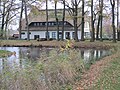
| The dumber at the windsurfer entry in Hüde | |
| GKZ | 49615 (Hunte from Bornbach to the mouth of the Rand Canal) |
| Geographical location | District of Diepholz , Lower Saxony ( Germany ) |
| Tributaries | Hunte |
| Drain | Arms of the Hunte: Hunte, Lohne , Grawiede , Wätering , Omptedakanal |
| Places on the shore | Hude , Lembruch |
| Location close to the shore | Damme , Diepholz , Lemförde |
| Data | |
| Coordinates | 52 ° 30 '42 " N , 8 ° 20' 9" E |
| Altitude above sea level | 37.1 m above sea level NHN |
| surface | 12.4 km² 14.97 km² (with silting zones) |
| length | 5.5 km |
| width | 4 km |
| volume | 14 million m³ |
| scope | 16.9 km 23.3 km (with siltation zones) |
| Maximum depth | 1.4 m |
| Middle deep | 1.1 m |
| Catchment area | 337 km² |

|
|
| Location of the stupid and course of the Hunte | |
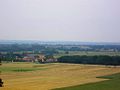
The Dümmer , also referred to as Dümmer See on official signposts , is a 12.4 km² large and up to 1.4 m deep lake in the west of the north German lowlands in the Lower Saxony district of Diepholz ( Germany ). It lies in the triangle between the spots and cities of Lemförde , Damme and Diepholz and is traversed by the Hunte .
etymology
In 965 the word "diummeri" was first mentioned in a document. The name "Dumber" is probably made up of the components "dumber" and "sea". In north-west Germany “sea” is the name for a calm body of water from and next to which moors form (cf. also the large Lower Saxony lakes “ Steinhuder Meer ” and “ Zwischenahner Meer ”); In terms of arable land, “stupid” means “damp” and “shady” in Westphalian.
There may also be a relationship between the word dumber and the southern Dutch word “doom” (“steam”, “fog”).
“The Dümmersee: Diummeri ... too Westphalian stupid, damp, dull (from land), Norwegian dumb, ambiguity in the air, fog corner. The second part is meri, the Landsee. "
geography
location
The Dümmer lies in the Dümmer-Geest lowlands at 37.1 m above sea level. NHN . To the west the landscape rises to the 146 m high Dammer Mountains , to the southeast to the Stemweder Berg ( 181.4 m ), and to the northeast it leads over to the Kellenberg ( 77 m ). In addition to these three mountain ranges, the lake is one of the main parts of the landscape in the Dümmer Nature Park , in the southern center of which it extends. It is traversed by the Hunte , which flows in in the southwest and out in the north.
The water surface of the lake belongs entirely to the district of Diepholz , but on its west bank the district of Vechta extends into the dike foreland. In the northwest, the district boundary is only a few meters from the shoreline. In the southwest next to the Hunte confluence, a corner of the Osnabrück district extends up to half a kilometer from the lake. While the Diepholz district had belonged to the Electorate of Hanover from 1585 ( Diepholz County ) and 1582 ( Hoya County ) , the area of the Vechta district had been the territorial property of the Diocese of Münster for centuries and only came to Oldenburg with the Reichsdeputationshauptschluss of 1803. Therefore it is counted as part of the Oldenburg Münsterland .
The Dümmer lies in the triangle between the spots and towns of Lemförde in the southeast, Damme in the west and Diepholz in the north-northeast. Direct riverside locations are Hüde in the southeast and Lembruch in the northeast; Somewhat away from the bank, in the northwest, lies the Dümmer district of Dümmerlohausen . Around the Dümmer there are low and high moors of the Diepholzer Moorniederung .

View from the observation tower on the Mordkuhlenberg in the Dammer Mountains east-southeast to the Dümmer
View from the north slope of the Stemweder mountain northwest to the Dümmer
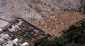
Aerial view of the beach and boat harbor at Hüde ( east bank ) in 1989

Embankment in the northeast of the lake

West bank with the Olga harbor in Dümmerlohausen
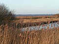
The south bank is under nature protection

Ochsenmoor south of Dümmerrandstrasse


Natural allocation
The Dümmer belongs to the natural area main unit group Dümmer-Geestniederung (No. 58), in the main unit Diepholzer Moorniederung (584) and in the sub-unit Dümmer-Moorniederung (584.0) to the natural area Dümmer-Niederung (No. 584.04).
features
The Dümmer is the second largest lake in Lower Saxony after the Steinhuder Meer . Its water surface is 12.4 km², the area within the ring dike including the silting zones is 14.97 km². The lake is a maximum of 1.4 m deep, which results in inexpensive swimming and water sports. The Flachsee with correspondingly flat beaches on the west and east banks is a maximum of 5.5 km long from south-southeast to north-northwest and a maximum of 4 km wide from west to east. Since the Bornbach diversion was founded, its catchment area has been 337 km².
The Hunte flows through the water body. She leaves the lake in several branches, the largest not the Hunte, but the reward is said arm. Other poor are the Grawiede and - artificially - Wätering , Dorflohne, Schoddenlohne and Omptedakanal . Only 13 km north of the lake and 3 km north of Diepholz are all the hunt arms reunited. The theoretical water retention time is around 85 days in summer and around 46 days in winter.
The fish-rich lake, which is also a breeding and resting place for birds, has a diverse flora and fauna . That is why the west and south banks of the lake and a strip on its east bank are largely under nature protection.
Although the lake is only about one meter deep on average, springs that are rich in water and also the Hunte keep its water level relatively constant. In the past, these tributaries combined with heavy rainfall caused regular floods, so that in the 1940s the lake began to be dammed in large areas. Russian prisoners of war were used on a large scale for this purpose from 1941 to 1945. The dike resulted in the fact that the absence of annual floods caused ever larger stocks of algae to form in the lake, which deprived most of the other living beings of oxygen. The low water level is due to heavy silting, which is also a result of the dyke. With the help of some locks, it was possible to artificially control these flood ingresses without interfering too much with nature. Nevertheless, the Dümmer suffers from heavy nutrient input due to intensive agriculture.
history
Origin of the stupid
The Dümmer was formed around 12,000 years ago and has a similar history to that of the Steinhuder Meer: Until now, it was assumed that the Dümmer was a deflationary basin. However, the surrounding sands (dunes) are not sufficient to interpret the formation as a deflation basin. Today it is believed that the lake basin of the Dümmers was formed by the formation of ice lenses during the Vistula glacial period . The glaciation of this last Ice Age did not extend into this region, but the landscape was periglacial , i.e. formed as a cold steppe. This ice lens theory was arrived at through studies of the periglacial space in Canada. However, this phenomenon must not be confused with the so-called pingos .
Paleolithic
The oldest human presence on the Dümmer so far is proven by a harpoon tip that was fished out in the Dümmer in 1887. It was made by people from the Paleolithic Age , who chased the reindeer 15,000 years ago in the treeless tundra of the Bölling-Interstadial of the Vistula Glaciation 15,000 years ago.
With the rise in temperatures around 12,000 years ago, nature changed on the Dümmer: birch and pine forests expanded, more hardwoods were added, large and small game became home - an ideal livelihood for the Mesolithic people. A barbed point, perhaps a harpoon point - found near Lemförde in 1973 - confirms the presence of these Mesolithic people as early as the end of the Vistula Glaciation, because the C14 method was used to date the point to an age of 11,000 years before our time.
A further 150 predominantly Mesolithic sites were identified from 1999 onwards through systematic field inspections, especially in the western area of the Dümmers along the early post-glacial shoreline of the lake.
Transition from the Mesolithic to the Neolithic
7000 years ago the previous nomads of the Dümmerniederung settled down.
During dike construction and drainage work, a prehistoric settlement was discovered south of the Dümmers on the Hunte tributary. This was systematically excavated from 1961 to 1967 under the scientific direction of Jürgen Deichmüller on a total area of 1100 m².
The found material, comprising many thousands of objects, “is extremely rich and varied and provides an unusually good insight into the everyday life of those people who still hunted and caught fish, but who had already started to breed pets, cultivate grains, and add stone axes pierce and grind, spin wool, shape vessels from clay and burn, and build huts that are stronger than their ancestors. "
Because of the extraordinary wealth of the finds, including organic substances that were suitable for radiocarbon dating, a chronological division of the settlement period of this place could be made:
- approx. 4200-3700 BC Chr .: First still numerically small settlement phase
- approx. 3700-3180 BC Chr .: "Main settlement period with a large number of processed and radiocarbon-dated woods that appeared outside the area of the upper culture layer."
- approx. 2950-2700 BC Chr .: The third settlement period “appears to be isolated from the two preceding ones; however, it cannot be ruled out that a small number of people still inhabited the settlement area. "
Judging by the bone finds in the individual layers, the inhabitants of the settlement were still hunters of the Mesolithic, even if pet bones are already present.
Evidence of Neolithic ceramics, in some cases even with their own characteristics ("Dümmer ceramics" or "Hude-Swifterband group"), suggests contacts to the Neolithic cultures that already existed south in the loess areas. The remains of grain in mills and bowls should not necessarily be considered evidence of a rural way of life, because productive forms of economy such as agriculture and cattle breeding cannot be proven.
The Neolithic
At the end of the second settlement phase of Hude I - around the time 3300 to 3200 BC. BC - people from a different cultural area created a settlement on a hilltop that rose slightly on the Hunte river north of the Dümmer. This was later referred to as "Hunte I".
This place was discovered in 1934 when the Hunte was being straightened out, but it was not systematically excavated until 1938 to 1940 by Hans Reinerth, then head of the Reich Prehistory Office. In 2000, the excavation documents scattered during the Second World War and the found material were brought together again as part of a research project by the Lower Saxony State Museum in Hanover in order to evaluate them scientifically.
The finds from the 1st settlement phase of "Hunte I" can be assigned to people of the funnel cup culture. It is "the first cultural group in northwest Germany that has all the characteristics of a Neolithic economy and society."
This Neolithic solved in the 4th millennium BC The previous Mesolithic way of life, which had existed for almost 5000 years, gradually declined. For this momentous transition phase from the Mesolithic to the Neolithic in northern Germany, the two sites of Hude I and Hunte I are of great scientific importance and characterize the Dümmerniederung as one of the most important prehistoric regions.
From antiquity to the early 20th century
Since its formation after the Vistula Ice Age, the Dümmerniederung has always been a lowland landscape characterized by abundant water. Over the millennia with slow global warming, bog soils developed. Because of the heavy moisture, settling the lowlands around the Dümmer was very difficult for people in the Middle Ages. The Hunteniederung was a landscape between water and land that could not yet be used for agriculture. For centuries, people used the lake primarily in search of fish. The first permanent small settlements from courtyard groups were established in the Middle Ages on small hills such as B. in Burlage, Marl and in the vicinity of the Stemweder mountain.
In the 13th century, Dutch hydraulic engineering specialists began to drain the wet lowlands north of the Dümmers with the help of drainage ditches. With the help of the hydraulic engineering experts, the lowland could be used extensively for agricultural purposes for the first time. The landscape slowly changed its face and gradually developed from a forest to a meadow landscape. Until the early 1950s, the meadows could only be used very extensively for agriculture and were regularly flooded. Therefore a rich bird and plant world developed here in the near-natural habitat types.
The poor passability of the constantly damp areas on both sides of the Hunte north and south of the Dümmers made the area a border region. After the Reichsdeputationshauptschluss 1803 with the loss of the secular power of earlier prince-bishops , the kingdoms of Hanover and Prussia and the Grand Duchy of Oldenburg bordered one another in the Dümmerraum . To this day, the Dümmer forms a denominational boundary between the predominantly Catholic Oldenburger Münsterland and the predominantly Protestant district of Diepholz.
Since 1939

The embankment of the Dümmers between 1939 and 1953 created the conditions for an economic development in which settlement, agriculture and trade could be intensified. In addition to the dike project, the improvement of the lowland with the draining of the moors for the purpose of intensifying agriculture, industrial peat extraction and the creation of additional usable areas resulted in the mineralization of the raised bog peat. The minerals (nitrogen from fens and phosphorus from raised bogs) are washed into the Dümmer via the drainage channels and the Hunte and lead to the “overfertilization” of the lake. Added to that comes manure -load of meadows and fields by the factory farms in the district of Vechta. In 2004 it was found that the Dümmer was polluted with about 30 tons of phosphorus annually by the bog mineralization and the intensive agriculture.
The price for this was severe damage to the natural balance of the stupid. Within a few years underwater plants and pond clams disappeared , reeds and rushes declined. The mud began to choke the lake. For decades there was a conflict of interest between Dümmer residents and conservationists. Even today, agriculture, water management and tourism are expressly classified as "threats" to the Dümmer landscape protection area in the landscape framework plan for the Diepholz district.
As early as the 1980s, there were first attempts to remediate stupid things. It turned out, however, that nature conservation on the Dümmer could only be politically enforced where the public authorities had bought the land from the landowners. After this was done, work began on the concept of dumber remediation in 2004. This concept has the following priorities:
- Nature conservation: Permanent conservation of the areas of the Dümmers and the Dümmerniederung, which are valuable for nature conservation, with the flora and fauna specific to the natural area; this also includes the restoration of special biotopes, insofar as these are significantly impaired or destroyed.
- Water management: Preservation of an open water surface of the Dümmers and the improvement of the water quality of the surface water and the groundwater by reducing the nutrient inputs.
- Agriculture: Securing the livelihoods of the agricultural operations concerned, taking into account land use oriented towards nature conservation and water management.
- Recreation and tourism: Preservation of the Dümmern and the Dümmellow as a recreational area.

It is difficult to get a grip on the large-scale blue - green algae that occurs regularly in summer . The lake water comes mainly from the Hunte. The catchment area of 324 square kilometers is predominantly used intensively for agriculture. The resulting, in spite of the already implemented measures for Dümmers remediation, persistently too high pollution with phosphorus leads to an increasing multiplication of planktonic algae.
present
In 2007, the local editor of the Oldenburgische Volkszeitung responsible for Damme , Klaus Peter Lammert, was convinced that the trend towards gentle tourism on the Dümmer was “irreversible”. As part of the “Experience Nature” funding program, the extensive network of hiking and cycling trails had been signposted, lookout towers had been roofed over and renovated and new information boards had been put up.
On 26 October 2016, presented FDP fraction in the parliament of Lower Saxony on the Dumber by State Ordinance, the the request, kite surfing to allow. The application was rejected by the majority of the members of the state parliament. In October 2018, the Landtag member responsible for the Diepholz district, Marcel Scharrelmann (CDU), warned against attaching too high priority to nature conservation. The Diepholz district administrator Cord Bockhop (CDU) also believes that there are "other interests in addition to nature conservation Dumber ”that should also be taken into account.
Conservationists, on the other hand, are of the opinion that the Dümmer “is simply too small for safe and at the same time nature-friendly kitesurfing”. The Lower Saxony State Agency for Water Management, Coastal Protection and Nature Conservation (NLWKN) rates the disruptive potential of kitesurfing higher than that of windsurfing, sailing or rowing boats ( practicing these sports on the Dümmer is justifiable). The NLWKN names high speed, unpredictable direction of movement, sails in bright colors and popping noises when the sail hits the water while kitesurfing as aspects that birds perceive as a threat. He puts the alarm and escape distance at 300 to 1000 meters, depending on the species. The distance at which the birds already felt disturbed and stopped eating, for example, was even higher. A single kite surfer is enough to scare away the waterfowl in the corresponding area, according to the NLWKN. If kitesurfing is done regularly in an area, waterfowl could be expelled permanently. Their habituation to the sport, including its various aspects, has not yet been proven and cannot be expected from a behavioral point of view.
Use of the dumber room by humans
Natural park
The Dümmer is the core of the Dümmer Nature Park , which has existed in its current size since October 19, 2011.
Nature conservation, water and energy management
The remediation concept envisages, on the one hand , reducing the nutrient input from the rivers and, on the other hand, sucking off the sludge over several years. For this purpose, the sewage treatment plants in the Dümmer area were equipped with a third purification stage , and the Bornbach was diverted. The desludging of the stupid is tackled as an ongoing task.
A restoration of the lake's self-cleaning powers cannot be achieved in this way. There is a lack of underwater plants and pond clams, algae-eating crabs and bottom animals as well as predatory fish that keep non- predatory fish at bay. The dead reeds cannot be washed out of the lake into the meadows because of the dike. The water level set via the locks - high in summer and low in winter - virtually prevents the reintroduction of many species of the former community. Only when there is little water in summer, light reaches the lake floor and air reaches the root area of the reed beds. Dead plant parts can only get out of the lake during floods and flooding in spring.
The areas to the west and south of the Dümmers were rewetted between 2002 and 2007. As part of this rewetting , around 175 hectares of former agricultural land were acquired. As a result, a fen area totaling 2500 hectares was rounded off in the EU bird sanctuary “Dümmer”. That was an essential prerequisite for the large-scale rewetting. With their help, one of the largest contiguous wet grassland areas in northwest Germany was developed as a suitable habitat for meadow birds. In 2009, the measure was the only German project to receive the “Best Practice Award” from the EU .
Nature conservationists warn that the Dümmer area should be more closely linked with the bordering moors on the western edge of the Diepholzer Moorniederung and that the renaturation of the flowing waters in the Dümmer area should be tackled.
To the west of the Dümmers, in the area of the town of Damme, is the Borringhauser Moor wind farm . Between the end of 2001 and mid-2017, 15 Vestas V80 wind turbines with a nominal output of 2 megawatts each (30 megawatts total output), 100 m hub height and 80 m rotor diameter (140 m total height) were operated there. Between the end of 2016 and mid-2017, these 15 wind turbines were replaced by twelve more powerful turbines ( repowering ). The new Siemens Gamesa SWT-DD-130 wind turbines each have a nominal output of 3.3 megawatts (39.6 megawatts total output), 135 m hub height and 130 m rotor diameter (200 m total height). Nature conservationists viewed this extension as extremely critical, as the required protective distances of 1000 m to the bird sanctuary would not be maintained and migration corridors would be impaired. In addition, the extension areas are important resting and grazing areas for birds. The NABU (Vechta district group) has detailed its concerns in a letter to the city of Damme. Last but not least, the significantly higher systems are likely to have an impact on the landscape of the nature park, which is mainly determined by large areas of moorland and meadows.
The nature conservation ring Dümmer promotes the resettlement of ospreys and tree frogs on the Dümmer. The NUVD is committed to revitalizing the ailing reed belt on the lake.

In 1993, the state of Lower Saxony set up a nature conservation station in Marl . The station operates a nature adventure trail.
In November 2009, several beavers were spotted on Dümmer . How they got there is unknown; natural immigration from the Elbe or the Hase appears unlikely. A year earlier, conservationists had campaigned for the beaver to be reintroduced to the area where it used to be; Water managers, on the other hand, see dangers for the stability of the Dümmerdeich, which has already been massively undermined in two places. For the protection of the dyke base at the eight weir systems by installing steel mesh mats alone, costs of around 250,000 euros can be expected. A drastic increase in the contributions for the Hunte water association cannot be ruled out. The Lower Nature Conservation Authority of the district of Diepholz announced that beavers may only be caught and taken away if the beavers cause considerable damage or if they were North American beavers, as cases of faunal adulteration must not be tolerated. The genetic and anatomical examinations of the two beavers found dead near Burlage and Hunteburg showed that they were European beavers. In February 2010 the press reported about further beaver tracks down the hunt in Barnstorf. At the end of March 2010, the police reported a minor traffic accident involving a beaver in Wildeshausen. The Lower Saxony State Agency for Water Management, Coastal Protection and Nature Conservation (NLWKN) rated in a paper from 1998 - without reference to the Dümmer - the west migration of the strictly protected Elbe beaver, which had long been considered lost or extinct.
As part of the Dümmer renovation project, the fact that the Dümmer should serve as a retention basin to regulate the water level of the Hunte to Wildeshausen and thus protect the communities downstream from flooding is also taken into account .
Agriculture, peat farming and fishing
In the middle of the 20th century, the dike in the Dümmer and the excavation of the peat on the adjacent moorland should create the possibility of intensive agricultural use of the Dümmer border areas and industrial peat extraction . As a result of these measures, the ecological value of the soils and the dumber itself (until 2004, 30 tons of phosphorus flowed annually from the Vechta district alone until 2004 ) were considerably reduced.
In the course of the land consolidation , the owners of the areas that were to be ecologically upgraded received partly compensation areas and partly compensation payments. Today, no peat is extracted from the rewetted areas.
The nature reserves have been leased to over 100 local farmers. The area management is controlled by the nature conservation station Dümmer on site in such a way that the conservation goals of the EU bird sanctuary are achieved, but the farmers remain integrated through a nature conservation-compliant management and maintenance of the areas.
The Dümmer forms a separate district among the 70 fishing districts in Lower Saxony. The commercial fishery on the Dümmer is operated by a tenant.
Once upon a time, dumber fishermen found up to 20 species of fish in their nets, including carp , pike , perch and chub . However, in the last few decades the catch results have steadily decreased. Today in Dumber lives overpopulation plankton -eating predatory fish ( roach , bream , rudd and bream that no longer reach their natural size).
Several times there were bitter disputes between the Dümmer fisherman and nature conservation organizations over the right to shoot cormorants , which the fisherman blames for the decline in fish stocks in the Dümmer.
There is a fish smokehouse each in Dümmerlohausen and Lembruch . However, most of the two companies no longer purchase their goods from Dümmer.
Tourism, leisure and services
The "Specialist Service Tourism in the District of Diepholz" regards the development of tourism in the district "as an important building block for sustainable regional development in rural areas and thus as active economic promotion for an important branch of the economy in the district." The specialist service is primarily active in the four segments of cycle tourism , Equestrian tourism, water tourism and nature experience.
The main places of Dümmer tourism are the towns of Hüde and Lembruch, located directly on the east bank of the Dümmer. But also on the west bank, in Dümmerlohausen in the district of Vechta, there are accommodations and gastronomic offers as well as opportunities to practice water sports.

Bridge over the Hunte as part of the Dümmer-Rund-Tour cycle path

Sailboats on the Dümmer. Lembruch in the background

Beach scene at Dümmer near Hüde in early summer 2019
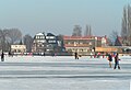
East bank of the Dumber in winter. Lembruch in the background
Dümmer Museum in Lembruch

Bronze sculpture “What's Up” by Edwin Partoll at the Dümmermuseum

Fireworks "The Dumber is Burning" at Hüde


Hiking and cycling
The bridge cycle path (Bremen – Osnabrück) leads west and east past the Dümmer, in sections near the shore. The 27 km long Dümmer-Rund-Tour cycle path leads around the lake . There are also two sculpture paths on the Dümmer-Ostufer (see below)
Sailing and surfing sports
Despite the extensive closures of the lake area for water sports enthusiasts in the interests of nature conservation, the Dümmer has become a popular destination for sailors and surfers .
In 1922 the first sailing club was founded on the Dümmer. By the Second World War there were about 60 sailors who had 35 dinghies at their disposal. Before that time, only one type of boat was known, the Dümmerpünte , a flat boat made of oak and almost exclusively used for economic purposes such as fishing and the transport of rushes and reeds. After the Second World War, water sports expanded. Further sailing clubs emerged. Today (2009) there are around 25 clubs around the Dümmer that practice their sport with more than 2000 boats and over 1000 surfboards. Most of the sailing clubs have joined forces to form the Dümmer racing community in order to cope with common tasks that arise from youth work, popular and competitive sports.
Sailing regattas with the regatta classes of the pirate boat class , the P boat , the S cruiser and the Europe boat class take place on the lake . The Sailing Club Clarholz (SCC) is one of the largest sailing clubs on the Dümmer. He has often hosted the International German Youth Championships (IDJM) in the 420 , P-Boat (2002) and in the Pirate, and in 2005 in the International German Championships (IDM) in the Pirate.
Other large clubs that organize national and international regattas are the Seglervereinigung Hüde (SVH), the Segler Club Dümmer (SCD), the Motor- und Segelclub Bielefeld (MSC) and the Bielefelder Segler Club (BSC). The sailing association Hüde has an environmentally friendly inland port for dinghies and sailing yachts up to approx. 7 m in length, which was newly built in 2005/06. The association is involved in youth work and in promoting competitive sport among young sailors. In the summer of 2005, the Lembruch Schoddenhof sailing club (SCLS; today: Lembruch sailing club - SCL) hosted the first world championship on the Dümmer for the FJ class. In order to ensure the organization of the regattas and the necessary security service, the "Dümmer See racing community" was founded.
For many years windsurfers have been organized in the registered association Windsurfclub Dümmersee (WSCD). The association works to improve the infrastructure for surfers on the Dümmer and supports surfing events.
From November to Easter there is a winter driving ban for sailors and surfers on the Dümmer. If a boat has a fuel-powered engine, it may not be used on the Dümmer.
to bathe
On the east bank of the Dümmers there are four sandy beaches where you can swim for free. These beaches are child-friendly as they have a relatively low gradient and the water quality is checked regularly. As a result of regular measurements, bathing was temporarily prohibited several times in the 2000s and 2010s due to excessive pollution of the water by blue-green algae.
fishing
On the banks of the Dümmers, recreational anglers have the opportunity to fish outside of the nature reserves and away from the mouth of the Huntes, where angling is generally prohibited, after obtaining a fishing permit.
Winter activities
As soon as the lake is frozen over in stable cold weather, you can skate, play ice hockey and ice sailing on the Dümmer . In the winter of 2008 10,000 people came to an ice party on the Dümmer.
Since 2001, the Dümmer ice bet has been held every year at the beginning of January, based on the model of the Bremen ice bet .
"Dumber Shamrock"
The so-called "Dümmerkleeblatt" includes four educational institutions on the Dümmer, which are committed to imparting knowledge in the areas of natural history, ornithology and the history of cultural agriculture. These are the Dümmer Museum in Lembruch, the nature conservation station in Marl, the Dümmer Vogelschau in Dümmerlohausen and the natural area Dümmerniederung eV with the Schäferhof on the Hunte.
The Dümmer Museum shows permanent multimedia exhibitions on the subjects of "landscape development", "flora and fauna" and "Stone Age settlement sites". The Dümmer Museum and the nature conservation station organize 70 to 100 excursions per year as part of environmental education .
Dumber home
The district of Vechta operates a youth and leisure center in Dümmerlohausen near the Dümmer-Westufer, which is also known as Dümmerheim and is available for leisure time, seminars, school trips and events. Self-caterers can use the self-catering house there.
Culture and events
Since 2014, a sculpture path called “The Sight” has led from the starting point at Diepholz Castle to the Dümmermuseum in Lembruch. This path merges into the “SEE SICHT” sculpture path, which was opened in 2016 and whose stations are located near the Dümmer-Ostufer. Cyclists and pedestrians can view a variety of sculptures along both trails.
Every year at the end of August there is a major event on the Dümmer near Hüde under the motto: “The Dumber is on fire”. Thousands of visitors watch the fireworks over the lake.
Vacation homes


Small settlements with holiday homes have been located on the north and east banks of the Dümmers for a long time.
To the south of the center of Lembruch, on the site of the former Schoddenhof, the "Marissa Park" is to be built on an area of 18 hectares by 2021, a holiday park with 478 holiday homes and apartments. In the final stage, 4,000 beds will be available. The first apartments were rented in August 2019. Due to the mild winter 2019/2020, the planned schedule could be adhered to until spring 2020 despite the corona crisis . The planned holiday park was the largest tourism project in Lower Saxony in 2019. In addition to the previous visitors to the Dümmers in the neighboring districts of Lower Saxony, in Bremen and north-eastern Westphalia, guests from the Rhine-Ruhr area, from more distant parts of northern Germany, will be invited by the new facility , but also from neighboring countries and Scandinavian countries to stay at the Dümmer.
Bend Averbeck, chairman of NABU Dümmer, sharply criticizes the “Marissa Park” project: The pressure on protected areas will increase. Water sports enthusiasts could drive away the birds, and hikers could penetrate the breeding and resting areas. The landscape is "completely devalued". The "huge facility" with four-story buildings also looks ugly. It is questionable whether the expected masses of tourists really come to the dumber. Averbeck points to failed tourism investments in the past and vacancies. Those who are really interested in nature do not want to “move into such a ghetto”. Holger Buschmann, Chairman of NABU Lower Saxony, said in November 2018 that NABU did not intend to block tourist developments on the Dümmer, the opposite was the case. The "right measure" is only given up by applying for permission to kitesurf on the Dümmer.
Protected areas

Due to its importance for species, nature and landscape protection, both the Dümmer and its surroundings are protected by various instruments.
Nature reserves
Areas around the Dümmer are protected by five nature reserves. The west and south banks of the Dümmer and a strip of land behind them have been in the Dümmer nature reserve since December 17, 1961 . A strip on the east bank between Hüde and Lembruch has also been under nature protection since September 2, 1971 (name of the nature reserve: Hohe Sieben ). The zone of contiguous nature reserves is supplemented by areas on both sides of the Hunte, south and north of the Dümmers (the nature reserves West Dümmerniederung since December 20, 2007, Ochsenmoor since February 16, 1995 and Huntebruch and Huntebruchwiesen since November 15, 2007). In the interests of nature conservation, the circular path around the Dümmer in the area of the upper Hunte crossing is clearly swiveled to the south.
Landscape protection area
On April 2, 2015, areas that had not yet had protection status were declared a landscape protection area.
Fauna-flora habitat area
The FFH area Dümmer with the area number 3415-301 has an area of 2965 hectares. It is a large flat lake with extensive natural silting zones on fens (including underwater, floating leaf and reed vegetation, reed beds, tall herbaceous meadows, sedge beds, alder-ash forest, alder forest , Wet grassland).
The habitat types are protected :
- natural eutrophic lakes with magnopotamion or hydrocharition vegetation
- Rivers of the planar to montane level with vegetation of the Ranunculion fluitantis and the Callitricho-Batrachion
- moist high herbaceous vegetation of the planar and montane to alpine level
- lean lowland hay meadows ( meadow foxtail , large meadow button )
- Transitional and swinging lawn bogs
- Alluvial forests with black alder and common ash (Alno-Padion, Alnion incanae, Salicion albae)
Appendix II species are protected : wolffish (fish) , mud whip , otter , creeping celery
Appendix IV species are protected : Moor frog , grape brine , common flesh-colored orchid , common broad-leaved orchid , swamp flat pea
Bird sanctuary

The bird sanctuary Dümmer with the area number 3415-401 has an area of 4630 ha. It is a eutrophic, diked shallow water lake, the main tributary is the Hunte. Large areas of reed beds in the silting area. Inland dyke extensive wet meadow complexes in the former floodplain, partly rewetted over large areas. The wetland is of international importance for bird protection, the largest resting and wintering area in the interior of Lower Saxony for ducks , goosander , lapwing , hen harrier . Nationally important breeding area for bird communities of wet meadows, reed beds, siltation zones.
Transport links
Coming from the federal highway 1 (junction Holdorf ), the Dümmer can only be reached on the federal highway 214 eastwards to Diepholz and then a few kilometers to the south on the federal highway 51 that passes east of the lake . The next passenger station is located southeast of the lake on the western edge of Lemförde , five kilometers by road. It is used by regional express trains on the Bremen - Osnabrück section of the Wanne-Eickel-Hamburg line.
literature
- Ernst Andreas Friedrich : Natural monuments of Lower Saxony. Landbuch-Verlag, Hannover 1980, ISBN 3-7842-0227-6 .
- Wolfgang Friemerding: Structure and development of tourism on the Dümmer. In: Yearbook for the Oldenburger Münsterland. 1986 (1985), ZDB ID 522409-3 , pp. 241-255.
- Andreas J. Helbig, Jürgen Ludwig, Heinrich Belting: The birds of the Dümmer area. Avifauna of a north German flat lake and its surroundings (= nature protection and landscape management in Lower Saxony. Vol. 21). Lower Saxony State Administration Office, Hanover 1990, ISBN 3-922321-51-8 .
- Werner Klohn: Problems of spatial design in the Dümmerniederung (= Vechta studies on applied geography and regional science. Vol. 3). Vechtaer Druckerei und Verlag, Vechta 1992, ISBN 3-88441-089-X .
- Werner Klohn: Distribution, structure and function of the smallest forests and woody plants in the Dümmerniederung and its peripheral areas. A forest geographic study (= Vechtaer work on geography and regional science . Vol. 3). Vechtaer Druckerei und Verlag, Vechta 1986, ISBN 3-88441-077-6 (also: Osnabrück, University, dissertation, 1986).
- Ulrike Klugmann, Ingeborg Villwock: Dümmer and Wiehengebirge (= outside . Issue 35). HB Verlags- und Vertriebs-Gesellschaft, Hamburg 1984, ISBN 3-616-06335-3 .
- Walter von Sanden-Guja : The great Binsensee. A year run. 2nd, expanded edition. Franckh, Stuttgart 1960.
- Arno Schmidt : Seascape with Pocahontas . In: texts and signs. A literary magazine. Vol. 1, 1955, ISSN 0563-3109 , pp. 9-53.
- Klaus Seehafer : The Dümmer See in color. A travel guide for nature lovers. Franckh, Stuttgart 1980, ISBN 3-440-04887-X .
- Jürgen Deichmüller , Ulrich Staesche : Man and the animal world on the Dümmer in prehistoric times . In: 118th Report of the Natural History Society in Hanover (1974), pp. 69–86.
- Becker, Gunter / Klohn, Werner (2003): The settlement development and tourism . In: Hunte-Wasserverband (Ed., 2003), pp. 48–51.
- Kossian, Rainer (2002): 15,000 years of human history on the Dümmer - an overview of the archeology of the Dümmer region . Lecture: unpublished manuscript.
- Kossian, Rainer (2003): The Neolithic settlement site "Hunte 1" near lake Dümmer in Diepholz District (Lower Saxony, Germany), a survey . In: Bauerochse / Haßmann (ed., 2003), pp. 79-88.
- Becker, Gunter: Thematic tourism: applied to the Dümmer region. A concept for the tourist development of rural areas . Berlin 2005, ISBN 3-86624-033-3
Web links
- DümmerWeserLand , on duemmer.de
- Nature reserve "Dümmer" in the database of the Lower Saxony State Office for Water Management, Coastal and Nature Conservation (NLWKN)
- Documentation of the condition and development of the most important lakes in Germany , part 4: Bremen and Lower Saxony , on tu-cottbus.de (PDF; 501.2 KB)
- Youth and leisure center at Dümmer See (Dümmerheim), on duemmerheim.de
- Interest group Dümmer e. V. , on rettet-den-duemmer.de
- The Dümmer See in the culture portal Northwest
- Dümmer (Guideline for planning measures for surface waters), Water Framework Directive, Volume 3 (Lower Saxony State Office for Water Management, Coastal and Nature Conservation; NLWKN; PDF; 2.25 MB)
Individual evidence
- ↑ a b c d e f g h i j k l m n o Dümmer (Guideline for planning measures for surface waters), Water Framework Directive, Volume 3 (Lower Saxony State Office for Water Management, Coastal and Nature Conservation; NLWKN), accessed on February 17, 2017 (PDF; 2.25 MB)
- ^ Hermann Friedrich Jellinghaus: The Westphalian place names according to their basic words. 1847, p. 103. Article mar, mer ( digitized version ).
- ↑ Hermann Jelinghaus: Village name to Osnabrück, Osnabrück 1922, p 10
- ↑ a b "Dümmer" nature reserve in the database of the Lower Saxony State Office for Water Management, Coastal and Nature Conservation (NLWKN)
- ↑ Deichmüller / Staesche 1974, p. 71 f.
- ↑ a b Deichmüller / Staesche 1974, p. 72
- ↑ Kossian 2002 , p. 6
- ↑ Natural landscape on the Dümmer in Luther's time . naturpark-duemmer.de. 2017
- ^ Cultural landscape on the Dümmer today . naturpark-duemmer.de. 2017
- ↑ The political borders in the Dümmer Nature Park: 2 federal states, 4 rural districts, 3 districts . naturpark-duemmer.de. 2017
- ↑ a b Otwin Skrotzki: Dümmer See ( Memento from February 10, 2013 in the web archive archive.today )
- ↑ Landscape protection area DH 14 (Dümmer) ( Memento from May 17, 2014 in the Internet Archive ), in the landscape framework plan of the district of Diepholz (PDF; 12 kB)
- ↑ The Dümmer and its depression in the area of competing interests of nature conservation, recreation and agriculture ( Memento from March 7, 2008 in the web archive archive.today ) (Biological Protection Association Hunte Weser-Ems; BSH), lecture from September 26, 2004 at the district home day Diepholz , on bsh-natur.de
- ↑ Land consolidations for Dümmersanierung ( Memento from July 1, 2004 in the Internet Archive ) (Land Niedersachsen), on landentwicklung.de
- ↑ Dümmer Advisory Board: Der Dümmer: Sick Lake, what to do? . Lower Saxony State Agency for Water Management, Coastal Protection and Nature Conservation (NLWKN). 2017
- ↑ Blue- green algae: Are blue-green algae dangerous in the lake? . Bayerischer Rundfunk Radio Bayern July 1st, 2018
- ^ A b Klaus Peter Lammert: Soft tourism is irreversible . In: Oldenburgische Volkszeitung , 2007
- ↑ Investment and Development Bank Niedersachsen GmbH: Sustainable Development. “Experience nature” section . 2007
- ^ Lower Saxony State Parliament: Stenographic report: 108th meeting, October 26, 2016. Agenda item 12: Adaptation of the Dümmer and Steinhuder Meer regulation to current tourism and economic concerns . Plenary minutes 17/108
- ↑ Melanie Russ: Goal: Trend sport on the Dümmer - kiters set colorful symbols for their sport . Kreiszeitung.de. October 22, 2018
- ↑ Melanie Russ: Disturbing or enriching? Kitesurfing advocates and skeptics argue before the environmental committee . Kreiszeitung.de. November 27, 2018
- ↑ Dümmer Advisory Board / Timetable (State Office for Geoinformation and Land Development Lower Saxony; NGLN), on gll.niedersachsen.de
- ↑ a b Museum am Schölerberg Osnabrück: Der Dümmer - a 10,000 year old biotope ( Memento from June 8, 2009 in the Internet Archive ), on museum-am-schoelerberg.de
- ↑ a b LIFE-Nature project "rewetting of the western Dümmerniederung" (Lower Saxony State Office for Water Management, Coastal and Nature Conservation; NLWKN)
- ↑ Nature conservation and landscape planning . Edition 10/2009
- ↑ Markus Richter: Nature conservation on the Dümmer . In: North German biotopes. Protection and Development 19 . December 2004 (PDF; 180 kB)
- ↑ Siemens supplies onshore wind turbines for the Damme repowering project and the Karlum wind farm. In: it-times.de. February 28, 2017, accessed April 7, 2018 .
- ↑ Borringhauser Moor wind farm west of Dümmer-See / City of Damme (NABU, Vechta district group)
- ↑ Naturschutzring Dümmer: Osprey Project and Tree Frog Project
- ^ "Belt of reeds in poor condition" ( Memento from June 23, 2015 in the Internet Archive ) (PDF; 344 kB). In: Diepholzer Kreisblatt , September 29, 2009.
- ↑ NLWKN: Nature Conservation On Site - The Dümmer Nature Conservation Station
- ↑ "The beaver belongs to Dumber as a character animal" . In: Diepholzer Kreisblatt , December 2, 2008.
- ↑ Biber am Dümmer . New Osnabrück newspaper . November 30, 2009
- ↑ Second beaver den discovered . In: Diepholzer Kreisblatt . January 7, 2010
- ↑ Diepholz district: Beaver building on the Dümmer . November 26, 2009
- ↑ NUVD: Beavers on the Dumber! ( Memento from July 26, 2014 in the Internet Archive )
- ↑ Kreiszeitung: Beavers are now also in Barnstorf . In: Diepholzer Kreisblatt February 10, 2010
- ^ POL-DEL: Beaver after an accident in downtown Wildeshaus doing well ( memento from March 24, 2010 in the Internet Archive ). March 22, 2010
- ↑ On the situation of wild cats and beavers in Lower Saxony . Nature Conservation Information Service Lower Saxony , issue 2/98
- ↑ Dümmersanierung , Naturraum Dümmerniederung e. V.
- ^ State of Lower Saxony: LIFE-Nature projects to rewet the Dümmerniederung
- ↑ Appendix 2 to the Lower Saxony Fisheries Act on § 18 Paragraph 1 (PDF; 159 kB)
- ^ Diepholz district: Tourism in the district
- ↑ Dümmer-Rund-Tour , accessed on February 18, 2017, from duemmer.de
- ^ Seglervereinigung Hüde ( Memento from August 29, 2005 in the Internet Archive )
- ↑ Online port handbook Germany: Der Dümmer. In: European Sailing Information System. Retrieved December 20, 2018 .
- ↑ Thousands of fish were suffocated by blue-green algae in the wage . In: Diepholzer Kreisblatt , July 27, 2009.
- ↑ Fishing in the waters of the Dümmerniederung. Tourist Information Dümmerland, accessed on December 20, 2018 .
- ↑ Dumber ice bet: A spectacle for thousands. HELLO LÜBBECKE, January 10, 2011, accessed on December 20, 2018 (press release).
- ↑ 12. Eiswette Dümmer See ( Memento from April 14, 2011 in the Internet Archive ), Tourist Information Dammer Berge
- ↑ Dümmer-Kleeblatt - the four natural history institutions around the lake . Torist Information Dümmer See
- ↑ Diepholz sculpture trail inaugurated . Kreiszeitung.de. June 23, 2014
- ↑ Christa Bechtel: Stones instead of handbags on the giant shelf - "Ippenburg grid" inaugurated on the Diepholz sculpture trail . Kreiszeitung.de. 4th May 2017
- ↑ See view. Dümmer See sculpture trail
- ↑ Homepage of the event "Der Dümmer burns"
- ↑ Anke Seidel: 105 visitors visit model houses. 500,000 overnight stays per year: Big plans for Marissa Park . Kreiszeitung.de. June 13, 2018
- ↑ Construction progress explained at TVD assembly. Marissa Holiday Park: First rentals from summer . Kreiszeitung.de. 5th March 2019
- ↑ The first guests have moved into Marissa Park. The beach club and lake sauna should open in autumn . Kreiszeitung.de. 17th August 2019.
- ↑ Tourism stands still - Marissa holiday park: construction work and planning are on target despite the corona crisis . Kreiszeitung.de. April 8, 2020
- ↑ Elmar Stephan: Dümmer attracts tourists . welt.de. 3rd January 2019
- ↑ Ferienpark am Dümmer: Conservationists fear conflicts . Süddeutsche Zeitung , January 2, 2019, accessed on August 19, 2020 . .
- ↑ Investors plan “Marissa Holiday Park” - Nabu criticizes the project The Dümmer is to become an international holiday region . westfalen-blatt.de. 2nd January 2019
- ↑ NABU Lower Saxony: Kitesurfing devalues Dümmer for water birds. Nature-friendly tourism offensive yes, march no! . November 26, 2018
- ↑ Standard data sheets / complete area data of the FFH areas in Lower Saxony. Lower Saxony Ministry for the Environment, Energy, Building and Climate Protection , November 26, 2015, accessed on April 7, 2018 .
- ↑ Standard data sheets / complete area data of the EU bird protection areas in Lower Saxony. Lower Saxony Ministry for the Environment, Energy, Building and Climate Protection , July 28, 2009, accessed on April 7, 2018 .