Dammer mountains
| Dammer mountains | ||
|---|---|---|
|
Dammer Berge from the air: View from the direction of Steinfeld to Damme , with the telecommunications tower and transmission tower and Dammer Bergsee (back) |
||
| Highest peak | Signalberg ( 146 m above sea level ) | |
| location | at Damme ; District of Vechta , Lower Saxony ( Germany ) | |
|
|
||
| Coordinates | 52 ° 33 ' N , 8 ° 13' E | |
| rock | Terminal moraine of the Saale Ice Age | |
| particularities | - Dammer Bergsee - three observation towers - transmission tower - telecommunications tower |
|

The Dammer Mountains are one to 146 m above sea level. NHN high, wooded ridge of the Oldenburger Münsterland . They are located near Damme in the south of the Lower Saxony district of Vechta , are around 25 km long and only a few kilometers wide.
geography
location
The Dammer Mountains in the Dümmer Nature Park are located on the southern edge of the North German Plain in the Dümmer-Geest lowlands and in the southern part of the Oldenburger Münsterland . The ridge is located between the communities of Neuenkirchen-Vörden in the southwest, Holdorf in the northwest and Steinfeld in the middle. With the elongated northern outlet of the Dammer Berge natural area, it ends in the area of the cities of Lohne and Vechta in the valley of the Vechta Moorbach . Something away Located in southwestern Bohmter Gemeindeteil Hunteburg . The closest major city is Osnabrück - about 30 km south-southwest.
The signal mountain is 146 m altitude, the highest elevation of the Damme Hills. The largest still water in the landscape is the centrally located Dammer Bergsee . To the east the Hunte flows past the ridge in a south-north direction , to the west the Hase runs in the same direction .
Neighboring landscapes of the Dammer Mountains are ( clockwise ): To the northeast the Great Moor near Vechta , to the east the Diepholzer Moorniederung and beyond that the Kellenberg ridge (up to 77 m ). Lake Dümmer is located south of the moorland and east-southeast of the ridge, and to the southeast is the Stemweder Berg ridge (up to 181.4 m ). To the south - beyond the Great Moors near Damme - in the Northern Teutoburg Forest-Wiehengebirge nature park are the west-northwest foothills of the Wiehengebirge (max. 319.6 m ), which are up to 161 m high with the Venner Egge . To the west, beyond the Hasetal, lies the Ankumer Höhe (up to 142 m ), to the west-north-west the Artland and north-west to north the heartland of the Oldenburger Münsterland.
geology
The Dammer Berge are part of a glacial terminal moraine series from the early glaciation of the Saale Ice Age , the so-called Drenthe I stage. To this as Rehburger phase designated ice stage , which can be dated to around 230,000 years before present, include the Lingen Heights that Ankum Heights, the Kellenberg and Brelinger mountain , but not rehburg hills on Steinhude .
Together with their almost symmetrical counterpart, the Ankumer Höhe, the Dammer Mountains trace the most striking glacier globe of this ice edge location. This so-called Bersenbrück-Dammer terminal moraine arc filled the lowland bay of Artland. Iron ore is located deep under the mountains, which was mined by the company Erzbergbau Porta-Damme AG from 1939 to 1967 . On the other hand, high-quality clay deposits with a high iron content can be found just below the surface from Neuenkirchen to Vechta , which led to the establishment of a brickworks in the Vechta district of Hagen as early as 1650 . The Olfry company still processes clay from the foothills of the Dammer Mountains.
Natural allocation
In terms of nature, the Dammer Mountains are assigned as follows:
-
(to 58 Dümmer-Geestniederung )
-
(to 585 Bersenbrücker Land )
-
(for 585.0 Bersenbrück-Dammer terminal moraine arch )
- 585.00 Bippener Berge (= Ankumer Höhe ; western arc)
- 585.01 Ankumer Flottsand area (southern eastern roof of the Bippen mountains near Ankum and south of it)
- 585.02 Suttruper Sander (middle eastern roof of the Bippen mountains near Kettenkamp and Nortrup - Suttrup )
- 585.03 Dammer Berge (eastern arc)
- 585.04 Holdorfer Sander (northwestern roof of the Dammer Mountains near Holdorf , reaching south to Neuenkirchen )
- 585.05 Dammer Flottsand- und Sandergebiet (south-east roofing of the Dammer Mountains near Damme )
-
(for 585.0 Bersenbrück-Dammer terminal moraine arch )
-
(to 585 Bersenbrücker Land )
Between 585.02 and 585.04 lies Artland (585.10), the core landscape of the Quakenbrück basin (585.1), the south of which separates the western and eastern wings at the valley of the Hase near Bersenbrück .
Surveys
The elevations of the Dammer Mountains with their natural northern outlet include - sorted by height in meters above sea level (NHN):
- Signalberg (146 m); highest point in the Oldenburger Münsterland ; with transmission tower and telecommunications tower - between Damme and Steinfeld
- Mordkuhlenberg (142 m; with observation tower) - between Damme and Steinfeld
- Kattenberg (125.7 m) - west of Damme
- Kronenberg (124 m) - near Damme, west of the Dammer Bergsee
- Stappenberg (123 m) - between Steinfeld von Dalinghausen
- Spröckelnberg (122 m) - west of Damme
- Kreuzberg (118 m) - west-southwest of Damme
- Wellenberg (116.3 m) - west-southwest of Damme
- Hülseberg (116 m) - west of Damme
- Bökenberg (114 m) - southeast of Steinfeld
- Steigenberg (111 m; with observation tower) - east of Neuenkirchen
- Common mountains (110 m) - north of Dalinghausen
- Dreesberg (103 m; with viewing platform) - north of Vörden
- Osterberg (97.2 m) - south of Langenberg
- Vosskuhlenberg (95 m) - west of Damme-Haverbeck
- Steinberg (85.2 m) - southwest of Damme-Haverbeck
- Kokenberg (80 m) - northeast of Steinfeld- Holthausen
- Kokener Berge (69 m) - northwest of Lohne - Kroge-Ehrendorf
- Grevingsberg (69 m) - in Lohne- Grevingsberg
- Hamberg (65 m) - between Lohne and Hamberg - Südlohne
- Kreuzberg (58 m) - between Lohne- Nordlohne and - Krimpenfort
Weser-Ems watershed and waters
The Dammer Berge lie on the Weser-Ems watershed : the water of all the streams that flow eastwards from the ridge has the Weser as its destination through the Hunte , and that of the streams running westwards through the Hase reaches the Ems .
The waters of the Dammer Mountains include:
- Hase, passes the ridge in the west, eastern tributary of the Ems
- Astruper Bach , rises in the south of the ridge between the Kreuzberg and Steigenberg near Wahlde , flows south through Astrup and flows in Vörden into the Vördener Aue , a tributary of the Nonnenbach which feeds the Hase
- Harpendorfer Mühlenbach , rises in the northeast of the ridge near the Stappenberg, flowing mainly northwards, passes Steinfeld and Harpendorf and flows into the Trenkampsbach (Trenkampsmühler Mühlenbach; Mühlener Mühlenbach) , which feeds the Dinklager Mühlenbach , which belongs to the Hase catchment area
- Hopener Mühlenbach , rises at the northern end of the ridge in Lohne , flows westward and, after flowing through Dinklage, also flows into the Dinklager Mühlenbach, which is part of the Hase catchment area
- Kronlager Mühlenbach , rises in the southwest of the ridge near the Kattenberg, flows northwest, passes the Kronlage courtyard from Nellinghof and flows into the Heller Binnenbach (Möllwiesenbach) , which feeds the Wrau canal belonging to the Hase catchment area
-
Hunte , passes the ridge in the east, western tributary of the Weser
- Dadau , rises at the northern end of the ridge east of Lohne-Hamberg, flows first northwards and then eastwards and flows into the Hunte at Cornau
- Dammer Mühlenbach , rises in the middle part of the ridge in the Dammer Bergmark between the Dammer districts of Bexadde and Glückauf , initially flows southwest by and through Damme, then southwards and flows into the Hunte tributary Bornbach
- Vosskuhlengraben (Vosskühlen Graben) , rises in the middle part of the ridge on the Stappenberg, passes the Vosskuhlenberg, flows eastwards through Damme- Haverbeck and flows into the Hunte
- Dammer Bergsee , (25 ha) in a nature reserve (105 ha), in the middle of the ridge near Damme
- Heidesee (10 ha) at the northwest foot of the ridge near Holdorf
- Sand-lime stone lake (7 ha) on the northwest slope of the ridge near Holdorf
Landscape image
In the rolling ridge Dammer mountains, hilly, changing forestry used forests (mainly pine forests ) and valleys with meadows , fields and pastures (eg paddocks) from. The numerous paths are suitable for cyclists and hikers.
Experts for the Federal Agency for Nature Conservation classify the Dammer Mountains as a "landscape of great importance for the natural and cultural heritage as a near-natural cultural landscape without any significant impact from technical infrastructure". "Valuable" for the "[typical] Saale Ice Age terminal moraine landscape with high peaks (moraine arches) and partly deeply eroded valleys" are above all the "old mixed forest complexes ".
The Dammer Bergsee, around which the Dammer Bergsee nature trail leads, forms a refuge for rare animals, and many endangered plant species also occur in this area: 68 of the 364 vascular plants recorded so far are listed in the Red List of Endangered Species in Lower Saxony. A particularly notable group reptiles , in the 4 types ( Ringelnatter , fence and Waldeidechse and blindworm ) are represented. From the bird world, woodpeckers with 5 species as well as woodcock , crossbill and pied flycatcher should be mentioned. 1974 even bred European Roller in this forest area, but were later by a farmer shot . With the deer , the rhinoceros and the cockchafer , 3 of the largest native beetle species can be found here.
Towers, hiking, recreation

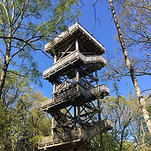
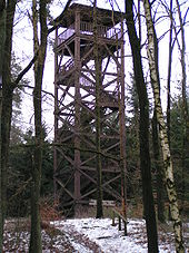
In addition to its forest landscape, the sights of the Dammer Mountains include three observation towers :
- Lookout tower Lohne ( ⊙ ) in the north end of the ridge on a hill in the Lohner city forest: The tower, built in 1908, is 17.35 m high. It offers a view of Lohne and, among other things, to Quakenbrück and Cloppenburg .
- Mordkuhlenberg observation tower ( ⊙ ) in the middle part of the ridge on the Mordkuhlenberg near Dalinghausen : It is 20 m high and was reopened in May 2013 after renovation. From its viewing platform, the view extends over large parts of the ridge and the Dümmer Nature Park with the Dümmer as well as the Oldenburg Münsterland and the Wiehen Mountains. In August 2013, eight iron sculptures with motifs from the legend “The robbers from Mordkuhlenberg” were erected along the ascent to the tower. The iron plates with the man-sized figures are ten millimeters thick; the figures were carved out of iron by laser.
- Steigenberg observation tower ( ⊙ ) in the southwest of the ridge on the mountain of the same name near Neuenkirchen : From its observation platform, the view over the Osnabrücker Land and up to the Wiehen Mountains fell until 2015 . Since then, the tower has been closed due to dilapidation. No decision has yet been made about its future.
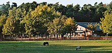
- The almost level viewpoint Dreesberg ( ⊙ ) near Severinghausen offers a clear view in western, southern and eastern directions. The Schemder Bergmark recreation area is located near Steinfeld ; there is a conference hotel and a riding stables and to the west of it a large stone grave on the Stappenberg.
The Pickerweg , a former trade and pilgrimage route that connects Wildeshausen with Osnabrück as a 107 km long hiking trail, runs through the Dammer Mountains in a north-northeast-south-southwest direction . Around the Dammer Bergsee there is a 2.5 km long information trail, the Dammer Bergsee nature trail , with panels on animals and plants.
On the Signal Mountain is a transmission tower of the armed forces and on its northern slope, a 134 m high telecommunications tower of Deutsche Telekom .
Large stone grave on Stappenberg near Steinfeld
Transport links

Through the southwest exit of the Dammer mountains and northwest past them running A 1 . Driving north from Osnabrück, the bridge restaurant at the Dammer Berge service station is ideal for a break. You can also leave the motorway at the Neuenkirchen-Vörden junction to drive via Vörden to Damme and take a tour from there.
Behind this ridge comes the North German Plain in the direction of Oldenburg or Bremen .
marketing
The town of Damme and the communities of Holdorf, Neuenkirchen-Vörden and Steinfeld have joined forces to form the “Dammer Berge recreation area”. The recreation area is one of five regions that the pit stop route runs through.
literature
- Frederik Michiel van der Wateren: Structural geology and sedimentation of the Dammer Berge push moraine, FRG , in: Jaap JM Van der Meer (Ed.): Tills and glaciotectonics , Balkema, Rotterdam, pp. 157-182.
Individual evidence
- ↑ a b c d e f g h i j k l m n o Topographic map with the Dammer Mountains ( Memento of the original from February 24, 2016 in the Internet Archive ) Info: The archive link was automatically inserted and not yet checked. Please check the original and archive link according to the instructions and then remove this notice. (TK 100; heights according to magnification levels DTK 50 – AK 2.5), on natur-erleben.niedersachsen.de
- ↑ ( page no longer available , search in web archives ) Ton und Erde , in Töne & Trends , issue 25/2007, p. 3, on olfry.de
- ^ Sofie Meisel: Geographical Land Survey: The natural spatial units on sheet 70/71 Cloppenburg / Lingen. Federal Institute for Regional Studies, Bad Godesberg 1959. → Online map (PDF; 7.0 MB)
- ^ Sofie Meisel: Geographical Land Survey: The natural space units on sheet 83/84 Osnabrück / Bentheim. Federal Institute for Regional Studies, Bad Godesberg 1961. → Online map (PDF; 6.4 MB)
- ↑ a b c d e f g Map services of the Federal Agency for Nature Conservation ( information )
- ↑ Markus Schwarzer et al.: Significant Landscapes in Germany Expert recommendations for a region to be selected Volume 1: Schleswig-Holstein and Hamburg, Lower Saxony and Bremen, Mecklenburg-Western Pomerania, North Rhine-Westphalia, Saxony-Anhalt, Brandenburg and Berlin BfN-Schriften 516. 2018, p 195 (197)
- ^ Lookout tower Lohne: Lookout tower in the city forest , accessed on February 25, 2016, on nordkreis-vechta.de
- ↑ Mordkuhlenberg , (note: same height information on the orientation table on the viewing platform), accessed on February 25, 2016, from damme.de
- ↑ Hermann Lübbing: The saga of Mordkuhlenberg , on dammerschweiz.de
- ↑ Sculptures are reminiscent of robbers. Sage attracts visitors to the Mordkuhlenberg . Nordwestzeitung , dated August 31, 2013, on nwzonline.de
- ↑ Christoph Heinzel: There are new considerations for the observation tower . Oldenburg People's Newspaper . April 9, 2018 ( online )
Web links
- Recreation area Dammer Berge , on dammer-berge.de


