Zwischenahner Meer
| Zwischenahner Meer | ||
|---|---|---|

|
||
| Zwischenahner Meer in Bad Zwischenahn | ||
| GKZ | 388215 ("Aue-Godensholter Tief with peripheral areas") | |
| Geographical location | Bad Zwischenahn , Ammerland district , Lower Saxony | |
| Tributaries | Auebach , Halfsteder Bäke , Otterbäke | |
| Drain | Aue , Speckener Bäke | |
| Places on the shore | Bad Zwischenahn , districts of Dreibergen , Rostrup | |
| Location close to the shore | Oldenburg | |
| Data | ||
| Coordinates | 53 ° 11 '51 " N , 8 ° 0' 58" E | |
|
|
||
| Altitude above sea level | 5 m above sea level NN | |
| surface | 5.5 km² | |
| length | 2.8 km | |
| width | 2 km | |
| scope | 11 km | |
| Maximum depth | 6 m | |
| Middle deep | 3.3 m | |
|
particularities |
Third largest lake in Lower Saxony |
|
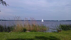
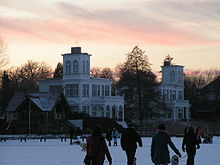
The Zwischenahner Meer is a lake in the municipality of Bad Zwischenahn in the Ammerland district in Lower Saxony . It lies between the main town of Bad Zwischenahn in the south and the district of Dreibergen in the north. The lake is also known as the pearl of the Ammerland . The name Zwischenahner Meer first caught on at the beginning of the 19th century, before the lake was known as "Elmendorfer" or "Ammersches Meer".
size
With a water area of 5.5 km² (550 ha ), the Zwischenahner Meer is the third largest lake in Lower Saxony after the Steinhuder Meer and the Dümmer . The north-south diameter is 2.8 kilometers, the east-west diameter about 2 kilometers. It has a circumference of 11 kilometers. The average water depth is 3.3 meters, the deepest point above a digested sludge layer is around 5.5 to 6.0 meters. The digested sludge layer is about 4 to 6 meters thick. The level is at 5 m above sea level. NN .
Inflows and outflows
The main tributaries in the north are the Auebach and Otterbäke (with the Heller Bäke inflow) and the Halfsteder Bäke on the east bank (with their Bokeler- and Nutteler Bäke inflows). The main flow of the lake is the Aue in the south near Eyhausen , a smaller flow is the Speckener Bäke in the center of Bad Zwischenahn .
Emergence
The Zwischenahner Meer is located above a salt dome as a remnant of the Zechstein Sea from the Permian era about 250 million years ago. It was created by the fact that the salt dome and the overlying overburden collapsed due to salt leaching caused by the groundwater . The Zwischenahner Meer formed in the cavity created in this way. Further examples of water bodies created by sinkholes are the Sager Meer , the Maujahn Moor , the Arendsee and the Seeburger See . These lakes are characterized by their great depth in relation to their diameter. The Zwischenahner Meer, however, is quite flat and seems rather untypical. However, steeper edges can be found on the Zwischenahner and Rostruper Ufer. However, they are heavily blurred by the thick layer of sludge.
In 1949 boreholes were carried out to prove a salt dome, the result of which was a map showing the location of the salt dome under the lake. Accordingly, this salt dome belongs to a salt line that extends from Delmenhorst via Leer and Jemgum to Bunde .
Evidence of the lake formation as a sinkhole lake began in 1956 when the State Museum of Natural History and Prehistory created a model of the Zwischenahner Sea, which with the help of a double relief depicted the surface of the digested sludge filling and the mineral lake bed. The steep edges typical of a sinkhole lake were highlighted by the transparent representation of the digested sludge layer in the model.
The apex of the salt dome is believed to be around 300 meters below the lake and is covered with clay layers. These layers ensured that the subrosions did not create typical collapse funnels, but rather a less deep, more extensive depression with clear steep edges.
Boreholes in the digested sludge deposits (also called Mudde or Gyttja ) revealed pollen that was found around 12,000 years ago (the end of the Vistula Ice Age in northern Germany, in this region characterized as a periglacial cold steppe).
nature
flora
The banks of the lake are almost entirely covered with reeds ( Reith, Reet ). Today the width of this reed belt is about 8-10 meters, in contrast to earlier times when it was 200 meters. The congestion of the sea with boat traffic led to a decrease in the reed growth and the formation of gaps in the belt. To counteract this, the private use of motor boats on the lake is completely prohibited and the number of surfers has been significantly restricted. A ring canal built around the sea also ensures that sewage water from the surrounding communities is no longer discharged into the lake, which would have led to further over-fertilization.
Often there are bulrushes , also called lamp cleaners, on the bank , which are even included in the coat of arms of Bad Zwischenahn . In summer, the marsh ragwort attracts attention with its yellow flowers. Yellow pond rose ( Nuphar lutea ), white water lily ( Nymphaea alba ), swan flower , hedgehog's cob , purple loosestrife and water must grow near the shore .
The lake used to be home to numerous floristic rarities, but these have now disappeared with increasing eutrophication . These included:
- Grass pondweed ( Potamogeton gramineus )
- Hedgehog hose ( Baldellia ranunculoides )
- Strandling ( Littorella uniflora )
- Marsh calla ( Calla palustris )
- Water feather ( Hottonia palustris )
- Common water hose ( Utricularia vulgaris )
fauna
The shore zone provides habitat for many native bird species. Here you will find the teal , mallard , coot , moorhen , bittern , kingfisher , gray heron , osprey , as well as the laughing gull , sea gull and herring gull .
In terms of fish, the lake is particularly populated (or occupied) by eels , carp , pikeperch , bream , pike , perch , tench , catfish and roach .
Nature reserves
On the north-west bank is the 24-hectare nature reserve "Stamers Hop" (NSG WE 075) with remaining areas typical of waterways, natural bank structures. The small "Drei Eichen" nature reserve (NSG WE 081, 2 ha) still exists on the north bank. The entire lake and shore area of the Zwischenahner Meer is also designated as a landscape protection area (LSG WST 56).
economy
While the south, west and north banks are built on, the east bank of the lake is currently hardly developed. Corresponding plans for development are currently being pushed ahead.
The lake is mainly fished for eels , which when smoked as smoked eel are one of the culinary specialties of the region. But there are also crabs and carp in the nets .
From April to October a ferry company connects the most important points on the lake. This commercial ferry operation was established in 1874 when the first machine-driven iron ship was put into service by a businessman from Dreibergen. It was named Puck . After two years of sailing, this steamer built on the Weser sank. It was replaced in 1876 by the 110-passenger Dreibergen .
The three passenger ships "MS Ammerland", "MS Oldenburg" and "MS Bad Zwischenahn" of the so-called "White Fleet" currently operate on the Zwischenahner Meer. Civil weddings are permitted on a ship. The radio presenter Lutz Ackermann has taken this ship a description of the sights on the banks that will be played during the drive.
Sports
There are four sailing clubs on the lake , of which around 300 boats and many windsurfers sail the lake. In addition, the only sailing school of the German Youth Hostel Association is located on the Zwischenahner Meer . The lake is known for its unconventional thermals , which can be described as very gusty . Motor boats are strictly prohibited. This does not apply to police boats, commercial passenger shipping, lifeboats and rescue boats as well as fishing vessels . Sailboats, pedal boats, row boats and electric boats can be rented from two boat rental stations.
Fishing is also popular. Every year, young fish are released for around 10,000 euros to enable the anglers to do their sport. On presentation of a valid annual fishing license, the fishing license required for sport fishing can be obtained from the spa administration or from the Bad Zwischenahn fishing association.
Legends
Formation of the Zwischenahner Meer
According to a north German legend , the creation of the lake is a work of the devil (Düwelswark). Accordingly, the devil tried to stop a church in Oldenburg and destroy it. He tore up a large piece of forest near Zwischenahn and flew in the direction of Oldenburg to hit the church. On the way to Oldenburg, however, the Düwel was so confused by three crowing roosters that it lost its way. Shortly before the city limits, he dropped the uprooted forest. At this point, the small and large Wildenloh , forest areas growing on sandy subsoil, emerged. The place where the forest was torn out is now the Zwischenahner Meer.
Big catfish
Since the late 1970s and early 1980s, the legend has been circulating about a giant catfish 3.50 meters long that is said to live in the lake. He is compared to the Loch Ness monster , with whom he has in common that nobody has seen him to this day. Since the legend is a tourist attraction, a bronze statue was dedicated to the catfish on the market square of Bad Zwischenahn.
See also
literature
- Remmer Akkermann, Gerd Fischer and Werner Michaelsen: The Zwischenahner Meer and its surrounding area. Oldenburg 2011.
- Chronicle of the Bad Zwischenahn community, Bad Zwischenahn community 1994, pp. 31–39.
- Ernst Andreas Friedrich : Natural monuments of Lower Saxony . Hanover 1980, ISBN 3-7842-0227-6 .
- Erwin Schlegel: About the Zwischenahner Meer, its fishermen, its banks and its villages . Fishing club, Bad Zwischenahn 1981.
- Werner Vahlenkamp: Der kleine Zwischenahner , Verlag Manfred Meins, 1990, pp. 24-27, ISBN 3-921904-12-9 .
Web links
- Lower Saxony State Office for Water Management, Coastal Protection and Nature Conservation: Guideline for planning measures for surface waters, Part B Still waters, Annex II - Sea reports: Zwischenahner Meer (PDF, 6.5 MB)
- Documentation of the condition and development of the most important lakes in Germany of the TU Cottbus, part 4: Bremen and Lower Saxony (PDF, 500 kB)
Individual evidence
- ↑ Poope, Franz: Between Ems and Weser: Land and people in Oldenburg and Ostfriesland . Nuremberg / Leipzig 1888, p. 50 .
- ↑ The white fleet Bad Zwischenahn: Die Flotte , accessed on March 25, 2017
- ^ DJH sailing school
- ↑ Zwischenahner Meer Ordinance ( Memento from April 15, 2013 in the Internet Archive ) (PDF; 57 kB)


