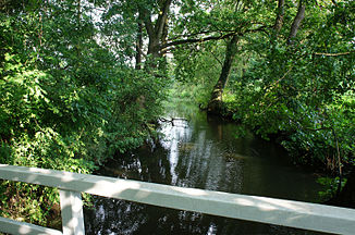
Halfsteder Bäke
| Halfsteder Bäke | ||
|
Shortly before it flows into the Zwischenahner Meer |
||
| Data | ||
| location | Ammerland district , Lower Saxony | |
| River system | Ems | |
| Drain over | Aue → Godensholter Tief → Nordloher Tief → Soeste → Jümme → Leda → Ems → North Sea | |
| source | northeast of Wiefelstede 53 ° 16 ′ 5 ″ N , 8 ° 8 ′ 35 ″ E |
|
| Source height | 17 m above sea level NN | |
| muzzle | in the east in the Zwischenahner Meer Coordinates: 53 ° 11 ′ 46 ″ N , 8 ° 1 ′ 59 ″ E 53 ° 11 ′ 46 ″ N , 8 ° 1 ′ 59 ″ E |
|
| Mouth height | 5 m | |
| Height difference | 12 m | |
| Bottom slope | 1 ‰ | |
| length | 12 km | |
| Communities | Wiefelstede, Bad Zwischenahn | |
The Halfsteder Bäke is a river in the Lower Saxony district of Ammerland .
The approximately 12 km long stream flows in the communities of Wiefelstede and Bad Zwischenahn . It rises in Wemkendorf and flows in Wiefelstede along the Olekamp, crosses Wemkendorfer Weg and the main street in Wiefelstede and then flows on between Gristeder Straße and Dingsfelder Weg towards Aschhausen and further into the Zwischenahner Meer .
In Aschhausen, about 500 m east of the Zwischenahner Meer, there was a medieval castle at the Halfsteder Bäke. This belonged to the Junker von Aschen.
The Ammerländer Wasseracht operates a level measuring point at the Halfsteder Bäke.
