
District of Osnabrück
| coat of arms | Germany map |
|---|---|

|

Coordinates: 52 ° 23 ' N , 8 ° 3' E |
| Basic data | |
| State : | Lower Saxony |
| Administrative headquarters : | Osnabrück |
| Area : | 2,121.63 km 2 |
| Residents: | 358,080 (Dec. 31, 2019) |
| Population density : | 169 inhabitants per km 2 |
| License plate : | OS , BSB, MEL, WTL |
| Circle key : | 03 4 59 |
| NUTS : | DE94E |
| Circle structure: | 34 municipalities |
| Address of the district administration: |
Am Schölerberg 1 49082 Osnabrück |
| Website : | |
| District Administrator : | Anna Kebschull ( Greens ) |
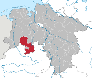
| Location of the district of Osnabrück in Lower Saxony | |
 .svg) |
|
The district of Osnabrück is located in the southwest of Lower Saxony in Germany . It belongs to the Northwest Metropolitan Region .
With 2121 km² it is the third largest municipal association in Lower Saxony after the neighboring district of Emsland and the Hanover region . It consists of 34 parishes, including eight cities. There are 17 unit municipalities and four joint communities with 17 member municipalities (1961 there were 261 municipalities). The size of the communities is between under 7,000 and more than 45,000 inhabitants. The district forms the main part of the Osnabrück region .
The independent city of Osnabrück, which does not belong to the district area, is located on the south-western edge of the district. It is the seat of the district administration.
geography
location
The northern two thirds of the district area belong to the North German Plain with an altitude below 50 m above sea level. NHN . The mountain ranges of the Teutoburg Forest and Wiehengebirge run from west to east through the southern third of the district. The Hase flows through the area from south to north , while the Hunte runs in the east . Both rivers have their source in the district of Osnabrück.
Together with the independent city of Osnabrück, the district forms the Osnabrücker Land region . This is divided among others into the sub-regions Artland , Grönegau and Wittlager Land .
The landscape of the Tecklenburger Land in the west is the continuation of the Osnabrück Land in the neighboring state of North Rhine-Westphalia . It is often ascribed to the Münsterland , although it is historically, scenically and economically closer to the Osnabrück region.
Neighboring areas
The northern district borders in a clockwise direction in the northwest on the districts of Emsland , Cloppenburg , Vechta and Diepholz (all in Lower Saxony), the latter only for a few kilometers, as well as the districts of Minden-Lübbecke , Herford , Gütersloh , Warendorf and Steinfurt (all in North Rhine -Westphalia ).
Weather stations
In the district of Osnabrück there are weather stations in:
- Alfhausen , 65 m above sea level, station of the German Weather Service (DWD) in the Thiene district .
- Belm , 103 m above sea level, DWD station. Replacement for the weather station of the DWD at Osnabrücker Ziegenbrink .
Nature reserves
There are 31 nature reserves in the Osnabrück district. The largest ( Suddenmoor / Anten ) has an area of 635 ha , the smallest ( Swatte Poele ) an area of 4.3 ha.
See also:
- List of nature reserves in the Osnabrück district
- List of landscape protection areas in the Osnabrück district
- List of natural monuments in the Osnabrück district
- List of protected landscape components in the district of Osnabrück
- List of geotopes in the Osnabrück district
history
prehistory
Today's district of Osnabrück, together with the independent city of Osnabrück, roughly encompasses the area of the former bishopric of Osnabrück , which was an imperial direct bishopric until 1802 . In 1803 the area was assigned to the Kingdom of Hanover by the Reichsdeputationshauptschluss of the Congress of Vienna . From 1807 to 1813 it was under French rule , and then again until 1866 to belong to the Kingdom of Hanover. In that year Prussia annexed the Kingdom of Hanover as a result of the German War , so that the former Prince Diocese of Osnabrück also came to Prussia and became part of the Province of Hanover .
1885 to 1932
The original district of Osnabrück was formed in 1885 in the Prussian province of Hanover from the old Osnabrück office and assigned to the Osnabrück administrative district . The community of Schinkel left the district on April 1, 1914 and was incorporated into the city of Osnabrück.
1932 to 1972
During the Prussian district reform of 1932, the Iburg district was incorporated into the Osnabrück district, the area of which almost doubled. On April 1, 1940, the municipality of Haste left the district and was incorporated into the city of Osnabrück. Since November 1, 1946, the Osnabrück region has been part of the newly founded state of Lower Saxony.
The first community mergers as part of the regional reform in Lower Saxony took place in the district of Osnabrück in 1968. On January 1, 1970, Sutthausen , which had previously belonged to the municipality of Holzhausen , was incorporated into Osnabrück.
1972 until today
A complete reorganization of the district and community boundaries resulted in the law on the reorganization of the communities in the Osnabrück area on July 1, 1972. The districts of Bersenbrück , Melle and Wittlage were merged with most of the then district of Osnabrück to form a new district of Osnabrück. The communities Atter , Darum , Gretesch , Hellern , Lüstringen , Nahne , Pye and Voxtrup were added to the independent city of Osnabrück .
In addition to changing borders, the regional reform of 1972 also resulted in the number of municipalities being considerably reduced by amalgamating them into larger units. In 1961 there were still a total of 261 communities in the four old districts, including 95 in the old district of Bersenbrück, 56 in the old district of Melle, 31 in the old district of Wittlage and 79 in the old district of Osnabrück. Eight of these were incorporated into the city of Osnabrück. The rest were combined to form the 34 unified congregations that exist today. In the northern district 17 of the unified communities merged to form the four joint communities Artland , Bersenbrück , Fürstenau and Neuenkirchen . The municipalities of the old district of Melle merged to form the town of Melle and in the old district of Wittlage, today's municipalities of Bad Essen , Bohmte and Ostercappeln emerged .
On March 1, 1974, Vörden , Hörsten and Hinnenkamp, three communities in the old district of Bersenbrück, were reclassified from the district of Osnabrück to the district of Vechta, where they became part of today's community of Neuenkirchen-Vörden .
Controversy over the riparian strips in 2019
After the district council in an FFH area in Melle had decided on a 1-meter strip of water at the edge of the water in spring 2019 , criticism came from the Federal Environment Ministry, which considered the 1-meter rule to be too low. Allowed in this area not fertilized and pesticides are applied, the living creatures in the water sector is not damaged. According to the Water Management Act, the waterfront strips are generally 5 meters, but the local authority can reduce this to 1 meter or remove it entirely. Since the district also had to define a waterfront strip for the FFH area "Bächten im Artland" during the course of the year, this sparked criticism. The district administration had also planned a protective strip of one meter for the FFH area "Bächten im Artland", although species worthy of protection such as the bullhead live in the corresponding waters . Since the district election was imminent, the various options were discussed intensively with the candidates.
After a controversial discussion, affected farmers brought the proposal of a 3-meter verge against payment of a corresponding compensation for the loss of cultivation.
In June, the District Administrator Michael Lübbersmann surprised shortly before the district election with a statement that up to 121,000 euros per year would be available as compensation for farmers who are affected by a wider strip of water. After the election, however, the district administration again favored the 1-meter verge, which the CDU also approved.
Matthias Liess from the Helmholtz Center for Environmental Research in Leipzig criticized the 1 meter distance as far too small. He referred to the city of Osnabrück, where a 5-meter strip is favored. Herbert Zucchi from the Osnabrück University of Applied Sciences resigned from the advisory board of the Osnabrück District Nature Conservation Foundation. In November 2017, he was elected to the Advisory Board of the Nature Conservation Foundation as a representative of the Osnabrück University of Applied Sciences .
On September 30th, the application for the protected area “Creeks in Artland” was passed through the district council with the votes of the CDU, FDP and AfD. The parliamentary groups of the SPD, the Greens and the electoral communities voted against the motion. For the streams in the FFH area, the 1 meter water distance was now valid.
Population development
| year | Residents | source |
|---|---|---|
| 1890 | 27,792 | |
| 1900 | 30,416 | |
| 1910 | 37,635 | |
| 1925 | 34.105 | |
| 1939 | 82,632 | |
| 1950 | 117,534 | |
| 1960 | 119,200 | |
| 1970 | 139,600 | |
| 1980 | 286,400 | |
| 1990 | 309.876 | |
| 2000 | 353.313 | |
| 2010 | 356.123 | |
| 2017 | 356.140 |
Religions
The area of the Osnabrück district has been denominationally mixed since the Reformation . With the Peace of Westphalia , the parishes were divided up confessionally, but without significantly changing the mix. At that time, 25 parishes were defined as Catholic, 17 parishes as Lutheran, 7 parishes as mixed denominations (Catholic and Lutheran) in the Prince Diocese of Osnabrück, which largely coincides with today's district . Today the Lutherans belong to the Evangelical Lutheran Church of Hanover , the Catholics to the Diocese of Osnabrück . Since the Osnabrück region bordered on formerly Reformed territories, there have been Reformed people in the district since the 19th century. The denominational distribution has not fundamentally changed after 1945 , despite the influx of expellees . Since the 1950s, members of other evangelical denominations, Orthodox and Muslims have joined them. A change in denominational relationships only brought about the admission of ethnic repatriates from the former Soviet Union in the 1990s, which led to a reversal of denominational relationships in Bersenbrück, for example .
politics
District administrators
From 1946 to 1949 Wilhelm Erpenbeck ( center / CDU ) was district administrator in the district of Osnabrück. He was followed by Walter Giesker (CDU) from 1949 to 1964 and Josef Tegeler (CDU) from 1964 to 1993.
In 1993, Manfred Hugo (CDU) followed. From July 1, 2002 to October 31, 2011, he was a full-time district administrator and thus both political representative and head of administration.
On September 11, 2011, Michael Lübbersmann (CDU) was elected as the new district administrator by the citizens of the district with 41.26% of the vote. He succeeded Manfred Hugo on November 1, 2011. Before that, he had been the full-time mayor of the joint municipality of Bersenbrück since 2001.
On June 16, 2019, Anna Kebschull ( Bündnis 90 / Die Grünen ) was elected as the new district administrator of the Osnabrück district. The incumbent District Administrator Michael Lübbersmann received the most votes in the first ballot on May 26, 2019, but could not prevail in the runoff election against the Green candidate. Michael Lübbersmann's successor was Anna Kebschull on November 1, 2019.
District administrators
- Since 2019 Anna Kebschull ( Alliance 90 / The Greens )
- 2011–2019 Michael Lübbersmann (CDU)
- 1993–2011 Manfred Hugo (CDU)
- 1972–1993 Josef Tegeler (CDU)
District administrators before the local government reform in 1972
- 1964–1972 Josef Tegeler (CDU)
- 1949–1964 Walter Giesker (CDU)
- 1946–1949 Wilhelm Erpenbeck ( center / CDU )
- 1945–1946 Hugo Homann (independent), deployed by the British military government
- 1940–1945 Gustav Lemke (NSDAP)
- 1933–1939 Eberhard Westerkamp (NSDAP)
- 1919–1933 Kurt von Detten (center)
- 1917–1919 Clemens August Ostman von der Leye
- 1902–1917 Carl von Wangenheim
District council
The following table shows the results of past elections:
| Parties and constituencies | % 2016 |
Seats 2016 |
% 2011 |
Seats 2011 |
% 2006 |
Seats 2006 |
% 2001 |
Seats 2001 |
Seats 1996 |
Seats 1991 |
|
|---|---|---|---|---|---|---|---|---|---|---|---|
| Christian Democratic Union of Germany | 40.86 | 28 | 43.71 | 30th | 49.50 | 34 | 51.21 | 36 | 35 | 33 | |
| Social Democratic Party of Germany | 29.48 | 20th | 33.16 | 23 | 34.80 | 24 | 34.86 | 24 | 24 | 25th | |
| Alliance 90 / The Greens | 10.54 | 7th | 13.97 | 10 | 7.58 | 5 | 6.29 | 4th | 5 | 5 | |
| Free Democratic Party | 4.86 | 3 | 3.31 | 2 | 6.03 | 4th | 5.81 | 4th | 2 | 4th | |
| Independent voter community (UWG) | 4.09 | 3 | 3.24 | 2 | 0.88 | 1 | - | - | - | - | |
| The left | 3.23 | 2 | 2.10 | 1 | - | - | - | - | - | - | |
| Groups of voters | 1 | 2.82 | 0 | 1.22 | 0 | 1.79 | 1 | 1 | - | ||
| AfD | 5.56 | 4th | - | ||||||||
| total | 100 | 68 | 100 | 68 | 100 | 68 | 100 | 68 | 67 | 67 | |
| voter turnout | 57.91% | 54.90% | 57.27% | 61.56% | k. A. | k. A. | |||||
Every five years the citizens of the Osnabrück district elect their representatives to the district council. The next election will take place in autumn 2021. Since the last local election on September 11, 2016, the district council has had 68 elected members and the district administrator . On September 10, 2018 Tanja Bojani switched from the AfD parliamentary group to the left parliamentary group in the district council.
The district council is the supreme body of the district. The district committee prepares the resolutions of the district council and decides on matters that do not have to be decided by the district council. The district committee includes eleven members who are entitled to vote and one member of the district council who is an advisory representative, depending on the size of the group.
Circular seat

The district administration of the district of Osnabrück has its seat in the city of Osnabrück , which is largely enclosed by the district area but is not a district, and is therefore the only district administration in Lower Saxony that has its seat outside the district area. The background is that the city of Osnabrück is the historical center (previously as the capital of the Principality of Osnabrück and today as the regional center ).
District partnerships
Since 1999, a partnership for county Olsztyn ( Allenstein ) in northeast Poland. Out of historical ties and with a view to Poland joining the European Union, the Osnabrück district makes its special contribution to the development of German-Polish friendship. In the past few years, close communal ties have developed with Polish circles. In 2007, the district and the municipality of Bad Essen signed a declaration of cooperation with the Wałcz district ( Deutsch Krone ); There are close contacts to the Gryfino ( Greifenhagen ) district .
Regional Association

The Landschaftsverband Osnabrücker Land , a registered association sponsored by the district and the city of Osnabrück, takes care of cultural issues .
coat of arms
The coat of arms of the district of Osnabrück shows a hexagonal, red tower with a pointed, blue roof in gold, on a six-spoke black wheel with a silver background.
The Osnabrücker Rad is the most frequently used coat of arms in the Osnabrück district. It was introduced by the bishops of Osnabrück around 1200 and stands for the “chariot of God”, the throne chariot, and thus for the Christian Church. As a symbol for the gospels and the church, the majority believe that it is based on the vision of the prophet Ezekiel in the Old Testament . The wheel of the Diocese of Osnabrück is red on a silver background.
The tower is the keep of the Iburg , which was expanded into a residence by the Osnabrück bishop Benno in the 11th century. This tower is therefore also called "Bennoturm", which is historically incorrect, as it was only built under Conrad IV of Rietberg, bishop from 1482 to 1508. The wheel originally used by the bishops in red appears in black on the county coat of arms, as in the city of Osnabrück.
The district has had the coat of arms since 1947. The district council adopted it at a time when there was still no government agency that could grant or approve a coat of arms.
Vocational education
The district of Osnabrück is responsible for four vocational schools:
- Vocational schools in the district of Osnabrück, Haste in Osnabrück- Haste
- Vocational schools in the district of Osnabrück, Brinkstrasse in Osnabrück
- Vocational schools Melle in Melle
- Bersenbrück Vocational Schools in Bersenbrück
Economy and Transport
In the Future Atlas 2016 , the district of Osnabrück was ranked 170th out of 402 districts, municipal associations and independent cities in Germany, making it one of the regions with a "balanced risk-opportunity mix" for the future.
Road traffic
- A1 from Puttgarden via Hamburg , Bremen , Cologne to Saarbrücken
- A 30 from Bad Bentheim to Bad Oeynhausen with connection to the A 2 to Berlin
- A 33 from Osnabrück via Bielefeld and Paderborn to the A 44
- B 51 Saarbrücken – Bremen
- B 65 Osnabrück - Hanover
- B 68 Osnabrück– Cloppenburg
- B 214 Lingen - Braunschweig
- B 218 Fürstenau - Bohmte
- B 402 Emmen (NL) –Fürstenau
By implementing the shared space concept, the municipality of Bohmte gained national recognition as the “first German city without traffic signs”.
Rail transport
The Hannoversche Westbahn reached Osnabrück in 1855, its extension to Rheine followed in 1856. The Cologne-Mindener Eisenbahn-Gesellschaft connected Osnabrück via the taxiway with Bremen in 1871 and with Münster in 1873 . This made the city an important rail hub.
The Oldenburg State Railroad opened another connection to the north in 1876 with the line to Oldenburg , from which a line to Delmenhorst via Vechta branches off in Hesepe . The city of Fürstenau in the north-west of the district was connected to the railway network by the Rheinische Eisenbahn-Gesellschaft in 1879 with the Rheine – Quakenbrück railway. The state railway network was completed in 1886 by the Prussian State Railway with the Osnabrück – Bielefeld ("Haller Willem") line. The Georgsmarienhütte – Hasbergen railway line was built as early as 1865–1870 and was particularly important for freight traffic.
In addition, the Wittlager Kreisbahn opened a branch line Holzhausen-Heddinghausen- Bad Essen-Bohmte in 1900 with a connection to the main line Osnabrück-Bremen. It was followed in 1914 by a route from Bohmte to Damme . The Teutoburg Forest Railway (TWE) has operated from Ibbenbüren to Gütersloh via Bad Iburg and Bad Laer on the southern edge of the Teutoburg Forest since 1900/01 . The north of the district was opened up from 1904 by the Lingen – Berge – Quakenbrück small railway (750 mm gauge). The Ankum-Bersenbrücker Railway gave the municipality of Ankum a rail connection to the main line in 1915.
The district's own transport company Landkreis Osnabrück (VLO) now operates goods traffic on the route of the former Wittlager Kreisbahn . It also owns the Lower Saxony section of the “ Haller Willem ” railway line . The Georgsmarienhütte – Hasbergen railway is also only used for freight traffic and is operated by Georgsmarienhütte Eisenbahn- und Transport GmbH .
The railway network reached a maximum extent of more than 300 km. Of these, passenger traffic was shut down for 121 km:
- 1952: Kleinbahn Lingen – Berge – Quakenbrück (29 km)
- 1962: Wittlager Kreisbahn Damme – Hunteburg (6 km) and Ankum – Bersenbrücker Railway (5 km)
- 1966: Wittlager Kreisbahn Hunteburg – Bohmte – Preußisch Oldendorf (24 km)
- 1968: TWE Ibbenbüren – Gütersloh (15 km)
- 1969: Quakenbrück – Rheine railway line (34 km)
- 1978: Hasbergen – Georgsmarienhütte – Oesede (8 km)
- 1984: "Haller Willem" Osnabrück – Dissen – Bad Rothenfelde (reactivated 2005).
Today the following railway lines are served in local passenger transport:
- Löhne – Rheine railway line : Lines RE 60 (Rheine - Braunschweig) and RB 61 ( Hengelo (NL) - Bielefeld) as well as long-distance services from Amsterdam - Bad Bentheim - Osnabrück Hbf –Hannover– Berlin ( KBS 375 )
- Wanne-Eickel – Hamburg railway line : lines RB 66 (Münster - Osnabrück) and RE 9 (Osnabrück - Bremerhaven); Long-distance traffic Cologne – Osnabrück Hbf – Bremen – Hamburg ( KBS 385 )
- Railway line Oldenburg – Osnabrück ( KBS 392 ): Line RE 18 (Osnabrück - Wilhelmshaven)
- Railway line Delmenhorst – Osnabrück via Vechta ( KBS 394 ): Line RB 58 (Osnabrück - Bremen)
- Osnabrück – Bielefeld railway line “Haller Willem” ( KBS 402 ): Line RB 75 (Osnabrück - Bielefeld)
Local transport operators are DB Regio Nord , NordWestBahn , Westfalenbahn and Eurobahn
Bus transport
PlaNOs Planungsgesellschaft Nahverkehr Osnabrück acts as the responsible body for public transport in the district . This is a joint subsidiary of Stadtwerke Osnabrück and the district. It creates the local transport plans for the district.
The bus transport in the district is operated by the following companies:
- Stadtwerke Osnabrück , (city traffic in Osnabrück)
- Weser-Ems Busverkehr (WEB), (bus routes in the entire district)
- Verkehrsgesellschaft Landkreis Osnabrück (VLO), (bus transport in the north-eastern district)
- Schrage Reisen GmbH, (including Melle city bus )
- Ankum-Bersenbrücker Eisenbahn (ABE), (bus transport in the north-western district)
- Regionalverkehr Münsterland GmbH (RVM), (bus routes to North Rhine-Westphalia)
- Beckermann GmbH & CO. KG (including city bus Bramsche)
- various other companies
The community tariff of the Verkehrsgemeinschaft Osnabrück applies .
air traffic
The nearest international airport is Münster / Osnabrück Airport near Greven . There are the following airfields in the district:
- Achmer Airfield ( special landing site )
- Bohmte-Bad Essen Airfield (special landing site)
- Melle-Grönegau airfield (special landing site)
- Airfield Osnabrück-Atterheide ( airfield )
Water transport
- Mittellandkanalhafen Bohmte -Leckermühle
- Mittelland Canal Ports of Bramsche
- Mittelland Canal ports Bad Essen
Communities
The district of Osnabrück is divided into 34 municipalities, eight of which have city rights.
The city of Osnabrück , which does not belong to the district area, is the seat of the district administration.
The number of inhabitants on December 31, 2019 in brackets.


|
|
Joint municipalities with their member municipalities
* Seat of the joint municipality administration
|
|
Municipalities in the old district of Osnabrück
The district of Osnabrück, formed in 1885, included the communities Astrup , Atter , Belm , Bissendorf , Cronsundern , Darum , Ellerbeck , Gaste , Georgsmarienhütte , Grambergen , Gretesch , Haltern , Harderberg , Hasbergen , Haste , Hellern , Himbergen , Hollage , Holsten-Mündrup , Holte- Sünsbeck , wood Hausen , Horne , Icker , Jeggen , Krevinghausen , Lechtingen , Linne , Lüstringen , Malbergen , Nahne , Natbergen , Nemden , Ohrbeck , powe , Pye , Rulle , Schelenburg , Schinkel (up to 1914), Schledehausen , Bauer shaft Stockum , Gut Stockum , Uphausen-Eistrup , Vehrte , Voxtrup , Wallenhorst , Wellingen , Wersche , Wissingen and Wulften .
In 1932 the 40 communities of the dissolved Iburg district were added to these communities . After several incorporations in the 1930s and 1940s, the Osnabrück district comprised 79 municipalities at the beginning of the 1960s (residents on June 6, 1961):
As part of the regional reform, the new communities Borgloh , Glane , Holte , Niedermark and Waldmark were formed in 1970 and 1971 , but they were all reintegrated into other communities on July 1, 1972.
Attractions
Museums
Museums in the district of Osnabrück:
- Badbergen : Artland horse breeding museum
- Bad Essen : Spring core museum
- Bad Iburg : Castle Museum Iburg, Clock Museum Bad Iburg
- Bersenbrück : Museum in the monastery
- Bramsche : Museum and Park Kalkriese , Clothmaker Museum Bramsche
- Bohmte : Hedgehog Museum
- Dissen : Wortmann cigar shop
- Georgsmarienhütte : Museum Villa Stahmer
- Hasbergen : Augustaschacht memorial , Hüggel geocenter
- Melle : Melle car museum, Melle-Buer / Meesdorf tractor museum, Melle Grönegau museum
- Ostercappeln : Museum Schnippenburg
- Ostercappeln-Venne : Waffle Museum, Iron Age House Darpvenne
- Quakenbrück : Quakenbrück City Museum
License Plate
On July 1, 1956, the district was assigned the distinctive sign OS when the license plates that are still valid today were introduced . It is still issued today.
Until the 1990s, vehicles from the old districts received special identification numbers:
| area | Letters | numbers |
|---|---|---|
| Old district of Osnabrück | AA to JZ | 100 to 999 |
| Old district of Bersenbrück | KA to RZ | |
| Altkreis Melle | SC to VZ | |
| Wittlage district | WA to ZZ |
Since June 11, 2018, in connection with the license plate liberalization, the distinctive signs BSB (old district Bersenbrück), MEL (old district Melle) and WTL (old district Wittlage) are available again.
literature
A homeland yearbook has been published annually for the city and the district of Osnabrück since 1974. The publisher of the book series is the Heimatbund Osnabrücker Land.
in chronological ascending order
- Werner Dobelmann : History and development of the Osnabrücker Nordland (Der Altkreis Bersenbrück ; 3; Heimat yesterday and today. Communications of the Kreisheimatbund Bersenbrück; 22), Quakenbrück 1979
- Günter Wegmann: The end of the war between Ems and Weser 1945. 2nd expanded edition, H. Th. Wenner, Osnabrück 2000, ISBN 3-87898-367-0 .
Web links
Individual evidence
- ↑ State Office for Statistics Lower Saxony, LSN-Online regional database, Table 12411: Update of the population, as of December 31, 2019 ( help ).
- ↑ agricultural constitution osnabrück .
- ^ [1] District Osnabrück at NLWKN
- ↑ [2] New nature reserves from 2009 at NLWKN
- ↑ [3] "Suddenmoor / Anten" nature reserve, registration number: NSG WE 214
- ↑ [4] "Swatte Poele" nature reserve, registration number: NSG WE 051
- ^ District regulation for the province of Hanover (1884)
- ^ Prussian State Ministry, § 72, Ordinance on the reorganization of districts, from August 1, 1932 Preußische Gesetzessammlung, Berlin 1932 , R. von Deckers Verlag, G. Schenk, 1932
- ↑ Law on the reorganization of the municipalities in the Osnabrück area of May 10, 1972
- ↑ Law on the reorganization of the communities in the Vechta / Cloppenburg area of February 11, 1974
- ^ Jean-Charles Fays: Federal Environment Ministry criticizes water protection in the Osnabrück district. In: New Osnabrück Newspaper. April 2, 2019, accessed February 23, 2020 .
- ↑ Jürgen Ackmann: Brooks in Artland: Lawyer seeks conversation with the district. In: New Osnabrück Newspaper. June 6, 2019, accessed February 23, 2020 .
- ↑ District administrator wants to compensate farmers with up to 121,000 euros per year. In: New Osnabrück Newspaper. June 13, 2019, accessed February 23, 2020 .
- ↑ Jean-Charles Fays: Osnabrück district wants to keep only 1-meter marginal strips in protected areas. In: New Osnabrück Newspaper. September 13, 2019, accessed February 23, 2020 .
- ^ Rainer Lahmann-Lammert: City of Osnabrück wants wider Düte protection strips than the district. In: New Osnabrück Newspaper. September 8, 2019, accessed February 23, 2020 .
- ↑ Jean-Charles Fays: Osnabrück professor resigns out of indignation over 1-meter protective strips. In: New Osnabrück Newspaper. September 22, 2019, accessed February 23, 2020 .
- ^ Jean-Charles Fays: CDU asserts itself in the Osnabrück district council with a 1-meter edge strip. In: New Osnabrück Newspaper. September 30, 2019, accessed February 23, 2020 .
- ↑ a b c d e f g Michael Rademacher: German administrative history. (No longer available online.) Archived from the original on September 24, 2015 ; accessed on January 2, 2015 . Info: The archive link was inserted automatically and has not yet been checked. Please check the original and archive link according to the instructions and then remove this notice.
- ↑ Statistical Yearbook for the Federal Republic of Germany 1972
- ↑ Statistical Yearbook for the Federal Republic of Germany 1981
- ↑ a b c d Lower Saxony regional database
- ↑ agricultural constitution osnabrück .
- ^ "What we are up to", Landkreis Osnabrück, 2002.
- ↑ Future Atlas 2016. (No longer available online.) Archived from the original on October 2, 2017 ; accessed on March 23, 2018 . Info: The archive link was inserted automatically and has not yet been checked. Please check the original and archive link according to the instructions and then remove this notice.
- ↑ Query of the course book route 375 at Deutsche Bahn.
- ↑ Query of the course book route 385 at Deutsche Bahn.
- ↑ Query of course book route 392 at Deutsche Bahn.
- ↑ Query of the course book route 394 at Deutsche Bahn.
- ↑ Query of course book route 402 at Deutsche Bahn.
- ↑ State Office for Statistics Lower Saxony, LSN-Online regional database, Table 12411: Update of the population, as of December 31, 2019 ( help ).
- ↑ Municipal directory of the Osnabrück district 1910
- ^ Museums in the Osnabrück region - Osnabrück district. Retrieved August 1, 2020 .
- ↑ Stella Essmann: Where the waffles for the Osnabrücker Schlecks come from. In: noz.de. Neue Osnabrücker Zeitung , July 11, 2019, accessed on August 1, 2020 .
Counties : Ammerland | Aurich | Celle | Cloppenburg | Cuxhaven | Diepholz | Emsland | Friesland | Gifhorn | Goslar | Göttingen | County of Bentheim | Hameln-Pyrmont | Harburg | Heidekreis | Helmstedt | Hildesheim | Holzminden | Empty | Lüchow-Dannenberg | Lüneburg | Nienburg / Weser | Northeim | Oldenburg | Osnabrück | Osterholz | Peine | Rotenburg (Wümme) | Schaumburg | Stade | Uelzen | Vechta | Verden | Wesermarsch | Wittmund | Wolfenbüttel
Region : Hanover
Independent cities : Braunschweig | Delmenhorst | Emden | Oldenburg (Oldb) | Osnabrück | Salzgitter | Wilhelmshaven | Wolfsburg