
Badbergen
| coat of arms | Germany map | |
|---|---|---|

|
Coordinates: 52 ° 38 ' N , 7 ° 59' E |
|
| Basic data | ||
| State : | Lower Saxony | |
| County : | Osnabrück | |
| Joint municipality : | Artland | |
| Height : | 29 m above sea level NHN | |
| Area : | 79.11 km 2 | |
| Residents: | 4577 (Dec. 31, 2019) | |
| Population density : | 58 inhabitants per km 2 | |
| Postal code : | 49635 | |
| Area code : | 05433 | |
| License plate : | OS , BSB, MEL, WTL | |
| Community key : | 03 4 59 007 | |
| LOCODE : | DE BZZ | |
| Community structure: | 9 parts of the community | |
| Address of the municipal administration: |
Am Markt 3 49635 Badbergen |
|
| Website : | ||
| Mayor : | Werner Meier (UWG) | |
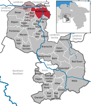
| Location of the municipality of Badbergen in the district of Osnabrück | ||
  |
||

Badbergen is a member municipality of the Samtgemeinde Artland in the northern district of Osnabrueck in Lower Saxony and is located in the Artland as part of the recreation area Hasetal .
geography
Geographical location

Badbergen lies within the North German Plain in the center of the alluvial plain of the Artland , an extensive flatness that is only weakly subdivided by valley sand slabs and damp lowlands.
Coming from the south of the Teutoburg Forest , the river Hase flows towards the Cloppenburger Geest and is pushed to the west by the rise in terrain.
Geology and hydrogeology

In the lowlands north of a tertiary ridge in the glacial valley of the Hase, the river has formed an inland delta (at the so-called Hase overfall ) near Quakenbrück . The area of this inland delta is almost congruent with the Artland region and consists mainly of glaciofluviatile sediments that were created during the ice age by the action of the river carrying glacier melt water . Because of the low gradient, the Hase formed several arms of the river and the Hase Inland Delta was created, at the beginning of which is Badbergen.
Drilling has shown that the soil consists primarily of loamy and sandy deposits from the Pleistocene . The top soil layer is five to seven meters thick and is underlain by a loamy and marbled layer of sediment that is up to ten meters thick . Sandy layers at a depth of 25 to 30 meters form a high-yield aquifer for pumping the groundwater . The top aquifer is at a depth of two to six meters.
Expansion of the municipal area
Badbergen is a row settlement, the center of which was on both sides of the B 68 until the bypass road was built, with several rows of mostly residential buildings on the eastern side, while several factories are located on the western side behind the road development between old-established farms. With the railway connection that the village received in 1876, some factories were established and the farming village developed into a village of craftsmen and merchants. Nevertheless, the community could not completely avoid the problem of rural exodus.
The farms are mainly located in the districts of Grönloh, Groß Mimmelage, Grothe, Langen, Lechterke, Vehs, Wehdel and Wulften, which are part of the Badbergen community .
Neighboring communities
Badbergen borders Gehrde and Bersenbrück in the south, Nortrup and Menslage in the west, Quakenbrück in the north and Dinklage and Holdorf (both districts of Vechta ) in the east .
Community structure

The parish parts of the unified parish are:
- Badbergen - seat of the municipal administration
- Grönloh
- Great Mimmelage
- Grothe
- Long
- Lechterke
- Vehs
- Wehdel
- Well
- Bulging
climate

Badbergen is located in the temperate climate zone of Lower Saxony in the transition area between the maritime climate of the North Sea coast and the continental climate in the south and east and is characterized by a temperate maritime climate, influenced by wet north-westerly winds from the North Sea.
On a long-term average, the air temperature in Badbergen reaches 8.5 to 9.0 ° C, and around 616 millimeters of precipitation fall (for comparison: the German average is around 800 millimeters). The warmest months are July and August with an average of 17.2 and 16.9 ° C and the coldest January and February with an average of 1.6 and 2.2 ° C. Most of the precipitation falls in the months of June and July with an average of 69 and 75 millimeters, respectively, and the lowest in February and March with an average of 36 and 42 millimeters. Between May and August, an average of 20 to 25 summer days can be expected. The number of rainy days is highest in December with ten, while the precipitation with 49 millimeters is more in the middle range.
|
Average monthly temperatures and rainfall for Badbergen
Source:
|
||||||||||||||||||||||||||||||||||||||||||||||||||||||||||||||||||||||||||||||||||||||||||||||||||||||||||||||||||||||||
history
Padberge is mentioned in a document from Count Simon von Tecklenburg from 1175 ; a document from 1188 uses the place name Batbergh .
Other peasants in the parish are mentioned much earlier. The reason for the formation of the church village, a narrow street village, was presumably a canonical foundation founded here in 1235 . Badbergen probably owes its further development and former importance as a trading place to its location at the intersection of two important trade routes. The north-south long-distance connection is still made today by federal highway 68, which is now regulated by a bypass.
Incorporations
On July 1, 1972, the communities of Grönloh, Groß Mimmelage, Grothe, Langen, Lechterke, Vehs, Wehdel and Wulften were incorporated.
Population development

The following overview shows the population of Badbergen in the respective territories and as of December 31st.
The figures are updates by the State Office for Statistics and Communication Technology Lower Saxony based on the census of May 25, 1987 .
The data from 1961 (June 6) and 1970 (May 27) are the census results including the places that were incorporated on July 1, 1972.
| year | Residents |
|---|---|
| 1961 | 4545 |
| 1970 | 4412 |
| 1987 | 3991 |
| 1990 | 4093 |
| 1995 | 4343 |
| 2000 | 4473 |
| 2005 | 4613 |
| 2010 | 4563 |
| 2011 | 4600 |
| 2015 | 4572 |
| 2017 | 4564 |
| 2017 | 4594 |
Name interpretation
A final interpretation of the place name has not yet taken place. The place name Padberg can be derived from Pad for path and mountains for hostel, refuge. Another interpretation refers to the Old Saxon personal name Bathard , on which the place name Batbergh could be based.
politics
Municipal council
The parish council currently has 15 members from five parties or groups. Mayor is Tobias Dörfler (CDU).
The following table shows the local election results since 1996.
| Badbergen municipality council: election results and municipal councils | |||||||||||||||||||
|---|---|---|---|---|---|---|---|---|---|---|---|---|---|---|---|---|---|---|---|
| CDU | SPD | Green | FDP | BfA 1 |
Individual applicants |
Others | total | electoral participation |
|||||||||||
| Electoral term | % |
|
% |
|
% |
|
% |
|
% |
|
% |
|
% |
|
% |
|
% | ||
| 1996-2001 | 31.3 | 5 | 50.0 | 8th | 8.2 | 1 | 10.6 | 1 | - | - | - | - | - | - | 100 | 15th | 67.8 | ||
| 2001-2006 | 35.2 | 5 | 43.6 | 8th | 5.1 | 0 | 11.6 | 2 | - | - | 4.5 | 0 | - | - | 100 | 15th | 65.9 | ||
| 2006-2011 | 39.6 | 6th | 43.4 | 6th | 4.6 | 1 | 10.9 | 2 | 1.5 | 0 | - | - | - | - | 100 | 15th | 57.8 | ||
| 2011-2016 | 39.0 | 6th | 42.7 | 6th | 11.2 | 2 | 7.1 | 1 | - | - | - | 100 | 15th | 56.0 | |||||
| 2016-2021 | 33.6 | 5 | 23.0 | 4th | 8.2 | 1 | 3.4 | 1 |
26.5 |
4th | - | - | 100 | 15th | 57.5 | ||||
|
Percentages rounded. Sources: State Office for Statistics and Communication Technology Lower Saxony, District Osnabrück. In the case of different information in the sources mentioned, the data from the State Office for Statistics and Communication Technology were used, as they are generally more plausible. 1 citizen for Artland |
|||||||||||||||||||
mayor
- since 2019 Werner Meier (UWG)
- 2016–2019 Tobias Dörfler (CDU)
- 2011–2016 Dietmar Berger (SPD)
- 2006–2011 Werner Katzer (CDU)
- 1991-2006 Siegfried Desing (SPD)
Town twinning
- Hédé-Bazouges , Ille-et-Vilaine , Brittany , France
- Jonkowo , Powiat Olsztyński , Warmian-Masurian Voivodeship , Poland
Culture and sights
Most of the sights of Badbergen can be reached via the Artland Route holiday route . The imposing, listed Artland farms (see Artland cultural treasure ) and their oak groves, which can be found at almost every farm, are well known. Other attractions are
- the Protestant St. George's Church with its eight-sided Romanesque tower substructure
- the Catholic St. Marien Church
both in the center of the village
- the restored windmill in Groß Mimmelage with rosarium
- the donkey farm in Langen.
Economy and Infrastructure
traffic
The federal road B 68 crossed the center of Badbergen in a north-south direction until December 20, 2013. On August 28, 2008, however, the planning approval procedure for the construction of a bypass was initiated. The bypass road was opened on December 20, 2013 after a construction period of 16 months.
Today's NordWestBahn route Osnabrück-Oldenburg crosses the municipality from south to north. When this Oldenburger Südbahn opened in 1876, there was also a train station in Badbergen, which was closed before 2000 in the interest of shortening travel times; The Langen station (Kr. Bersenbrück) is also no longer in operation. The closest stations are in Bersenbrück and Quakenbrück . The trains on line RE 18 (Osnabrück - Wilhelmshaven) stop here. In addition, the Duisburg – Quakenbrück railway with the disused section Coesfeld – Rheine – Quakenbrück ran through the municipality, so the stopping point there in the Vehs district also sees no trains.
There are bus connections from the Verkehrsgemeinschaft Osnabrück from Badbergen to Quakenbrück. There is also the Bürgerbus Badbergen association based on a private initiative. This operates the citizen bus , which connects the community with Quakenbrück market square and hospital from Monday to Saturday.
Established businesses
Artland Convenience GmbH with 340 employees is the town's largest employer. Other well-known companies are the event company Kedz Event, Holtkamp Mineralöle, RBAG, Thorsten Kamper Landtechnik, Autohaus Plog, Energyfuchs Bornhorst and Fleischhandel Riedel. Some traditional retail stores were able to find successors and continue to exist today, such as the Herkenhof bakery or the former Nethler stationery store, now Hinderks.
Public facilities
Heimathaus Badbergen eV as well as the Artländer Trachtenbund and the shanty choir "Hasejungs" stand for traditional country life and regional culture. All of the clubs mentioned have considerable problems with young talent and are constantly looking for newcomers.
education
The former school unit, which once consisted of elementary school, orientation level, secondary school and secondary school, first lost the secondary school and later also the secondary school with the centralization in the neighboring Quakenbrück, so that there is now only the primary school. There is also the Protestant kindergarten.
Sons and daughters of the church
- Karl Allöder (1898–1981), German sculptor and painter
- Tale Rantzen , high medieval merchant, mentioned in a document in the parish archive
Picture gallery

St. George's Church

St. Mary's Church

Farm with cottage garden in Wulften

Donkey farm in Langen


literature
- Author collective / Kreisheimatbund Bersenbrück (KHBB) e. V .: Badbergen. A contribution to the settlement, economic and cultural history of Artland . Home yesterday and today (Issue 18). Kreisheimatbund Bersenbrück (KHBB) e. V., Bersenbrück and Thoben, Quakenbrück 1975, 216 pages, ISBN 3-921176-27-1
- Rolf Diekmann: The history of the Wohlde farmers and their farms. In: Home calendar for the district of Bersenbrück 1939. pp. 84–92
- Werner Dobelmann : Die Kirchenburg zu Badbergen , in: Am heimatlichen Herd - Heimatblatt 12 (1961), No. 5 (May 1961), p. 18 ff.
- Dietrich Korfhage: The Wohldbuch. History of a late medieval settlement. Quakenbrück 1930.
- Herbert Obenaus et al. (Ed.): Historical manual of the Jewish communities in Lower Saxony and Bremen . Volume 1. Wallstein Verlag, 2005. ISBN 3-8924-4753-5 . Pp. 152-159
- Joseph Rottmann: 600 years of Hof Elting in Badbergen. In: Heimat-Jahrbuch Osnabrücker Land 2001. pp. 157–162
- Hermann Rothert: Elting to Vehs. History of an Artländer Freihof. Munster (Aschendorff). 1948.
- Marten Pelzer: Agricultural associations in northwest Germany. The Badbergen example. (Sources and studies on the regional history of Lower Saxony, vol. 8), Cloppenburg, Museumsdorf, 2002.
Web links
Individual evidence
- ↑ State Office for Statistics Lower Saxony, LSN-Online regional database, Table 12411: Update of the population, as of December 31, 2019 ( help ).
- ^ Kuhlmann: The Artland and the city of Quakenbrück in their historical development. P. 7.
- ↑ Martin Teller: The geological genesis of the north-west German natural area. ( PDF file) + explanations on the course of the hare ( memento of the original from July 5, 2007 in the Internet Archive ) Info: The archive link was inserted automatically and has not yet been checked. Please check the original and archive link according to the instructions and then remove this notice.
- ^ HA Meissner: Persistence and change in a north-west German agricultural area. The Quakenbrücker Basin. Leer (Schuster) 1979. ISBN 3-7963-0157-6 .
- ↑ Wolfgang Schlüter: The prehistory and early history of the Artland and its surroundings. In: H.-R. Jarck (ed.): Quakenbrück. From the border fortress to the commercial center. P. 34f.
- ↑ "Summer day" is a climatological term for days on which the maximum temperature reaches or exceeds 25 ° C
- ↑ The precipitation mean values of the DWD come directly from Badbergen; the climate records for the neighboring Bersenbrück can be used due to the similar weather conditions, see Kuhlmann: Das Artland , p. 7: "The Artland with its landscape around Quakenbrück and the Osnabrücker Nordland have largely identical climatic conditions ..."
- ↑ Weather station Bersenbrück.
- ↑ German Weather Service.
- ↑ a b Federal Statistical Office (ed.): Historical municipality register for the Federal Republic of Germany. Name, border and key number changes in municipalities, counties and administrative districts from May 27, 1970 to December 31, 1982 . W. Kohlhammer GmbH, Stuttgart / Mainz 1983, ISBN 3-17-003263-1 , p. 253 .
- ↑ State Office for Statistics and Communication Technology Lower Saxony, population update ( page no longer available , search in web archives ) Info: The link was automatically marked as defective. Please check the link according to the instructions and then remove this notice.
- ^ Wilhelm Fangmeyer: Interpretation of place names in the Osnabrück region. In: Heimat-Jahrbuch Osnabrücker Land, 1982. P. 78.
- ↑ State Office for Statistics and Communication Technology Lower Saxony, Table 5000311
- ↑ Landkreis Osnabrück, official final results of the district election on September 9, 2001 ( Memento from May 25, 2005 in the Internet Archive ) (PDF; 528 kB)
- ^ The local elections for the district of Osnabrück on September 11, 2011 (also includes 2006 results). (PDF 8.0MB p. 17 column "Municipal elections") In: www.landkreis-osnabrueck.de. District of Osnabrück, accessed on March 6, 2016 .
- ↑ https://www.noz.de/artikel/33055/dietmar-berger-neuer-badberger-burgermeister In Neue Osnabrücker Zeitung on November 10, 2011: "Dietmar Berger new Badberger Mayor"; accessed on September 26, 2018
- ↑ On August 26, 2016 in the Neue Osnabrücker Zeitung: Obituary by the Badbergen community for Siegfried Desing
- ^ Lower Saxony State Authority for Road Construction and Transport: Badbergen bypass in the course of federal highway 68
- ^ Finding aid for the parish archive in Badbergen, A: Documents. 1312 Aug. 14; in this context the street "Am Rantzen Donnerkiel" was named in the district of Grönloh .
Alfhausen | Ankum | Bad food | Bad Iburg | Bad Laer | Bad Rothenfelde | Badbergen | Belm | Mountains | Bersenbrück | Tapping | Bissendorf | Boiled | Bramsche | Dissen at the Teutoburg Forest | Eggermühlen | Fürstenau | Gehrde | Georgsmarienhütte | Glandorf | Hagen am Teutoburg Forest | Hasbergen | Hilter at the Teutoburg Forest | Kettenkamp | Melle | Menslage | Merzen | Neuenkirchen | Nortrup | Ostercappeln | Quakenbrück | Rieste | Voltage | Wallenhorst