
Brittany
| Brittany | |
|---|---|
.svg)
|

|
  |
|
| Basic data | |
| Country |
|
| prefecture | Rennes |
| President of the Regional Council | Loïg Chesnais-Girard ( PS ) |
| population | 3,318,904 (January 1, 2017) |
| Population density | 122 inhabitants per km² |
| surface | 27,206 km² |
| Departments | 4th |
| Arrondissements | 15th |
| Community associations | 60 |
| Cantons | 102 |
| Communities | 1,208 |
| ISO-3166-2 code | FR-BRE |
 Relief map of the Brittany region |
|
The Brittany [ bʀətaɲ ] ( Breton Breizh [ brɛɪ̯s ], German outdated and small Kingdom ) is a western French region . Today it consists of the departments of Côtes-d'Armor (Bret. Aodoù-an-Arvor ), Finistère (Bret. Penn-ar-Bed ), Ille-et-Vilaine (Bret. Il-ha-Gwilen ) and Morbihan (Bret . Mor-bihan ). The region has an area of 27,208 km² and 3,318,904 inhabitants (as of January 1, 2017). The capital of the region is Rennes (Bret. Roazhon ).
The Loire-Atlantique (Bret. Liger-Atlantel ) department, which belongs to historic Brittany, but not to the modern administrative region of the same name, was split off in 1941 - together with the original Breton capital Nantes (Bret. Naoned ).
Brittany is the largest peninsula in France and the westernmost branch of mainland Europe north of the Iberian Peninsula . The Gauls called this land Aremorica (Bret. Arvorig ), which means something like "land by the sea". The inhabitants of Brittany are called Bretons .
geography


location
Armor is the Breton name for sea , but not only the coast is meant, but also the islands, the amphibious zone of the mudflats and the wide coastal strip. The Bretons refer to the woodland of Brittany as Argoat .
Brittany is a large peninsula in the far west of mainland France. In the north, west and south it is surrounded by the Atlantic (Bret. Meurvor Atlantel ). Brittany separates the English Channel (Bret. Mor Breizh ) in the north from the Biscay in the south. On the mainland, it borders the Normandy region in the northeast and the Pays de la Loire region in the southeast .
In Brittany lies with the coordinates '47 ° 13 N , 1 ° 32' W near the town of Nantes the center of the land hemisphere so that hemisphere (, hemisphere ) of the terrestrial globe , the (determined by calculation) the largest mainland portion has.
geology
Geologically, Brittany is part of the Armorican Mountains that were unfolded in the Carboniferous . Most of the land mass of Brittany rests on very old and hard rock. Brittany has a very rugged coastline, which - especially in the west - is formed as a steep coast over long stretches . At Cap Fréhel , near the old fortress Fort la Latte , the granite cliffs protrude over 70 meters from the Atlantic. Elsewhere the landscape is more hilly; You will look in vain for particularly steep or high mountains. The highest point is the Roc'h Ruz (385 meters) in the ridge of the Monts d'Arrée (Bret. Menez Are ).
climate

Corresponding to its location close to the Atlantic on the western edge of mainland Europe and in the area of influence of the Gulf Stream, Brittany has a decidedly oceanic climate with relatively mild temperatures, which are between 9 and 12 ° C on an annual average. Snow and frost rarely occur, the summers are moderately warm with over 2000 hours of sunshine annually.
The course of the weather is shaped by a rapid alternation of high and low pressure areas that draw in from the Atlantic. The prevailing westerly winds often reach storm strength, especially in winter. Rain showers and strong winds can occur very briefly, but are usually only of short duration. With an average of between 700 and 800 mm per year, the amounts of precipitation are relatively low; while the rainfall is lower in the coastal areas, the interior is more humid.
The influence of the strong tides on the course of the weather is clearly noticeable, but also the iodine content of the air, which reaches very high levels in Brittany. The strong winds also cause a low level of pollutants in the air.
nature

In the Neolithic Age, Brittany was mostly covered by forest. Remains of this huge forest area can be found between the former Forêt de Scissy near Mont-Saint-Michel (Bret. Menez Mikael ) and the Brocéliande (Bret. Brekilien , today Paimpont west of the city of Rennes ). Another well-known forest area is located near Huelgoat in the Finistère department . The original landscape in the interior has been significantly changed since the medieval clearing. It has largely given way to industrialized agriculture. In the interior of Brittany there are only a few larger beech and oak forests. Today the landscape is dominated by fields and grassland, which is divided up like a chessboard by the countless hedges ( bocage ) and stone walls.
badges and flags
Heraldic description: Six rows of black ermine interspersed in white .
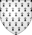
Coat of arms from 1316 ( semé d'hermine )

Ermine flag

Kroaz you

Today's regional flag ("Gwenn ha you")

.svg)

The historical flag of Brittany was the ermine flag . Since the beginning of the 20th century, the " Gwenn ha du " is mainly used.
history

Brittany was already settled in the Paleolithic , which is evidenced by isolated tool finds from the Acheuléen culture. Only a few traces of human settlement are known from the Mesolithic , namely scrapers from the Moustérien industry, while rock paintings and hewn flint stones are missing. While people had lived from hunting, fishing and collecting up until then, they became a living from 5000 BC. Settled and farmed livestock and agriculture in the Neolithic . The megalithic systems were also built during this time . Most ( dolmens , tumuli and menhirs ) were built between 4500 and 2000 BC. Built or used.
From the ensuing Early Bronze Age (beginning between 2000 and 1800 BC) rich grave finds (dagger graves of series I and II) document contacts with England ( Wessex culture ), Denmark and southern Germany ( Singen group ). In the Bronze Age , Brittany was an important trading center because of its metal deposits, which can be concluded from numerous other extensive hoard finds . The Breton bronze axes with straight shafts (1200 to 1000 BC) were common throughout Northern Europe.
The comparatively late in Brittany, namely from the 6th century BC. The beginning of the Iron Age was marked by the immigration of the Celts , who called Brittany Aremorica or Armorica ("land by the sea"). They did not displace the entire already resident population, but completely ended the bronze culture of the peninsula. While iron finds from this era are rather rare, the ceramic finds testify to a diverse pottery culture. Fortified settlements ( oppida ) were located on headlands, hills and in fenced fortifications. In the 2nd century BC BC five Celtic tribes lived on the Breton peninsula: the Venetians in the south, the Osismians in the northwest, the Redons in the east, the Coriosolites in the north and finally the Namneten in the southeast. They did not form a unit, but were divided. The most powerful tribe among them were the Venetians, who lived in the 1st century BC. Ruled all other tribes. They were at the head of the league of all Breton tribes, which the Romans from 58 BC onwards. Resisted.
In 56 BC In BC, Julius Caesar and his legions defeated almost the entire Venetian fleet in a devastating sea battle, thereby ending the economic prosperity of this tribe as well as the Gallic supremacy in shipping. The Romanization of Brittany began immediately after the conquest and, in addition to the triumphant advance of Roman administration, architecture and street layout, primarily consisted of the founding of Roman cities such as Nantes , Rennes , Vannes , Carhaix-Plouguer and Corseul . However, it was not over until the end of late antiquity. At this point in time, the Celtic language of Gaul, Gaulish , had probably almost completely disappeared.
Breton immigration
Already at the time of the Roman colonization there had been intensive contacts between the Aremorican peninsula and Great Britain . In the late 4th century the fortified towns and forts on the coast belonged to the Limes of the so-called Saxon coast , whose crews were under the command of a Dux tractus Armoricani et Nervicani . After the Roman army withdrew at the beginning of the 5th century under Emperor Honorius , the Provençals drove out the Roman administrative officials around 409 and declared themselves independent. Germanus of Auxerre traveled to the imperial court in Ravenna in 437 to show indulgence for the inhabitants of Aremorica. The influential Roman army master Aëtius had sent Alan troops on a punitive expedition against the Bagauden there , who had risen under the leadership of a certain Tibatto . The Aremorican tribal leaders and cities subsequently formed a protective alliance against Anglo-Saxon looters, which existed up to 500 when the country was conquered by the Frankish king Clovis I.
At the time of the decline of the Western Roman Empire , from around 450 AD, mainly Christianized Welsh immigrated to the Breton peninsula. At the same time, the settlement areas of the still pagan Saxons , Angles and Jutes on the island of Great Britain continued to expand. For about two centuries, so-called island celts crossed into Brittany at irregular intervals in order to escape the uncertain political conditions of their former homeland. They settled and Christianized Aremorica and brought their language to Gaul, which had long been Romanized. The Breton so do not go to the spoken yet about Caesars times in Brittany Celtic idiom back. In the course of the revival of the Celtic language and culture, the influence of the Gallo-Romans was steadily pushed back until they finally lost their supremacy around 580. According to François Falc'hun, however, the Breton dialect used in the region around Vannes still goes back to the original Celtic language Aremoricas.
Kingdom, Carolingian, Duchy of Brittany


In 497 the Bretons submitted to the Franconian Merovingian king Clovis I , but the sovereignty of the Merovingian kings remained very loose before it was completely thrown off after the (first) Franconian division or the death of Clovis's son Childebert I .
Around 600, after power struggles, the Bretons founded a kingdom that lasted 200 years and was only smashed in 799 by the Frankish ruler Charlemagne .
In 786 Karl made eastern Brittany the Breton border march and thus part of the Franconian Empire, the first margrave was Hruotland . After the division of the empire, the Breton Count Nominoë defeated the West Frankish King Charles the Bald in 845 at the Battle of Ballon and in 850 conquered Nantes. In addition to the four departments mentioned above, the core area of historic Brittany has also included today's Loire-Atlantique (Bret. Liger-Atlantel ) department since 851 .
After Nominoë's death (851), as had been the case for centuries, disputes arose between the individual areas. Nominoës nephew Salomon allied himself with the Norman Vikings and received the Cotentin peninsula from West Franconian King Charles II in 867 in order to persuade him to help defend against the Normans . But in 886 and 919 the Loire-Normans overran Nantes and Brittany respectively and drove out the Breton rulers; and at the latest in 930, Contentin, where the Seine-Normans established themselves, fell to Normandy. From 952 to 980 Brittany itself had to recognize the sovereignty of the Norman dukes. The time of kingship in Brittany ended before the turn of the millennium, followed by the establishment of countless smaller duchies that constantly fought over the country. In contrast, the West Franconian Empire stabilized as the Kingdom of France and a duchy was established in Normandy, which increasingly extended into Brittany.
The area of the Duchy of Brittany maintained a relative independence in armed conflicts with the Normans , French and English until the 15th century.
Middle Ages and French feudal times

After all, the duchies could not withstand the threats from their neighbors and called foreign countries for help. These were France and England , who wanted to assert their claims to power over Brittany in the following years and were also involved in the War of the Breton Succession , which raged for 20 years in the mid-14th century. Here England's favorite Jean de Montfort succeeded in gaining power and asserting himself as Duke of Brittany. Years of prosperity and growth followed, until Duke Francis II went to battle against the French at the end of the 15th century and lost miserably (1488, St. Aubin du Cormier, East Brittany).
Anne de Bretagne (1477–1514), the daughter of Duke Francis II, was the last independent ruler of Brittany. She married two French kings one after the other: Charles VIII in 1490, and his third uncle and heir to the throne, Louis XII. 1499. In order to guarantee the succession to the throne and not to provoke any disputes in this regard, the still young Anne gave birth to her first children at an early age (eleven in all), of which only three were older than three years. Her daughter, Claude de France, married Franz I. At a meeting of estates in the southern Breton town of Vannes in 1532 , he proclaimed the official "annexation" to the French kingdom. Even 400 years later, some Breton nationalists still felt "occupied" by the French state. B. manifested in the demolition of the Unification Monument in Rennes (Bret. Roazhon ) in 1932, which is attributed to Célestin Lainé .
Modern times

Within France, Brittany was primarily of maritime importance. From 1631 Brest became the best and most fortified naval port in France. The Breton port cities and coastal towns became the cradle of many outstanding naval officers in the French Navy ; only from Saint-Malo came z. B. Jacques Cartier , René Duguay-Trouin , Robert Surcouf or Martin Fourichon . From Brest came z. B. the marine engineer Jacques-Noël Sané , from Fougères the Admiral de Guichen , from Rennes the Admiral Picquet de la Motte . As home ports and shipyards of the French Atlantic fleet , Brest, Lorient and Saint-Malo have been of great strategic importance since the 17th century, and the French Naval School has been located in Lanvéoc near Brest since the 19th century .
As a province of France, Brittany got the right to its own assembly of estates (French états ). There was also a supreme court of justice in Brittany, which had to protect Brittany's rights vis-à-vis the crown. This so-called parliament , which met in Rennes, lasted until the French Revolution.
The years after the annexation were marked by high prosperity and prosperity. This was particularly true of the coastal cities, whereas the hinterland continued to be characterized by poverty and backwardness. The discontent was expressed in the stamp paper revolt of 1675, an uprising against royal taxation.
From around 1700 onwards, New Bretonic gradually developed, largely thanks to scientific research into the language. If it was difficult to preserve the Breton language and culture in the past under French rule, everything came to a head after the French Revolution. While the Bretons had high hopes for it, the revolutionaries now showed themselves to be repressors by banning the Breton language and the free practice of religion by the Catholics living there. A counterrevolutionary guerrilla developed, the Chouans (French tawny owl , because the members could be recognized by the call of this bird). Similar to the south of the Loire in the Vendée , the French republic needed many years and large troop contingents to master the uprising. But the language and culture were preserved, supported by the majority of the population and groups of independence fighters.
Fearing that French could have a bad influence on Breton, the "Union Régionaliste Bretonne" was founded in 1898 with the aim of popularizing the idea of an independent Brittany. Then there was the "Fédération Régionaliste de Bretagne", founded in 1911, which campaigned for the autonomy of Brittany and published the newspaper "Breiz Dishual" (Free Brittany). However, both societies had to cease their activities in the turmoil of the First World War.
First World War and the interwar period
Right-wing intellectuals founded the newspaper Breiz Atao (Bretagne Forever), which advocated a free Brittany in a Europe without borders, while the more extreme circles founded the “Nationalist Breton Party” (PNB) in 1934, which became more and more fascist in the following years And the underground organization Gwen ha du (white and black), named after the Breton flag , came into being. The latter tried to enforce their efforts by force of arms.
Second World War


After the economic boom in the 1930s, the Second World War broke out. At the start of the war, the modern and powerful battleships Richelieu and Dunkerque as well as the submarine cruiser Surcouf were anchored in Brest . In 1940, the light cruiser De Grasse was just being built in Lorient . The equally modern sister ships of the Dunkerque and the Richelieu , the Strasbourg and the also still unfinished Jean Bart were moored in Saint-Nazaire ( Loire-Atlantique ) . Two aircraft carriers (the Joffre and the Painlevé ) were also to be built in Saint-Nazaire.
First, in 1940, the French government considered withdrawing to the Reduit in Brittany after the fall of Paris and entrenching it there with the help of the French and British fleets. In view of the lack of protection against German bombers, however, the plan was rejected and the government fled to Bordeaux and Vichy. The commander of the Brest naval district, Admiral Jean de Laborde , shipped the gold reserves of Belgium and Poland stored in Brest to Dakar on June 16. The Richelieu , Dunkerque and Surcouf ran together with 80 other warships and 76 civilian ships from Brest to French West Africa and French Algeria, 15 warships and 35 minesweepers escaped from Lorient on June 18. 32,000 Allied soldiers were evacuated from Brest and 57,000 from Lorient. The Strasbourg and Jean Bart also escaped from Saint-Nazaire to French North Africa. The unfinished De Grasse fell into the hands of the German conquerors in Lorient on June 19, as did the unfinished Joffre in Saint-Nazaire.
After Brittany fell to the German troops almost without a fight, they turned the coasts into fortresses. The port and arsenal of Brest , which the French had destroyed when they withdrew, were rebuilt by the Germans as well as Lorient as a submarine port. The 1st U-Flotilla and the 9th U-Flotilla were stationed in Brest, the 2nd U-Flotilla in Lorient and the 6th U-Flotilla and the 7th U-Flotilla in Saint-Nazaire . From his headquarters in Lorient, Admiral Dönitz led the submarines into the battle of the Atlantic . The submarine ports and coastal fortifications were then targeted by Allied bombings, and most of the coastal cities were largely destroyed.
The German occupying power immediately began to promote the autonomous aspirations of the Bretons directed against Paris. Despite many war victims, some Bretons (e.g. Célestin Lainé ) saw the way to the desired state independence in the collaboration with the Germans. Members of the “Nationalist Breton Party” (PNB) participated and some Bretons (around 40) wore the uniform of the Waffen SS under the name Bezen Perrot . A Breton “National Council” was set up in Pontivy as early as July 1940, and in 1941 the French Vichy government had to allow lessons in the Breton language and history under German pressure.
Also in 1941 was the centuries-French Loire-Atlantique (Bret. Liger-Atlantel ) with the capital Nantes (Bret. Naoned ) and the port of Saint-Nazaire by the Vichy government without a referendum and without the consent of the local political representatives from the rest of the Brittany severed. This separation has not been reversed until today, although according to information from Breton autonomists, surveys should have clearly shown a willingness to reunite the (now almost exclusively francophone) Bretons of Loire-Atlantique.
However, there was also resistance against the occupiers. After the Allied landing in Normandy in June 1944, British and French parachute troops also landed in Brittany and increased the resistance. Most of Brittany was liberated in August 1944, and Brest fell in September after the Battle of Brittany . Only in the war ports of Lorient and Saint-Nazaire did the German crews hold out until the end of the war in May 1945 - on the one hand following a senseless command from the Fiihrer to hold the naval bases at all costs and to the last man, on the other hand because the Allies were making a quick advance northwards and east against Germany was more important than the laborious fight against the last German garrisons in the extreme west of France, which were blocked anyway.
After 1945
After the Second World War, the regionalists, who were hated as collaborators, went into hiding and the liberal forces brought a revival of the Breton language and culture. This became even more pronounced when President Charles de Gaulle set up a committee to promote the interests of Brittany in 1951 and to promote culture and language. Thanks to the support from the government, the region experienced an unexpected economic boom and further emigration of the Bretons was prevented. These measures have made the peninsula the most important agricultural region and the second most important tourist region after the Côte d'Azur. In 1978 the Amoco Cadiz tanker accident occurred on the coast of Brittany. In 1999 the tanker Erika sank south of the coast of Brittany.
With the establishment of the regions in 1960, the region of Brittany was created within the current borders. In 1972 the region received the status of an établissement public under the direction of a regional prefect . The decentralization laws of 1982 gave the regions the status of collectivités territoriales ( territorial authorities ), which until then had only been enjoyed by the municipalities and the départements . In 1986 the regional councils were directly elected for the first time. Since then, the region's powers vis-à-vis the central government in Paris have been gradually expanded.
The arsenal of Brest was the place of manufacture in 1957 and the home port of the French aircraft carrier Clemenceau from 1961–1997 , since 2001 the port of Brest has been the home port of the aircraft carrier Charles de Gaulle, which was also built there in 1994 .
In autumn 2013 there were protests against French and European economic policy in Brittany.
population

In the population of Brittany, Celtic immigrants from south-west England mix with Normans and French who have advanced from the north and east .
Cities
The most populous cities in Brittany are:
| city | Inhabitants (year) | Department |
|---|---|---|
| Rennes | 216,815 (2017) | Ille-et-Vilaine |
| Brest | 140,064 (2017) | Finistère |
| Quimper | 62,985 (2017) | Finistère |
| Lorient | 57,149 (2017) | Morbihan |
| Vannes | 53,352 (2017) | Morbihan |
| Saint-Brieuc | 44,372 (2017) | Cotes-d'Armor |
| Saint Malo | 46,097 (2017) | Ille-et-Vilaine |
| Lanester | 22,728 (2017) | Morbihan |
| Fougères | 20,418 (2017) | Ille-et-Vilaine |
| Lannion | 19,880 (2017) | Cotes-d'Armor |
language

Be Breizh
“Breizh” is the Breton word for Brittany. Since the Bretons feel very attached to their region, the abbreviation “BZH” and other Breton symbols such as the black and white flag “Gwen ha you” and the triskell are still often on cars, houses and elsewhere in Brittany Find. With the exclamation “Be Breizh!”, Bretons also wish a good friend “Good luck!” Or “Good luck!”. Since 2011, the Brittany Tourism Association has been using the international slogan “Be Breizh!” To convey the strong identity of Brittany.
Breton in school lessons
With the introduction of compulsory schooling in France in the late 19th century, all "minority languages" were suppressed. After a brief phase of toleration (forced under the impression of the weakness of occupied France) in the 1940s and a subsequent period of renewed repression (under allegations of collaboration), the Breton language is now tolerated by the French state, if not encouraged. It was not until 1951 that the state lifted the ban on regional languages, but Breton is still not officially recognized. It would be years before general teaching was introduced. In 1967, 150,000 signatures were collected to demonstrate for the teaching of the Breton language in schools. Since the 1970s, lessons in Breton have been given in the Diwan schools run by an association - with French as the second written language from the second school year. There is now the option of choosing Breton in the Abitur, later also in the lower grades. In the beginning there were only a few students, today around 3,000 students are learning Breton through immersion lessons . In state schools (Parents' Association Div Yezh ), several thousand students can follow part of their lessons in Breton. Cultural groups, private institutions ( Dihun and Diwan associations ) or organizations ( Ofis ar Brezhoneg ) promote the language. In addition, there is still the possibility at individual schools to learn the language as an optional subject, which is made more difficult due to savings in the education sector and the bad will of the French government, as many posts are not filled.
In view of the threat of the language becoming extinct, the Breton regional council decided at the end of 2004 to promote Breton as far as it is feasible with its very limited financial and political possibilities. Chairs for the Breton and Celtic languages have been established at the universities of Brest and Rennes. The universities also publish four magazines: “Ar Vro” (The Land), “Hor Yezh” (our language), “Skol” (school) and “Skrid” (essays).
Books are also published, mostly in editions of 1500 to 2000 copies. On the other hand, bestsellers are the “Kan an Douar” (songs of the earth) and the Breton-French dictionary, which have been sold 20,000 times within ten years. There are now Breton newspapers, radio stations and television programs (but in very few numbers compared to countries like Wales).
Is spoken Breton , only a maximum of 250,000 of the 2.3 million Britons, and just as many understand it. In everyday use, the language is used regularly by far fewer people. Over two thirds of the speakers are now over 60 years old, the proportion of those under 15 years of age was well below 5% at the time of F. Broudic's study in 1992. The majority of the speakers are native speakers, but the weight is shifting more and more towards the perhaps 30,000 language activists who first learned Breton in school or later.
religion

The majority of the people in Brittany are Catholic. The Church's influence on society was enormous up to the mid-1950s, especially in the Breton-speaking western part of the country (Breiz-izel). A famous saying is the proof: "Ar brezoneg hag ar feiz zo breur ha c'hoar e Breiz" ("Breton and faith are siblings in Brittany"). However, today this influence is getting smaller and fewer and fewer people go to church on Sundays.
Arts and Culture


From a cultural point of view, the diverse megalithic monuments have nothing “Celtic” about them, but date from the Neolithic Age. The names for the various types of megalithic structures in German are pseudo-Breton (that is, composed of Breton roots in a way that does not correspond to Breton grammar): Dolmen, for example (from Bret. Taol - table, table and maen - stone). The correct Breton name is taol-vaen . The same applies to the term menhir (from Bret. Maen - stone and hir - long), which does not exist in Breton, where the word peulven is used instead .
The Breton music scene is extremely lively. Where in other parts of the western world young people go to the disco , the young Bretons are still drawn to the Fest-noz ("night festival"), where traditional - for example binioù kozh ( bagpipes ), bombard ( bombarde ) or treujenn gaol ( Clarinet ) - as well as modern instruments to traditional folk dances . Young and old dance at weddings, village festivals and other happy occasions. Despite the musical affinity with other Celtic dances such as the plinns , jigs and reels , many Breton variants are more like chain dances in which all those present can participate. There is also a tradition of purely vocal dance music, which is performed in the style of Kan-ha-Diskan ("song and counter-song"). In Breton vocal music, the genre of gwerzioù (lamentations / ballads / morality) is also of great importance. Major interpreters are Yann-Fañch Kemener , Denez Prigent , Alan Stivell , Nolwenn Leroy , Annie Ebrel and Erik Marchand .
Cultural similarities with the other Celtic regions can be seen not only in language but also in other cultural areas, for example in literature (which includes the large field of oral tradition) and the kitchen. Remnants of a verse form called kenganez have survived in Central Breton literature , which are very similar to the Welsh cynghanedd and are characterized by a complicated combination of stave, inner and end rhymes. In addition, the motifs of Arthurian literature are likely to have reached the European continent through Breton mediation from Great Britain.
The traditional Breton cuisine, like that of the other Celtic countries, despite its variety of fish and seafood, is primarily the product of an old cattle breeding and farming culture. In addition to meat played mainly dairy products such as salted butter and buttermilk (cheese production long remained significantly underdeveloped) Getreidebreie (bret. Yod ), cooked in bags mush (bret. Farz ) and crepes (bret. Krampouezh ) starred in the traditional diet of rural Population.
politics
_2005.jpg)
Not only since the beginning of the 20th century there have been significant attempts at autonomy among the Bretons, which manifested themselves, especially in the 1970s, in attacks on state institutions organized by the ARB (Bret. ADB, Arme Dispac'hel Breizh - Bretonische revolutionary army), including a terrorist attack on Versailles Palace . The “Breton Liberation Front”, which was slipping more and more into terrorism, was banned and smashed in 1974. A series of assassinations were also carried out in the 1990s (in Cintegabelles, the headquarters of the then Prime Minister Lionel Jospin, and in Belfort, the headquarters of the then Interior Minister Jean-Pierre Chevenement). As a sign of its desire for independence, Brittany has a regional anthem (“ Bro gozh ma zadoù ”) and a soccer team .
Political structure

The Brittany region is divided into four departments :
| OZ | = Ordinal number of the department | Arr. | = Number of arrondissements | According to | = Number of municipalities |
| W. | = Coat of arms of the department | Kant. | = Number of cantons | ||
| ISO | = ISO-3166-2 code | GV | = Number of municipal associations |
| OZ | W. | Department | prefecture | ISO | Arr. | GV | Kant. | According to | Residents January 1, 2017 |
Area (km²) |
Density (inh / km²) |
|---|---|---|---|---|---|---|---|---|---|---|---|
| 22nd |
|
Cotes-d'Armor | Saint-Brieuc | FR-22 | 4th | 11 | 27 | 348 | 598.814 | 6,878 | 87 |
| 29 |
|
Finistère | Quimper | FR-29 | 4th | 21st | 27 | 277 | 909.028 | 6,731 | 135 |
| 35 |
|
Ille-et-Vilaine | Rennes | FR-35 | 4th | 18th | 27 | 333 | 1,060,199 | 6,775 | 156 |
| 56 |
|
Morbihan | Vannes | FR-56 | 3 | 14th | 21st | 250 | 750.863 | 6,822 | 110 |
| total | 15th | 60 | 102 | 1,208 | 3,318,904 | 27.206 | 122 | ||||


In the past, a superficial distinction was made between Upper Brittany with Rennes, Nantes (no longer part of Brittany since 1941), Saint-Malo, Dol-de-Bretagne and Saint-Brieuc, and Lower Brittany with Vannes , Quimper , Saint-Pol-de-Léon and Tréguier . The river Vilaine flowing through Rennes divides Upper Brittany into an almost exclusively Francophone east and a predominantly Breton-speaking west.
Regional council
Result of the election of the regional council on December 13, 2015:
- List Jean-Yves Le Drian (Union de la Gauche from PS and PRG ): 51.41% = 670,754 votes, 53 seats
- List Marc Le Fur (Union de la Droite from LR and UDI ): 29.72% = 387,836 votes, 18 seats
- List Gilles Pennelle ( FN ): 18.87% = 246 177 votes, 12 seats
science and education
Brittany is home to a number of prestigious higher education institutions. In addition to the University of Rennes 1 , the University of Rennes 2 and the University of West Brittany , the ESC Rennes School of Business , which is one of the best business schools in the world, should be mentioned here.
economy

Economically, Brittany is one of the structurally weaker parts of France . Mainly in summer, it benefits greatly from tourism , which predominantly takes place on the coasts. Compared with the GDP of the EU expressed in purchasing power standards, the region achieved an index of 96.7 (EU-25: 100) (2003). In 2017 the unemployment rate was 7.3%.
At the end of the 20th century, the French government made greater efforts to attract industrial companies to settle in Brittany - which was partly successful. Nevertheless, the landscape - especially inland - is predominantly agricultural. The "Léon" (Breton Bro Leon ) landscape in northern Finistère is known for growing vegetables ( artichokes , cauliflower , new potatoes ); in the Côtes-d'Armor , pig breeding, turkey fattening and dairy farming predominate.
For a long time, Brittany was considered the poor house of France. In the 1960s, the aspirations for independence led the central government in Paris to invest in the industrialization of Brittany. These high investments have made tourism, fishing, agriculture and industry profitable branches of industry.
To make matters worse, however, was the unfavorable situation in relation to the large sales markets, which together with the region's low purchasing power made the upswing difficult.
As a coastal region, fishing and - especially on the north coast - oyster farming also play a role for Brittany. In Cancale on the north coast the oysters are raised on 450 hectares, in the Gulf of Morbihan on the south coast on 1,500 hectares. For centuries those from Cancale have generally been considered to be the most valuable oysters in France in terms of quality and taste (traditional transports of Cancale oysters to Rome; delivery privilege for the French royal court).
energy

On the English Channel coast between Saint-Malo (Bret. Sant Maloù ) and the Mont-Saint-Michel (Bret. Menez Mikael ) there is an enormous tidal range of 9 to 15 m (depending on the tidal coefficient). This tidal difference is completed in 1967 Tidal Power Station Rance in the mouth of the Rance between Dinard ( Dinarzh , used) and Saint-Malo to generate electricity. This power plant has a visitor center that provides interesting insights into the technology used to generate electricity using tidal power.
Furthermore, the country near the coast with its almost constantly blowing winds from northwest and western directions is ideal for generating electricity from wind energy . The first wind farms on the cliffs were already producing electricity in 2002, and a rapid further expansion is being planned. In recent years, numerous wind power plants have also been built on the hills inland.
An experimental nuclear reactor, the Brennilis nuclear power plant , which used heavy water , was in operation in Brennilis from 1967 to 1985. Despite the good geographical conditions, the Bretons were able to prevent the construction of further nuclear power plants in their region through vehement protests . The Brennilis reactor, the oldest nuclear power plant in France, is currently being dismantled.
traffic
The traffic routes follow the coastlines in connection with the port cities. The sparsely populated center of Brittany (Kreiz-Breizh) is, apart from the capital Rennes , only accessible by national roads. There are no motorways (thus no motorway tolls), instead there are four-lane national roads on which the speed is limited to 110 km / h.
Brittany is connected to the French TGV network via the LGV Bretagne-Pays de la Loire . At its western endpoint, Rennes, the TGV traffic is divided into a north branch ( Paris – Brest line ) via Saint-Brieuc to Brest and a south branch ( Rennes – Redon and Savenay – Landerneau line ) via Vannes and Lorient to Quimper . The southern route is also served by intercités trains that connect Brittany with Nantes and Bordeaux . The TGV journey from Paris to Rennes takes 1h26 and to Quimper 3h50.
The regional rail passenger transport is carried out by TER Bretagne . For about local public transport (public transport) are the departments responsible for the inner-city public transport communities. Rennes has a fully automated metro , Brest a tram .
Commercial airports are Brest , Rennes , Lorient , Dinard , Quimper and Lannion . Due to its size, the Nantes Atlantique airport, located in the Pays de la Loire region , is also important for Brittany.
tourism

Attractions
As a peninsula in northwest France, Brittany is surrounded by 2,700 km of coastline. This coast is characterized by its diversity: The Côte de Granit Rose (Pink Granite Coast ) is located in the north of Brittany in the Côtes-d'Armor department . It extends over 30 km from Plestin-les-Grèves to Louannec . The pink granite is very rare and can only be found in three other places on earth: Ontario in Canada, Corsica and China. One of the most characteristic and famous headlands of Brittany is the wild Pointe du Raz in the south-west, which rises 70 meters above the sea. The panorama over the wild Atlantic inspired the French authors Victor Hugo and Gustave Flaubert. In the distance, the small island of Sein can be seen amid numerous lighthouses, including the famous Ar Men . The white sandy beaches and green islands of the Gulf of Morbihan, whose name means “little sea” in Breton, contrast with the rough landscape of the Pointe du Raz. The Gulf of Morbihan is an inland sea connected to the Atlantic with 42 green islands in the south of Brittany in the Morbihan department .
As diverse as the coast are the more than 800 small and large islands that surround Brittany. Some of them are:

- Île-de-Bréhat : also known as the “flower island” because of its flora
- Île de Batz : The island, which lives on fishing, vegetable growing and tourism, attracts numerous visitors every year with its tropical garden.
- Ouessant : westernmost island on the French mainland
- Île-Molène : The Molène archipelago is not to be found on every map. This green island ring is a wild paradise with its white sand beaches and reefs.
- Île de Sein : The island is so flat that it has been completely submerged by water several times in its history. In the only village on the island, the houses are close together to protect themselves from the gusts of wind.
- Glénan Islands : The archipelago off the coast of Concarneau resembles tropical countries with its paradisiacal landscapes.
- Belle-Île : natural harbors, small beautiful bays, large beaches with fine sand, dunes and cliffs with numerous coastal grottos
- Île-aux-Moines
- Sept Îles : The "Seven Islands" have been a nature reserve since 1912 and a paradise for rare bird species.

The so-called "villes et pays d'Art et d'Histoire" ( French cities and countries of art and history ) are cities that have been recognized by the French Ministry of Culture for their rich cultural and historical heritage and are in a joint charter for the Commit to preserving and promoting this heritage. These cities include in Brittany
There are over 6,000 megaliths and 1,000 dolmens in Brittany . The largest collection with more than 3,000 stones is in Carnac .
Breton festivals
Due to its long music and dance tradition, which has developed in Brittany since the time of the Celts, numerous festivals take place on the peninsula every year; some are also of international importance:
- Scallop Festival
- Annual festival in April that takes place alternately in the northern Breton coastal towns of Erquy, Saint-Quay-Portrieux and Loguivy-de-la-Mer in the Côtes-d'Armor department . The month of April is the harvest time of the scallop , which is often referred to as the queen of all mussels. The program includes tastings and sales, boat parades and excursions with fishing boats.
- Brest International Harbor Festival
- This festival is dedicated to maritime culture and takes place every four years in the port of Brest (Brest 2000, Brest 2004, Brest 2008, Brest 2012, etc.). From July 13th to 19th, 2012, the Seemannsfest will be celebrating its 20th anniversary. Up to one million visitors, 30 participating countries, over 2500 different boats (traditional ships, historic sailing boats, classic yachts), regattas, harbor tours.
- Festival de Cornouaille
- This multi-day music and dance festival, which has been held annually at the end of July in the city center of Quimper (like Brest, also in the Finistère department ) since 1947, is one of the oldest still existing Breton festivals.
- Festival Interceltique de Lorient
- Annually in August, ten-day Celtic festival in Lorient in the Morbihan department , first held in 1971 and currently the world's largest Celtic meeting with around 800,000 visitors and several thousand musicians and dancers from Scotland, Ireland, Galicia, Cornwall, Wales, Asturias and others, Celtic shaped regions.
- Festival des Vieilles Charrues
- This music "festival of the old plows" takes place annually in July in the inland town of Carhaix-Plougouer. It was first organized in 1991 by a group of friends; it has become a major event that now has more than 230,000 visitors every year. Since then, the Scorpions, David Guetta, Snoop Dogg, Jack Johnson and other international artists have performed at the Vieilles Charrues.
- Festival Yaouank
- The “Young Festival” has been held annually since 1999 in the university town of Rennes ( Ille-et-Vilaine ). It has its focus on the more recent Breton light music; the concerts will be staged at various locations in the city over the month of November.
Sports
Brittany is one of the four French regions with the most football players ; In 2007, 167,000 residents were organized in a football club. In 2014/15, six men's teams played in the two French professional leagues ( Stade Rennes , FC Lorient , EA Guingamp , FC Nantes , the historic capital of the Bretons, however, administratively belongs to the Pays de la Loire region , in Ligue 1 , while Stade Brest in the Ligue) 2 and OC Vannes is active in the semi-professional third division ); Guingamp / Saint-Brieuc is represented in the top women 's division. In addition, Brittany has its own “national team” .
Archaeological sites
There are numerous prehistoric sites in Brittany.
- Long graves of Brittany
- Megalithic sites in Brittany
- Menhirs of Brittany
- Basement in Brittany
- Bretagne stone enclosure
- Engravings on megaliths of Brittany
documentation
literature
- Niklas Bender Ed .: Bretagne. A literary invitation. Wagenbach, Berlin 2017 (literary scene then and now)
- Marianne Berger: Language contact in Brittany. Language loyalty versus language change . Niemeyer, Tübingen 1988 ISBN 3-484-52220-8
- Jochen Grasshäuser, Walter Schäffer: Brittany . Müller, Erlangen 2004 ISBN 3-89953-160-4
- Jean Noli: Brittany: Plague in installments. In: Geo-Magazin. Hamburg 1979, 3 ISSN 0342-8311 pp. 70-92. The author describes the situation after the Amoco Cadiz accident
- Almut Rother: Brittany. The land of dolmens, menhirs and calvaries . Dumont, Cologne 1995 ISBN 3-7701-3485-0
- Meic Stephens: Minorities in Western Europe . Matthiesen, Husum 1979 ISBN 3-7868-0801-5
Web links
- Brittany region (French, partly German)
- Prefecture of the Brittany region (French)
- Brittany Tourist Board website
- Link catalog on the subject of Brittany at curlie.org (formerly DMOZ )
Individual evidence
- ↑ Michel Renouard: Lovable Brittany . Editions OUEST-FRANCE, Rennes 2007, p. 16.
- ^ John Robert Martindale: Germanus 1. In: The Prosopography of the Later Roman Empire (PLRE). Volume 2, Cambridge University Press, Cambridge 1980, ISBN 0-521-20159-4 , pp. 504-505.
- ↑ Zosimus , 6.5.3
- ↑ Michel Renouard: Lovable Brittany . Editions OUEST-FRANCE, Rennes 2007, p. 6 f.
- ^ André Maurois : The history of France , page 622. Löwit Wiesbaden 1947
- ↑ Frank Kurowski: Kreuzer - Auf allen Meeren , page 111-112; Pavillon Verlag Munich 1999
- ^ Erwin Karl Münz: France , page 27. Glock and Lutz, Nuremberg 1953
- ↑ Michael Braga: Peoples for Freedom , pp. 121-122; Arndt, Kiel 1982
- ↑ bretagneenresistance platform against French centralism ( Memento of the original from August 11, 2015 in the Internet Archive ) Info: The archive link was automatically inserted and not yet checked. Please check the original and archive link according to the instructions and then remove this notice.
- ^ Outburst of anger against Paris . FAZ.net, November 6, 2013
- ↑ Breton language. Retrieved August 2, 2020 .
- ↑ Résultats régionales 2015 - Bretagne on linternaute.com, accessed on January 6, 2016
- ^ Financial Times Ranking
- ↑ Regional GDP per inhabitant in the EU 25 (PDF) Eurostat News, Release 63/2006
- ↑ Unemployment rate, by NUTS 2 regions. Retrieved November 5, 2018 .
- ↑ see the overview of members (PDF; 93 kB) on the website of the French Football Association FFF
Coordinates: 48 ° 7 ′ N , 2 ° 46 ′ W
Collectivités :
Auvergne-Rhône-Alpes |
Bourgogne-Franche-Comté |
Brittany |
Center-Val de Loire |
Grand Est |
Hauts-de-France |
Île-de-France |
Normandy |
Nouvelle-Aquitaine |
Occitania |
Pays de la Loire |
Provence-Alpes-Cote d'Azur
Collectivité with special status:
Corsica
Overseas Regions (ROM) :
French Guiana |
Guadeloupe |
Martinique |
Mayotte |
Reunion
Former regions (disbanded 2015):
Aquitaine |
Auvergne |
Burgundy |
Champagne-Ardenne |
Alsace |
Franche-Comté |
Languedoc-Roussillon |
Limousin |
Lorraine |
Midi-Pyrénées |
Nord-Pas-de-Calais |
Lower Normandy |
Upper Normandy |
Picardy |
Poitou-Charentes |
Rhône-Alpes