Gulf of Morbihan
| Gulf of Morbihan Golfe du Morbihan |
||
|---|---|---|
| Waters | Atlantic Ocean | |
| Land mass | Brittany ( Europe ) | |
| Geographical location | 47 ° 36 ′ 0 ″ N , 2 ° 48 ′ 0 ″ W | |
|
|
||
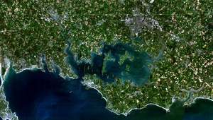
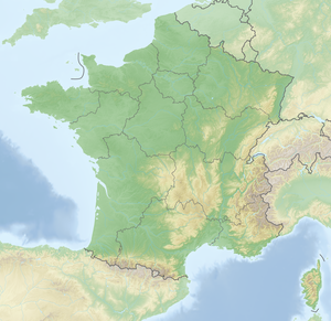
The Gulf of Morbihan ( French Golfe du Morbihan , actually "Gulf of Morbihan") is an inland sea with many islands in the Breton department of Morbihan (France), which is connected to the Atlantic by a narrow passage and is therefore salty.
The name of the golf comes from the Breton mor bihan , which means "little sea". The Morbihan department was named after the golf.
geography
The Gulf of Morbihan is separated from the Bay of Quiberon (Atlantic Ocean) by the Rhuys Peninsula . The connection to the Atlantic is only one kilometer wide and lies between the headland of Kerpenhir (Pointe de Kerpenhir in the municipality of Locmariaquer ) in the west and the headland of Port-Navalo (Pointe Port-Navalo in the municipality of Arzon ) in the east. The tidal currents there are very strong, with speeds of up to 4 meters per second. There are also many currents within the gulf due to the tides and the shallow water in many places, which is why the marinas in the area of the gulf offer recreational captains pilot services.
The three rivers Auray , Vannes and Noyalo flow into the Gulf . A third of the area of the gulf is only covered by water at high tide and is dry at low tide. There are almost 60 smaller and larger islands in the Gulf; the vernacular in Brittany even claims that there are as many islands as there are days in a year. The two largest islands, Île-aux-Moines and Île d'Arz , are separate municipalities . Numerous smaller islands are privately owned. The largest city on the Gulf is Vannes, which is connected to the Gulf in the north by a river.
colonization
The area around the Gulf of Morbihan is particularly rich in prehistoric evidence. You can find many megalithic monuments there, in the form of menhirs , dolmens , tumuli or stone circles (see also Carnac and Locmariaquer ).
In the past, the economic basis was agriculture and oyster farming . Traditionally, the fishermen go out either with small fishing trawlers or with specially adapted flat boats. In the Gulf of Morbihan, special types of boats were developed for this purpose : the Sinagot , a small schooner , was built in the small port of Séné near Vannes ; a similar boat with a slightly different hull , the Forban, was built in Le Bono , a small port near Auray. Today, however, it is mainly the anglers who go fishing in golf. But oyster farming is still important with an annual production of 450 tons.
The main line of business today is tourism. On the outskirts of the villages, the number of holiday apartments has increased significantly and the tourist infrastructure has changed the area significantly. Shipping on the Gulf has increased significantly in recent years. The people living on the coast feel particularly disturbed by the motor boats and demand a speed limit of 5 knots .
Flora and fauna as well as nature conservation
The tidal flats of the gulf form a special habitat. It is characterized by carpets of algae, which help to stabilize the soil and reduce the turbidity of the water, they generate oxygen and form a shelter for young animals. The gulf is also an important habitat for water birds. Hundreds of thousands of geese, ducks and waders live here during the winter season .
The Gulf of Morbihan and its banks as well as the coast directly at the exit of the Gulf - a total of 20,609 hectares - were designated as an area of Community importance (French: Site d'Importance Communautaire) as part of Natura 2000 , a transnational system of protected areas within the European Union . classified. 6,213 hectares of the gulf, especially its eastern area, were declared under Natura 2000 in addition to a special protection area (French Zone de Protection Spéciale) .
Problems for nature conservation are caused by water pollution and disruptions to the animal world, including water sports carried out near the coast.
Port of the
Île-aux-MoinesThe “pink house”: Orientation aid for
navigation at the entrance to VannesA “Sinagot”: traditional type of boat from the Séné Golf Harbor
The Rhuys Peninsula
from the sea
Web links
Individual evidence
- ↑ Golfe du Morbihan, Côte Ouest de Rhuys, on the website Le réseau de Natura 2000 ( Memento of August 17, 2007 in the Internet Archive ) (French, accessed April 19, 2007)
- ↑ Golfe du Morbihan, on the website Le réseau de Natura 2000 ( memento of November 26, 2006 in the Internet Archive ) (French, accessed April 19, 2007)


