Fougères
|
Fougères rim |
||
|---|---|---|

|
|
|
| region | Brittany | |
| Department | Ille-et-Vilaine | |
| Arrondissement | Fougères-Vitré ( chef-lieu ) | |
| Canton | Fougères-1 , Fougères-2 | |
| Community association | Fougères agglomeration | |
| Coordinates | 48 ° 21 ′ N , 1 ° 12 ′ W | |
| height | 62-171 m | |
| surface | 10.46 km 2 | |
| Residents | 20,418 (January 1, 2017) | |
| Population density | 1,952 inhabitants / km 2 | |
| Post Code | 35300 | |
| INSEE code | 35115 | |
| Website | mairie-fougeres.fr | |
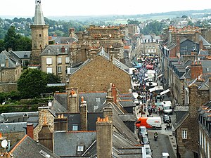
 Fougères - View from the church |
||
Fougeres ( Breton : Felger , Gallo : Feljerr ) is a French municipality with 20,418 inhabitants (at January 1, 2017) in the Ille-et-Vilaine in the region of Brittany .
geography
Fougères is in the east of Brittany. Neighboring municipalities are Laignelet in the northeast, Beaucé in the east, La Selle-en-Luitré in the southeast, Javené in the south and Lécousse in the west.
The river Couesnon runs along the southern boundary of the municipality, into which - crossing the municipality from the north - the Ruisseau de Greslay and the Nançon flow as right tributaries.
Population development
| year | 1962 | 1968 | 1975 | 1982 | 1990 | 1999 | 2006 | 2017 |
| Residents | 24,279 | 26,045 | 26,610 | 24,362 | 22,239 | 21,779 | 20,941 | 20,418 |
| Sources: Cassini and INSEE | ||||||||
Attractions
See also: List of Monuments historiques in Fougères
- Fougères is a town worth seeing, especially because of the picturesque city walls and the castle (Fougères was a border fortress to France). The constellation with the castle in the valley, the city on the mountain and a city wall that connects the castle and city with one another differs significantly from the layout of the other border fortresses of Rennes and Vitré .
- The gallery tomb Pierre Courcoulée .
Town twinning
- Ashford (United Kingdom) - since 1984
- Bad Münstereifel (Germany) - since 1967
- Śrem (Poland)
Personalities
- Marcel Lehoux (1888 / 1889–1936), automobile racing driver
- Jean Guéhenno (1890–1978), educator, journalist and writer
- Yak Rivais (* 1939), artist and writer
literature
- Le Patrimoine des Communes d'Ille-et-Vilaine. Flohic Editions, Volume 1, Paris 2000, ISBN 2-84234-072-8 , pp. 578-604.
Web links
Commons : Fougères - Collection of images, videos and audio files

