Étrelles
|
Étrelles Stredell |
||
|---|---|---|

|
|
|
| region | Brittany | |
| Department | Ille-et-Vilaine | |
| Arrondissement | Fougères-Vitré | |
| Canton | La Guerche-de-Bretagne | |
| Community association | Vitré Communauté | |
| Coordinates | 48 ° 4 ′ N , 1 ° 12 ′ W | |
| height | 52-108 m | |
| surface | 27.17 km 2 | |
| Residents | 2,543 (January 1, 2017) | |
| Population density | 94 inhabitants / km 2 | |
| Post Code | 35370 | |
| INSEE code | 35109 | |
| Website | http://www.ville-etrelles.fr/ | |
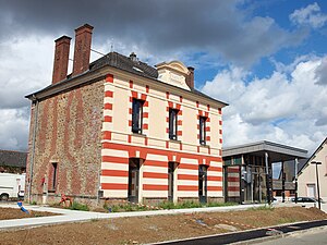
 Mairie Étrelles |
||
Étrelles ( Breton : Stredell ; Gallo : Estrell ) is a commune with 2,543 inhabitants (as of January 1 2017) in the Ille-et-Vilaine in the region of Brittany . It belongs to the arrondissement Fougères-Vitré and is part of the canton of La Guerche-de-Bretagne (until 2015: canton of Argentré-du-Plessis ). The inhabitants are called Étrellais .
geography
Étrelles is about 36 kilometers east of Rennes . The Valière river limits the municipality to the north. The Étang de Beuvron , a specially protected nature reserve, is also located in the municipality . Étrelles is surrounded by the neighboring communities of Vitré in the north, Erbrée in the northeast, Argentré-du-Plessis in the east and southeast, Domalain in the south, Vergéal in the southwest, Torcé in the west and Saint-Aubin-des-Landes in the northwest.
The national route 157 runs through the municipality .
history
In 1589 there was a massacre here during the wars of religion. 101 inhabitants were killed by Huguenots.
Population development
| year | 1962 | 1968 | 1975 | 1982 | 1990 | 1999 | 2006 | 2017 |
| Residents | 1232 | 1251 | 1327 | 1486 | 1809 | 2130 | 2479 | 2543 |
Attractions
- Remnants of the Roman road from Rennes to Le Mans
- Church of St-Pierre-St-Paul with pulpit ( Monument historique ), built in 1891, with window on the massacre of 1589 (Monument historique)
literature
- Le Patrimoine des Communes d'Ille-et-Vilaine. Flohic Editions, Volume 1, Paris 2000, ISBN 2-84234-072-8 , pp. 93-94.

