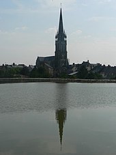
Le Pertre
|
Le Pertre Ar Perzh |
||
|---|---|---|

|
|
|
| region | Brittany | |
| Department | Ille-et-Vilaine | |
| Arrondissement | Fougères-Vitré | |
| Canton | La Guerche-de-Bretagne | |
| Community association | Vitré Communauté | |
| Coordinates | 48 ° 2 ′ N , 1 ° 2 ′ W | |
| height | 67-184 m | |
| surface | 43.63 km 2 | |
| Residents | 1,389 (January 1, 2017) | |
| Population density | 32 inhabitants / km 2 | |
| Post Code | 35680 | |
| INSEE code | 35217 | |
| Website | http://www.lepertre.fr/ | |
 Town hall (Mairie) of Le Pertre |
||
Le Pertre ( Breton : Ar Perzh ; Gallo : Le Pèrtr ) is a French municipality with 1,389 inhabitants (as of January 1 2017) in the department of Ille-et-Vilaine in the region of Brittany . It belongs to the arrondissement Fougères-Vitré and is part of the canton of La Guerche-de-Bretagne (until 2015: canton of Argentré-du-Plessis ). The inhabitants are called Pertrais .
geography
Le Pertre is about 45 kilometers east-southeast of Rennes . The seiche rises here . Le Pertre is surrounded by the neighboring municipalities of Bréal-sous-Vitré in the north, La Gravelle in the northeast, Saint-Cyr-le-Gravelais in the east, Beaulieu-sur-Oudon in the southeast, Méral in the south and southeast, Cuillé in the southwest, Brielles in the West and Southwest, Argentré-du-Plessis in the West and Mondevert in the Northwest.
Population development
| year | 1962 | 1968 | 1975 | 1982 | 1990 | 1999 | 2006 | 2013 |
| Residents | 1,475 | 1,376 | 1,270 | 1,335 | 1,326 | 1,361 | 1,374 | 1,416 |
| Source: Cassini and INSEE | ||||||||
Attractions
See also: List of Monuments historiques in Le Pertre
- Saint-Martin-de-Vertou church
literature
- Le Patrimoine des Communes d'Ille-et-Vilaine. Flohic Editions, Volume 1, Paris 2000, ISBN 2-84234-072-8 , pp. 97-100.

