
Drouges
| Drouges | ||
|---|---|---|
.svg)
|
|
|
| region | Brittany | |
| Department | Ille-et-Vilaine | |
| Arrondissement | Fougères-Vitré | |
| Canton | La Guerche-de-Bretagne | |
| Community association | Vitré Communauté | |
| Coordinates | 47 ° 54 ′ N , 1 ° 16 ′ W | |
| height | 57-109 m | |
| surface | 11.63 km 2 | |
| Residents | 519 (January 1, 2017) | |
| Population density | 45 inhabitants / km 2 | |
| Post Code | 35130 | |
| INSEE code | 35102 | |

Drouges (in Gallo Drouj , in Breton Dougez ) is a commune in Brittany in France . It belongs to the department of Ille-et-Vilaine , the Arrondissement Redon and the canton of La Guerche-de-Bretagne . It borders Moussé to the northwest , Rannée to the northeast, east and south and Retiers to the west .
The national route 178 leads through Drouges.
Population development
| year | 1962 | 1968 | 1975 | 1982 | 1990 | 1999 | 2005 | 2017 |
|---|---|---|---|---|---|---|---|---|
| Residents | 600 | 564 | 488 | 450 | 397 | 419 | 445 | 519 |
Attractions
- Manor house (Manoir) de La Motte
- Saint-Pierre church
- War memorial

Manoir de La Motte

Saint-Pierre church

Interior of the Saint-Pierre church
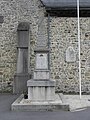
War memorial
_Manoir_de_La_Motte.JPG)
_%C3%89glise_01.JPG)
_%C3%89glise_04.JPG)
_Monument_aux_morts.JPG)
literature
- Le Patrimoine des Communes d'Ille-et-Vilaine. Flohic Editions, Volume 1, Paris 2000, ISBN 2-84234-072-8 , p. 658.
Web links
Commons : Drouges - collection of images, videos and audio files