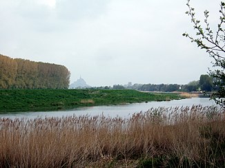
Couesnon
| Couesnon | ||
|
Couesnon near the mouth |
||
| Data | ||
| Water code | FR : J0--0150 | |
| location | France , Pays de la Loire regions , Brittany and Normandy | |
| River system | Couesnon | |
| source | in the municipality of Saint-Pierre-des-Landes, 48 ° 18 ′ 38 ″ N , 1 ° 3 ′ 29 ″ W |
|
| Source height | approx. 185 m | |
| muzzle | In the bay of Mont-Saint-Michel in the English Channel Coordinates: 48 ° 37 ′ 56 ″ N , 1 ° 30 ′ 36 ″ W 48 ° 37 ′ 56 ″ N , 1 ° 30 ′ 36 ″ W |
|
| Mouth height | 0 m | |
| Height difference | approx. 185 m | |
| Bottom slope | approx. 1.9 ‰ | |
| length | 98 km | |
| Catchment area | 1124 km² | |
| Left tributaries | Tamout | |
| Right tributaries | Nançon , Minette , Loisance , Guerge , Tronçon | |
| Reservoirs flowed through | Étang de Vézins | |
| Medium-sized cities | Fougères | |
The Couesnon [ kwenɔ̃ ], Kouenon in Breton , is a French coastal river that runs through the Pays de la Loire , Brittany and Normandy regions.
geography
It rises in the municipality of Saint-Pierre-des-Landes , initially drains generally in a westerly direction, but then turns to the north and flows into the English Channel after 98 kilometers at Mont-Saint-Michel . Its lower course forms the border between the regions of Normandy and Brittany . On his way he crosses the departments of Mayenne , Ille-et-Vilaine and Manche .
history
The Couesnon was canalized in the 19th century to stem the erosion of the bank. In 1969 a dam was built at the mouth. Various expansion works and the dam as access to Mont-Saint-Michel led to the silting of the bay of Mont-Saint-Michel. To prevent the Mont-Saint-Michel from losing its island character as a result, the dam is to be replaced by a viaduct and the dam is to be changed.
The menhir de la Roche au Diable, southeast of Sougéal, stands near the river.
Places on the river
Web links
- http://www.projetmontsaintmichel.fr/ (French)
