Loisance
|
Loisance Loysance |
||
|
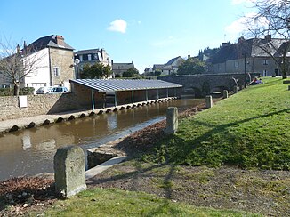
Wash house by the river in the local area of Antrain |
||
| Data | ||
| Water code | FR : J0144000 | |
| location | France , Brittany region | |
| River system | Couesnon | |
| Drain over | Couesnon → English Channel | |
| source | in the municipality of Le Châtellier, 48 ° 26 ′ 32 ″ N , 1 ° 14 ′ 37 ″ W |
|
| Source height | approx. 159 m | |
| muzzle | in the municipality of Antrain in the Couesnon Coordinates: 48 ° 28 ′ 12 ″ N , 1 ° 29 ′ 10 ″ W 48 ° 28 ′ 12 ″ N , 1 ° 29 ′ 10 ″ W |
|
| Mouth height | approx. 9 m | |
| Height difference | approx. 150 m | |
| Bottom slope | approx. 5 ‰ | |
| length | 30 km | |
| Discharge at the Saint-Ouen-la-Rouërie A Eo gauge : 81.5 km² |
MQ Mq |
790 l / s 9.7 l / (s km²) |
The Loisance (also: Loysance ) is a river in France that runs in the Ille-et-Vilaine department in the Brittany region . It rises under the name Ruisseau de Fretay in the municipality of Le Châtellier , generally drains west to northwest through the old cultural landscape of Coglais and after 30 kilometers flows into the Couesnon as a right tributary in the municipality of Antrain . In its upper course it is repeatedly dammed and water is diverted into underground aqueducts .
Places on the river
(Order in flow direction)
Individual evidence
- ↑ Source geoportail.gouv.fr
- ↑ estuary geoportail.gouv.fr
- ↑ a b The information on the length of the river is based on the information on the Loisance at SANDRE (French), accessed on November 23, 2013, rounded to full kilometers.
- ↑ hydro.eaufrance.fr (station: J0144010 , option: Synthèse ) .
