
Upper Normandy
|
Upper Normandy Former French region (until 2015) |
|

|

|
  |
|
| Basic data | |
|---|---|
| Today part of | Normandy |
| Administrative headquarters | Rouen |
|
population
- total January 1, 2017 |
1,856,221 inhabitants |
|
surface - total |
12,317 km² |
| Departments | 2 |
| Arrondissements | 6th |
| Cantons | 112 |
| Communities | 1,420 |
| Formerly ISO 3166-2 code | FR-Q |
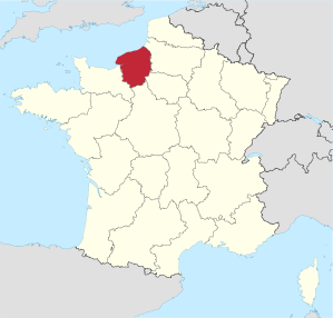
The Haute-Normandie [ otnɔʀmɑ̃ˈdi ] ( German Upper Normandy ) was a region in the north of France , which consisted of the departments Eure and Seine-Maritime . It had an area of 12,317 km² and 1,856,221 inhabitants (as of January 1, 2017). The capital of the region was Rouen . On January 1, 2016, Lower Normandy merged with Upper Normandy to form the Normandy region . The provisional capital of the new region is Rouen.
geography
Upper Normandy lies on the English Channel and borders the regions of Basse-Normandie , Center-Val de Loire , Île-de-France and Picardie .
coat of arms
Description: In red, two blue-tongued and thus armored golden, walking leopards .
history
The Haute-Normandie region was formed in 1956 when historical Normandy was divided into the two regions of Lower Normandy and Upper Normandy when France was divided into program regions .
In 1972 the region received the status of an établissement public under the direction of a regional prefect.
The decentralization laws of 1982 gave the regions the status of collectivités territoriales ( territorial authorities ), which until then had only been enjoyed by the municipalities and the départements .
In 1986 the regional councils were directly elected for the first time. Since then, the region's powers vis-à-vis the central government in Paris have been gradually expanded.
On January 1, 2016 , the Haute-Normandie region merged with the neighboring region of Basse-Normandie to form the new region of Normandy .
Cities
The most populous cities in Upper Normandy are:
| city | Inhabitants (year) | Department |
|---|---|---|
| Le Havre | 170,147 (2017) | Seine-Maritime |
| Rouen | 110,145 (2017) | Seine-Maritime |
| Evreux | 47,733 (2017) | Your |
| Dieppe | 29,080 (2017) | Seine-Maritime |
| Sotteville-lès-Rouen | 28,965 (2017) | Seine-Maritime |
| Saint-Etienne-du-Rouvray | 28,641 (2017) | Seine-Maritime |
| Le Grand-Quevilly | 25,698 (2017) | Seine-Maritime |
| Vernon | 23,872 (2017) | Your |
| Le Petit-Quevilly | 21,995 (2017) | Seine-Maritime |
| Mont-Saint-Aignan | 18,850 (2017) | Seine-Maritime |
Political structure
The Haute-Normandie region is divided into two departments :
| Department | prefecture | ISO 3166-2 | Arrondissements | Cantons | Communities | Inhabitants (year) | Area (km²) |
Density (inh / km²) |
||
|---|---|---|---|---|---|---|---|---|---|---|
| Your | Evreux | FR-27 | 3 | 43 | 675 |
|
6,040 | 99.6 | ||
| Seine-Maritime | Rouen | FR-76 | 3 | 69 | 745 |
|
6,278 | 199.8 |
economy
When compared with the GDP of the European Union expressed in purchasing power standards , the region achieved an index of 99.3 in 2006 (EU-27 = 100).
Tourist Normandy
On January 3, 1987, a law was passed in France that the regional councils (frz. Conseil régional) of the French regions should set up so-called “Comité Régional de Tourisme” (German tourism association of a region). The task of the "Comité Régional de Tourisme de Normandie" (German Tourism Association of Normandy) is to market Normandy as a holiday destination at home and abroad. The peculiarity of this tourist association is that two administrative regions (Upper and Lower Normandy ) pool their resources and their commitment to promote the Normandy region together. In addition to marketing, market analyzes and the improvement of the tourist offer in cooperation with the Norman service providers are also important tasks of this organization.
See also
Web links
- Upper Normandy region (French)
- Upper Normandy: a haven of peace in France official website (english)
Individual evidence
- ↑ Eurostat press release 23/2009: Regional GDP per inhabitant in the EU27 (PDF file; 360 kB)
Collectivités :
Auvergne-Rhône-Alpes |
Bourgogne-Franche-Comté |
Brittany |
Center-Val de Loire |
Grand Est |
Hauts-de-France |
Île-de-France |
Normandy |
Nouvelle-Aquitaine |
Occitania |
Pays de la Loire |
Provence-Alpes-Cote d'Azur
Collectivité with special status:
Corsica
Overseas Regions (ROM) :
French Guiana |
Guadeloupe |
Martinique |
Mayotte |
Reunion
Former regions (disbanded 2015):
Aquitaine |
Auvergne |
Burgundy |
Champagne-Ardenne |
Alsace |
Franche-Comté |
Languedoc-Roussillon |
Limousin |
Lorraine |
Midi-Pyrénées |
Nord-Pas-de-Calais |
Lower Normandy |
Upper Normandy |
Picardy |
Poitou-Charentes |
Rhône-Alpes
Coordinates: 49 ° 27 ' N , 1 ° 5' E