
Department of Eure
| Your | |
|---|---|
 |
  |
| region | Normandy |
| prefecture | Evreux |
| Sub-prefecture (s) |
Les Andelys Bernay |
| Residents | 601,843 (Jan. 1, 2017) |
| Population density | 100 inhabitants per km² |
| surface | 6,041.80 km² |
| Arrondissements | 3 |
| Community associations | 16 |
| Cantons | 23 |
| Communities | 585 |
|
President of the Department Council |
Pascal Lehongre |
| ISO-3166-2 code | FR-27 |
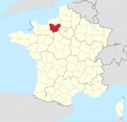
 Location of the department of Eure in the region of Normandy |
|
The Eure [ œːʀ ] is the French department of 27 with the ordinal number It is located in the north of the country in the region Normandy and after the river Eure named.
geography

The Eure department borders on the Seine-Maritime , Oise , Val-d'Oise , Yvelines , Eure-et-Loir , Orne and Calvados departments, as well as a bay in the English Channel .
Eure is in the northwest of the Paris Basin . The soil is rich in chalk from the Mesozoic . The landscape consists of six plateaus surrounded by valleys. The plateaus are about 150 meters above sea level . In the south-west the foothills of the mountains of the Le Perche landscape reach a height of 220 meters. The six plateaus are the Vexin , the Madrie plateau between Seine and Eure, the Saint-André plain between Eure, Avre and Iton , the Neubourg plateau , the Pays d'Ouche and the Lieuvin .
coat of arms
Description: In the coat of arms, which is divided into red and blue, there are two running, golden, looking blue-tongued and blue-armored lions at the top and golden lilies sown below, above which is a three-fold red and white diagonal bar .
history
The department was created on March 4, 1790 from parts of the province of Normandy.
Archeology in the Eure department
.jpg)
The first scientific excavation in the Eure department took place in Houlbec-Cocherel in 1685 . At the beginning of the 19th century, the Gallo-Roman settlement Gisacum was discovered in Le Vieil-Évreux . From 1830 to the Second World War (1939-1945), the archaeological research was carried out by local scholars such as Auguste Le Prévost , Jean Benoît Désiré Cochet , Léon Coutil , Léon de Vesly , Alphonse-Georges Poulain and Henri Gadeau de Kerville . After the Second World War, thanks in particular to the influence of Michel de Boüard from the University of Caen, the methods of archaeological research in Eure were improved. The excavations were supervised by specialists but still relied on the work of interested volunteers, who were often members of archaeological societies. Since the 1980s, the excavations have only been carried out by archaeologists.
Megalithic site in the Eure department
- Aubevoye dolmen
- Gallery tomb of Dampsmesnil
- Dolmen de la Grosse Pierre (Verneusses)
- Dolmen de l'Hôtel-Dieu
- Pierre Courcoulée (Les Ventes)
- Pierre Tournante (Bosgouet)
- Pierre Trouée by Aizier
- Rugles dolmen
Iron age
Hallstatt period
It is difficult to determine the transition from the Bronze Age to the Hallstatt Age (Early or Earlier Iron Age) in the Eure department , as only a few bronze finds were made. The finds point to a delayed beginning of the Hallstatt period. Traces of settlement from the older iron age were only found in the east of the department in the valley of the Eure and in the valley of the Seine (as of 1993). The rivers were transport routes, which is attested by place names such as Vieux-Port ('old port'). The burial mound in Garennes-sur-Eure is one of the finds that were certainly from the Early Iron Age . Some sites were used in the Hallstatt and Latène periods , for example the necropolises of Jouy-sur-Eure and Les Damps and the houses of Tournedos-sur-Seine . The transition between the two periods in the Eure department is dated to the 5th century BC. Dated.
La Tène time
Finds from the Early and Middle Latène were made in the river valleys, as in the Hallstatt period, especially in the Andelle , Eure and Seine areas. That changed in the late La Tène , many finds come from the plains in the east of the department. The graves of the Early and Middle Latène contain only jewelry, no weapons or ceramics. Guns and helmets from this period were mainly found in rivers. That changed again in the late La Tène, when pottery, funeral urns , swords, lances, helmets, shields and food were found in these graves . The swords were often bent and deliberately rendered unusable. The grave goods in the late Latène, for example in the necropolis of La Remise in Pîtres , indicate a hierarchical structure of society, whereby the number of warriors ( aristocratie guerrière ) had increased compared to the early La Tène . Even so, agriculture remained the basis of society.
The grave goods found in Eure correspond to those found on the Marne in the eastern Paris basin. Trade between the Eure department and northern Italy is evidenced by the helmet of Amfreville-sous-les-Monts and the torques of Notre-Dame-du-Vaudreuil .

In the late La Tène the Veliocassen settled the area north of the Seine with the exception of the forest of Lyons-la-Forêt , in which Bellovaks settled. The eastern area south of the Seine was inhabited by the Eburovices , a subgroup of the Aulerci . The western area south of the Seine was inhabited by the Lexovii . In the southeast corner of the department, for example in Armentières-sur-Avre and Saint-Victor-sur-Avre , lived carnutes . Especially the areas of the Veliocasses and the Eburovices at the confluence of the Eure and Seine rivers were not separated by the rivers, but overlapped. Murus Gallicus , Gallic fortification walls of a Celtic oppidum , have so far (as of 1993) only been found in the Vernonnet district of Vernon .
Seven Celtic coin treasures were found in the Eure department (as of 1993). The most important finds of this type are the treasure of Lyons-la-Forêt (around 80 BC) and the treasure of Les Andelys (52 to 45 BC). More interesting, however, are the individual finds and not the depot finds . The individual coins allow conclusions to be drawn about the trade routes. In the Risle valley , coins from the Baiokassen and the Eburovices were equally common. In the rest of the department the coins of the Eburovices dominated.
Gallo-Roman time

In the Gallo-Roman period (52 BC to 486 AD), the Civitas of the Eburovices made up the main part of what is now the Eure department. The Civitas of the Veliocasses included the Roumois as well as Pîtres, Les Andelys and Lyons-la-Forêt. Brionne and the Berthouville temple complex were on the edge of the Lexovii Civitas area. The exact border lines north and south of Brionne are not known. The border between the territory of the Eburovices and the Carnutes was the Avre .
The Eburovices fought alongside the other tribes of Aremorica in the Gallic War (58 to 51/50 BC) . 3,000 warriors of the Eburovices, Lexovii and Veliocasses took 52 BC. In the battle for Alesia . 51 BC They supported a revolt of the Belgians .
The area of today's department belonged after 52 BC. BC to the Roman province of Gallia Lugdunensis , which was under a legatus Augusti pro praetore . The capital was Lyon . Many hoard finds in Eure date from the time of the imperial crisis of the 3rd century . Diocletian (emperor from 284 to 305) divided Gallia Lugdunensis into two parts. Today's Eure was part of the second part with the capital Rouen (Rotomagus) . The area corresponded roughly to today's areas of Normandy and Brittany. In the years 364 to 388 this province was divided again, Brittany was split off.
reformation
The Reformation began in Eure from 1520. In the 16th century there were only six real Protestant churches, in the 17th century there were only four and not a single one in the 18th century. That is significantly less than in the other departments of Normandy. The affected municipalities were Brionne, Conches-en-Ouche , Évreux, Sancourt , Lieurey , Lyons-la-Forêt, Bosguérard-de-Marcouville , Pont-Audemer and Quillebeuf-sur-Seine . Noble and wealthy townspeople set up small houses of prayer, but these are not to be seen as regular churches because they lacked a pastor . In 1531 the Inquisition Court met in Gisors, and in 1541 in Évreux. During the reign of Henry II from 1547 to 1559, the pressure on the Protestants increased. In 1555 a monk from the Notre-Dame du Parc priory in Harcourt was burned at the stake in Évreux for heresy . Several Protestants then met in the cemetery at the Saint-Adrien chapel and damaged a statue and the cemetery cross. Even so, the above-mentioned Reformed churches were founded from 1559. They were subordinate to the Colloquium of Rouen, which formed a synod with the other five Colloquia of Normandy .
Franco-German War
The elections of the National Assembly of the Third French Republic had to be suspended because of the Franco-Prussian War (1870–1871). The prefecture of the department was temporarily moved to Bernay during the siege of Évreux . In the elections of February 1871, seven Orléanists and one Republican were elected in Eure .
Second World War
During the Second World War (1939-1945), the department was liberated by the Allies within ten days from August 20-29, 1944 during Operation Overlord . 146 architectural works of art were destroyed. The road and rail network was bombed and disrupted in 141 locations . Between 1940 and 1944, 144 residents of the department were executed by shooting by the Wehrmacht . About 190 people were abducted for political reasons and died in captivity. 221 people returned from the deportation .
Since 1960
From 1960 to 2015, the department was part of the Haute-Normandie region , which became part of the Normandy region in 2016 .
Cities

The most populous municipalities in the Eure department are:
| city | Population (2017) |
Arrondissement |
|---|---|---|
| Evreux | 47,733 | Evreux |
| Vernon | 23,872 | Evreux |
| Louviers | 18,648 | Les Andelys |
| Val-de-Reuil | 13,063 | Les Andelys |
| Gisors | 11,537 | Les Andelys |
| Pont-Audemer | 10,230 | Bernay |
| Bernay | 10,085 | Bernay |
| Verneuil-sur-Avre | 8,170 | Evreux |
| Les Andelys | 8,056 | Les Andelys |
| Gaillon | 6,924 | Les Andelys |
Administrative division


The Eure department is divided into 3 arrondissements , 23 cantons and 602 communes :
| Arrondissement | Cantons | Communities | Residents January 1, 2017 |
Area km² |
Density of population / km² |
Code INSEE |
|---|---|---|---|---|---|---|
| Les Andelys | 9 | 185 | 235.604 | 1,854.38 | 127 | 271 |
| Bernay | 9 | 297 | 227.195 | 3,229.10 | 70 | 272 |
| Evreux | 7th | 103 | 139.044 | 958.32 | 145 | 273 |
| Department of Eure | 23 | 585 | 601.843 | 6,041.80 | 100 | 27 |
An administrative reform was carried out with effect from January 1, 2006. The cantons of Louviers-Nord and Louviers-Sud moved from the Arrondissement Évreux to the Arrondissement Les Andelys, and the canton Amfreville-la-Campagne was spun off from the Arrondissement Évreux and assigned to the Arrondissement Bernay.
See also:
- List of communes in the Eure department
- List of cantons in the Eure department
- List of associations of municipalities in the Eure department
Web links
- Department Eure (French)
- Prefecture of the Eure department (French)
- Archives of the Eure department. (French)
Individual evidence
- ^ Dominique Cliquet: L'Eure . 27. In: Michel Provost, Academie des inscriptions et belles-lettres, Ministere de la culture (ed.): Carte Archéologique de la Gaule . Fondation Maison des Sciences de l'Homme, Paris 1993, ISBN 2-87754-018-9 , p. 33 f . (French).
- ↑ Bernard Bodinier (ed.): L'Eure de la Préhistoire à nos jours . Jean-Michel Bordessoules, Saint-Jean-d'Angély 2001, ISBN 2-913471-28-5 , pp. 10-13 (French).
- ↑ a b c Dominique Cliquet: L'Eure . 27. In: Michel Provost, Academie des inscriptions et belles-lettres, Ministere de la culture (ed.): Carte Archéologique de la Gaule . Fondation Maison des Sciences de l'Homme, Paris 1993, ISBN 2-87754-018-9 , p. 36-45 (French).
- ^ Dominique Cliquet: L'Eure . 27. In: Michel Provost, Academie des inscriptions et belles-lettres, Ministere de la culture (ed.): Carte Archéologique de la Gaule . Fondation Maison des Sciences de l'Homme, Paris 1993, ISBN 2-87754-018-9 , p. 44-46 (French).
- ↑ Pierre Le Brasseur: Histoire civile et ecclesiastique du comté d'Evreux, ou l'on voit tout ce qui s'est passé depuis la fondation de la monarchie, tant par rapport aux rois de France, qu'aux anciens ducs de Normandie, & aux rois d'Angleterre . François Barois, Paris 1722, p. 319 (French, online ).
- ↑ Bernard Bodinier (ed.): L'Eure de la Préhistoire à nos jours . Jean-Michel Bordessoules, Saint-Jean-d'Angély 2001, ISBN 2-913471-28-5 , pp. 248 (French).
- ↑ Laurence Riviale: Le vitrail en Normandie entre Renaissance et Réforme (1517–1596) . In: Corpus Vitrearum . tape 7 . Presses Universitaires de Rennes, Rennes 2007, ISBN 978-2-7535-0525-4 , pp. 28 f . (French).
- ↑ Alex Gardin: La guerre de 1870–1871 à Bernay . Les Éditions Page de Garde, Saint-Aubin-les-Elbeuf 1997, ISBN 2-84340-037-6 , p. 27–44 (French, first edition: 1898, reprint).
- ↑ Alex Gardin: La guerre de 1870–1871 à Bernay . Les Éditions Page de Garde, Saint-Aubin-les-Elbeuf 1997, ISBN 2-84340-037-6 , p. 83–85 (French, first edition: 1898, reprint).
- ↑ A.-V. de Walle: Évreux et l'Eure pendant la guerre . Charles Herissey, Évreux 2000, ISBN 2-914417-05-5 , pp. 184 + 191–199 (French, first edition: 1946).
01 Ain | 02 Aisne | 03 Allier | 04 Alpes-de-Haute-Provence | 05 Hautes-Alpes | 06 Alpes-Maritimes | 07 Ardèche | 08 Ardennes | 09 Ariège | 10 Aube | 11 Aude | 12 Aveyron | 13 Bouches-du-Rhône | 14 Calvados | 15 Cantal | 16 Charente | 17 Charente-Maritime | 18 Cher | 19 Corrèze | 21 Côte-d'Or | 22 Côtes-d'Armor | 23 Creuse | 24 Dordogne | 25 Doubs | 26 Drôme | 27 Your | 28 Eure-et-Loir | 29 Finistère | 30 Gard | 31 Haute-Garonne | 32 Gers | 33 Gironde | 34 Hérault | 35 Ille-et-Vilaine | 36 Indre | 37 Indre-et-Loire | 38 Isère | 39 Jura | 40 Landes | 41 Loir-et-Cher | 42 Loire | 43 Haute-Loire | 44 Loire-Atlantique | 45 Loiret | 46 Lot | 47 Lot-et-Garonne | 48 Lozère | 49 Maine-et-Loire | 50 Some | 51 Marne | 52 Haute-Marne | 53 Mayenne | 54 Meurthe-et-Moselle | 55 Meuse | 56 Morbihan | 57 Moselle | 58 Nièvre | 59 North | 60 Oise | 61 Orne | 62 Pas-de-Calais | 63 Puy-de-Dôme | 64 Pyrénées-Atlantiques | 65 Hautes-Pyrénées | 66 Pyrénées-Orientales | 67 Bas-Rhin | 68 Haut-Rhin | 69D Rhône | 69M Métropole de Lyon (from 2015) | 70 Haute-Saône | 71 Saône-et-Loire | 72 Sarthe | 73 Savoie | 74 Haute-Savoie | 75 Paris (from 1968) | 76 Seine-Maritime | 77 Seine-et-Marne | 78 Yvelines (from 1968) | 79 Deux-Sèvres | 80 Somme | 81 Tarn | 82 Tarn-et-Garonne | 83 Var | 84 Vaucluse | 85 Vendée | 86 Vienne | 87 Haute-Vienne | 88 Vosges | 89 Yonne | 90 Territoire de Belfort | 91 Essonne (from 1968) | 92 Hauts-de-Seine (from 1968) | 93 Seine-Saint-Denis (from 1968) | 94 Val-de-Marne (from 1968) | 95 Val-d'Oise (from 1968)
Overseas Departments (DOM)
971 Guadeloupe |
972 Martinique |
973 French Guiana |
974 Réunion |
976 Mayotte
Départements
20 Corse
dissolved after 1962 (until 1975) | 2A Corse-du-Sud (1976-2017) |
2B Haute-Corse (1976-2017) |
75 Seine (until 1967) |
78 Seine-et-Oise (until 1967)
Coordinates: 49 ° 1 ' N , 1 ° 9' E