
Creuse department
| Creuse | |
|---|---|
 |
  |
| region | Nouvelle-Aquitaine |
| prefecture | Guéret |
| Sub-prefecture (s) | Aubusson |
| Residents | 118,638 (Jan. 1, 2017) |
| Population density | 21 inhabitants per km² |
| surface | 5,564.65 km² |
| Arrondissements | 2 |
| Community associations | 8th |
| Cantons | 15th |
| Communities | 256 |
|
President of the Department Council |
Valérie Simonet |
| ISO-3166-2 code | FR-23 |
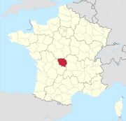
 Location of the department of Creuse in the region Nouvelle-Aquitaine |
|
The Creuse department ([ kʀøːz ], Occitan Cruesa ) is the French department of 23 with the serial number located in the center of the country in the region Nouvelle-Aquitaine and is named after the river Creuse named.
geography
The Creuse department is bordered by the Indre and Cher departments to the north, the Allier department to the northeast, the Puy-de-Dôme department to the east, the Corrèze department to the south and the Haute-Vienne department to the west .
The department lies in the north-west of the Massif Central and extends into the Plateau de Millevaches in the south . The eponymous Creuse , which flows through the department in a north-westerly direction, also rises in the Plateau de Millevaches .
history
It was formed on March 4, 1790 from the main part of the Marche province and part of the Limousin . It also belonged to the Limousin region from 1960 to 2015 , which became part of the Nouvelle Aquitaine region in 2016 .
population
Population development
| year | 1962 | 1968 | 1975 | 1982 | 1990 | 1999 | 2006 | 2016 |
| Residents | 163,515 | 156,876 | 146.214 | 139,968 | 131,349 | 124,470 | 123.401 | 119.502 |
| Source: INSEE | ||||||||
The number of inhabitants in the department has been steadily declining since the early 1960s. The reason for this is, in addition to the emigration, which was recorded until the mid-1970s, a well below average birth rate, which was consistently below the mortality rate. Observers see here "a future laboratory for Europe when it comes to emigration".
Cities

The most populous communes in the Creuse department are:
| city | Population (2017) |
Arrondissement |
|---|---|---|
| Guéret | 13,161 | Guéret |
| La Souterraine | 5,207 | Guéret |
| Aubusson | 3,366 | Aubusson |
Administrative division
The Creuse department is divided into 2 arrondissements , 15 cantons and 256 communes :

| Arrondissement | Cantons | Communities | Residents January 1, 2017 |
Area km² |
Density of population / km² |
Code INSEE |
|---|---|---|---|---|---|---|
| Aubusson | 6th | 129 | 44,361 | 2,827.95 | 16 | 231 |
| Guéret | 11 | 127 | 74,277 | 2,736.70 | 27 | 232 |
| Creuse department | 15th | 256 | 118,638 | 5,564.65 | 21st | 23 |

See also:
- List of communes in the Creuse department
- List of cantons in the Creuse department
- List of associations of municipalities in the Creuse department
economy
The Creuse department is predominantly agricultural. In addition, tourism is an important source of income.
Web links
- Département Creuse (French)
- Prefecture of the Creuse department (French)
Individual evidence
- ↑ http://www.creuse.fr/spip.php?article84 accessed on May 6, 2015
- ^ Daniele Muscionico: What will flourish for us in the future: The village is dying. , nzz.de, July 30, 2019, accessed July 30, 2019
01 Ain | 02 Aisne | 03 Allier | 04 Alpes-de-Haute-Provence | 05 Hautes-Alpes | 06 Alpes-Maritimes | 07 Ardèche | 08 Ardennes | 09 Ariège | 10 Aube | 11 Aude | 12 Aveyron | 13 Bouches-du-Rhône | 14 Calvados | 15 Cantal | 16 Charente | 17 Charente-Maritime | 18 Cher | 19 Corrèze | 21 Côte-d'Or | 22 Côtes-d'Armor | 23 Creuse | 24 Dordogne | 25 Doubs | 26 Drôme | 27 Your | 28 Eure-et-Loir | 29 Finistère | 30 Gard | 31 Haute-Garonne | 32 Gers | 33 Gironde | 34 Hérault | 35 Ille-et-Vilaine | 36 Indre | 37 Indre-et-Loire | 38 Isère | 39 Jura | 40 Landes | 41 Loir-et-Cher | 42 Loire | 43 Haute-Loire | 44 Loire-Atlantique | 45 Loiret | 46 Lot | 47 Lot-et-Garonne | 48 Lozère | 49 Maine-et-Loire | 50 Some | 51 Marne | 52 Haute-Marne | 53 Mayenne | 54 Meurthe-et-Moselle | 55 Meuse | 56 Morbihan | 57 Moselle | 58 Nièvre | 59 North | 60 Oise | 61 Orne | 62 Pas-de-Calais | 63 Puy-de-Dôme | 64 Pyrénées-Atlantiques | 65 Hautes-Pyrénées | 66 Pyrénées-Orientales | 67 Bas-Rhin | 68 Haut-Rhin | 69D Rhône | 69M Métropole de Lyon (from 2015) | 70 Haute-Saône | 71 Saône-et-Loire | 72 Sarthe | 73 Savoie | 74 Haute-Savoie | 75 Paris (from 1968) | 76 Seine-Maritime | 77 Seine-et-Marne | 78 Yvelines (from 1968) | 79 Deux-Sèvres | 80 Somme | 81 Tarn | 82 Tarn-et-Garonne | 83 Var | 84 Vaucluse | 85 Vendée | 86 Vienne | 87 Haute-Vienne | 88 Vosges | 89 Yonne | 90 Territoire de Belfort | 91 Essonne (from 1968) | 92 Hauts-de-Seine (from 1968) | 93 Seine-Saint-Denis (from 1968) | 94 Val-de-Marne (from 1968) | 95 Val-d'Oise (from 1968)
Overseas Departments (DOM)
971 Guadeloupe |
972 Martinique |
973 French Guiana |
974 Réunion |
976 Mayotte
Départements
20 Corse
dissolved after 1962 (until 1975) | 2A Corse-du-Sud (1976-2017) |
2B Haute-Corse (1976-2017) |
75 Seine (until 1967) |
78 Seine-et-Oise (until 1967)
Coordinates: 46 ° 9 ′ N , 1 ° 58 ′ E