
Cantal department
| Cantal | |
|---|---|
 |
  |
| region | Auvergne-Rhône-Alpes |
| prefecture | Aurillac |
| Sub-prefecture (s) |
Mauriac Saint-Flour |
| Residents | 145,143 (Jan. 1, 2017) |
| Population density | 25 inhabitants per km² |
| surface | 5,725.05 km² |
| Arrondissements | 3 |
| Community associations | 10 |
| Cantons | 15th |
| Communities | 246 |
|
President of the Department Council |
Vincent Descœur |
| ISO-3166-2 code | FR-15 |
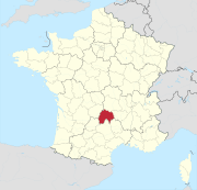
 Location of the Cantal in the region of Auvergne Rhône-Alpes |
|
The Cantal department [ kɑtal ] is the French department of 15 with the ordinal number It is located in the center of the country in the region Auvergne Rhône-Alpes and after the second highest mountain in the Massif Central , the Plomb du Cantal , named (1855 m).
geography
The department borders in the north with the department Puy-de-Dôme , in the east with the department Haute-Loire , in the southeast with the department Lozère of the region Occitania , in the south with the department Aveyron , also Occitania, in the southwest with the department Lot , also Occitania, and to the west and northwest to the Corrèze department of the Nouvelle-Aquitaine region .
The department is located in the interior of the Massif Central . In the Monts du Cantal , in the middle of the department, is the eponymous Plomb du Cantal . The Volcans d'Auvergne Regional Nature Park encompasses the central part of the department and merges into the Puy-de-Dôme department in the north. The Artense granite plateau and the Cézallier mountains lie on the border of the department . The Dordogne mostly flows on the north-western border to the Corrèze department, the Lot on part of the southern border to the Aveyron department. The Truyère , a right tributary of the Lot, runs through the southeast of the department in a chain of gorges and reservoirs.
coat of arms
Description: In gold, a red church flag with a green border on which a blue sign with a golden diagonal bar lies, which is accompanied by three silver shells on both sides.
history
The department was formed during the French Revolution on March 4, 1790 from part of what was then the province of Auvergne . It was divided into four districts ( French: district ), the forerunners of the arrondissements . The districts were Aurillac, Mauriac, Murat and Saint-Flour. The department and the districts were divided into 20 cantons and had (1791) 239,972 inhabitants. The capital was initially Saint-Flour , alternating with Aurillac . In 1794, Saint-Flour was designated the sole capital, but was finally set to Aurillac in 1795.
The districts corresponding arrondissements Aurillac , Mauriac , Murat and Saint-Flour were established on February 17, 1800. On September 10, 1926, the Arrondissement Murat was dissolved and incorporated into the Arrondissement Saint-Flour.
From 1960 to 2015 it was part of the Auvergne region , which in 2016 became part of the Auvergne-Rhône-Alpes region.
Cities
The most populous municipalities in the Cantal department are:
| city | Population (2017) |
Arrondissement |
|---|---|---|
| Aurillac | 25,499 | Aurillac |
| Saint-Flour | 6,435 | Saint-Flour |
| Arpajon-sur-Cère | 6.217 | Aurillac |
Administrative division

The Cantal department is divided into 3 arrondissements , 15 cantons and 246 communes :
| Arrondissement | Cantons | Communities | Residents January 1, 2017 |
Area km² |
Density of population / km² |
Code INSEE |
|---|---|---|---|---|---|---|
| Aurillac | 8th | 93 | 81,896 | 1,935.99 | 42 | 151 |
| Mauriac | 3 (+1) | 55 | 25,739 | 1,278.47 | 20th | 152 |
| Saint-Flour | 4 (+1) | 98 | 37.508 | 2,510.59 | 15th | 153 |
| Cantal department | 15th | 246 | 145.143 | 5,725.05 | 25th | 15th |
See also:
- List of communes in the Cantal department
- List of cantons in the Cantal department
- List of associations of municipalities in the Cantal department
economy
The department gives its name to the Cantal cheese .
Plomb du Cantal , the highest mountain in the department

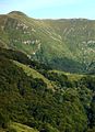
Truyère river on the Grandval reservoir


Web links
- Cantal department (French)
- Prefecture of the Cantal Department (French)
Individual evidence
- ↑ http://www.cantal.fr/l-assemblee-du-conseil-departemental-du-cantal-auvergne-aurillac-saint-flour-mauriac.html?id=7 accessed on May 6, 2015
01 Ain | 02 Aisne | 03 Allier | 04 Alpes-de-Haute-Provence | 05 Hautes-Alpes | 06 Alpes-Maritimes | 07 Ardèche | 08 Ardennes | 09 Ariège | 10 Aube | 11 Aude | 12 Aveyron | 13 Bouches-du-Rhône | 14 Calvados | 15 Cantal | 16 Charente | 17 Charente-Maritime | 18 Cher | 19 Corrèze | 21 Côte-d'Or | 22 Côtes-d'Armor | 23 Creuse | 24 Dordogne | 25 Doubs | 26 Drôme | 27 Your | 28 Eure-et-Loir | 29 Finistère | 30 Gard | 31 Haute-Garonne | 32 Gers | 33 Gironde | 34 Hérault | 35 Ille-et-Vilaine | 36 Indre | 37 Indre-et-Loire | 38 Isère | 39 Jura | 40 Landes | 41 Loir-et-Cher | 42 Loire | 43 Haute-Loire | 44 Loire-Atlantique | 45 Loiret | 46 Lot | 47 Lot-et-Garonne | 48 Lozère | 49 Maine-et-Loire | 50 Some | 51 Marne | 52 Haute-Marne | 53 Mayenne | 54 Meurthe-et-Moselle | 55 Meuse | 56 Morbihan | 57 Moselle | 58 Nièvre | 59 North | 60 Oise | 61 Orne | 62 Pas-de-Calais | 63 Puy-de-Dôme | 64 Pyrénées-Atlantiques | 65 Hautes-Pyrénées | 66 Pyrénées-Orientales | 67 Bas-Rhin | 68 Haut-Rhin | 69D Rhône | 69M Métropole de Lyon (from 2015) | 70 Haute-Saône | 71 Saône-et-Loire | 72 Sarthe | 73 Savoie | 74 Haute-Savoie | 75 Paris (from 1968) | 76 Seine-Maritime | 77 Seine-et-Marne | 78 Yvelines (from 1968) | 79 Deux-Sèvres | 80 Somme | 81 Tarn | 82 Tarn-et-Garonne | 83 Var | 84 Vaucluse | 85 Vendée | 86 Vienne | 87 Haute-Vienne | 88 Vosges | 89 Yonne | 90 Territoire de Belfort | 91 Essonne (from 1968) | 92 Hauts-de-Seine (from 1968) | 93 Seine-Saint-Denis (from 1968) | 94 Val-de-Marne (from 1968) | 95 Val-d'Oise (from 1968)
Overseas Departments (DOM)
971 Guadeloupe |
972 Martinique |
973 French Guiana |
974 Réunion |
976 Mayotte
Départements
20 Corse
dissolved after 1962 (until 1975) | 2A Corse-du-Sud (1976-2017) |
2B Haute-Corse (1976-2017) |
75 Seine (until 1967) |
78 Seine-et-Oise (until 1967)
Coordinates: 45 ° 5 ' N , 2 ° 39' E