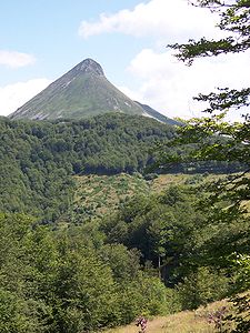
Monts du Cantal
| Monts du Cantal | |
|---|---|
|
Monts du Cantal in the Massif Central |
|
| Highest peak | Plomb du Cantal ( 1855 m ) |
| location | Cantal department (Central France ) |
| part of | Massif Central |
| Coordinates | 45 ° 3 ' N , 2 ° 45' E |
The massif of the Monts du Cantal is located in the French central massif of the Auvergne in the Cantal department .
geography
The Monts du Cantal, located in the south of the Cantal department on the border with the Aveyron department , belong to the French massif Central , but, unlike its other, mid-mountainous parts, have a high mountain character , even if the peaks do not quite reach 2000 m above sea level.
The mountain range forming a circle with a diameter of approx. 80 km has been identified as the largest stratovolcano in Europe. The highest peaks are the Plomb du Cantal ( 1855 m ), the Puy Mary ( 1783 m ) and the Puy Griou ( 1690 m ). The rivers Cère and Jordanne have their source in the region.
population
In the Monts du Cantal area, almost 20,000 people live in around 50 communities. The largest towns are Murat and Vic-sur-Cère , each with just under 2,000 inhabitants. Most municipalities, however, only have between 70 and 500 inhabitants.
cheese
The mountain pastures of the Monts du Cantal were probably the home of Cantal and Salers cheese , which nowadays can only be made from the fat milk of the frugal and weatherproof Salers cattle , who mostly spend the whole year on their pastures.
tourism
- The area, criss-crossed by numerous hiking trails, is part of the Volcans d'Auvergne Regional Nature Park .
- The medieval-looking towns of Salers and Tournemire are among the most beautiful villages in France .
- The Super Lioran winter sports resort with modern concrete architecture is located on the Puy Griou .


