
Loir-et-Cher department
| Loir-et-Cher | |
|---|---|
 |
  |
| region | Center-Val de Loire |
| prefecture | Blois |
| Sub-prefecture (s) |
Romorantin-Lanthenay Vendôme |
| Residents | 331,915 (Jan. 1, 2017) |
| Population density | 52 inhabitants per km² |
| surface | 6,343.44 km² |
| Arrondissements | 3 |
| Community associations | 12 |
| Cantons | 15th |
| Communities | 267 |
|
President of the Department Council |
Maurice Leroy ( UDI ) |
| ISO-3166-2 code | FR-41 |
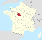
 Location of the department of Loir-et-Cher in the region Center-Val de Loire |
|
The Loir-et-Cher [ lwaʀeʃɛːʀ ] is the French department with the atomic number 41. It is in the center of the country in the Region Center-Val de Loire and by the rivers Cher and Loir named.
geography
The Loir-et-Cher department borders in the north with the Eure-et-Loir department , in the northeast with the Loiret department , in the southeast with the Cher department , in the south with the Indre department , and in the southwest with the Indre-et-Loire department and in the northwest to the Sarthe department .
The most important river is the Loire , which divides the department from northeast to southwest and passes the centrally located capital Blois . The Loir , a left tributary of the Sarthe , flows through the département in the north, the second named river Cher flows through it in the south.
history
The department was formed on March 4, 1790 from the western part of the province of Orléanais .
It has belonged to the Center region since 1960 , which was renamed Center-Val de Loire in 2016 .
Cities
The most populous communes in the Loir-et-Cher department are:
| city | Population (2017) |
Arrondissement |
|---|---|---|
| Blois | 46,086 | Blois |
| Romorantin-Lanthenay | 17,754 | Romorantin-Lanthenay |
| Vendôme | 16,569 | Vendôme |
| Vineuil | 7,815 | Blois |
| Mer | 6.238 | |
| Salbris | 5,166 | Romorantin-Lanthenay |
Administrative division
The Loir-et-Cher department is divided into 3 arrondissements , 15 cantons and 267 communes :

| Arrondissement | Cantons | Communities | Residents January 1, 2017 |
Area km² |
Density of population / km² |
Code INSEE |
|---|---|---|---|---|---|---|
| Blois | 7th | 93 | 151.065 | 1,950.24 | 77 | 411 |
| Romorantin-Lanthenay | 7th | 74 | 111,448 | 2,670.86 | 42 | 413 |
| Vendôme | 3 | 100 | 69,402 | 1,722.34 | 40 | 412 |
| Loir-et-Cher department | 15th | 267 | 331.915 | 6,343.44 | 52 | 41 |
See also:
- List of communes in the Loir-et-Cher department
- List of cantons in the Loir-et-Cher department
- List of associations of municipalities in the Loir-et-Cher department
Web links
- Loir-et-Cher department (French)
- Prefecture of the Loir-et-Cher (French)
Individual evidence
- ↑ le-loir-et-cher.fr accessed on May 3, 2015.
01 Ain | 02 Aisne | 03 Allier | 04 Alpes-de-Haute-Provence | 05 Hautes-Alpes | 06 Alpes-Maritimes | 07 Ardèche | 08 Ardennes | 09 Ariège | 10 Aube | 11 Aude | 12 Aveyron | 13 Bouches-du-Rhône | 14 Calvados | 15 Cantal | 16 Charente | 17 Charente-Maritime | 18 Cher | 19 Corrèze | 21 Côte-d'Or | 22 Côtes-d'Armor | 23 Creuse | 24 Dordogne | 25 Doubs | 26 Drôme | 27 Your | 28 Eure-et-Loir | 29 Finistère | 30 Gard | 31 Haute-Garonne | 32 Gers | 33 Gironde | 34 Hérault | 35 Ille-et-Vilaine | 36 Indre | 37 Indre-et-Loire | 38 Isère | 39 Jura | 40 Landes | 41 Loir-et-Cher | 42 Loire | 43 Haute-Loire | 44 Loire-Atlantique | 45 Loiret | 46 Lot | 47 Lot-et-Garonne | 48 Lozère | 49 Maine-et-Loire | 50 Some | 51 Marne | 52 Haute-Marne | 53 Mayenne | 54 Meurthe-et-Moselle | 55 Meuse | 56 Morbihan | 57 Moselle | 58 Nièvre | 59 North | 60 Oise | 61 Orne | 62 Pas-de-Calais | 63 Puy-de-Dôme | 64 Pyrénées-Atlantiques | 65 Hautes-Pyrénées | 66 Pyrénées-Orientales | 67 Bas-Rhin | 68 Haut-Rhin | 69D Rhône | 69M Métropole de Lyon (from 2015) | 70 Haute-Saône | 71 Saône-et-Loire | 72 Sarthe | 73 Savoie | 74 Haute-Savoie | 75 Paris (from 1968) | 76 Seine-Maritime | 77 Seine-et-Marne | 78 Yvelines (from 1968) | 79 Deux-Sèvres | 80 Somme | 81 Tarn | 82 Tarn-et-Garonne | 83 Var | 84 Vaucluse | 85 Vendée | 86 Vienne | 87 Haute-Vienne | 88 Vosges | 89 Yonne | 90 Territoire de Belfort | 91 Essonne (from 1968) | 92 Hauts-de-Seine (from 1968) | 93 Seine-Saint-Denis (from 1968) | 94 Val-de-Marne (from 1968) | 95 Val-d'Oise (from 1968)
Overseas Departments (DOM)
971 Guadeloupe |
972 Martinique |
973 French Guiana |
974 Réunion |
976 Mayotte
Départements
20 Corse
dissolved after 1962 (until 1975) | 2A Corse-du-Sud (1976-2017) |
2B Haute-Corse (1976-2017) |
75 Seine (until 1967) |
78 Seine-et-Oise (until 1967)

18 Cher | 28 Eure-et-Loir | 36 Indre | 37 Indre-et-Loire | 41 Loir-et-Cher | 45 Loiret
Coordinates: 47 ° 35 ' N , 1 ° 20' E