
Lozère department
| Lozère | |
|---|---|
 |
  |
| region | Occitania |
| prefecture | Mende |
| Sub-prefecture (s) | Florac |
| Residents | 76,601 (Jan. 1, 2017) |
| Population density | 15 inhabitants per km² |
| surface | 5,167.58 km² |
| Arrondissements | 2 |
| Community associations | 11 |
| Cantons | 13 |
| Communities | 152 |
|
President of the Department Council |
Sophie Pantel ( PS ) |
| ISO-3166-2 code | FR-48 |
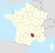
 Location of the Lozère department in the Occitanie region |
|
The Lozère [ loˈzɛːʀ ] department is the French department with serial number 48. It is located in the south of the country in the Occitanie region and is named after the Mont Lozère massif in the Cevennes National Park .
geography

With a size of just over 5,000 km², the department is located in the north of the Occitanie region and borders the Cantal , Haute-Loire , Ardèche , Gard and Aveyron departments . The low mountain range of the Cevennes runs right through the southeastern part of the department, which is largely designated as a national park ( Cevennes National Park , fr: Parc National des Cévennes ). The Gorges du Tarn (gorges of the Tarn river ) represent a particular scenic attraction .
The Lozère department is divided into four regions, the differences between which are based on geological conditions and result in four natural landscapes:
- the Margeride landscape : Located in the northeast of the department, it is a heavily forested granite landscape, the relief of which was created in the course of the early days. It used to belong to the county of Gévaudan and is characterized not only by forests but also by extensive pastures and heathland. The average altitude is between 1,000 and 1,500 m above sea level. d. The plateaus are littered with large granite blocks. The highest point is the Signal de Randon at 1,551 meters. In the past, the two reservoirs of Lac de Charpal and Lac de Naussac were created.
- the Aubrac landscape : The Aubrac landscape is a sparsely forested, basaltic plateau in the north-west of the department, which is criss-crossed by rivers (including Bès , Rimeize ) and lakes (Lac de Salhens, Lac de Saint-Andéol, etc.). Parts of the landscape extend to the neighboring departments of Cantal in the north-west and Aveyron in the south-west. The highest point is the Signal de Mailhebiau at 1,469 m above sea level. d. M.
- the Cevennes: The Cevennes, a foothill of the southern Massif Central , are located in the southeast of the Lozère department and are also part of the Gard and Haute-Loire departments. Geologically dominated by slate, the landscape of the Cevennes is shaped very unevenly by the course of the streams and rivers such as the Tarn and the Gardon . The most important peaks are the Mont Aigoual (1,567 m, Département Gard) and the Sommet de Finiels (1,699 m).
- the landscape of Causse : The Grandes Causses are a limestone landscape that extends over far-reaching dry plateaus in the south-west of the department. The landscape is less high than the Aubrac, but with several elevations well over 1,000 m high it still belongs to the low mountain range. The Causses are dominated geographically by the Tarn Gorges. Numerous grottos and karst caves can be found in the Causses.
The Lozère department is considered to have the highest habitable settlement area.
coat of arms
Description : Split in blue and gold; in front with golden lilies and behind four red posts .
history
The department goes back to the law of December 22, 1789 and was created on March 4, 1790. The boundaries of the department coincide roughly with those of the diocese of Gévaudan (a subordinate of the province of Languedoc ), which is part of the province of Languedoc under the ancien régime has been. The department is known as the home of the cryptic beast of Gévaudan .
From 1960 to 2015 it belonged to the Languedoc-Roussillon region , which in 2016 became part of the Occitania region.
Population and administrative division
With 76,601 inhabitants (as of January 1, 2017), the Lozère department is the least populous department in France and one of the least populous areas of the European Union . With a population density of 15 inhabitants / km² it is also the most sparsely populated department in France with the exception of French Guiana . Since the 19th century, the population has fallen from 150,000 at that time to less than half, which can be explained by the strongly rural character, the inaccessible location of the department and the general phenomenon of rural exodus . Since the mid-1990s, however, there has been a slight upward trend, which is due in particular to the development of the region through modern transport routes (motorway, air traffic).

Population development:
| 1881 | 1891 | 1901 | 1911 | 1921 | 1931 | 1936 | 1954 |
|---|---|---|---|---|---|---|---|
| 150,768 | 135,527 | 128,866 | 122,738 | 108,822 | 101,859 | 98,480 | 82.391 |
| 1962 | 1968 | 1975 | 1982 | 1990 | 1999 | 2009 | |
| 81,868 | 77,258 | 74,825 | 74,294 | 72,825 | 73.509 | 77.163 |
| Arrondissement | Cantons | Communities | Residents January 1, 2017 |
Area km² |
Density of population / km² |
Code INSEE |
|---|---|---|---|---|---|---|
| Florac | 4th | 38 | 13.199 | 1,687.65 | 8th | 481 |
| Mende | 11 | 114 | 63,402 | 3,479.93 | 18th | 482 |
| Lozère department | 13 | 152 | 76,601 | 5,167.58 | 15th | 48 |
See also:
- List of communes in the Lozère department
- List of cantons in the Lozère department
- List of associations of municipalities in the Lozère department
Attractions


- the Lacam de Peyrarines stone circle
- the Dolmen de la Marque
- Dolmen de Drigas
- Dolmen de Gaujac
- Dolmen of the grass
- Dolmen de Licide
- Dolmen de Moun Long also La Tombe du Géant
- Lanuéjols Mausoleum
- Menhirs of la Barelle
- Temple de la Boissonnade , Romanesque church from the 12th century
A chalk plateau of the Cham des Bondons lies on Mont Lozère . There are over 150 menhirs scattered across the area .
Web links
- General Council of the Lozère Department (French)
- Prefecture of the Lozère department (French)
- Lozère Tourisme (French)
- cevennen.fr (French)
Individual evidence
01 Ain | 02 Aisne | 03 Allier | 04 Alpes-de-Haute-Provence | 05 Hautes-Alpes | 06 Alpes-Maritimes | 07 Ardèche | 08 Ardennes | 09 Ariège | 10 Aube | 11 Aude | 12 Aveyron | 13 Bouches-du-Rhône | 14 Calvados | 15 Cantal | 16 Charente | 17 Charente-Maritime | 18 Cher | 19 Corrèze | 21 Côte-d'Or | 22 Côtes-d'Armor | 23 Creuse | 24 Dordogne | 25 Doubs | 26 Drôme | 27 Your | 28 Eure-et-Loir | 29 Finistère | 30 Gard | 31 Haute-Garonne | 32 Gers | 33 Gironde | 34 Hérault | 35 Ille-et-Vilaine | 36 Indre | 37 Indre-et-Loire | 38 Isère | 39 Jura | 40 Landes | 41 Loir-et-Cher | 42 Loire | 43 Haute-Loire | 44 Loire-Atlantique | 45 Loiret | 46 Lot | 47 Lot-et-Garonne | 48 Lozère | 49 Maine-et-Loire | 50 Some | 51 Marne | 52 Haute-Marne | 53 Mayenne | 54 Meurthe-et-Moselle | 55 Meuse | 56 Morbihan | 57 Moselle | 58 Nièvre | 59 North | 60 Oise | 61 Orne | 62 Pas-de-Calais | 63 Puy-de-Dôme | 64 Pyrénées-Atlantiques | 65 Hautes-Pyrénées | 66 Pyrénées-Orientales | 67 Bas-Rhin | 68 Haut-Rhin | 69D Rhône | 69M Métropole de Lyon (from 2015) | 70 Haute-Saône | 71 Saône-et-Loire | 72 Sarthe | 73 Savoie | 74 Haute-Savoie | 75 Paris (from 1968) | 76 Seine-Maritime | 77 Seine-et-Marne | 78 Yvelines (from 1968) | 79 Deux-Sèvres | 80 Somme | 81 Tarn | 82 Tarn-et-Garonne | 83 Var | 84 Vaucluse | 85 Vendée | 86 Vienne | 87 Haute-Vienne | 88 Vosges | 89 Yonne | 90 Territoire de Belfort | 91 Essonne (from 1968) | 92 Hauts-de-Seine (from 1968) | 93 Seine-Saint-Denis (from 1968) | 94 Val-de-Marne (from 1968) | 95 Val-d'Oise (from 1968)
Overseas Departments (DOM)
971 Guadeloupe |
972 Martinique |
973 French Guiana |
974 Réunion |
976 Mayotte
Départements
20 Corse
dissolved after 1962 (until 1975) | 2A Corse-du-Sud (1976-2017) |
2B Haute-Corse (1976-2017) |
75 Seine (until 1967) |
78 Seine-et-Oise (until 1967)
Coordinates: 44 ° 30 ' N , 3 ° 31' E