Cevennes
| Cevennes | ||
|---|---|---|
|
Typical Cevennes landscape |
||
| Highest peak | Mont Lozère ( 1699 m ) | |
| location | France | |
| part of | Massif Central | |
|
|
||
| Coordinates | 44 ° 26 ' N , 3 ° 44' E | |
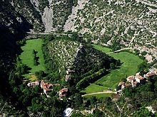
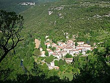
The Cevennes or, more rarely, Sevennes ( French Cévennes , Occitan Cevenas ) are the southeastern part of the French massif Central . Karst mountains with narrow, steep gorges and plateaus characterize the landscape . Montane and Mediterranean flora and fauna merge.
geography
Roughly speaking, the Cevennes lie south of a line between Mende and Montélimar , west of the Rhone Valley and east of motorway 75. In the northern part ( Lozère department ) the climate is predominantly Atlantic and damp and cool, south of Mont Aigoual ( Gard and Hérault departments) ), on the other hand, there is a dry and warm Mediterranean climate . The larger cities are all on the edge of the Cevennes: Mende (12,134 inhabitants, as of January 1, 2017), Millau (22,109), Lodève (7441) and Alès (40,219). According to Patrick Cabanel, the modern definition of the Cevennes does not primarily follow geographical or geological criteria, but includes the evangelical areas. As an indication, he cites that the Ardèche department , because it is Catholic, is not attributed to the Cevennes, although it belongs to the same landscape and has the same economic history.
geology
The Massif Central and with it the Cevennes were created around 350 million years ago when the sea floor rose. At the top of the granite base is a layer of limestone (calcite) and dolomite , some of which is still several hundred meters thick , from which the plateaus (Causses) are made. Rivers like Tarn , Gardon and Vis have carved deep gorges into the Causses through these deposits from the seabed. Between granite and limestone, layers of continental sedimentary rock ( slate and sandstone ) are embedded in many places , as well as local coal (Alès basin). The highest peaks are in the far north of the Cevennes of Mont Lozère ( 1699 m ) and further south of Mont Aigoual ( 1567 m ). They are made of granite, the layers of sediment have been removed here over the course of millions of years. Along a fault, which runs roughly (from northeast to southwest) on a line between Alès , Anduze , Ganges , the mountain range of the Séranne and Lodève , the Cevennes drop off steeply to the Rhone Valley and the Mediterranean Sea. This fault line originated around 40 million years ago and today forms the southern edge of the Cevennes. There was no volcanism here, unlike in the regions immediately to the west (between Cap d'Agde and Lodève) and north ( Auvergne ).
history
The oldest traces of human settlement discovered to date date to around 40,000 BC. From the time between 3500 and 2500 BC. There are numerous architectural monuments such as stone circles and megalithic tombs . The geographer Strabo describes the Cevennes ( cemmene ) in the 1st century AD as a 350 km long mountain range between the Pyrenees and Lyon . There is numerous evidence of settlement in the form of coin and grave finds from the subsequent Gallo-Roman period . In the Middle Ages it has in the Cevennes a bishopric called Arisitum have given the once under the rule of the Visigoths under which, once the Franks and finally Moorish fell domination. The former bishopric was probably in the area of today's city of Le Vigan . From the 13th century onwards, various cities received limited self-government ( syndicat perpétuel ), including Florac , Trèves and Sumène .

From the 16th to the 18th century, the Cevennes were the center of a violent conflict over the freedom of the evangelical faith ( camisard wars ). This has led to a deeply rooted attitude towards freedom and self-determination, according to a thesis that is popular in the region. Proof of this: at the end of 1851, after his coup d'état, Louis-Napoleón Bonaparte (“Napoleón III”) let the French vote on a constitution that would grant him dictatorial powers. Only a minority of 8.5 percent rejected this nationwide, whereas in the Cevennes there was a majority, two municipalities in Lozère were at the top with more than 85% rejections. Another evidence: the resistance against the German occupation 1940-1945, because here too the Cevennes played a central role as a retreat for German Nazi opponents and for Jews. 800 to 1000 Jews are said to have found refuge here.
With the decline of the regional economy, the Cevennes lost more than two thirds of their population between 1846 and 1975. Since the 1980s, the population has gradually increased again. First, young “dropouts” immigrated who wanted to escape from bourgeois life. Then people from northern France and abroad discovered the beauty of the landscape and bought their second or old-age homes here. And finally, more and more people from the nearby cities (especially from the fast-growing Montpellier) pushed (and pushes) into the mountainous province, for whom living in the city has become too expensive.
- The Huguenots in the Cevennes
Protestantism found many followers in the Cevennes after the Reformation . Many former Waldensians joined the Reformed Church. Under Louis XIV , an intense persecution and harassment of the Protestants began, with the aim of forcibly returning them to the Catholic Church up to the Edict of Fontainebleau in 1685, through which the Edict of Tolerance of Nantes was repealed. Nevertheless, the Protestant faith could never be completely erased, as the mountainous and inaccessible land offered Protestants many opportunities to retreat. During the War of the Spanish Succession , the Protestants (the so-called Camisards ) revolted in the Cevennes in 1702 , which, despite brutal warfare and a scorched earth policy, could not be brought under control by Marshal Montrevel with several 10,000 soldiers. Only after a general amnesty in 1704 could the conflict be largely resolved. Small resistance groups, however, fought on for many years. In the end this civil war led to the devastation and impoverishment of the area.
- The Maquis in World War II
The Cevennes were a focus of armed resistance against the German occupation. The first groups of Maquisards here consisted of Germans who had fought in the Spanish Civil War and who had fled to southern France . Under the Forced Labor Act (1942), many young French came to avoid it. At the celebration of the liberation in Nîmes, three German maquisards were given the place of honor at the head of the train.
economy
Since the Middle Ages, animal husbandry, above all wandering grazing ( transhumance ) and the cultivation of wine, grain and chestnuts, have determined the meager economic life in the Cevennes. The oldest evidence of transhumance dates back to the 7th century BC. In the 15th century, the income of the sovereigns from the taxes of the subjects was made up as follows: around a quarter each from the sale of dried chestnuts and grain and half from the wine trade.
In the 21st century, extensive agriculture still plays a minor role: the rearing of cattle, pigs, goats (regional cheese type Pelardon ) and, above all, sheep, arable farming and fruit growing (onion type: Doux des Cevennes; apple type: Reinette de Vigan). Tourism has become the main economic factor. Above all the Cevennes National Park and the Prat Peyrot ski area on Mont Aigoual attract visitors, but also large stalactite caves, hiking trails, climbing areas, cycling, water and air sports. In addition, the new and seasonal residents leave their money in the region that they earn elsewhere.
- Chestnuts
For centuries the chestnut was the 'bread tree' of the Cevennes. From the 13th century on, the planting and cultivation of these trees was documented. In the first half of the 19th century, chestnut forests covered more than a third of the area in the Lozère department, while fields and pastures made up only ten percent. But then the high point of chestnut cultivation was already past. In the winter of 1709, most of the trees froze to death. Since then, hundreds of thousands of mulberry trees have been planted instead of chestnuts , which provided the food for the rearing of silkworms . Although large chestnut forests were still being planted in the 19th century (near Saint-Germain-de-Calberte and Saint-Jean-du-Gard ), the decline of this industry was sealed by a tree disease called chestnut crayfish , which appeared in 1956, caused by the Fungus Cryphonectria parasitica.
- silk
Two branches of industry replaced agriculture as the central branch of the economy in the Cevennes during modern times, and these too have medieval roots: mining and the manufacture of silk. The first magnaneries (factories for breeding silkworms) are documented for 1340 in Alès and 1360 in Saint-Jean-du-Gard. In the 19th century, around one million kilograms of silk was produced in Le Vigan per year, in Alès 6.2 million kilograms, a quarter of all French silk production. In 1845, however, a fungal disease broke out ("La Pébrine"), which had a devastating effect on silkworm farming. Now the industry imported silk and focused on the manufacture of yarn and clothing, v. a. of silk stockings. In 1788 there were 36 yarn factories with 4,000 looms between Alès and Ganges . In 1841, 150 workers and 1240 women workers were employed in weaving mills (filatures) in the small town of Saint-Jean-du-Gard, which had 4,450 inhabitants at the time. Synthetic fibers and competition from the Far East put an end to this profitable era in the 20th century. Only in Le Vigan was there a textile factory with several hundred employees after 2013.
- Mining
Ore mining already existed in Gallo-Roman times, around 2000 years ago, at Bleymard , and then in Villefort in the 12th century. The ores contained lead , zinc , silver , iron , antimony and barite . Ore mining had its heyday in the 18th to 20th centuries. The centers were around the Mont Lozère (in the department of the same name) and in Saint-Laurent-le-Minier and Durfort (Gard). The last ore mines were closed in 1992 (Malines near St. Laurent) and 2001 near Notre-Dame-de-Laval . Hard coal mining in the Alès basin was documented as early as 1230 by a monastery document. From the end of the 18th century it reached industrial proportions. In 1913 two million tons were mined, five percent of French coal production. 12,000 miners brought the coal to light. There were 20,000 buddies in 1947 before the decline began. They extracted two million tons of hard coal a year. The last mine closed in 1987.

Landscape and nature
In June 2011, UNESCO declared over 3,023 square kilometers of the Cevennes between the cities of Ganges and Millau , Mende and Lodève to be World Heritage Sites . In addition, there are around 100 square kilometers of buffer zone around the actual World Heritage area. Its area largely coincides with the national park, which has existed since 1970, and the UNESCO biosphere reserve (since 1985).
The decisive factor for recognition as a world natural heritage site was that migrant sheep farming ( transhumance ) was still practiced here as it was in ancient times. "The landscapes of the plateaus ( causses ) have been shaped by pasture farming over three millennia". They stand for a cultural tradition “which is based on typical social structures and local sheep races and is reflected in the structure of the landscape, especially in the type of farms, buildings, fields, water management, the ways of cattle drive ( drailles ) and the communal commons ".
Because of the overlapping of Mediterranean and montane landscape types and the diverse structure of these landscapes, a great variety of species can be found. Several dozen species of orchids are found, and at the same time, with Mediterranean bird species such as European roller and bee-eater , montane species such as Alpine swifts , Choughs , golden eagles and griffon vultures can be observed.
Attractions
- Chaos de Nîmes-le-Vieux
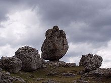
- Chaos de Montpellier-le-Vieux
- Causse Méjean
- Ronc Traoucat dolmen
- Abîme de Bramabiau
- Grotto des Demoiselles
- Mont Aigoual
- Mont Lozère
- Sommet de Finiels
also
- The author Robert Louis Stevenson set the area a literary monument with his work A journey with the donkey through the Cevennes ( Travels with a Donkey in the Cévennes , 1879).
- The mountain region gave its name to the asteroid (1333) Cevenola .
See also
- Cevennes War (Camisards)
- The beast of Gévaudan , known from the film "Pact of Wolves"
literature
- Patrick Cabanel: Que sais je? - Histoire des Cévennes. Paris 2009
- Jean-Paul Chabrol and Jacques Mauduy: Atlas des Camisards. 1521–1789 Nîmes 2013
- Christoph Lenhartz and Hans Walter Goll: Cévennen - for friends. Editions La Colombe, Bergisch Gladbach 2005 (3rd edition), ISBN 978-3-929351-25-5
- Ralf Nestmeyer : Languedoc-Roussillon. A travel guide. Michael Müller Verlag, Erlangen 2006, ISBN 3-89953-214-7
- Robert Louis Stevenson: Journey with the donkey through the Cévennes. Editions La Colombe, Bergisch Gladbach 2000, ISBN 978-3-929351-21-7
- Ludwig Tieck: The uproar in the Cevennes. Editions La Colombe, Bergisch Gladbach 2001, ISBN 978-3-929351-13-2
- Patrick Cabanel: Cevennes. A garden of Israel. Editions La Colombe, Moers 2011, ISBN 978-3-929351-35-4
Web links
- The South Cevennes - photos and background information
- A limestone world: landscapes, animals and plants of the southern Cevennes
- The Cevennes
- The Stevenson hiking trail or GR70 crosses the Cevennes
- Tourist Offices Cevennes Mediterranean
- Cevennes Tourist Offices
- Article on Stevenson's book on French and English Wikipedia
- On the way by Robert Louis Stevenson (French, partly German)
- Bayerischer Rundfunk: Evangelical Perspectives: The Checkered History of French Protestants


