Lozère (mountain)
| Mont Lozère | ||
|---|---|---|
|
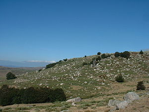
Landscape on the Mont Lozère |
||
| height | 1699 m | |
| location | Massif Central , France | |
| Mountains | Cevennes | |
| Coordinates | 44 ° 25 '34 " N , 3 ° 44' 21" E | |
|
|
||
The Mont Lozère ( Occitan mont Losera ) is a mountain massif in France consisting mainly of granite . Its highest peak is the Sommet de Finiels . It lies at an altitude of 1699 m . A little further east of this peak is the source of the Tarn river .
The mountain is located in the southeast of both the Massif Central and the departments of Lozère , which he has also given the name.
It is part of the Cevennes National Park . The narrow road connection from Le Bleymard to Le Pont-de-Montvert passes relatively close to the summit.
Web links
Commons : Mont Lozère - Collection of images, videos and audio files

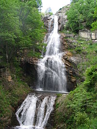
La cascade de Rûnes (58 m high) near Fraissinet-de-Lozère on the southern edge of the mountain

