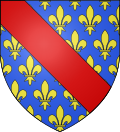
Allier department
| Allier | |
|---|---|
| region | Auvergne-Rhône-Alpes |
| prefecture | Moulins |
| Sub-prefecture (s) |
Montluçon Vichy |
| Residents | 337,988 (Jan. 1, 2017) |
| Population density | 46 inhabitants per km² |
| surface | 7,340.62 km² |
| Arrondissements | 3 |
| Community associations | 12 |
| Cantons | 19th |
| Communities | 317 |
|
President of the Department Council |
Claude Riboulet |
| ISO-3166-2 code | FR-03 |
 Location of the department of Allier in the region Auvergne Rhône-Alpes |
|
The Allier department ([ Alje ] in, Occitan Alèir [ a'lɛj ]) is the French department with the atomic number 03. It is in the center of the country in the region Auvergne Rhône-Alpes and is named after the river Allier named.
geography
The department borders in the northwest on the Cher department of the Center-Val de Loire region , in the north on the Nièvre department of the Bourgogne-Franche-Comté region , in the east on the Saône-et-Loire department , also in Bourgogne-Franche-Comté, to the south-east to the Loire department , to the south to the Puy-de-Dôme department and to the west to the Creuse department of the Nouvelle-Aquitaine region .
The west of the department is drained northwards by the Cher , the river also crosses the largest city of Montluçon . The eponymous Allier also flows through the center of the department in a northerly direction, passing Vichy and the capital Moulins . The Loire forms most of the eastern border with the Saône-et-Loire department.
history
The Allier department covers most of the historic Bourbonnais county , the ancestral home of the House of Bourbon .
The department was formed during the French Revolution on March 4, 1790 from most of the previously existing Bourbonnais province . It was divided into seven districts ( French: district ), the forerunners of the arrondissements . The districts were Cérilly, Cusset, Le Donjon, Gannat, Montluçon, Montmarault and Moulins. The department and the districts were divided into 59 cantons and had (1791) 267,126 inhabitants. The capital was already Moulins at that time .
The arrondissements of Gannat, Lapalisse, Montluçon and Moulins were established on February 17, 1800. On September 10, 1926, the Gannat arrondissement was dissolved and assigned to the other arrondissements. On August 24, 1941, the Arrondissement Lapalisse became the Arrondissement Vichy . Here the Marshal Pétain set up the capital of the III. Republic replacing État Français .
From 1960 to 2015 it was part of the Auvergne region , which in 2016 became part of the Auvergne-Rhône-Alpes region.
population
Demographics
The department today has around 341,000 inhabitants. With a population density of 47 inhabitants per km², it is one of the most sparsely populated departments in France. While there was a steady increase in population over the 19th and 20th centuries and the population had risen to 420,000 people by the Second World War , it sank to today's level afterwards due to deindustrialization and rural exodus. This trend has continued over the course of the year The 2000 years weakened, like many rural departments, Allier now has a slightly positive migration pay. The population is concentrated in the three large cities of Vichy, Montluçon and Moulins and their surrounding area ( aires urbaines ), where two thirds of the population live. There are no other centers, the sixth largest city, Domérat, already has less than 10,000 inhabitants.
Cities
The most populous municipalities in the Allier department are:
| city | Population (2017) |
Arrondissement |
|---|---|---|
| Montluçon | 35,653 | Montluçon |
| Vichy | 24,166 | Vichy |
| Moulins | 19,664 | Moulins |
| Yzeure | 13,088 | Moulins |
| Cusset | 12,661 | Vichy |
| Domérat | 8,780 | Montluçon |
| Bellerive-sur-Allier | 8,500 | Vichy |
| Commentry | 6.239 | Montluçon |
| Gannat | 5,832 | Vichy |
| Saint-Pourçain-sur-Sioule | 5,160 | Moulins |
Administrative division
The Allier department is divided into 3 arrondissements , 19 cantons and 317 communes :
| Arrondissement | Cantons | Communities | Residents January 1, 2017 |
Area km² |
Density of population / km² |
Code INSEE |
|---|---|---|---|---|---|---|
| Montluçon | 7th | 89 | 107,615 | 2,116.68 | 51 | 031 |
| Moulins | 8th | 109 | 106.036 | 2,957.87 | 36 | 032 |
| Vichy | 9 | 119 | 124,337 | 2,266.07 | 55 | 033 |
| Allier department | 23 | 317 | 337.988 | 7,340.62 | 46 | 03 |
See also
- List of communes in the Allier department
- List of cantons in the Allier department
- List of associations of municipalities in the Allier department
Web links
- Allier department (French)
- Prefecture of the Allier department (French)
Individual evidence
- ↑ http://www.allier.fr/1388-president-du-conseil-departemental-de-l-allier.htm accessed on February 14, 2018
Coordinates: 46 ° 25 ' N , 3 ° 15' E


