
Doubs department
| Doubs | |
|---|---|
 |
  |
| region | Bourgogne-Franche-Comté |
| prefecture | Besançon |
| Sub-prefecture (s) |
Montbéliard Pontarlier |
| Residents | 539,067 (Jan. 1, 2017) |
| Population density | 103 inhabitants per km² |
| surface | 5,234.33 km² |
| Arrondissements | 3 |
| Community associations | 18th |
| Cantons | 19th |
| Communities | 573 |
|
President of the Department Council |
Christine Bouquin |
| ISO-3166-2 code | FR-25 |
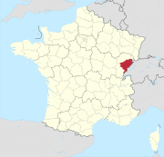
 Location of the Doubs department in the region of Bourgogne Franche-Comté |
|
Doubs [ you ], officially du Doubs is the French department of 25 with the ordinal number It is located in the east of the country in the Region Bourgogne Franche-Comté and after the river Doubs named. The department covers an area of 5234 km² and has 539,067 inhabitants (as of January 1, 2017). The capital is Besançon .
geography
The Doubs department is bordered by the Haute-Saône department to the north, the Territoire de Belfort to the north-east, the Swiss cantons of Jura , Neuchâtel and Vaud to the east and south-east and the Jura department to the west .
The most important river in the department is the eponymous Doubs . Its main tributaries are the Loue , which runs through the southwest of the department, and the Dessoubre, which irrigates the eastern region . Only the north, the area between the Ognon, which forms the north-western border, and the lower reaches of the Doubs, represents low hill country, while the remaining, about four-fifths of the department, especially the south-east, is mountainous and crossed by four limestone chains of the Jura . The Montagnes du Lomont are the lowest of these chains; they are east of Baume-les-Dames , rise to 835 m and have an east-west orientation. Deep in the south of the department near the Swiss border is its highest point, the Mont d'Or (1463 m). Other high mountain peaks are the Morond (1419 m) and the Gros Crêt (1419 m). The largest lakes include Lac de Saint-Point (4.2 km 2 ), Lac de Remoray (0.95 km 2 ) and Lac des Brenets (0.8 km 2 ). The climate is temperate continental and rainy; it shows a considerable difference between summer and winter temperatures.
history
The Sequaner settled in the area of what is now the Doubs department in ancient times . These were in the 50s BC. Submitted to the Roman Empire by Gaius Iulius Caesar . Augustus united the country with Gallia Belgica . It was under Roman rule until the 5th century, when it came under the Burgundian rule . From the 11th century it belonged to the county of Burgundy and to the Dukes of Burgundy in the late Middle Ages . With the marriage of the Burgundian heiress Maria to Maximilian von Habsburg , the area fell to the Spanish line of the Habsburgs in 1477 , which had to cede it to France in the Peace of Nijmegen in 1678.
The Doubs department was formed on March 4, 1790 from parts of the Free County of Burgundy . In 1796 the House of Württemburg ceded the County of Mömpelgard to France. Their area belonged to the Mont-Terrible department until 1800 , after its dissolution to the Haut-Rhin department and finally from 1814 to the Doubs department. After the Allied victory in the Battle of Waterloo , the Doubs department was occupied by Austrian and Swiss troops from June 1815 to November 1818.
From 1960 to 2015, the department was part of the Franche-Comté region , which in 2016 became part of the Bourgogne-Franche-Comté region.
coat of arms
Description: In the blue and gold coat of arms, divided by a wavy cut , there is a growing golden lion with a crown, red tongue and claws between seeded golden shingles and a blue wavy bar below .
Cities
The most populous municipalities in the Doubs department are:
| city | Population (2017) |
Arrondissement |
|---|---|---|
| Besançon | 115.934 | Besançon |
| Montbeliard | 25,395 | Montbeliard |
| Pontarlier | 17.197 | Pontarlier |
| Audincourt | 13,387 | Montbeliard |
| Valentigney | 10,714 | Montbeliard |
| Morteau | 6,935 | Pontarlier |
| Seloncourt | 5,775 | Montbeliard |
| Bethoncourt | 5,647 | Montbeliard |
| Grand-Charmont | 5,699 | Montbeliard |
| Baume-les-Dames | 5,063 | Besançon |
Administrative division
The Doubs department is divided into 3 arrondissements , 19 cantons and 573 communes :

| Arrondissement | Cantons | Communities | Residents January 1, 2017 |
Area km² |
Density of population / km² |
Code INSEE |
|---|---|---|---|---|---|---|
| Besançon | 11 | 256 | 249.276 | 1,927.74 | 129 | 251 |
| Montbeliard | 7th | 168 | 176.113 | 1,255.71 | 140 | 252 |
| Pontarlier | 5 | 149 | 113,678 | 2,050.88 | 55 | 253 |
| Doubs department | 19th | 573 | 539.067 | 5,234.33 | 103 | 25th |
See also:
- List of communes in the Doubs department
- List of cantons in the Doubs department
- List of associations of municipalities in the Doubs department
Attractions
- Les Salines Royales
- Montbeliard
- Montagney-Servigney - la Forge not far from Rougemont. Small place with an “iron past”: here on the river Ognon there is a largely preserved blast furnace ( Haut Fourneau ) from the 18th century as well as a newly established adventure trail ( Sentier de découverte ), which takes the visitor back to the time of iron mining. A charcoal burner's hut was reconstructed and the production of the iron is explained on panels.
- Bournel Castle located a little north of Rougemont in the village of Cubry. The completely restored, magnificent castle is located in the middle of a beautiful golf course and serves as a hotel. The place is characterized by a number of well restored houses.
Web links
- Doubs department (French)
- Prefecture of the Doubs department (French)
Individual evidence
- ↑ www2.doubs.fr accessed on May 1, 2015
01 Ain | 02 Aisne | 03 Allier | 04 Alpes-de-Haute-Provence | 05 Hautes-Alpes | 06 Alpes-Maritimes | 07 Ardèche | 08 Ardennes | 09 Ariège | 10 Aube | 11 Aude | 12 Aveyron | 13 Bouches-du-Rhône | 14 Calvados | 15 Cantal | 16 Charente | 17 Charente-Maritime | 18 Cher | 19 Corrèze | 21 Côte-d'Or | 22 Côtes-d'Armor | 23 Creuse | 24 Dordogne | 25 Doubs | 26 Drôme | 27 Your | 28 Eure-et-Loir | 29 Finistère | 30 Gard | 31 Haute-Garonne | 32 Gers | 33 Gironde | 34 Hérault | 35 Ille-et-Vilaine | 36 Indre | 37 Indre-et-Loire | 38 Isère | 39 Jura | 40 Landes | 41 Loir-et-Cher | 42 Loire | 43 Haute-Loire | 44 Loire-Atlantique | 45 Loiret | 46 Lot | 47 Lot-et-Garonne | 48 Lozère | 49 Maine-et-Loire | 50 Some | 51 Marne | 52 Haute-Marne | 53 Mayenne | 54 Meurthe-et-Moselle | 55 Meuse | 56 Morbihan | 57 Moselle | 58 Nièvre | 59 North | 60 Oise | 61 Orne | 62 Pas-de-Calais | 63 Puy-de-Dôme | 64 Pyrénées-Atlantiques | 65 Hautes-Pyrénées | 66 Pyrénées-Orientales | 67 Bas-Rhin | 68 Haut-Rhin | 69D Rhône | 69M Métropole de Lyon (from 2015) | 70 Haute-Saône | 71 Saône-et-Loire | 72 Sarthe | 73 Savoie | 74 Haute-Savoie | 75 Paris (from 1968) | 76 Seine-Maritime | 77 Seine-et-Marne | 78 Yvelines (from 1968) | 79 Deux-Sèvres | 80 Somme | 81 Tarn | 82 Tarn-et-Garonne | 83 Var | 84 Vaucluse | 85 Vendée | 86 Vienne | 87 Haute-Vienne | 88 Vosges | 89 Yonne | 90 Territoire de Belfort | 91 Essonne (from 1968) | 92 Hauts-de-Seine (from 1968) | 93 Seine-Saint-Denis (from 1968) | 94 Val-de-Marne (from 1968) | 95 Val-d'Oise (from 1968)
Overseas Departments (DOM)
971 Guadeloupe |
972 Martinique |
973 French Guiana |
974 Réunion |
976 Mayotte
Départements
20 Corse
dissolved after 1962 (until 1975) | 2A Corse-du-Sud (1976-2017) |
2B Haute-Corse (1976-2017) |
75 Seine (until 1967) |
78 Seine-et-Oise (until 1967)
Coordinates: 47 ° 12 ' N , 6 ° 20' E