Your (river)
| Your | ||
|
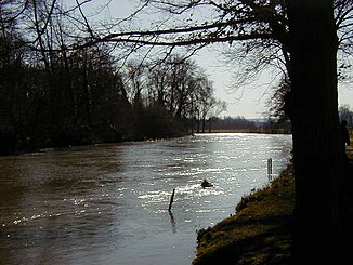
Yours when the water level is high |
||
| Data | ||
| Water code | FR : H4-0200 | |
| location | Northwest France | |
| River system | His | |
| Drain over | Its → English Channel | |
| source | at La Lande-sur-Eure 48 ° 33 ′ 11 ″ N , 0 ° 51 ′ 30 ″ E |
|
| Source height | approx. 220 m | |
| muzzle | at Saint-Pierre-lès-Elbeuf in the Seine coordinates: 49 ° 17 ′ 41 ″ N , 1 ° 2 ′ 23 ″ E 49 ° 17 ′ 41 ″ N , 1 ° 2 ′ 23 ″ E |
|
| Mouth height | 5 m | |
| Height difference | approx. 215 m | |
| Bottom slope | approx. 0.94 ‰ | |
| length | 229 km | |
| Discharge at the Louviers A Eo gauge : 5935 km² |
MQ Mq |
25 m³ / s 4.2 l / (s km²) |
| Left tributaries | Coinon , Blaise , Avre , Iton | |
| Right tributaries | Voise , Drouette , Maltorne , Vesgre | |
| Medium-sized cities | Chartres , Dreux | |
| Small towns | Louviers , Val-de-Reuil , Saint-Pierre-lès-Elbeuf | |
The Eure [ œːʀ ], or Autura in older times , is a river in northwestern France. It rises in the Perche Regional Nature Park , near La Lande-sur-Eure , at an altitude of 220 meters, where several streams form the Eure. It drains in its upper reaches to the southeast, turns north at Chartres and flows into the Seine after 229 kilometers in Saint-Pierre-lès-Elbeuf as a left tributary . The estuary is a so-called dragged-out estuary : although the Seine has already been reached at Pont-de-l'Arche , the Eure runs parallel to the Seine for another six kilometers until it finally flows into it. Two departments are named after the Eure, namely Eure and Eure-et-Loir .
Crossed departments
in the Normandy region
in the Center-Val de Loire region
Places on the river
(Order in flow direction)
- La Lande-sur-Eure
- Courville-sur-Eure
- Saint-Georges-sur-Eure
- Chartres
- Maintenon
- Nogent-le-Roi
- Dreux
- Marcilly-sur-Eure
- Ézy-sur-Eure
- Ivry-la-Bataille
- Pacy-sur-Eure
- Louviers
- Val-de-Reuil
- Pont-de-l'Arche
- Saint-Pierre-lès-Elbeuf
Web links
Individual evidence
- ↑ a b geoportail.fr (1: 16,000)
- ↑ a b The information on the length of the river is based on the information about the Eure at SANDRE (French), accessed on December 16, 2008, rounded to full kilometers.
- ↑ hydro.eaufrance.fr (station: H9501010 , option: Synthèse ) .
