Lieuvin
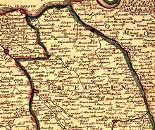
The Lieuvin is a landscape in the west of the French department of Eure .
geography
It is a bocage plateau bordered by the Touques to the west, by the mouth of the Seine to the north, by the Risle valley to the east and by the Charentonne valley to the south . In the west it borders on the Pays d'Auge , in the east on the Roumois and in the south on the Pays d'Ouche . The Lieuvin has an area of around 790 km² at an average height of 150 meters. The topsoil consists mainly of silt containing carbonate and residual clay and flint .
The Lieuvin corresponds to the cantons of Beuzeville , Saint-Georges-du-Vièvre and Thiberville as well as part of the canton of Cormeilles (without the Calonne , Pont-Audemer and Montfort-sur-Risle in the west of the Risle). The biggest cities are: Beuzeville , Épaignes , Lieurey and Thiberville .
history
In the Ancien Régime (1589–1792), the Lieuvin was a deanery that belonged to the Lisieux diocese .
economy
The region is dominated by agriculture with a focus on cattle breeding.
Web link
Individual evidence
- ^ Dominique Cliquet: L'Eure . In: Michel Provost, Academie des inscriptions et belles-lettres, Ministere de la culture (ed.): Carte Archéologique de la Gaule . No. 27 . Fondation Maison des Sciences de l'Homme, Paris 1993, ISBN 2-87754-018-9 , Introduction, p. 34 (French).
- ↑ Gilles Rossignol: Yours . La Renaissance du Livre, Tournai 2001, ISBN 978-2-8046-0507-0 , pp. 228-240 (French).

