Calonne (river)
|
Calonne Rivière Morte |
||
|
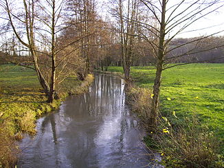
The Calonne at Saint-Pierre-de-Cormeilles |
||
| Data | ||
| Water code | FR : I03-0400 | |
| location | France , Normandy region | |
| River system | Touques | |
| Drain over | Touques → English Channel | |
| source | in the municipality of Le Planquay 49 ° 5 ′ 50 ″ N , 0 ° 26 ′ 31 ″ E |
|
| Source height | approx. 197 m | |
| muzzle | in the municipality of Pont-l'Évêque in the Touques coordinates: 49 ° 17 ′ 14 ″ N , 0 ° 11 ′ 6 ″ E 49 ° 17 ′ 14 ″ N , 0 ° 11 ′ 6 ″ E |
|
| Mouth height | approx. 8 m | |
| Height difference | approx. 189 m | |
| Bottom slope | approx. 4.2 ‰ | |
| length | 45 km | |
| Discharge at the Authieux-sur-Calonne A Eo gauge : 176 km² |
MQ Mq |
1.7 m³ / s 9.7 l / (s km²) |
The Calonne (also: Rivière Morte ) is a river in France that runs in the Normandy region .
geography
course

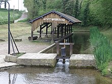
The karst spring of the river in Fontaine-la-Louvet, which has been converted into a wash house ( lavoir )
It rises in the municipality of Le Planquay , from where it runs underground for the first 10 kilometers in some cases and the water only comes to light in a karst spring at Fontaine-la-Louvet . The Calonne drains in an arc from northeast over north to west between the natural landscapes of Lieuvin and Pays d'Auge and flows into the Touques after 45 kilometers on the outskirts of Pont-l'Évêque as a right tributary . On its way, the Calonne crosses the Eure and Calvados departments .
Places on the river
(Order in flow direction)
- Drucourt
- Bournainville-Faverolles
- Fontaine-la-Louvet
- Bailleul-la-Vallée
- Saint-Pierre-de-Cormeilles
- Cormeilles
- Bonneville-la-Louvet
- Les Authieux-sur-Calonne
- Saint-Julien-sur-Calonne
- Pont-l'Évêque
Web links
Commons : Calonne - Collection of images, videos and audio files
Individual evidence
- ↑ Source geoportail.gouv.fr
- ↑ estuary geoportail.gouv.fr
- ↑ a b The information on the length of the river is based on the information on the Calonne from SANDRE (French), accessed on November 15, 2013, rounded to full kilometers.
- ↑ hydro.eaufrance.fr (station: I1203010 , option: Synthèse ) .
