Lighten
|
|||
|---|---|---|---|
Map:
|
|||
| Basic data | |||
| Area : | 12.14 km² | ||
| Residents : | 7061 As of December 31, 2019 | ||
| Population density : | 582 inhabitants / km² | ||
| Postal code : | 49078 | ||
| Primaries : | 0541 | ||
| structure | |||
| District number: |
18th |
||
Hellern is a district of Osnabrück with 7061 inhabitants (12/2019), spread over an area of 12.14 km². It is located on the west-southwestern edge of the city. Neighboring districts are Atter , Westerberg , Weststadt , Desert and Sutthausen . In the west and south, Hellern borders the municipality of Hasbergen in the district of Osnabrück . Hellern lies in the valley of the small river Düte .
History and appearance
Hellern was originally a village in the district of Osnabrück and was incorporated into Osnabrück on July 1, 1972 as part of the regional reform . The city of Osnabrück justified this with the lack of building land in the city.
In 1973 a zoning plan was drawn up for Hellern . An industrial park was built between the federal highway 30 and the Rheiner Landstrasse. Four high-rise buildings were to be built on 5 hectares on Töpferstrasse. After this idea was vehemently rejected, the city only wanted to build an eight-story house. Today there are several three to four-story residential buildings on Töpferstrasse. When the city had built a school, a kindergarten and a community hall, the plans went in the direction of a town center, but there was a lack of shops to create a town center.
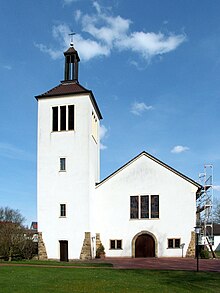
There are two churches in Hellern: the Evangelical Lutheran. Martinskirche and the cath. St. Wiho Church. In the industrial area Hellern-Nord are u. a. the former buw Holding , today the German headquarters of the US group Convergys , and the mail center 49 of Deutsche Post AG are located.
Population development
The population development of the Hafen district:
|
|
|
|
Transport links
Lengericher Landstrasse runs through the middle of Hellern and leads to the city center - in the further course under the names Kurt-Schumacher-Damm and Martinistraße - and is one of Osnabrück's major entry and exit roads . Hellern is connected to several city bus and regional bus routes in regular intervals, which also lead to the Osnabrück Hbf and Hasbergen train stations . In addition, the Osnabrück-Hellern motorway junction connects the district with the A30 federal motorway.
societies
- Sports club Hellern from 1924 with various sports departments
- Men's choir MGV Hermania Hellern
- Rifle Brotherhood Hellern
Individual evidence
- ↑ Municipal statistics and monitoring portal Osnabrück (KOSMOS): Population - residents with main residence , osnabrueck.de, accessed on August 3, 2019
- ↑ City of Osnabrück, statistics, size of the city districts and statistical districts 11/2011 (PDF file)
- ^ Federal Statistical Office (ed.): Historical municipality directory for the Federal Republic of Germany. Name, border and key number changes in municipalities, counties and administrative districts from May 27, 1970 to December 31, 1982 . W. Kohlhammer GmbH, Stuttgart and Mainz 1983, ISBN 3-17-003263-1 , p. 252 .
- ↑ Citizens' Association Hellern: Hellern. Chronicle of Hellern . Volume 2, 2003, page 16
- ↑ a b Citizens' Association Hellern: Hellern. Chronicle of Hellern . Volume 2, 2003, page 18
- ↑ City of Osnabrück, statistics, population by district 2004 - 2014 (PDF file)
- ↑ https://geo.osnabrueck.de/kosmos/bericht_daten_statistik/atlas.html?select=Stadtstrich KOSMOS - Municipal Statistics and Monitoring Portal Osnabrück Figures 2014 - 2019
Web links
- Quarterly information from the Department of Urban Development and Citizen Participation, Statistics Division, 4/2008 (PDF file; 1.49 MB)
- City of Osnabrück, Department for Urban Development and Public Participation -Statistics-, 11/2009 (PDF file; 35.40 kB)
Coordinates: 52 ° 15 ' N , 8 ° 0' E

