
Schölerberg
|
|||
|---|---|---|---|
Map:
|
|||
| Basic data | |||
| Area : | 3.64 km² | ||
| Residents : | 14,818 as of December 31, 2019 | ||
| Population density : | 4,058 inhabitants / km² | ||
| Postal code : | 49082 | ||
| Primaries : | 0541 | ||
| structure | |||
| District number: |
14th |
||

Schölerberg is a district of Osnabrück with 14,774 inhabitants (12/2018). These are spread over an area of 3.64 km². According to statistics, the Schölerberg is the district with the second highest number of inhabitants in Osnabrück, just behind the desert district .
geography
The Schölerberg district is located in the south of the city of Osnabrück. In a clockwise direction (starting from 12 noon) Schölerberg borders the city center , Fledder , Voxtrup , Nahne and Kalkhügel districts . The hill that gives it its name is the 126 m high Schölerberg limestone ridge , which is part of the Osnabrück hill country .
A notable watercourse in the district is the Riedenbach , which flows in a northerly direction and is almost continuously canal except for a short section between the Schölerberg forest park and Vila-Real-Platz. After about 1.6 km underground it flows into the Hase at the Neue Mühle in the city center . There is also the Huxmühlenbach in the east of the district.
traffic
The Iburger Straße as the one and exit road in Osnabrück is part of the federal highway 68 . The city bus routes M5 in the direction of Kreishaus / Zoo and 12 in the direction of Paradiesweg / Harderberg Franziskus-Hospital (partly replaced by regional bus routes 463-468) run on it. Line 17 bends from Iburger Straße to Ameldstraße in the direction of Voxtrup and the M1 line, which has been electrified since 2019, runs on Meller Straße in the direction of Düstrup.
To better connect the south of Osnabrück to rail traffic, a train stop is to be built on the Osnabrück – Münster railway line between Iburger Strasse and Sutthauser Strasse, where the Haller Willem will stop.
history
The wooded Schölerberg has been a popular local recreation area since the beginning of the 20th century . Even today, many relics such as walls, stairs and observation bastions point to the original use of the Schölerberg as a forest park . At the beginning of the 1950s, the excursion restaurants and a summer toboggan run were attractive excursion destinations.

The FH Hammersen textile factory was active in an area in the north of the district until 1981 . The factory buildings then gave way to row houses, while the administration building on Iburger Strasse is now through the Nds. Landessozialamt is used.
The Schölerberg got a connection to the Osnabrück tram early on ; Line 2 ran from the "Schölerberg" terminus on Iburger Strasse via Lutherkirche, Johannistor (Rosenplatz), Neumarkt, Nikolaiort and Hasetor to Haste .
Population development
The population development of the Schölerberg district:
|
|
|
religion
The largest churches are the Evangelical Lutheran Luther Church , the Evangelical Lutheran Church , built in 1909 and fully preserved with Art Nouveau furnishings . Lukaskirche and the Catholic Church of St. Joseph , consecrated in 1917 . The previous Catholic parish church of the Holy Family was converted into a columbarium between 2009 and 2011 . In addition, the parish hall of the ev.-ref. Friedenskirche, which is used as a youth church. Another denomination is the local church of The Church of Jesus Christ of Latter-day Saints .
The Schölerberg district is also home to four Muslim places of worship (Ditib Mosque, Aya Sofia Mosque and Merkez Mosque and one more).
The municipal Johannisfriedhof was de-dedicated as a cemetery in 2015 and converted into a park, but the partly historical graves are preserved. The Jewish part of the cemetery is still used.

Luther Church

St. Joseph

Columbarium Holy Family

Entrance area of the Johannisfriedhof with chapel


education

Educational institutions of the Schölerberg are the municipal vocational schools (BBS) on the Schölerberg , the primary schools Overbergschule and primary school on Schölerberg (Jellinghausstraße) as well as the Protestant technical schools Osnabrück for the socio-educational area.
A former school is the Käthe-Kollwitz-Gymnasium (1961–1990) on Ameldstrasse, which was then used as a secondary and secondary school until 2012. In the meantime, the school building serves as an alternative location for other schools that are being renovated, such as B. the evening high school Sophie Scholl , the Overberg school and the BBS Schölerberg . There is also the former Teutoburg School , which today houses social projects such as unemployment self-help.
Culture and sights
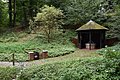
The city park Schölerberg on the hill of the same name has a diverse flora . In addition to maples and beeches , oaks , ash trees , cherries and robinia are also found . Typical spring flowers such as wood anemones , spring celandine , spotted arum and pearl grass can also be found on the Schölerberg. Another green hill is the Ziegenbrink , which is often used for tobogganing in winter and offers a view of the city.
The water from the Brüningsquelle spring on the southeastern slope of the Schölerberg, named after the former Mayor of Osnabrück Heinrich Brüning , has been used to produce soft drinks since the 1920s. In the 1960s, the use of the spring water for beverage production ended, as the spring was less productive from then on due to the construction of the later A 30 . In 1990 a new protective pavilion was built, in which the spring can still be viewed today.
The special location on Schölerberg is also used by the nationally known Osnabrück Zoo , which is located there and is also known as the forest zoo due to its location . After the opening of the Samburu area, the underground zoo was opened in early 2009 , which connects the zoo with the neighboring natural history museum on Schölerberg . A planetarium is also integrated in the museum .
The municipal community center in Ziegenbrink offers activities for children, adolescents and adults and organizes a soap box race on Hauswörmannsweg every year on Ascension Day . There is a youth hostel of the DJH on Iburger Straße .

Animals in the Osnabrück Zoo

Museum on the Schölerberg
Brüningsquelle

Ziegenbrink with a view over the city


Sports
With the SC Schölerberg and the SV Eintracht 08 Osnabrück , two traditional sports clubs are located in the Schölerberg district, which in addition to football also offer other sports such as aerobics , badminton , basketball , women's gymnastics , athletics , shooting , taekwondo , table tennis and tennis . Larger sports fields are located on Hanns-Braun-Straße, Brinkstraße and Bröckerweg.
The Judo Crocodiles Osnabrück , which offer the martial arts Judo and Ju-Jutsu, are known nationwide. Nationally and internationally successful judoka with individual and team titles emerge from their ranks. The Lower Saxony judo performance center on Iburger Strasse has a 600 m² judo hall as well as an attached 500 m² weight room.
In addition, the Schützenbund Osnabrück-Emsland-Grafschaft Bentheim is located on the street Auf dem Ziegenbrink.
Other facilities

The Osnabrück Children's Hospital on Iburger Strasse, founded in 1872, is now a pure child and adolescent psychiatry . Which lies on the Wasastraße local fire brigade Neustadt of the volunteer fire brigade Osnabrück . There are also some government offices on Schölerberg:
- Monastery rent office Osnabrück on Klöntrupstraße
- Eichamt Osnabrück on Frankenstrasse
- Lower Saxony State Office for Social Affairs, Youth and Family - Osnabrück branch on Iburger Strasse
- Main customs office in Osnabrück on Meller Strasse
Individual evidence
- ↑ Municipal statistics and monitoring portal Osnabrück (KOSMOS): Population - residents with main residence , osnabrueck.de, accessed on August 3, 2019
- ↑ City of Osnabrück, statistics, size of the city districts and statistical districts 11/2011 (PDF)
- ↑ tributaries of the rabbit , bne.uni-osnabrueck.de, accessed on June 12, 2020.
- ↑ City of Osnabrück, statistics, population by district 2004 - 2014 (PDF file)
- ↑ https://geo.osnabrueck.de/kosmos/bericht_daten_statistik/atlas.html?select=Stadtstrich KOSMOS - Municipal Statistics and Monitoring Portal Osnabrück Figures 2014 - 2019
- ↑ The future of the Käthe-Kollwitz-Schule in Osnabrück , noz.de, October 18, 2018, accessed on June 12, 2020.
- ↑ The changeful history of the Brüningsquelle in Osnabrück , noz.de, July 19, 2017, accessed on April 10, 2018.
- ^ Osnabrück Zoo: The "Underground Zoo" was opened
Web links
- Quarterly information from the Department of Urban Development and Citizen Participation, Statistics Division, 4/2008 (PDF; 1.49 MB)
- City of Osnabrück, Department for Urban Development and Citizen Participation -Statistics-, 11/2009 (PDF; 35.40 kB)
Atter | Therefore / Gretesch / Lüstringen | Dodesheide | Eversburg | Fledder | Garden location | Port | Haste | Lightening | Downtown | Limestone hill | Nahne | Pye | Schinkel | Schinkel-Ost | Schölerberg | Sun hill | Sutthausen | Voxtrup | Westerberg | Weststadt | Widukindland | desert
Coordinates: 52 ° 15 ' N , 8 ° 4' E