
Weststadt (Osnabrück)
|
|||
|---|---|---|---|
Map:
|
|||
| Basic data | |||
| Area : | 3.18 km² | ||
| Residents : | 9,625 As of December 31, 2018 | ||
| Population density : | 3,027 inhabitants / km² | ||
| Postal code : | 49078 | ||
| Primaries : | 0541 | ||
| structure | |||
| District number: |
02 |
||

Weststadt is a district of Osnabrück with 9,625 inhabitants (12/2018), spread over an area of 3.18 km². It is located west of the city center and continues to border on the districts of Westerberg , Desert and Hellern .
Spatial structure
In the eastern part of the Weststadt, the Katharinenviertel with its Wilhelminian style buildings , green spaces , traffic-calmed zones and bicycle streets forms a quiet and green zone between the in and out streets Lotter Straße in the north and Martinistraße in the south. In the western city there is due to its convenient location between the main sites of the University and the University has always been a lot of students - WGs . The largely dense residential development decreases towards the west, where commercial and rural areas can then also be found.
history
The settlement of the Weststadt began, starting with the Katharinenviertel, essentially since 1843, when the fortress law was lifted. This had previously made larger development possible only within the historic city walls of Osnabrück.
In 1906, the synagogue on Rolandstrasse was opened in the presence of the regional rabbi. It was set on fire in the course of the November pogroms in 1938 and demolished immediately afterwards. The section of Rolandstraße where the synagogue was located was renamed Alte Synagogenstraße in 1978 . A memorial was erected in 2004 at the former position of the synagogue.
Also in 1906 the Osnabrück tram was opened with two lines, of which line 1 connected the Weststadt via Lotter Straße, Heger Tor, Rißmüllerplatz, Rathaus, Nikolaiort, Hauptpost and the main station . From 1925 line 3 was added from Martiniplatz (H.-Lübke-Platz) via Martinistraße, Arndtplatz, Neumarkt, Hauptpost to the Schinkel . Line 1 was later extended to the Heger Friedhof and a service track was laid through Am Kirchenkamp to connect the two branches of the line. The tram depot was on Lotter Strasse. After the tram was shut down, it was used as a bus depot by Stadtwerke Osnabrück from 1960 onwards, before moving to the Gartlage in 2006 .
On the Rheiner Landstrasse, opposite the confluence with Ernst-Sievers-Strasse, was the well-known tourist restaurant Schweizerhaus from 1907 . It was run by the restaurateur Fritz Feldmann. Dance evenings and club meetings were held regularly in the restaurant. When the heyday of the Schweizerhaus was over in the 1970s, the 24-year-old Conny Overbeck set up the alternative music club Hyde Park there in 1976 . The discotheque, which is particularly popular with young people but frowned upon by local residents, was closed on July 31, 1983, which led to street battles between visitors and the police. The "Park" on Fürstenauer Weg was later reopened, where it is still located today. The building on Rheiner Landstrasse was demolished in 1988.
Facilities in the district
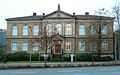
In the east of the district, on Lotter Straße, is the emma-theater , a venue for the municipal theaters , in a representative building in neo-Romanesque style. The Ernst-Moritz-Arndt-Gymnasium (1867–1980) and later the Hans-Calmeyer orientation level (1980–2003) were housed here. Since 2004, parts of the building have also been used by the Möser Realschule am Westerberg and the Altstädter Schule primary school . The museum complex at the Heger Tor is located on the border with the city center and consists of the Felix Nussbaum House , the Museum of Cultural History and the Akzisehaus . Set in a listed building on the Heger-Tor-Wall, the seat of former district government , today's police headquarters Osnabrück resident.
In the west of the district is the urban sports facility Illoshöhe , which u. a. is used by the Osnabrücker Turnerbund resident there and by VfL Osnabrück . The sports facility of Spielverein 16 is on Blumenhaller Weg and a tennis club is on Rheiner Landstrasse.
The Evangelical Lutheran Churches are among the spiritual institutions in the Weststadt. Bonnus Church and the cath. St. Elisabeth Church. For the members of the Old Catholic community, services are made possible in the Bonnuskirche. The (new) synagogue , inaugurated in 1969 and expanded for 3.6 million euros in 2008/2010, after the Jewish community had grown to more than 1,000 members since 1991 due to the influx of contingent refugees from the former Soviet Union, is located in Straße In der Barlage . The Heger cemetery is also the largest cemetery in Osnabrück in the Weststadt district.
Other educational institutions in addition to the Möser Realschule and the Altstädter School are the municipal primary school Rückertschule , the Catholic primary school Elisabethschule , the special school Horst-Koesling-Schule , the Montessori school Osnabrück and a vocational school for nursing professions. Parts of the university are also housed in the Katharinenviertel.
For fire protection in the district that provides local fire brigade center of the volunteer fire brigade Osnabrück on Kurt-Schumacher-Damm.
Transport links
From the highway, the West City is on the A 30 -Anschlussstelle Osnabrück -Hellern reach. The main traffic axis of the district is the Martinistraße. The bus lines M4, 15, 16, 17 and 10/20 run on Martini- and Lotter Straße.
gallery

Typical development in the Katharinenviertel (Herderstrasse)

Möser secondary school on Westerberg

new synagogue

Memorial of the Old Synagogue

Felix Nussbaum House
Cultural history museum

Excise House


.jpg)
Web links
- Quarterly information from the Department of Urban Development and Citizen Participation, Statistics Division, 4/2008 (PDF file; 1.49 MB)
- City of Osnabrück, Department for Urban Development and Public Participation -Statistics-, 11/2009 (PDF file; 35.40 kB)
- Interest group Lotter Strasse
Individual evidence
- ↑ Municipal statistics and monitoring portal Osnabrück (KOSMOS): Population - residents with main residence , osnabrueck.de, accessed on August 3, 2019
- ↑ City of Osnabrück, statistics, size of the city districts and statistical districts 11/2011 (PDF file)
- ↑ Ludwig Hoffmeyer, Ludwig Bäte, Heinrich Koch: Chronicle of the city of Osnabrück . 4th edition. Meinders & Elstermann, Osnabrück 1982, ISBN 3-88926-004-7 , p. 417-419 .
- ↑ Osnabrück bus depot has given way to the “Mittewest” quarter , noz.de, May 27, 2014, accessed on May 20, 2020.
- ↑ Time travel: From the excursion restaurant to the “Park” - The Schweizerhaus on Rheiner Landstrasse , noz.de, September 4, 2012, accessed on May 20, 2020.
Atter | Therefore / Gretesch / Lüstringen | Dodesheide | Eversburg | Fledder | Garden location | Port | Haste | Lightening | Downtown | Limestone hill | Nahne | Pye | Schinkel | Schinkel-Ost | Schölerberg | Sun hill | Sutthausen | Voxtrup | Westerberg | Weststadt | Widukindland | desert
Coordinates: 52 ° 16 ' N , 8 ° 1' E