Desert (osnabrück)
|
|||
|---|---|---|---|
Map:
|
|||
| Basic data | |||
| Area : | 2.73 km² | ||
| Residents : | 15,044 (December 31, 2018) | ||
| Population density : | 5,511 inhabitants / km² | ||
| Postal code : | 49080 | ||
| Primaries : | 0541 | ||
| structure | |||
| District number: |
16 |
||
The desert is a district of Osnabrück in Lower Saxony . With 15,044 inhabitants (12/2018) spread over an area of 2.73 km², it is the Osnabrück district with the highest population. The district is divided into the Front Desert and the Rear Desert and is a popular residential area due to its central location and good infrastructure.
geography
The desert is located southwest of the city center of Osnabrück in a valley between Kalkhügel and Westerberg . Martinistraße and Blumenhaller Weg represent the border to Weststadt , which is located north of the district . In the west, Autobahn 30 forms the border with Hellern . The junction with the railway line between Münster and Osnabrück is the southernmost point of the desert. From there, the district boundary runs along the railway line to Sutthauser Straße. There it follows the course of the street along Rosenplatz and Kommenderiestraße to Johannistorwall. Along the wall, the district ends at the intersection of Schlosswall and Martinistraße.
Most of the road network in the desert has a rectangular, block-like structure. While the front desert near the city center is characterized by block perimeter development, there are more detached single and multi-family houses in the rear part of the desert. Striking public green spaces are Jahnplatz between Weidenstrasse and Jahnstrasse, Hoffmeyerplatz at the intersection of Rehmstrasse and Parkstrasse, and Willy-Brandt-Platz on Schlosswall, between Schloßstrasse and Laischaftssstrasse.
The only larger watercourse in the desert is the poplar ditch, which was created in the 17th century. Originally it had the function of a border line, but between 1781 and 1784 it was expanded into a drainage ditch, which was only partially successful. The ditch got its name from the planting of poplars on the north side of the ditch in 1829. With the development of the sewer system and the progressive development of the desert, the poplar ditch was rebuilt and expanded from around 1960. It begins today with the rain retention basin at the Hörner Bruch. From the intersection at Am Pappelgraben / Sandstraße it is canalised and follows the streets Schnatgang, Neuer Graben and Neumarkt underground to flow into the Hase at a pumping station on Kollegienwall .
Larger lakes in the desert are the two rain retention basins , the "Wüstensee" and the "Pappelsee". The desert lake was laid out on Schreberstrasse in 1975/76. In the 1980s, the Pappelsee, another artificial but natural lake, was created along the “Am Pappelgraben” road.
history
The name "desert" is reminiscent of the original landscape of today's district: there used to be a low moor formed during the Ice Age that was "wöst" (Low German: uninhabitable). In the 18th century the area was supposed to be used for livestock farming, but this was not very suitable due to its nature. Even the expansion of the poplar ditch did not lead to drainage . With the end of the fortress requirements of the city of Osnabrück in 1843, the demand for land increased. So began the extensive drainage of the desert with the earth masses of the old ramparts and city walls. From the beginning of the 20th century until the 1960s, household waste, rubble, slag and ash were also used for this purpose.
At the beginning of the 1990s, pollutants were discovered during construction work. Investigations revealed that the soil was contaminated with PAHs , lead , cadmium , barium , copper and zinc on an area of around 270 hectares . In 218 of around 1,700 residential properties examined, the test value of the Federal Soil Protection Ordinance was exceeded. Therefore, the desert district is one of the largest known inhabited contaminated sites in Germany. From 2006 to 2008, the renovation of over 70 properties took place in three construction phases. The city of Osnabrück took over the costs, the property owners only had to pay for the restoration of their gardens.
Infrastructure
The district has a school center consisting of the Erich-Maria-Remarque-Realschule and the high school “In der Desert” , which is also attended by many students from the south-western district because of the favorable public transport connections. There is also a primary school and several day-care centers. The state education center for the hearing impaired , also located in the desert, is a state special needs school with boarding school, which enables students with auditory perception disorders to obtain secondary school leaving certificate. Facilities of the Osnabrück University of Applied Sciences are located on Rehmstrasse .
The sports facilities include the sports hall on Schlosswall , located on the border with the city center district, and the Moskaubad outdoor and indoor swimming pool, which opened in 1926 . There is also the sports center of the Osnabrück Sports Club (OSC) on Hiärm-Grupe-Straße, the stadium of Rasensport Osnabrück on Kokschen Straße and the sports center of the University of Osnabrück on Jahnstraße.
In the past there were also industrial companies in the desert, such as the Karmann automobile factory on Martinistraße or the Kromschröder gas meter factory on Jahnplatz. The latter was converted into a student residence at the beginning of the 1980s; with 291 places it is one of the largest in the city.
Ecclesiastical institutions are the Evangelical Methodist Christ Church, the Evangelical Free Church of the Baptists, the Free Church Adventist Congregation and a New Apostolic Congregation.
traffic
The district is served by the bus lines M4, 14 and 19 as well as the night lines N3 and N4 of Stadtwerke Osnabrück . There was a connection to the Osnabrück tram with tram line 3, which drove from Martiniplatz (today Heinrich-Lübke-Platz) via Martinistraße, Arndtplatz, Neumarkt, Hauptpost to Schinkel.
Anecdotal
- The magazine Der Spiegel published an advertisement from the Neue Osnabrücker Zeitung with the title “For our mother we are looking for a quiet, sunny apartment for our mother , in the“ Concave mirror ”category, which reproduces clumsy or paradoxical formulations from other magazines in the desert".
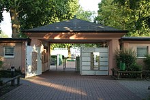
- The unusual statement "Moscow is in the desert" also makes people who are not Osnabrueckers smile. What is meant is the Moscow bath, which is usually only called Moscow in the vernacular .
- In relation to the Moscow bath, it is often jokingly claimed that Osnabrück is the largest city in the world because it stretches from the desert to Moscow.
- Some residents of the district humorously refer to themselves as "libertines".
Web links
- Information page about the old sedimentation in the desert ( Memento from February 25, 2011 in the Internet Archive )
- Quarterly information from the Department of Urban Development and Citizen Participation, Statistics Division, 4/2008 (PDF file; 1.49 MB)
- City of Osnabrück, Department for Urban Development and Citizen Participation -Statistics-, 11/2009 (PDF file; 35.40 KB)
Individual evidence
- ↑ Municipal statistics and monitoring portal Osnabrück (KOSMOS): Population - residents with main residence , osnabrueck.de, accessed on August 3, 2019
- ↑ City of Osnabrück, statistics, size of the city districts and statistical districts 11/2011 (PDF file)
- ↑ a b The Pappelgraben in the "Desert" district , bne.uni-osnabrueck.de, accessed on June 12, 2020.
- ↑ Contaminated sites in the desert
- ^ "Alte Fabrik" dormitory , studentenwerk-osnabrueck.de, accessed on August 5, 2019.
- ↑ Der Spiegel, No. 48 of November 25, 1985, p. 290
Coordinates: 52 ° 16 ' N , 8 ° 2' E


