List of landscape protection areas in Oldenburg (Oldb)
The list of landscape protection areas in Oldenburg (Oldenburg) contains the landscape protection areas of the independent city of Oldenburg (Oldenburg) in Lower Saxony .
| image | number | Name of the area | Area in hectares | map | Coordinates | Date of regulation |
|---|---|---|---|---|---|---|
| LSG OL-S 00008 | Bird sanctuary between the Coastal and Easter Burger Canal | 0.90 | location | position | 1938 | |
| LSG OL-S 00009 | The oaks on the 19th Dragoon Memorial on Cloppenburger Strasse | 0.00 | location | position | 1938 | |
| LSG OL-S 00010 | Trees at Vossstrasse and the trees at the Drielaker School | 0.10 | location | position | 1938 | |
| LSG OL-S 00011 | Rest of the old Krusenbusch | 4.00 | location | position | 1938 | |
| LSG OL-S 00013 | Gerdshorst | 26.00 | location | position | 1994 | |
| LSG OL-S 00016 | Bümmerstede village | 13.30 | location | position | 1938 | |
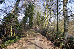
| LSG OL-S 00017 | Heiligengeistwall | 1.50 | location | position | 1948 | |
| LSG OL-S 00018 | Congestion line | 0.70 | location | position | 1947 | |
| LSG OL-S 00019 | Poststrasse | 0.40 | location | position | 1947 | |
| LSG OL-S 00021 | Theater wall | 4.70 | location | position | 1947 | |
| LSG OL-S 00022 | Cecilia Square | 0.70 | location | position | 1947 | |
| LSG OL-S 00023 | Herbartplatz | 1.00 | location | position | 1947 | |
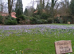
| LSG OL-S 00024 | Castle garden | 14.20 | location | position | 1951 | |

|
LSG OL-S 00025 | Elisabethstrasse | 1.20 | location | position | 1947 |
| LSG OL-S 00026 | Eversten wood | 22.90 | location | position | 1995 | |
| LSG OL-S 00027 | Dobben systems | 7.90 | location | position | 1947 | |
| LSG OL-S 00028 | Wittschiebenteich | 2.50 | location | position | 1947 | |
| LSG OL-S 00029 | Schleusenstrasse | 2.70 | location | position | 1947 | |
| LSG OL-S 00030 | Wunderburgpark | 2.60 | location | position | 1947 | |
| LSG OL-S 00031 | Infantry path -Anlage- | 1.00 | location | position | 1947 | |
| LSG OL-S 00032 | Johann-Justus-Weg -Anlage- | 5.40 | location | position | 1947 | |
| LSG OL-S 00033 | Volkspark on Alexanderstraße (Kleiner Bürgerbusch) | 7.20 | location | position | 1947 | |
| LSG OL-S 00034 | Volkspark am Scheideweg (Großer Bürgerbusch) | 18.70 | location | position | 1947 | |
| LSG OL-S 00035 | Area at the Nadorster pond (flute pond) | 24.70 | location | position | 1947 | |
| LSG OL-S 00036 | Weißenmoorstrasse | Coordinates: 53 ° 10 ′ 49.1 ″ N , 8 ° 12 ′ 44.1 ″ E | 1947 | |||
| LSG OL-S 00037 | Cemetery on Hochheider Weg | 1.30 | location | position | 1947 | |
| LSG OL-S 00038 | Ohmstede cemetery | 2.00 | location | position | 1948 | |

|
LSG OL-S 00039 | Gertrudenfriedhof | 3.30 | location | position | 1948 |
| LSG OL-S 00040 | Eversten cemetery | 3.00 | location | position | 1948 | |
| LSG OL-S 00041 | Old Easter Castle cemetery | 0.90 | location | position | 1948 | |
| LSG OL-S 00042 | New Easter Castle cemetery | 0.90 | location | position | 1948 | |
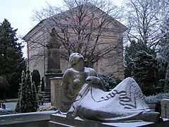
| LSG OL-S 00043 | Catholic cemetery | 1.90 | location | position | 1948 | |
| LSG OL-S 00044 | Jewish Cemetery | 0.30 | location | position | 1948 | |
| LSG OL-S 00046 | Cenotaph on Ofener Strasse | 0.00 | location | position | 1948 | |
| LSG OL-S 00047 | New cemetery on Friedhofsweg | 9.50 | location | position | 1948 | |
| LSG OL-S 00049 | Oldenburg - Rasteder Geestrand | 1226.20 | location | position | 1975 | |
| LSG OL-S 00050 | Castle garden - extension | 2.00 | location | position | 1954 | |
| LSG OL-S 00053 | Blankenburger Holz and Klostermark | 390.00 | location | position | 1997 | |
| LSG OL-S 00055 | Trees on the Ziegelhof property | 0.00 | location | position | 1965 | |
| LSG OL-S 00057 | Wüschemeer | 8.70 | location | position | 2001 | |
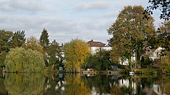
| LSG OL-S 00058 | Drielaker Lake | 21.50 | location | position | 1981 | |

|
LSG OL-S 00059 | Mühlenhunte (includes Mühlenhunte Landscape Park ) | 14.00 | location | position | 1981 |

|
LSG OL-S 00060 | Hair loss | 67.00 | location | position | 1991 |
| LSG OL-S 00061 | Tegelbusch | 31.40 | location | position | 1958 | |
| LSG OL-S 00062 | Medium hunte | 126.90 | location | position | 1976 | |
| LSG OL-S 00070 | Hausbäke lowland | 458.00 | location | position | 1996 |
Remarks
- ↑ Coordinates were taken from the European Nature Information System (EUNIS) of the European Environment Agency : Nationally designated areas (CDDA) , file CDDA_v12_csv.zip, status October 2014. The map column shows the exact boundaries.
- ^ Mühlenhunte Landscape Park , website of the city of Oldenburg, accessed on August 15, 2016.
See also
- List of nature reserves in Oldenburg (Oldb)
- List of natural monuments in Oldenburg (Oldb)
- List of protected landscape components in Oldenburg (Oldb)
- List of geotopes in Oldenburg (Oldb)
Web links
Commons : Landscape protection areas in Oldenburg - collection of pictures, videos and audio files
- Lower Saxony Ministry for the Environment, Energy, Building and Climate Protection: Parts of nature and landscape that are particularly protected under nature conservation law
- City of Oldenburg: Landscape Protection Areas (LSG)


