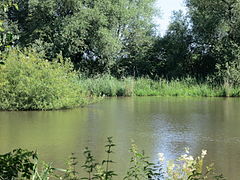
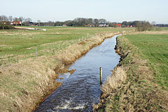
List of landscape protection areas in the Diepholz district
The list of landscape protection areas in the district of Diepholz contains the landscape protection areas of the district of Diepholz in Lower Saxony .
| image | number | Name of the area | Area in hectares | map | Coordinates | Date of regulation |
|---|---|---|---|---|---|---|
| LSG DH 00001 | Sprekelsmeer | 4.50 | location | position | 1968 | |
| LSG DH 00003 | Kellenberg | 1084.00 | location | position | 1966 | |
| LSG DH 00008 | Ostermoor - Felstehausener Schanzen | 200.00 | location | position | 1971 | |
| LSG DH 00009 | Barnstorfer Huntetal | 1475.80 | location | position | 1967 | |
| LSG DH 00010 | Stemweder Berg | 717.90 | location | position | 1971 | |
| LSG DH 00011 | Path wood | 96.00 | location | position | 1965 | |
| LSG DH 00012 | Böhrde / Hohes Moor | 635.00 | location | position | 1966 | |
| LSG DH 00014 | dumber | 1169.70 | location | position | 1981 | |
| LSG DH 00015 | Maaser Höpen | 40.00 | location | position | 1967 | |
| LSG DH 00017 | The Sette | 106.00 | location | position | 1967 | |
| LSG DH 00018 | Bauerbruch | 230.00 | location | position | 1967 | |
| LSG DH 00019 | Diepholzer Moor | 26.00 | location | position | 1968 | |
| LSG DH 00020 | Environment of the Great Sea | 90.00 | location | position | 1968 | |
| LSG DH 00021 | Oberwald | 574.50 | location | position | 1968 | |
| LSG DH 00022 | Kuhbachtal | 256.00 | location | position | 1968 | |
| LSG DH 00023 | Schwaförden forest | 100.00 | location | position | 1968 | |
| LSG DH 00024 | Eitzer Sunder | 30.00 | location | position | 1968 | |
| LSG DH 00025 | Dickeler sand | 1315.00 | location | position | 1968 | |
| LSG DH 00026 | Original lodge | 930.00 | location | position | 1968 | |
| LSG DH 00027 | sinner | 440.00 | location | position | 1968 | |
| LSG DH 00028 | Varrel, Neue Horst, Dankelshorst and Hahnhorst | 770.00 | location | position | 1968 | |
| LSG DH 00029 | Deadbreak Bog | 37.30 | location | position | 1968 | |
| LSG DH 00030 | Klausheide | 166.10 | location | position | 1968 | |
| LSG DH 00031 | Papenhuser Sunder and Wiethoop | 374.00 | location | position | 1968 | |
| LSG DH 00032 | Bockstedter Moor | 430.00 | location | position | 1968 | |
| LSG DH 00033 | Aschener and Heeder Moor and Hoher Atonement | 635.00 | location | position | 1968 | |
| LSG DH 00034 | Falkenhardt and Hengemühle | 70.00 | location | position | 1968 | |
| LSG DH 00035 | Great Renzeler Moor and Black Moor | 1538.50 | location | position | 1969 | |
| LSG DH 00036 | Small floodplain | 1522.30 | location | position | 1969 | |
| LSG DH 00037 | Northern Wietingsmoor | 688.30 | location | position | 1969 | |
| LSG DH 00038 | Thielmannshorst, Lembrucher Torfmoor, Brockumer and Stemmer Moor | 406.00 | location | position | 1969 | |
| LSG DH 00039 | Mühlenbach - Wedehorner wood | 671.10 | location | position | 1969 | |
| LSG DH 00040 | Weddigeloh | 248.60 | location | position | 1969 | |
| LSG DH 00041 | Osterheide | 95.00 | location | position | 1965 | |
| LSG DH 00042 | Wetscher Fladder and Vossen Neufeld | 1136.50 | location | position | 1970 | |
| LSG DH 00043 | Rocky mountains and adjacent parts of the landscape | 140.00 | location | position | 1970 | |
| LSG DH 00044 | Sulinger Moor and Maasener Moor | 443.20 | location | position | 1970 | |
| LSG DH 00045 | Scharrel and Bargeloh | 125.00 | location | position | 1970 | |
| LSG DH 00046 | Ox break | 59.60 | location | position | 1971 | |
| LSG DH 00047 | Long mountain | 740.00 | location | position | 1972 | |
| LSG DH 00048 | Southern Kuhbachtal, Bobrink and Groß Lessener Moor | 1480.00 | location | position | 1972 | |
| LSG DH 00049 | Cooper Moor | 5.00 | location | position | 1938 | |
| LSG DH 00050 | Kirchweyher See | 160.00 | location | position | 1975 | |
| LSG DH 00051 | Ristedter oil pot | 7.00 | location | position | 1939 | |
| LSG DH 00052 | Siekholz | 14.00 | location | position | 1939 | |
| LSG DH 00053 | Vorwerk Syke | 2.00 | location | position | 1948 | |
| LSG DH 00054 | Empty Schlatt | 2.00 | location | position | 1950 | |

|
LSG DH 00056 | Peace wood | 425.00 | location | position | 1960 |
| LSG DH 00057 | Streitheide | 32.00 | location | position | 1964 | |
| LSG DH 00058 | The Gesseler Spreeken | 30.00 | location | position | 1964 | |
| LSG DH 00059 | Westermark | 701.50 | location | position | 1964 | |

|
LSG DH 00060 | Hombach - Finkenbach - Klosterbach | 2302.00 | location | position | 1967 |
| LSG DH 00061 | Blankes Schlatt and Kleines Schlatt | 7.00 | location | position | 1969 | |
| LSG DH 00062 | Stuhr churchyard | 0.50 | location | position | 1950 | |
| LSG DH 00063 | Freidorf | 269.00 | location | position | 1971 | |
| LSG DH 00064 | Dehmse | 771.00 | location | position | 1970 | |
| LSG DH 00065 | Rutental | 297.00 | location | position | 1974 | |
| LSG DH 00066 | Basket island | 67.00 | location | position | 1977 | |
| LSG DH 00067 | Herrenhassel - Harbergerheide | 417.00 | location | position | 1971 | |
| LSG DH 00069 | Wilshauser Moor | 30.00 | location | position | 1950 | |

|
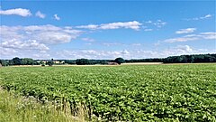
LSG DH 00070 | Huntetal | 420.00 | location | position | 1971 |
|
LSG DH 00071 | Harpstedter Geest | 206.00 | location | position | 1973 |
| LSG DH 00072 | Dünsener Bach - Steller Heide | 335.00 | location | position | 1972 | |

|
LSG DH 00073 | Hachetal I | 8.60 | location | position | 1990 |
| LSG DH 00074 | Red vine | 270.00 | location | position | 1992 | |
| LSG DH 00075 | Klosterbach | 338.00 | location | position | 1995 | |
| LSG DH 00076 | Kronsbruch near Heiligenrode | 156.00 | location | position | 1995 | |
| LSG DH 00077 | Hachetal II | 350.30 | location | position | 1996 | |
| LSG DH 00078 | Heiligenloher Beeke and the adjacent brook lowlands | 400.00 | location | position | 1996 | |
| LSG DH 00079 | Brinkum Kronsbruch | 176.00 | location | position | 1996 |
Remarks
- ↑ Coordinates were taken from the European Nature Information System (EUNIS) of the European Environment Agency : Nationally designated areas (CDDA) , file CDDA_v12_csv.zip, status October 2014. The map column shows the exact boundaries.
See also
- List of nature reserves in the Diepholz district
- List of natural monuments in the Diepholz district
- List of protected landscape components in the Diepholz district
- List of geotopes in the Diepholz district

