List of landscape protection areas in the district of Goslar
The list of landscape protection areas in the district of Goslar contains the landscape protection areas of the district of Goslar in Lower Saxony .
| image | number | Name of the area | Area in hectares | map | Coordinates | Date of regulation |
|---|---|---|---|---|---|---|

|
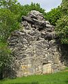
LSG GS 00001 | Ruins on the Petersberg including Klusfelsen | 3.00 | location | position | 1937 |

|
LSG GS 00002 | Grauhöfer wood | 155.00 | location | position | 1942 |

|
LSG GS 00006 | Sudmerberg | 150.00 | location | position | 1966 |

|
LSG GS 00007 | Kattenberg | 7.00 | location | position | 1966 |

|
LSG GS 00008 | Grauhöfer Landwehr | 4.00 | location | position | 1966 |

|
LSG GS 00009 | Riechenberg Manor Park | 4.00 | location | position | 1966 |

|
LSG GS 00010 | Cemetery and Gutswald of the Ohlhof estate | 6.00 | location | position | 1966 |

|
LSG GS 00011 | Graveyard of the Grauhof monastery | 0.30 | location | position | 1966 |

|
LSG GS 00012 | Cemetery on Hildesheimer Strasse | 12.90 | location | position | 1966 |

|
LSG GS 00013 | New cemetery on Feldstrasse | 6.00 | location | position | 1966 |

|
LSG GS 00014 | Jewish Cemetery | 0.20 | location | position | 1966 |

|
LSG GS 00015 | Georgenbergruine including the entire tree population | 0.70 | location | position | 1966 |

|
LSG GS 00016 | Neuwerk monastery garden with trees | 1.50 | location | position | 1966 |
| LSG GS 00017 | Trees in the "beautiful garden" | 0.00 | location | position | 1966 | |
| LSG GS 00018 | Trees on Thomasstrasse | 0.00 | location | position | 1966 | |

|
LSG GS 00019 | Tree population of the stephan garden | 0.00 | location | position | 1966 |

|
LSG GS 00020 | Trees in the club garden | 0.00 | location | position | 1966 |

|
LSG GS 00024 | Poplar, oak and beech trees at the quail gate | 0.00 | location | position | 1966 |

|
LSG GS 00025 | Trees between the "Oberen Triftweg" and the "Von-Garßen-Straße" | 0.00 | location | position | 1966 |

|
LSG GS 00026 | Horse chestnut group | 0.00 | location | position | 1966 |

|
LSG GS 00027 | Horse chestnut group | 0.00 | location | position | 1966 |
| LSG GS 00037 | Farm wood Lah | 6.20 | location | position | 1976 | |

|
LSG GS 00039 | Harli | 493.00 | location | position | 1966 |

|
LSG GS 00040 | Salzgitterscher mountain range | 2127.80 | location | position | 1966 |

|
LSG GS 00041 | Wallmodener Berge, Appelhorn-Bredelemer Holz | 1754.70 | location | position | 1966 |
| LSG GS 00042 | Nettetal Upper Nettetal |
336.00 |
location |
position | 1967 |
|
| LSG GS 00043 | Luttertal | 32.10 | location | position | 1967 | |
| LSG GS 00044 | Wohldenstein | 19.40 | location | position | 1967 | |
| LSG GS 00048 | Tannenberg | 2.80 | location | position | 1956 | |
| LSG GS 00051 | Silver hollow | 24.60 | location | position | 1968 | |
| LSG GS 00052 | Söhrteich and Steimker Bach | 17.50 | location | position | 1972 | |
| LSG GS 00053 | Wullwinkel, Finkenberg, Mädeberg and Westerberg | 302.20 | location | position | 1972 | |

|
LSG GS 00056 | Eastern Langenberg | 45.00 | location | position | 1984 |

|
LSG GS 00059 | Harz (district of Goslar) | 38975.00 | location | position | 2001 |

|
LSG GS 00061 | Bodensteiner Klippen and Klein Rhüdener Holz | 3140.00 | location | position | 2008 |
Remarks
- ↑ Coordinates were taken from the European Nature Information System (EUNIS) of the European Environment Agency : Nationally designated areas (CDDA) , file CDDA_v12_csv.zip, status October 2014. The map column shows the exact boundaries.
- ↑ The state of Lower Saxony calls the LSG "Nettetal", the district of Goslar "Nettetal (district of Goslar)" and the Federal Agency for Nature Conservation "Upper Nettetal".
See also
- List of nature reserves in the Goslar district
- List of natural monuments in the Goslar district
- List of protected landscape components in the district of Goslar
- List of geotopes in the Goslar district
Web links
Commons : Landscape protection areas in the Goslar district - collection of pictures, videos and audio files