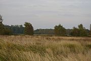
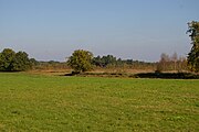
List of geotopes in the Diepholz district
The list of geotopes in the Diepholz district names the geotopes in the Diepholz district in Lower Saxony .
| Geotope no. | designation | place | comment | Coordinates | image |
|---|---|---|---|---|---|
| 3018/01 | Boulder "De krumme Snider" | on the NE outskirts of Ristedt , crossroads | Geotope type: boulder. Length 1.1 m, width 0.7 m, height 1.4 m. Stratigraphy: Quaternary Pleistocene, Drenthe glaciation. Petrography: granite, coarse-grained. Natural monument ND-DH 24. |
52 ° 56 '40.3 " N , 8 ° 46' 15.3" E | |
| 3117/01 | Outcrop - Middle Miocene mica clay: Sunder clay pit | approx. 2.5 km northwest of Twistringen | Geotope type: sequence of layers. Length 200 m, height 15 m. Size: 20,000 m²; Between 1806 and 1992 clay stones were mined in the Sunder clay pit in Twistringen. The clay pit was a refuge for scientists and amateur palaeontologists who primarily looked for molluscs in the layers of the Miocene, which are around 15 million years old. The last scientific summary took place in 1992, at the same time as the end of the dismantling. Stratigraphy: Tertiary - Middle Miocene, Reinbek-Dingden stage. |
52 ° 48 '50.4 " N , 8 ° 36' 25.2" E | |
| 3217/01 | Boulder "Alderter Sacrificial Stone" | N of street Barnstorf -Twistringen | Geotope type: boulder. Cuboid. Length 2 m, width 1.7 m, height 0.9 m. Stratigraphy: Quaternary - Pleistocene, Saale glaciation. Petrography: granite, medium-grained, reddish. Natural monument ND-DH 4. |
52 ° 42 ′ 55 " N , 8 ° 30 ′ 56.3" E | |
| 3218/01 | " Pastorendiek " raised bog | Sudwalde | Geotope type: raised bog. Stratigraphy: Quaternary. Nature reserve NSG-HA 001 "Pastorendiek". |
52 ° 45 ′ 50.4 " N , 8 ° 48 ′ 55.6" E |

|
| 3316/01 | Boulder | 5 km north of Diepholz in Aschen , schoolyard | Geotope type: boulder. Length 2.6 m, width m, height 1.6 m. Stratigraphy: Quaternary Pleistocene, Saale glaciation. Petrography: granite, angular edges, black-white-colored and pale reddish, medium-grained. Natural monument ND-DH 13. |
52 ° 39 '4.5 " N , 8 ° 21' 20.6" E | |
| 3319/01 | Hochmoor " Siedener Moor " | Maasen | Geotope type: raised bog. Size 825.0 ha. Stratigraphy: Quaternary. Nature reserve NSG-HA-112 "Siedener Moor". |
52 ° 38 '28.3 " N , 8 ° 54' 12.9" E |
 more pictures |
| 3418/01 | Ring-shaped dune wall with moor | approx. 5 km WSW Scharringhausen | Geotope types: dune, dune landscape, bog. Length 600 m, width 250 m, height 4 m. Size 100,000 m². A valley filled with raised bog peat, which can be interpreted as an Aeolian blow-out basin. Stratigraphy: Quaternary Holocene. In the landscape protection area LSG-DH 35. |
52 ° 35 '20.4 " N , 8 ° 44' 9.6" E | |
| 3418/02 | " Great Renzeler Moor " high moor | Barenburg | Geotope type: raised bog. Size 231.6 ha. Stratigraphy: Quaternary. Nature reserve NSG-HA 033 "Großes Renzeler Moor". |
52 ° 34 ′ 26 " N , 8 ° 44 ′ 57" E |
 more pictures |
| 3419/01 | " Hohes Moor " high moor | Church Village | Geotope type: raised bog. Size 633.0 ha. Stratigraphy: Quaternary. Nature reserve NSG-HA 159 "Hohes Moor (Hannover)". |
52 ° 35 '25.1 " N , 8 ° 53' 13.1" E |
 more pictures |
See also
- List of nature reserves in the Diepholz district
- List of landscape protection areas in the Diepholz district
- List of natural monuments in the Diepholz district
- List of protected landscape components in the Diepholz district
Web links
Commons : Geotopes in the district of Diepholz - Collection of images, videos and audio files