List of geotopes in the Wolfenbüttel district
The list of geotopes in the Wolfenbüttel district contains the geotopes in the Wolfenbüttel district in Lower Saxony . Some of these geotopes are also protected as natural monuments (ND), landscape protection areas (LSG), nature reserves (NSG) or part of these.
| Geotope no. | designation | place | comment | Coordinates | image |
|---|---|---|---|---|---|
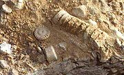
| 3730/01 | Former Quarry in the Trochitic Limestone | east of Erkerode | Geotope type: directional profile, fossil finds. Length 20 m, width 40 m, height 8 m. Stratigraphy: Triassic Upper Muschelkalk (Trochitenkalk). Petrography: 1 sole, rich in limestone shell residues. In the landscape protection area LSG-WF 22 Elm |
52 ° 12 '6.5 " N , 10 ° 42' 48.3" E |
 more pictures |
| 3730/02 | Sinkhole area and stream shrinkage "devil's kitchen" | approx. 400 m (SO Vorwerk Reitling), community-free area Am Großen Rhode | Geotope types: sinkhole, stream shrinkage. Length 50 m, width 50 m, height 15 m. Stratigraphy: Triassic - Upper Buntsandstein (red). Petrography: colorful, clay-contaminated, thin-plate plaster stones of the Röt. In the landscape protection area LSG-WF 22 |
52 ° 12 ′ 14.4 " N , 10 ° 45 ′ 31" E | |
| 3730/03 | Foam lime banks, former Angerstein quarry | on the Königslutter-Sambleben road, NW of the Whs. Tetzelstein, Sickte | Geotope type: directional profile. Length 120 m, width 200 m, height 6 m. Stratigraphy: Triassic Lower Muschelkalk. Petrography: Wavy limestone and foam limestone banks. In the landscape protection area LSG-WF 22 |
52 ° 12 '0.7 " N , 10 ° 47' 38.8" E | |
| 3730/11 | Former Limestone quarry | approx. 1.4 km SE Destedt, Erkerode | Geotope type: directional profile. Length 330 m, width 220 m, height 40 m. Stratigraphy: Triassic Lower Muschelkalk. In the landscape protection area LSG-WF 22 |
52 ° 13 '56.6 " N , 10 ° 44' 6.4" E | |
| 3730/14 | Steep step landscape with cracks in the Elm | all around the Reitlingstal, Evessen | Geotope type: directional profile. Length 4500 m, width 1100 m. Stratigraphy: Triassic Lower Muschelkalk. Petrography: Quaternary. In the landscape protection area LSG-WF 22 |
52 ° 11 '53.2 " N , 10 ° 43' 2.6" E |

|
| 3829/01 | source | on the northern edge of the Oder forest on the Posteiche near Halchter , Wolfenbüttel | Geotope type: source. Length 20 m, width 40 m. Stratigraphy: Upper Cretaceous, Cenomanian marls. Petrography: The source arises from Cenomanian marls, which have a slight loess or loess clay cover (Pleistocene). |
52 ° 8 ′ 1 ″ N , 10 ° 30 ′ 55.1 ″ E | |
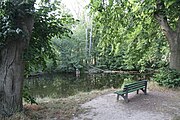
| 3829/04 | Vilgensee, source | 1 km W Dettum, Denkte | Spring pond in the limestone area with several small islands. Geotope types: lake, source XQ. In the landscape protection area LSG-WF 3. |
52 ° 10 '19.6 " N , 10 ° 38' 54.6" E |

|
| 3830/03 | Gabbro boulder | at the barrow near Eilum approx. 260 m N Eilum , Schöppenstedt | Geotope type: boulder. Length 1 m, width 1.4 m, height 1 m. Stratigraphy: Quaternary Pleistocene. Petrography: dark gabbro. Natural monument ND-WF 12 |
52 ° 9 '56.5 " N , 10 ° 43' 21.4" E | |
| 3830/04 | former quarry, steep, trochitic limestone | at Mühlenberg approx. 500 m NW Uehrde , Schöppenstedt | Geotope type: storage conditions. Length 500 m, width 40 m, height 1 m. Stratigraphy: Triassic Upper Muschelkalk. |
52 ° 6 '20.2 " N , 10 ° 45' 6.8" O | |
| 3830/05 | Sinkholes | about 1.6 km E Whs. Tetzelstein, Schöppenstedt | Geotope type: sinkhole. Length 1200 m, width 650 m, height 5 m. Stratigraphy: Triassic Upper Muschelkalk to Quaternary. Petrography: The sinkholes were created by leaching the gypsum. In the landscape protection area LSG-WF 22 |
52 ° 11 '30.1 " N , 10 ° 48' 47.2" E | |
| 3830/06 | Medieval quarries | approx. 2 km N Kneitlingen , community-free area Am Großen Rhode | Geotope type: directional profile. Length 11 m, width 800 m, height 100 m. Stratigraphy: Triassic Lower Muschelkalk. In the landscape protection area LSG-WF 22 |
52 ° 11 '35.9 " N , 10 ° 45' 20.9" O | |
| 3927/03 | Hilssandstone cliffs | on the Hainberg approx. 3.5 km WSW Sehlde | Geotope type: cliffs. Height 10 m. Stratigraphy: Lower Cretaceous, Alb. In the landscape protection area LSG-HI 56, LSG-WF 31, LSG-GS 45 "Hainberg, Wohldenberg, Braune Heide, Klein Rhüdener Holz and angr. Landscape parts" |
52 ° 1 '46.6 " N , 10 ° 12' 46.8" E |

|
| 3927/05 | Border area between white and red skimmer limestone, former quarry | N outskirts of Baddeckestedt | Geotope type: directional profile. Stratigraphy: Upper Cretaceous. |
52 ° 5 '27.2 " N , 10 ° 13' 45.1" E | |
| 3929/02 | Former Sandstone quarry | approx. 1.8 km NE Seinstedt-Hedeper, Achim | Geotope type: directional profile. Length 220 m, height 15 m. Stratigraphy: Upper Cretaceous. |
52 ° 3 '42.8 " N , 10 ° 39' 35.6" E | |
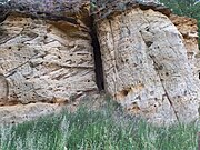
| 3930/02 | Rhätsandsteinklippe in the NSG "Klotzberg" | Klotzberg , approx. 1 km south of Wetzleben, Hedeper | Geotope type: sedimentary structures. Length 300 m, width 40 m, height 28 m. Stratigraphy: Trias-Oberer Keuper (Rhät). Petrography: soft quartz sandstone of light color and fine-grained. In the nature reserve NSG-BR 012 "Klotzberg". |
52 ° 3 '31 " N , 10 ° 42' 47.9" E |

|
| 4029/08 | Abandoned loess pit (upper Schierksmühle) | Schladen | Geotope type: drifting sand cover. Stratigraphy: Quaternary - Pleistocene, Vistula Glaciation. Petrography: Vistula loess, fossil soils, Holocene parabrown earth. |
51 ° 59 '26.2 " N , 10 ° 30' 14.8" E |
See also
- List of nature reserves in the Wolfenbüttel district
- List of landscape protection areas in the Wolfenbüttel district
- List of natural monuments in the Wolfenbüttel district
- List of protected landscape components in the Wolfenbüttel district
Web links
Commons : Geotopes in the Wolfenbüttel district - collection of images, videos and audio files
Individual evidence
- ↑ Vilgensee on elm-asse-kultur.de: trips
- ↑ Bodensteiner Cliff , (pdf; 217 kB)
- ↑ Baddeckestedt , (pdf; 301 kB)
- ↑ Seinstedt Keuper , (pdf; 349 kB)