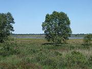
List of geotopes in the Osterholz district
The list of geotopes in the Osterholz district names the geotopes in the Osterholz district in Lower Saxony .
| Geotope no. | designation | place | comment | Coordinates | image |
|---|---|---|---|---|---|
| 2619/03 | Heilsberg | approx. 3.3 km NE Hambergen , Vollersode | Geotope type: glacial embankment form. Petrography: Dune-like hilltop made of sand and gravel of fluvioglacial origin. In the landscape protection area LSG OHZ 9. |
53 ° 20 '2.4 " N , 8 ° 51' 21.6" E | |
| 2718/01 | Small raised bog | Osterholz-Scharmbeck | Geotope type: small raised bog. | 53 ° 15 '7.9 " N , 8 ° 43' 32.2" E | |
| 2719/01 | Boulder "De grote Stehen" | 500 m W Hilsdorf, 20 m EB 74 on the edge of the field, protrudes into the neighboring ditch | Geotope type: boulder. Length 3.2 m, width 2.5 m, height 1 m, ellipsoidal shape. Stratigraphy: Quaternary Pleistocene, Drenthe glaciation. Petrography: Granite, coarse-grained, 1 fine-grained bench, coarse-grained area e.g. T. buried, stuck in the ground. |
53 ° 17 '52.8 " N , 8 ° 50' 9.6" E | |
| 2719/06 | " Günnemoor " (Teufelsmoor) | It makes up a large part of the Osterholz district (north of Bremen) and extends into adjacent parts of the Rotenburg district (Gnarrenburg municipality). | Geotope type: raised bog. Stratigraphy: Quaternary. |
53 ° 16 ′ 48 " N , 8 ° 54 ′ 36" E |

|
See also
- List of nature reserves in the Osterholz district
- List of landscape protection areas in the district of Osterholz
- List of natural monuments in the district of Osterholz
- List of protected landscape components in the district of Osterholz
Web links
Commons : Geotopes in the district of Osterholz - collection of images, videos and audio files
Individual evidence
- ↑ The Freißenbüttel sand pit , (pdf; 430 kB)