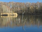
List of geotopes in Braunschweig
The list of geotopes in Braunschweig contains the geotopes in the independent city of Braunschweig in Lower Saxony .
| Geotope no. | designation | place | comment | Coordinates | image |
|---|---|---|---|---|---|
| 3629/04 | Ziegeleiteich Querum | Across | Abandoned brick clay pit Stratigraphy: Middle tone. |
52 ° 18 '0.8 " N , 10 ° 33' 52.2" E |
 |
| 3728/02 | Source Teufelsspring | approx. 650 m west of Broitzem | Source for the Fuhse Canal , according to the NIBIS map server, "Plänerkarst source that periodically spits in an earth-fall-like depression". Area: length 10 m, width 20 m. Stratigraphy: Upper Cretaceous. |
52 ° 14 ′ 1.8 ″ N , 10 ° 27 ′ 41.2 ″ E | |
| 3729/01 | Lower red sandstone including roe stone from the Nussberg | at the Prinz-Albrecht-Park in Braunschweig | heavily structured, largely recultivated former mining area on the Nussberg. Directional profile. Length 600 m, width 200 m. Stratigraphy: Triassic Lower Buntsandstein. |
52 ° 16 '15.8 " N , 10 ° 33' 29.5" E |

|
| 3729/02 | Dowesee | Northern city area of Braunschweig | Sinkhole over salt dome. | 52 ° 17 '36.8 " N , 10 ° 31' 53.7" E |
 |
| 3729/07 | Moorhütte Pond | Folk ailment | Brick clay pit Moorhütte Stratigraphy: Lower Cretaceous. |
52 ° 17 '26.2 " N , 10 ° 35' 8.2" E |

|
See also
- List of nature reserves in Braunschweig
- List of landscape protection areas in Braunschweig
- List of natural monuments in Braunschweig
- List of protected landscape components in Braunschweig
literature
City of Königslutter u. a. (Ed.): Geological hiking map, 1: 100000, Braunschweiger Land , Königslutter 1984.
Web links
Commons : Geotopes in Braunschweig - Collection of images
- Geotopes on the NIBIS map server
- Geological objects in Lower Saxony - Braunschweiger Land / Ostfalen. State Office for Mining, Energy and Geology, accessed on April 15, 2017 .
Individual evidence
- ↑ a b c City of Königslutter u. a. (Ed.): Geological hiking map, 1: 100000, Braunschweiger Land , Königslutter 1984.
- ↑ NIBIS map server. Retrieved April 9, 2017 .