Fuhse Canal (Braunschweig)
| Fuhse Canal | ||
|
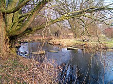
Original outlet of the Fuhse Canal into the South Pacific (April 2010) |
||
| Data | ||
| Water code | DE : 48276 | |
| location | Lower Saxony , Germany | |
| River system | Weser | |
| Drain over | Oker → Aller → Weser → North Sea | |
| Western end |
Salzgitter branch canal 52 ° 13 ′ 24 ″ N , 10 ° 25 ′ 10 ″ E |
|
| Source height | 74 m above sea level NHN | |
| Eastern end |
Oker coordinates: 52 ° 13 '22 " N , 10 ° 30' 40" E 52 ° 13 '22 " N , 10 ° 30' 40" E |
|
| Mouth height | 70.8 m | |
| Height difference | 3.2 m | |
| Bottom slope | 0.64 ‰ | |
| length | 5 km | |
| Catchment area | 10.19 km² | |
| Drain |
MQ HHQ (2002) |
0.094 5 m³ / s
|
| Big cities | Braunschweig | |
| Communities | Vechelde | |
| Water body 15034 | ||

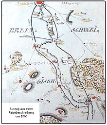
The Fuhse Canal (formerly also known as Neuer Canal , Landwehr Canal or Aubach ) is a canal in the southwest of the city of Braunschweig that was dug in the 18th century .
geography
The canal runs from its westernmost point on the Salzgitter branch canal near Groß Gleidingen along the Ellernbruch forest and the Teufelsspring spring, continues north of Broitzem , crosses the Hanover – Braunschweig railway twice and forms the southern border of the Gartenstadt district . To the north of Rüningen it flows into the South Sea region and then into the Oker at the level of the Rüningen mill .
Its geodetically highest point is 78 m above sea level. NN the source Teufelsspring ( location ) between Broitzem and Stiddien . From there the water of the canal flows in both directions, to the west to the Salzgitter canal ( 74 m above sea level ) and to the east towards the South Sea ( 70.8 m above sea level ). Its length is 7.2 km today. The catchment area covers 10.19 km². It should not be confused with the Aue-Oker Canal near Wendeburg .
Originally the western part of the Fuhse Canal ran up to the floodplain . With the construction of the Salzgitter branch canal, the course was interrupted and the new western end was established. The Fuhse Canal no longer exists between the branch canal and the floodplain, there - begun in 1956, completed in 1965 - two retention basins (official designation: rainwater reservoir and clarification ponds; fed by the floodplain and drained into the floodplain) have been created.
history
The first plans for a canal between the Oker and Aue were made in the 16th century under Duke Julius . At that time the aim was to create a waterway connection between Wolfenbüttel and Celle , which bypassed the insubordinate city of Braunschweig and avoided the heavily built-up Oker in the Braunschweig city area.
In 1745, Duke Karl I of Braunschweig-Wolfenbüttel commissioned the continuous desludging and clearing of the floodplain . In the course of this work it turned out that a runoff from the boggy floodplain area to the Oker is necessary. A canal was therefore planned, which was to run south of Groß Gleidingen in the Ottergraben that existed at the time and in the Landwehr Canal near Broitzem, which was started in 1757.
The ambitious forester Eduard August Anton von Hoym (1713–1776), who was commissioned with the execution and who was responsible for the peat system of the Principality of Braunschweig from 1751 , even wanted to expand it as the Oker-Fuhse Canal to the Fuhse . However, this connection was never realized. Only the name "Fuhsekanal" remained.
At the time of its greatest expansion, it connected the river Aue with the Oker. Contrary to the original plans, smaller lock structures were necessary. The construction became considerably more expensive to over 60,000 Reichstaler and could not permanently meet the economic expectations. It is interesting that the forester took out loans for the construction on his own initiative and at times concealed the actual construction costs from the sovereign. The work on the Fuhse Canal began in Braunschweig near Rüningen on the old Okerlauf at roughly the same point as today and led to Sonnenberg in the regulated floodplain.
Peat was transported on the canal from the mining areas near Sonnenberg, Groß Gleidingen and Wierthe to the city of Braunschweig. Wood and grain were also transported. The canal was mainly fed from the "Teufelsspring", a spring pond between Broitzem and Stiddien . Due to a lack of water supply, the canal quickly silted up again in parts, so that it could not serve as a permanent transport route. All work on the canal was stopped in March 1776 by order of the Duke. The peat was hauled by horse-drawn carts until mining was stopped in the early 19th century.
In the floodplain, the canal contributed to the drainage of the floodplains of the floodplain and improved the quality of the arable land. On the other hand, complaints have been passed down from the farmers in Timmerlah and Broitzem that their meadows are drying up and they are harvesting a third less hay.
Today's meaning
North from Broitzem to Groß Gleidingen, the canal is still recognizable as a narrow ditch over a length of 5 km. East of the Teufelsspring it takes on the surface drainage of the Braunschweig Weststadt and leads it in the South Sea area to the Oker.
The Fuhse Canal has been a protected natural monument since 1982, from the border of the Broitzem development to the embankment throughflow to the northwest of the Stiddien district . As part of a species protection concept, the city of Braunschweig is planning the creation of further shallow waters with little vegetation in the area of the canal, which amphibians and freshwater mollusks can serve as habitats.
Since 2006, the canal no longer flows into the South Sea, but is instead led south to the Oker in the former bed of the Oker and the mill trench. In the western area of the South Sea, a section of canal was renatured in 2008 and transformed into a pike-spawning area. In the course of the new construction of the south-west motorway triangle , a larger area has been expanded into a pond area since 2011.
Water quality
The Fuhse Canal belongs with the Oker to the Schunter , the Brückenbach and the Thiedebach to the water body group 15005 and is maintained and qualitatively monitored by the Stadtentwässerung Braunschweig GmbH. As an artificial body of water, the canal has poor structural quality in terms of its course. Achievement of the goals within the framework of the EU Water Framework Directive , i.e. good ecological potential by 2015, was stated in the environmental atlas of the city of Braunschweig as unlikely in 2007. Incidentally, this applies to most bodies of water for which a significant improvement cannot be achieved through extensive renaturation measures.
As a loess-loam-shaped lowland stream , the Fuhse Canal is primarily polluted by the flooding of the surrounding fields, which are enriched with fertilizers and pesticides. Along with the Thiedebach, it is regarded as an important source of pollution for the Oker.
Investigations of the water quality in 2010 showed that, although the biological quality was still “moderate”, the number of species had decreased compared to 2007, but the population had increased. The ecological quality was therefore upgraded from “bad” to “unsatisfactory”, corresponding to a water quality of 4. Achieving the grade “good” was rated as unlikely.
The investigations carried out in 2011, 2014 and 2015 still rated the structural quality with grades 4 to 5. Although some structural improvements have been achieved through the design of a near-natural area north of Rüningen, in the area of the motorway triangle the bank is due to bridge structures and stone pouring installed. The biological quality was strongly dependent on the location of the investigation: there were sections with species-rich populations as well as completely species-poor canal areas, in particular in the area of the motorway the biodiversity was developing after the construction work. The Fuhse Canal achieved an average grade of II to III for its biological quality.
literature
- Wilhelm Bornstedt : The Devil's Spring at Broitzem (legend) and the Oker-Fuhse Canal. (= Building blocks. 7.) Stadtheimatpfleger, Braunschweig 1980, OCLC 256135388 .
- Georg Hassel : Geographical-statistical description of the principalities of Wolfenbüttel and Blankenburg . Friedrich Bernhard Culemann, Braunschweig 1802. , OCLC 174943394 .
- Bernd Hoppe-Dominik, Verena Löder, Gunnar Rehfeldt, Andreas Werner, Nikolaus Wilke-Jäkel: Plant and animal species protection concept for the city of Braunschweig. Verlag Stadt Braunschweig, Department of Urban Planning and Environmental Protection, Department of Environmental Protection, Braunschweig 2008, OCLC 837460879 .
- Günter Strebe, Hans-Georg Hoßbach: Sonnenberg - history of a village. Vechelde 2008.
Web links
- Map display of the Fuhse Canal on openstreetmap.org
- City of Braunschweig: Ordinance to secure the natural monument "Fuhsekanal" , Braunschweig 1982 on braunschweig.de (PDF; 337 kB)
Individual evidence
- ↑ a b LGLN : Topographic Map 1: 50,000 , as of 2000, CD-ROM Top50 Viewer
- ↑ a b c Inventory of the implementation of the EU Water Framework Directive, surface waters, Oker processing area; Tab. 3, list of water bodies source publications by the federal states (February 1, 2010)
- ↑ Prof. Hartung and partner / client Nds. State authority for road construction and traffic: Building description / explanations - Braunschweig-Südwest Autobahn triangle, expansion of the Fuhse Canal , Braunschweig, June 20, 2011, water engineering calculations.
- ^ Topographic map 1: 50000 of the state of Lower Saxony
- ↑ P. Glogner and W. Korowski: Üfingen over time . Üfingen, 2007, p. 65 ff.
- ^ W. Bornstedt: Chronicle of the pile village Rüningen. Keddig-Druck Rüningen, 1980, p. 218.
- ^ Ernst Pitz : Landeskulturtechnik, Landscheide- und surveying in the Duchy of Braunschweig until the end of the 18th century . Vandenhoeck & Ruprecht, Göttingen 1967, p. 313
- ↑ a b T. Müller: Shipping and rafting in the river area of the Oker . Waisenhaus-Verlag, Braunschweig 1968, p. 162 ff.
- ↑ State of Lower Saxony, C-Report Oker, Karte_06_Wasserkässer_Wasserk involved groups_041222.pdf , wasserblick.net accessed on February 1, 2010
- ↑ ALAND (commissioned by the city of Braunschweig): Concept of measures according to the EC WFD for the Oker water body in Braunschweig , Hanover, March 2012.
- ^ Institute for Geoecology, TU Braunschweig, Thomas Ols Eggers: Water structure and water quality investigations in flowing waters in the area of the city of Braunschweig, annual report 2011. Braunschweig 2011, p. 46 ff.
- ^ Institute for Geoecology, TU Braunschweig, Diana Goertzen: Water structure and water quality investigations in flowing waters in the area of the city of Braunschweig, annual report 2014. Braunschweig 2014, p. 11 ff. And 55 ff.
- ^ Institute for Geoecology, TU Braunschweig, Diana Goertzen: Water structure and water quality investigations in flowing waters in the area of the city of Braunschweig, annual report 2015. Braunschweig 2015, p. 71 ff.


