List of geotopes in the Helmstedt district
The list of geotopes in the Helmstedt district names the geotopes in the Helmstedt district in Lower Saxony . Some of these geotopes are also protected as natural monuments (ND), landscape protection areas (LSG), nature reserves (NSG) or part of these.
| Geotope no. | designation | place | comment | Coordinates | image |
|---|---|---|---|---|---|
| 3631/04 | Sandstone quarry | approx. 1.2 km east of Querenhorst | Geotope type: sequence of layers. Length 140 m, width 70 m, height 4 m. Stratigraphy: Trias-Oberer Keuper (Rhät). Petrography: light, yellowish to brownish-gray thick-banded sandstones with thin, dark-gray mudstone intermediate layers. |
52 ° 20 ′ 9.6 " N , 10 ° 59 ′ 6" E | |
| 3730/05 | Lutter spring , overflow karst springs | south of Königslutter | Geotope type: source. Length 800 m, width 50 m, diameter 10 m. Stratigraphy: Triassic Lower Muschelkalk. In the landscape protection area LSG-HE 16 "Elm". |
52 ° 14 '9.5 " N , 10 ° 48' 27.2" E |
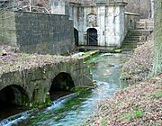 more pictures |
| 3730/06 | "Gütte" sinkhole in the shell limestone | approx. 3 km south of Königslutter | Geotope type: sinkhole. Length 50 m, width 30 m. A sinkhole with year-round water level, created by gypsum leaching. Stratigraphy: Quaternary Holocene. In the landscape protection area LSG-HE 16 "Elm". |
52 ° 12 '49 " N , 10 ° 48' 39.6" E |
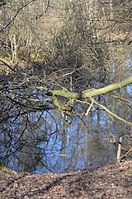 more pictures |
| 3730/07 | Riesberger Moor | approx. 1.2 km SO Rieseberg , Königslutter | Geotope type: fen. Size 1.6 km². Stratigraphy: Quaternary Holocene. Petrography: strongly decomposed sedge peat, thickness 1.5–2 (max. 2.7) m. In the nature reserve NSG-BR 005 "Rieseberger Moor". |
52 ° 17 ′ 5.6 " N , 10 ° 48 ′ 29.2" E |
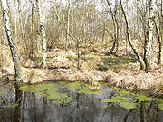 more pictures |
| 3730/08 | "Cross source" | about 1.6 km south of Bornum , Königslutter | Geotope type: source. Length 2 m, width 20 m. Stratigraphy: Triassic Upper Muschelkalk. In the landscape protection area LSG-WF 22. |
52 ° 14 ′ 33 " N , 10 ° 45 ′ 21.6" E | |
| 3730/09 | Lime banks "Tiefental Ost" | approx. 1.7 km west of the Whs. Lutterspring, Königslutter | Geotope type: sedimentary structures. Length 200 m, width 70 m, height 20 m. Stratigraphy: Triassic Lower Muschelkalk. Petrography: thin-plate wavy limestone and thick, thicker limestone banks. In the landscape protection area LSG-HE 16 "Elm". |
52 ° 14 '7.1 " N , 10 ° 46' 55.6" E | |
| 3730/10 | "Kuhspring", shift source | approx. 1 km SW Königslutter | Geotope type: source. Length 10 m, width 5 m. The layer source forms a pond. Stratigraphy: Triassic Upper Muschelkalk. In the landscape protection area LSG-HE 16 "Elm" and LSG-WF 22. |
52 ° 14 '32.3 " N , 10 ° 47' 34.4" E | |
| 3731/01 | Former Opencast iron ore mine "Grube Ernst-August" | in Rottorf am Klei , Rennau | Geotope type: iron ore exposure. Length 300 m, width 160 m, height 10 m. Stratigraphy: Jura, Lias gamma (Carixium). Petrography: Former Iron ore mine with a lake. |
52 ° 17 '50.6 " N , 10 ° 56' 53.9" E |
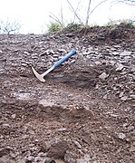
|
| 3731/02 | Fenugreek cliff (tuber quartzite) | at the NE end of Groß Steinum , Königslutter | Geotope type: sandstone cliff. Length 15 m, height 6 m. Stratigraphy: Tertiary Miocene. Natural monument ND-He 16. |
52 ° 16 '7.7 " N , 10 ° 52' 33.6" E |

|
| 3731/05 | Outcrop in the N area of the clay pit | former brickworks pit at the northwest end of Helmstedt | Geotope type: directional profile. Length 40 m. Stratigraphy: Triassic - Upper Keuper (Rhät) to Jura, Lias strata. Natural monument ND-HE 21. In the landscape protection area LSG-HE 19. |
52 ° 14 '36.6 " N , 10 ° 59" 27.6 " E | |
| 3731/06 | Drainage channel in the Upper Buntsandstein | approx. 500 m N Groß Steinum | Geotope type: sinkhole. Length 1200 m, width 200 m. Stratigraphy: Quaternary Holocene. In the landscape protection area LSG-HE 13. |
52 ° 16 '22.8 " N , 10 ° 52' 48" E | |
| 3831/02 | Schunterquelle | approx. 1.1 km SW Räbke | Geotope type: source. Several spring pots. Length 400 m, width 100 m, height 20 m. Stratigraphy: Triassic Upper Muschelkalk. Natural monument ND-He 10. In the landscape protection area LSG-He 19. |
52 ° 11 '15.7 " N , 10 ° 51' 26.6" E |

|
| 3831/03 | "Golden deer" boulder | approx. 2 km west of Schöningen in the SE part of the Elm | Geotope type: boulder. Width 6 m, height 2.5 m. Stratigraphy: Quaternary Pleistocene. Petrography: Tuberous quartzite of the Tertiary. In the landscape protection area LSG-WF 22. |
52 ° 8 '32.6 " N , 10 ° 55' 36.8" E |

|
| 3831/04 | Sinkholes, pings and springs | SO part of the Elm, Schöningen | Geotope types: sinkhole, spring, pingo. Length 8500 m, width 4000 m. Stratigraphy: Triassic Upper Muschelkalk to Quaternary. In the landscape protection areas LSG-He 16 and LSG-WF 22. |
52 ° 8 ′ 8.2 " N , 10 ° 50 ′ 1" E | |
| 3831/05 | Source "Güldenspring" | approx. 900 m SW Warberg - Räbke | Geotope type: source. Source pot 50 × 50, length of source with source pot approx. 220 m. Width 50 m. Stratigraphy: Triassic Upper Muschelkalk. In the landscape protection area LSG-He 16. |
52 ° 10 ′ 31.8 " N , 10 ° 54 ′ 15.5" E |

|
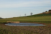
| 3930/01 | Brine source | Gevensleben , in the Soltau valley between Barnstorf and Watenstedt near the Watenstedter sugar factory. | Geotope type: brine spring. Length 5 m, width 7 m. Height 1 m. Stratigraphy: Triassic red sandstone to Triassic Muschelkalk. Petrography: several spring pots. Natural monument ND-HE 9. |
52 ° 5 '25.8 " N , 10 ° 49' 16.7" E |
|
| 3931/01 | Former degradation in the red plaster of the cusp | Beierstedt , on the road from Watenstedt approx. 700 m O Watenstedt to Jerxheim. | Geotope type: directional profile. Length 100 m, width 50 m, height 10 m. Stratigraphy: Triassic Upper Buntsandstein (red). |
52 ° 5 '22.6 " N , 10 ° 51' 5.8" E | |
| 3931/02 | Main roe stone bank and stromatolites in the former quarry in the NSG "Heeseberg" | approx. 900 m N Beierstedt | Geotope type: fossil deposits. Length 60 m, width 30 m. Height 6 m. Stratigraphy: Triassic Lower Buntsandstein. Petrography: 1 sole. In the nature reserve NSG-BR 008 "Heeseberg". |
52 ° 5 '1.1 " N , 10 ° 51' 24.3" E |
 more pictures |
| 3931/06 | Boulder | on Bruch-Berg approx. 1.1 km SE Jerxheim | Geotope type: boulder. Width 2 m, height 1.3 m. Stratigraphy: Quaternary Pleistocene. Petrography: granite, reddish. |
52 ° 4 '14.3 " N , 10 ° 54' 28.4" E |

|
| 3931/07 | Seckertrift salt meadow with leaks of salty groundwater | approx. 2 km SO Jerxheim | Geotope type: source. Area 4.0 ha. In the nature reserve NSG BR 011 "Salzwiese Seckertrift". |
52 ° 4 '48.4 " N , 10 ° 54' 27.2" E |
 more pictures |
| 3931/07 | Limestone quarry on Lohlberg | approx. 2 km SO Jerxheim | Geotope type: rocks. Length 385 m, width 115 m. Area 4.0 ha. Stratigraphy: Triassic Lower Muschelkalk. In the nature reserve NSG BR 076 "Kalksteinbruch am Lohlberg". |
52 ° 5 '12.1 " N , 10 ° 52' 48.4" E |
 more pictures |
See also
- List of nature reserves in the Helmstedt district
- List of landscape protection areas in the Helmstedt district
- List of natural monuments in the Helmstedt district
- List of protected landscape components in the Helmstedt district
Web links
Commons : Geotopes in the Helmstedt district - collection of images, videos and audio files
Individual evidence
- ↑ Lutterquelle ( Memento of the original from April 17, 2005 in the Internet Archive ) Info: The archive link was inserted automatically and has not yet been checked. Please check the original and archive link according to the instructions and then remove this notice.
- ↑ The Ernst-August iron ore mine in Rottorf am Klei , (pdf; 271 kB)
- ↑ Fenugreek cliff and construction site Großsteingrab near Groß Steinum , (pdf; 122 kB)
- ↑ Roe stones and algae reefs in the quarry on Heeseberg near Jerxheim , (pdf; 293 kB)


